Let’s be honest: One could call the approximately 4.7 mi Harris Lake Peninsula Trail a hike, but it’s really a long walk in the woods, surrounded by water and a variety of trees. But sometimes when you want to get outside, you don’t have time for far-flung adventures to the distant reaches of…wherever. That acknowledged, I appreciate that Harris Lake Country Park—and the Peninsula Trail—aren’t that far away.
Peninsula Trail
I drove over speed bumps past several single-track crossings, past the disc golf parking lot, and parked at the picnic/play area adjacent to the trailhead. I didn’t have much with me today, just camera gear and a water bottle. From the parking lot, I followed the sign marked Peninsula Trail, toward the kayak/canoe launch, then took a sharp right.
Pines immediately surrounded me as I turned right—then left—and walked past a pretty nasty-looking “pond.” It’s not a pond, not really, but it’s larger than a puddle, and it’s always there. And it’s always pretty gross.
About 150 ft after that, the trail gives you two options: left or right. If you’re interested in counting up the miles, turn left (or stay straight-ish); if you’d rather count down the miles, turn right. Today I kept straight. After another 100 ft or so, the trail crosses through a brushy corridor under several powerlines before it re-enters the woods.
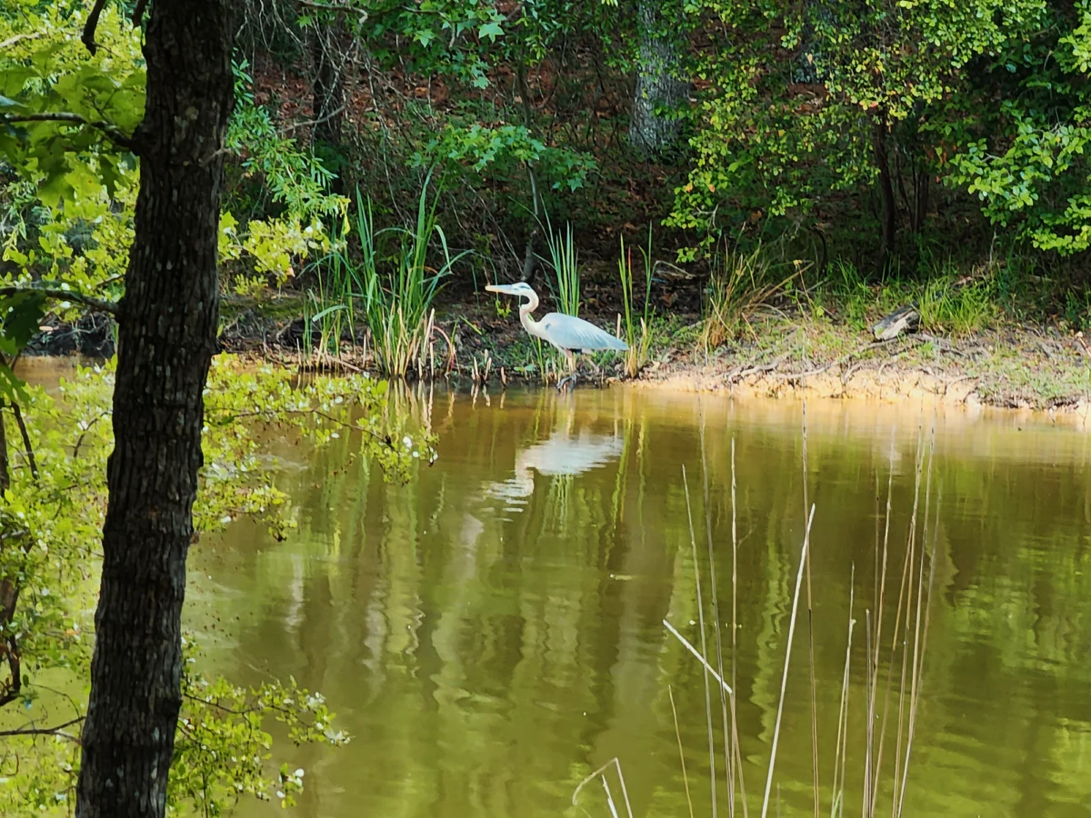
Most of the Peninsula Trail is a series of sharp turns that hug Harris Lake’s shoreline with almost no elevation change. Many of the “coves” provide fishing opportunities for waterfowl (like the poorly-photographed great blue heron pictured below) and critters like beavers and otters.
Somewhere between 1.1 mi to 1.4 mi into the hike, I saw longleaf pine growing in the center of the peninsula. Young longleaf pines look like tufts of grass (see photo below), and they typically thrive in places where fire has helped prepare any potential seedbed. I saw numerous signs of prescribed burns—char around tree trunks and carbonized fallen logs while hiking walking through this segment.
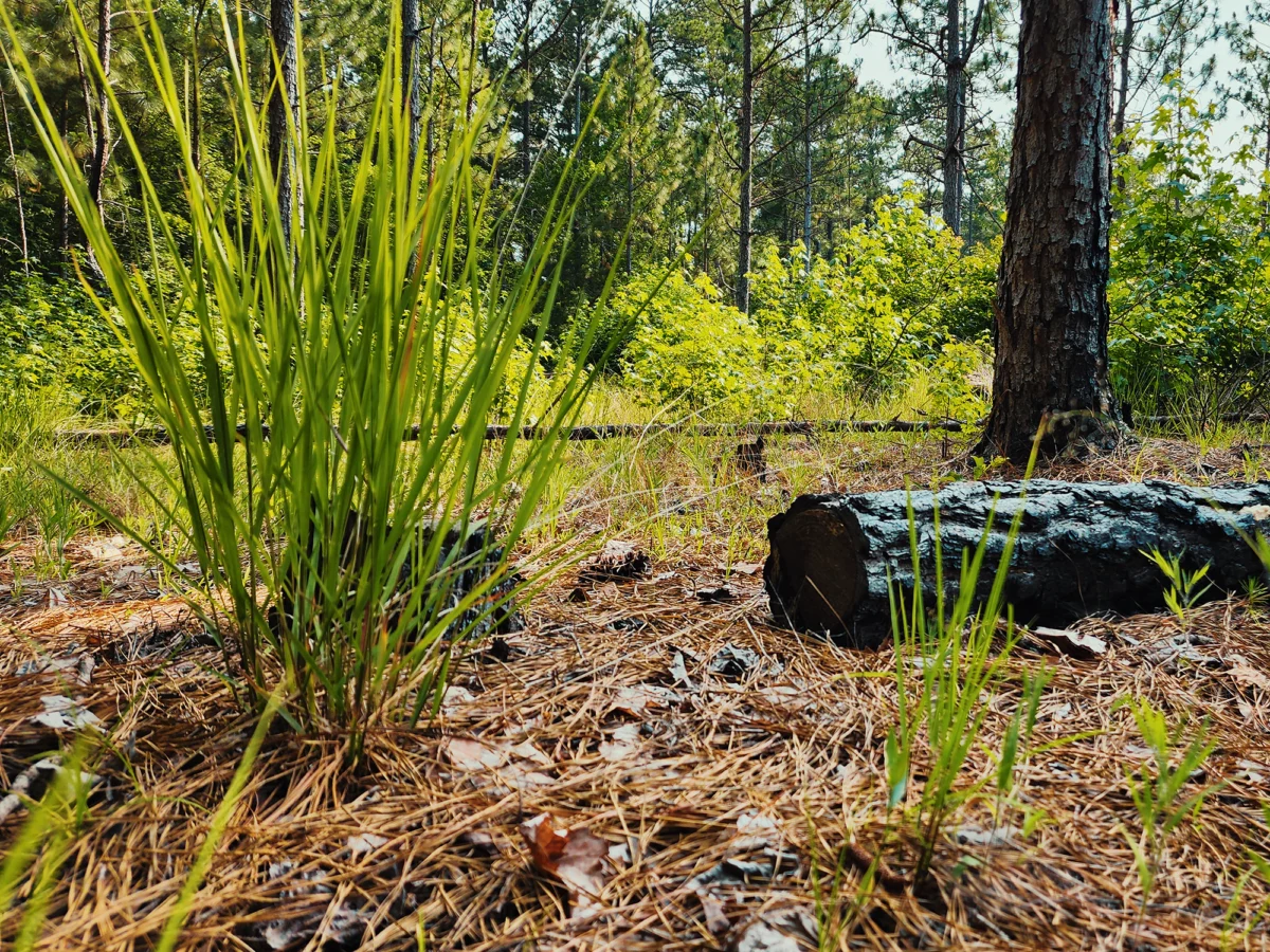
North Carolina used to have a much vaster acreage of longleaf pine. Forestry companies plant areas like the one at Harris Lake to help restore those numbers.
The trail dips quite close to the water in several places, and today, when the wind hit just right, I got a noseful of…something. I don’t know how best to describe the “fragrance,” but it reminds of days swimming at my grandparents’ camp at Sebec Lake (in Maine). It’s a welcome scent.
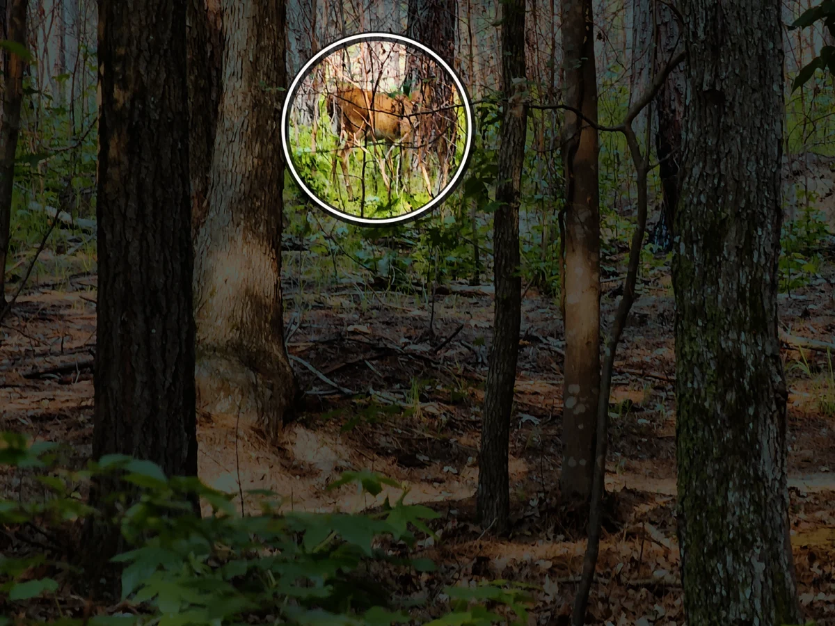
Sometime after that, maybe 2 to 3 mi in, I caught a glimpse of movement up ahead. I waited for a minute, then saw it again. He was hard to make out against the varied browns and greens of trees and filtered sunlight, but a whitetail deer strolled casually through the woods. Deer aren’t the rarest animal around here, but I enjoy seeing them in these settings (versus less…vivified states along the side of the road). He tolerated me for a brief while, then disappeared into the forest.
Shearon Harris nuclear plant
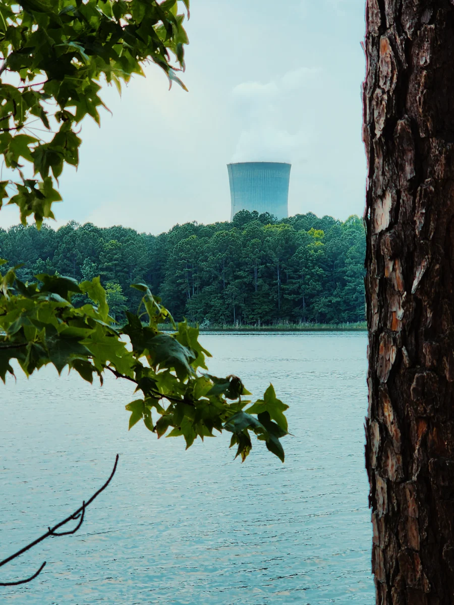
Right around 3.5 mi, you get the best view of the Shearon Harris nuclear plant across the lake. The plant features a single pressurized water reactor that achieved criticality in January 1987. In May 1987, it started providing power commercially. One interesting thing about Shearon Harris is it uses a refurbished generator from an older nuclear plant—Three Mile Island—installed in 2010.
In 2008, Duke Energy (the company that operates Shearon Harris) filed an application to build two additional reactors (the original site plan included four). In 2013, because of regulatory stuff, Duke Energy requested that the Nuclear Regulatory Commision (NRC) suspend its review of their application, effectively ending any plans to add more reactors. However, Duke Energy could file another application in the future.
The trail trends toward the right at about 4 mi in and shares about 1/10 mi with a gravel access road and the Buckhorn Disc Golf Course. [They’ve rerouted the holes since this trip, but I think you pass the tee for hole 14. Maybe 15.]
Womble home site
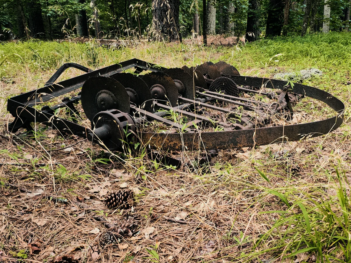
The last 1/2 mi leads you through what’s left of the Womble home site. The Wombles lived in the area since the 1700s, but today, there’s not much left of their presence. A couple of elements that do remain are the brick foundation of the Womble house, built in 1807, and a rusted piece of abandoned farm equipment.
With maybe 1/10 mi to 2/10 mi left to go, I saw three or four more deer, including one with large white swatches mingled with brown. Piebald deer like this are fairly rare. I had no idea I’d see one, but I’m glad I did! (You’ll get a jumpy shot of him in the video.)
Lots of times, if I need to get in some miles before a “real” hike, I’ll make a circuit around this part of Harris Lake. And like I said at the beginning: the Peninsula Trail isn’t really a hike so much as an excuse to breathe fresh air for a couple of hours. But what a great excuse!
Catch the whole adventure on YouTube! Please consider subscribing (if you haven’t already). Thanks for stopping by!