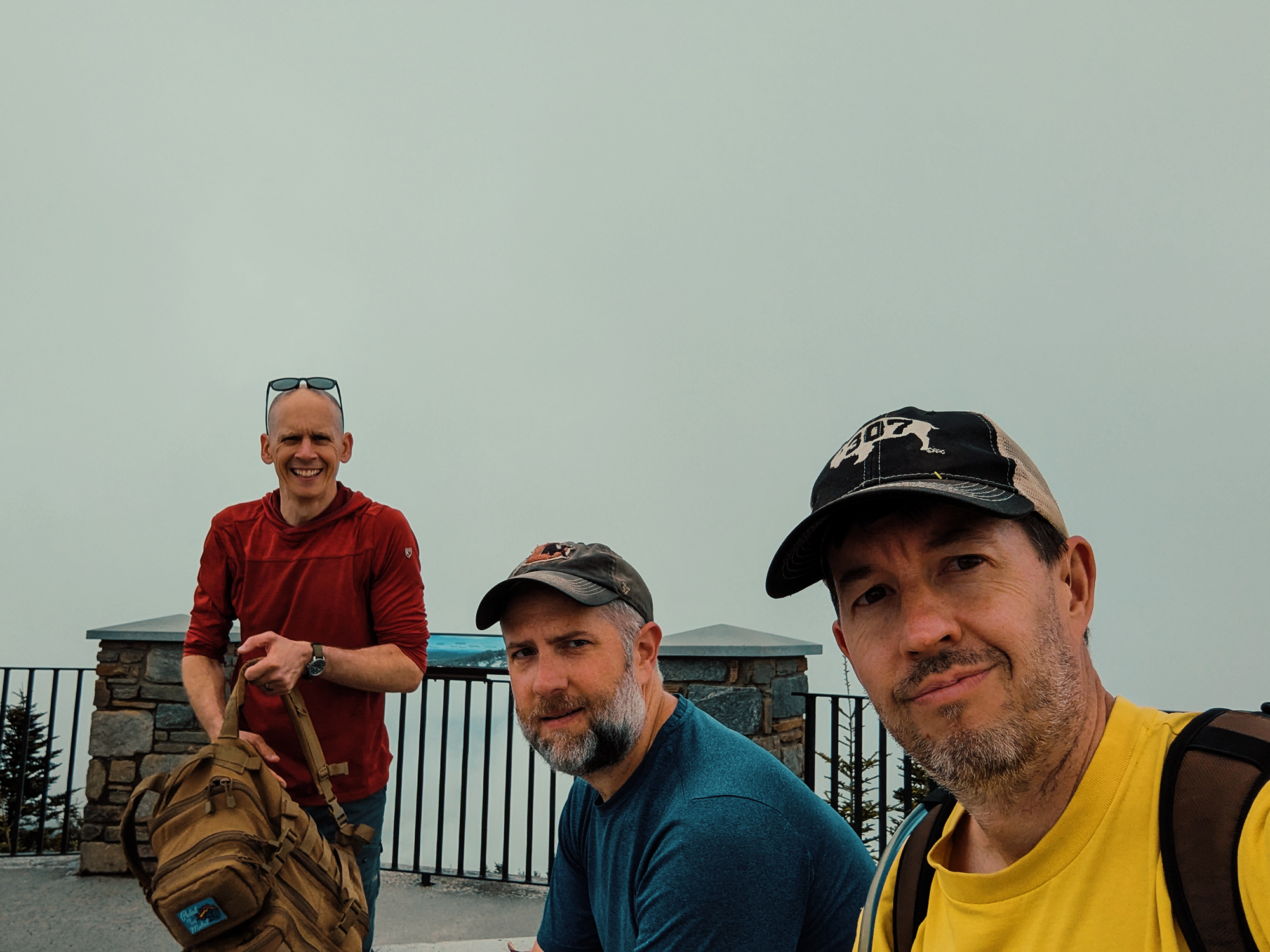
Toward the end of May, four of us—Zack B., Brian D., Matt M., and I—headed toward the Black Mountains. Mount Mitchell specifically. I’d never been there before; some of the other guys had, when they were younger, but none of us had ascended via the Mount Mitchell Trail. Just about 6 mi (one way) and a little more than 3,300 ft of elevation gain, it was, well, it was a lot! (I’ve made better choices than choosing Mount Mitchell as my first hike of the season! And yes, it’s almost June, and this is the first chance I’ve had to get away. So sad.)
We started out at the Carolina Hemlocks Recreation Area the night before—driving 4+ hours and then attempting that climb didn’t seem like a great idea. I think Matt M. read a review that said as much, something like, “Don’t do this long-a██ climb on 3 hours of sleep!” Sound advice, if you ask me.
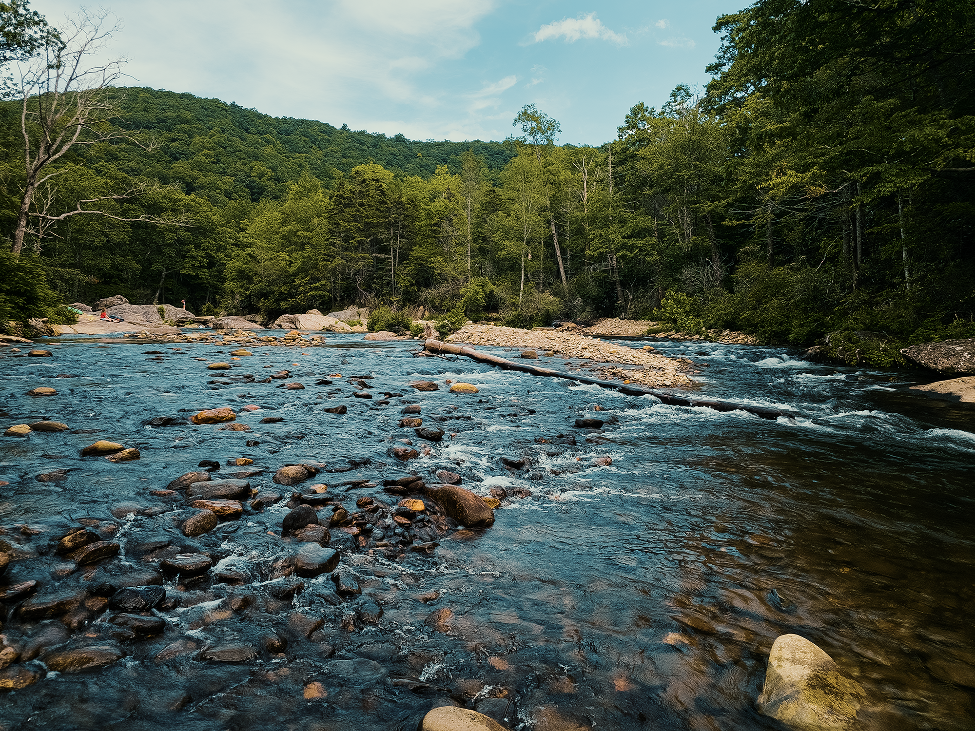
We attempted fishing, too: the South Toe River was just behind our campsite, and at least a few of us had purchased licenses just for the opportunity. I’m pretty sure none of us knew what he was doing, but not trying would have been a waste! We later learned there was a fishing competition scheduled for the next morning—for children, not adults us! The Forest Service (I think?) had stocked a portion of the river with 600 lbs. of trout—and netted it off. But of course, we weren’t allowed to fish there! (Probably wouldn’t have mattered.) Instead, we walked up and down the river.
And saw nothing.
At least the river was pretty!
After eating half a pack of hotdogs and staring at the fire for a while, we called it a night.
At least, we wanted to call it a night: sometime around 0300 hrs, rain penetrated the tent and created something of a pond inside! (It was the same “Tent Mahal” we used at Stone Mountain back in the day.) Zack B. at least had a cot and managed to keep himself above the deluge: the rest of us had to content ourselves with soggy sleeping bags and wet sleeping pads. It wasn’t entirely terrible, but I’ve had better sleep!
Anyway, in the morning, after breakfast, we drove south to the Black Mountain Campground—which is currently closed as the Forest Service attempts to repair what Hurricane Helene destroyed—and headed for the Briar Bottom Trail.
Briar Bottom Trail
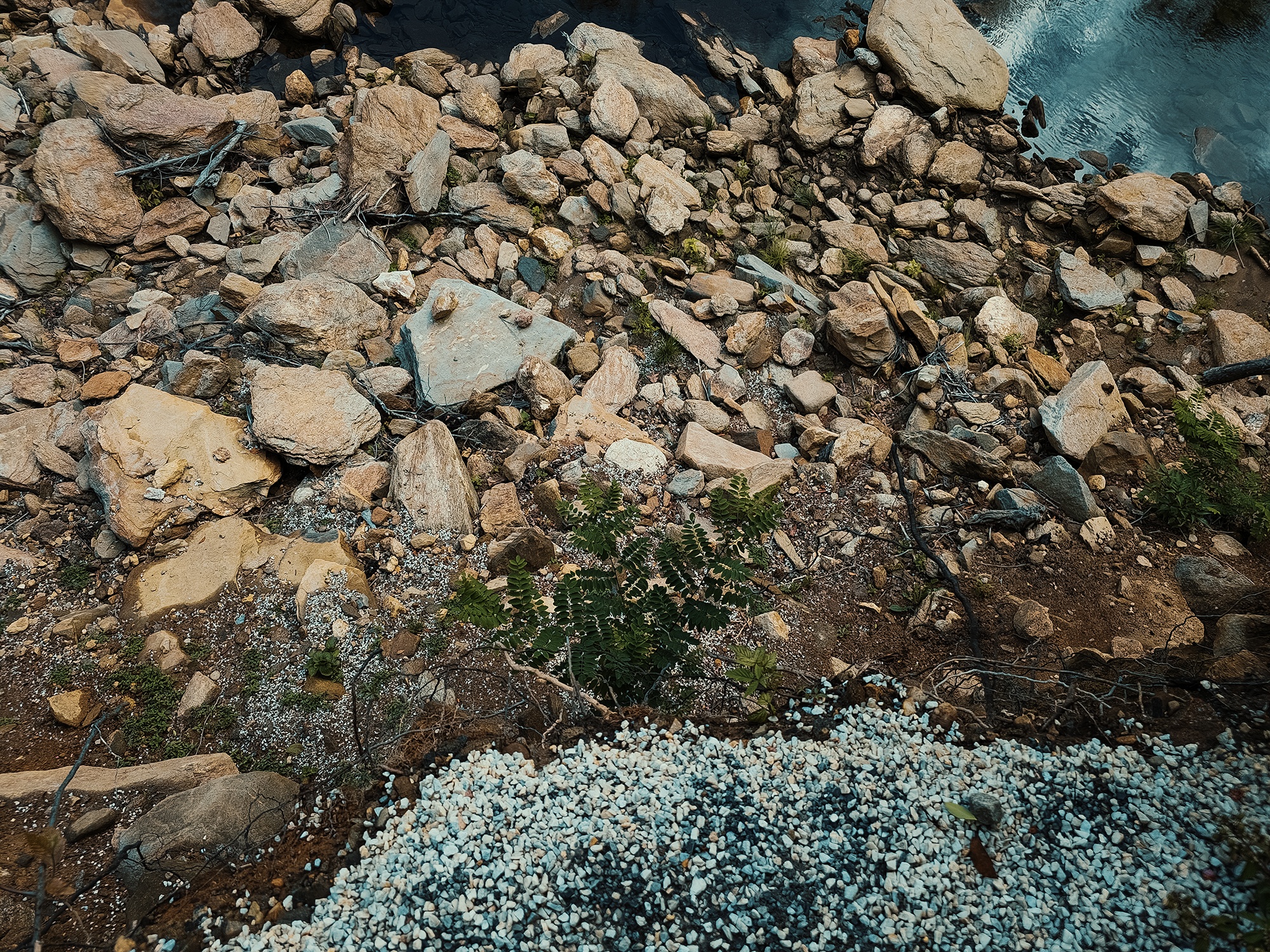
Our route only followed the Briar Bottom Trail (BBT) for about 1,500 ft. The trail itself extends longer than that, but we only needed enough of it to connect to the Mount Mitchell Trail. It’s likely that in the past, Cherokee and early settlers might have used this corridor as a means of travel throughout various regions within the Black Mountains. Prior to 1915, before North Carolina established Mount Mitchell State Park as its first state park, loggers likely would have used this route as well.
Despite only traveling the BBT for 1,500 ft, it took us to the literal edge of the South Toe River:
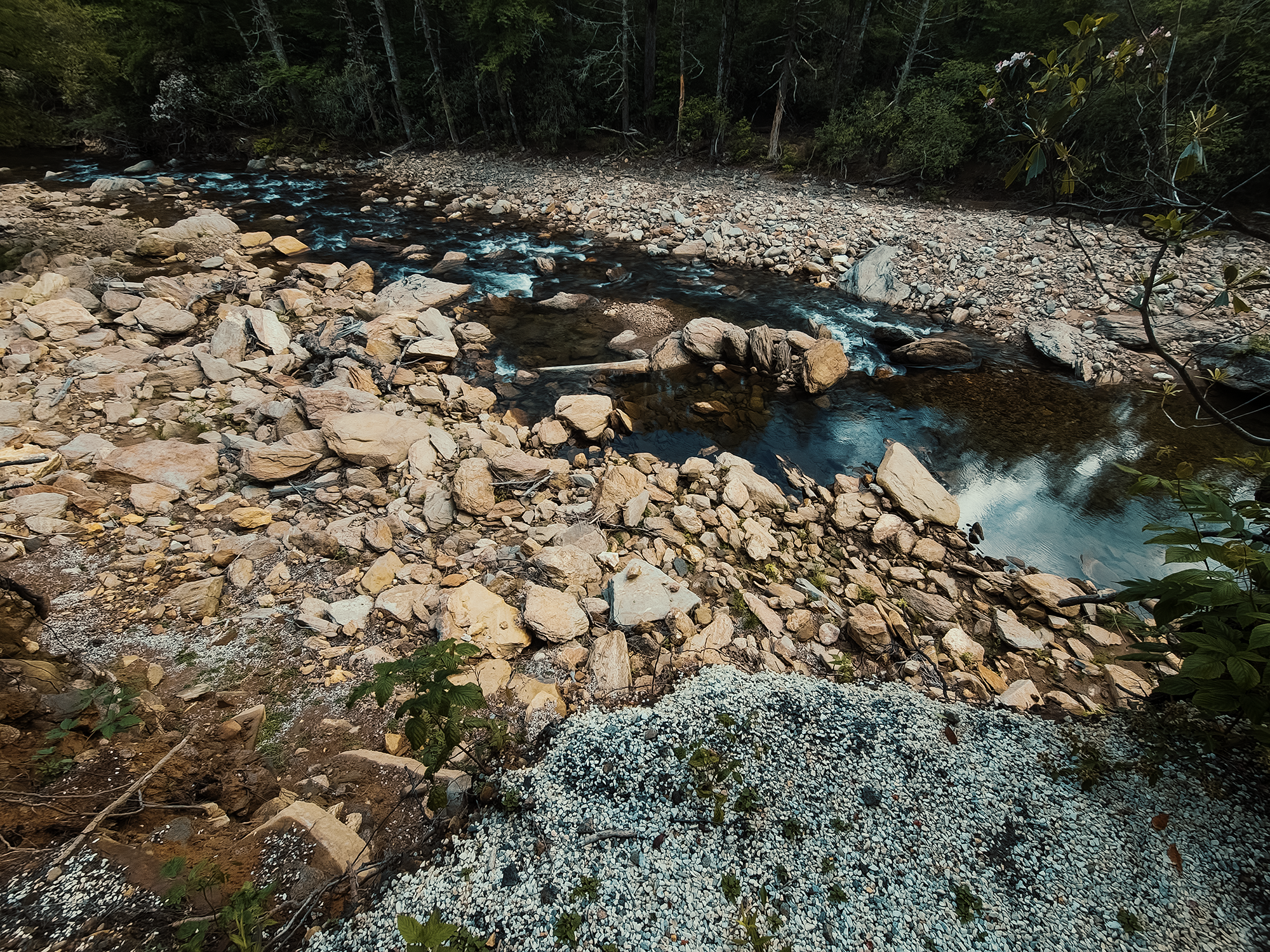
Hurricane Helene did a number on the South Toe (on the entire region, really). The day before, while fishing, I ran into a local whose family visited the Carolina Hemlocks Recreation Area frequently. He told me he still couldn’t believe how much the river had changed: previously narrower and deeper, now wider and shallower. Water run amok is no joke.
Mount Mitchell Trail
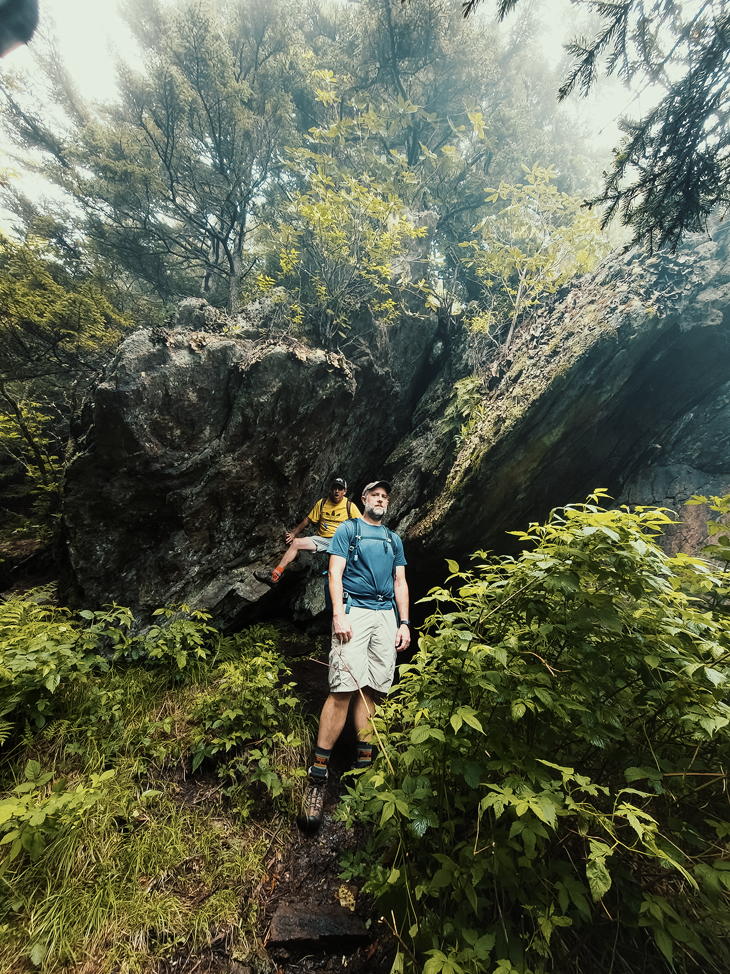
We turned right onto the Mount Mitchell Trail (MMT). We’d follow this trail for the majority of the day, although we would explore a few alternate elements as well. Within a mile (maybe less), I could tell I was not in the shape I needed to be in for this! The other guys had raced ahead of me (not really: it just felt that way), but eventually I caught up with them. Well, no, I didn’t catch up: they waited for me. After a much-needed break, we continued until we reached the split between the MMT and the Higgins Bald Trail. (1.5 mi from the BBT.)
Higgins Bald Trail
The Higgins Bald Trail (HBT) adds 2/10 mi, maybe 3/10 mi to our overall distance (it runs about 1.2 mi), but the first mile of its 1.2 mi length is gentler than the 9/10 mi to 1 mi of the same portion of the MMT.
Worth it.
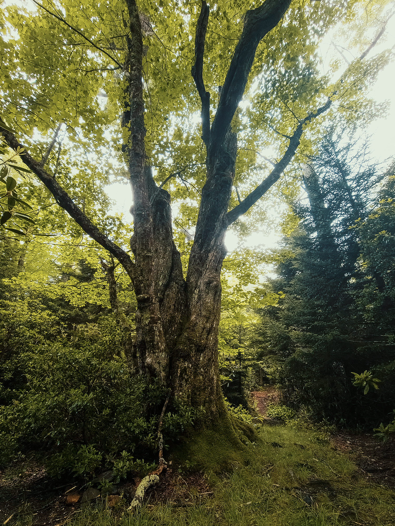
Of course, the last 2/10 mi or so is a touch rougher than the previous 1 mi, but not obnoxiously so. And along the way, I saw a few noteworthy trees:
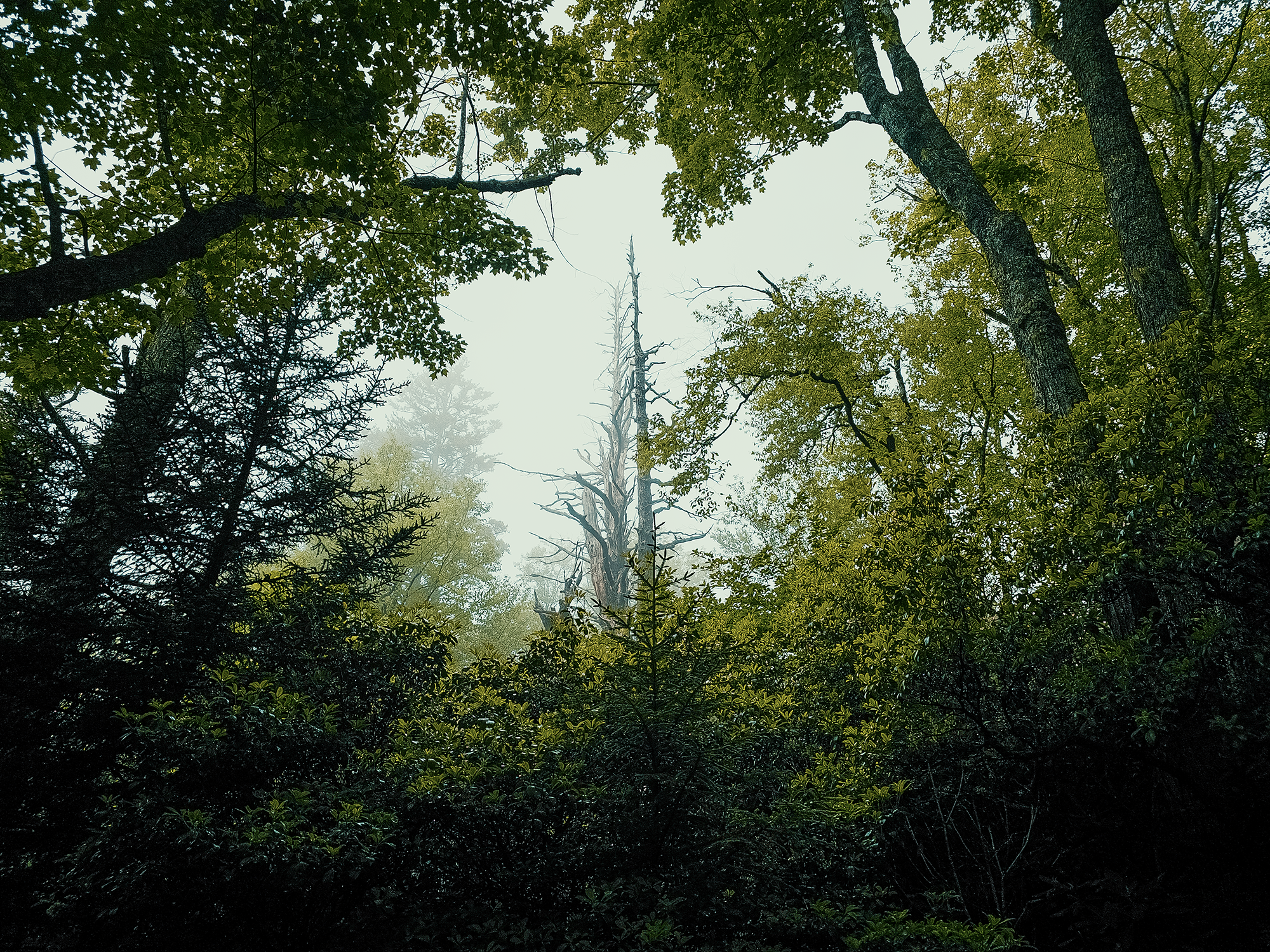
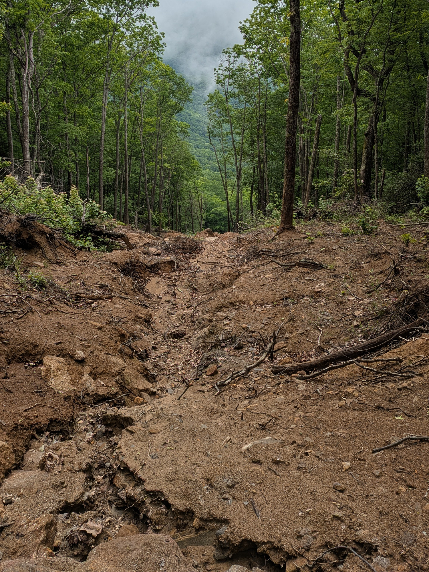
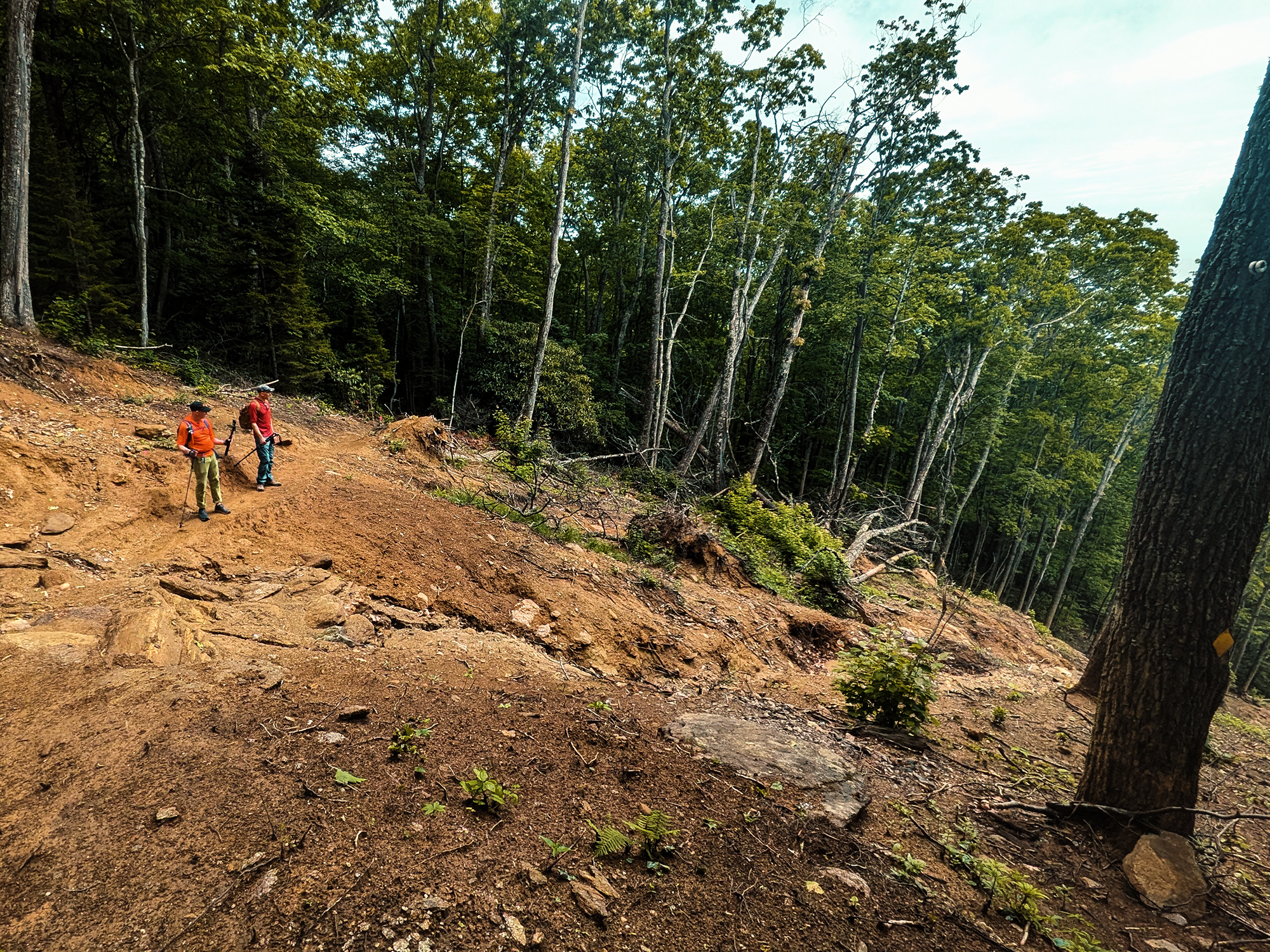
I’ve mentioned Hurricane Helene a few times already, but somewhere along the HBT, we came across an appreciable region of landslide. Trees knocked down along either edge, others dragged down the slope. The slope itself gouged and refashioned by hydraulic forces. Part of me would have loved to have seen the side of the mountain just…collapse, but for many of those in the valley below, I know it’s more than a mere curiosity: Helene altered their lives in ways I pray I’ll never have to experience.
I thought I was recording while we paused here, but I had a number of equipment goofs throughout the day: this moment turned out to be one of them. Fortunately, Zack B. and Matt M. were kind enough to share some of their photos with me:
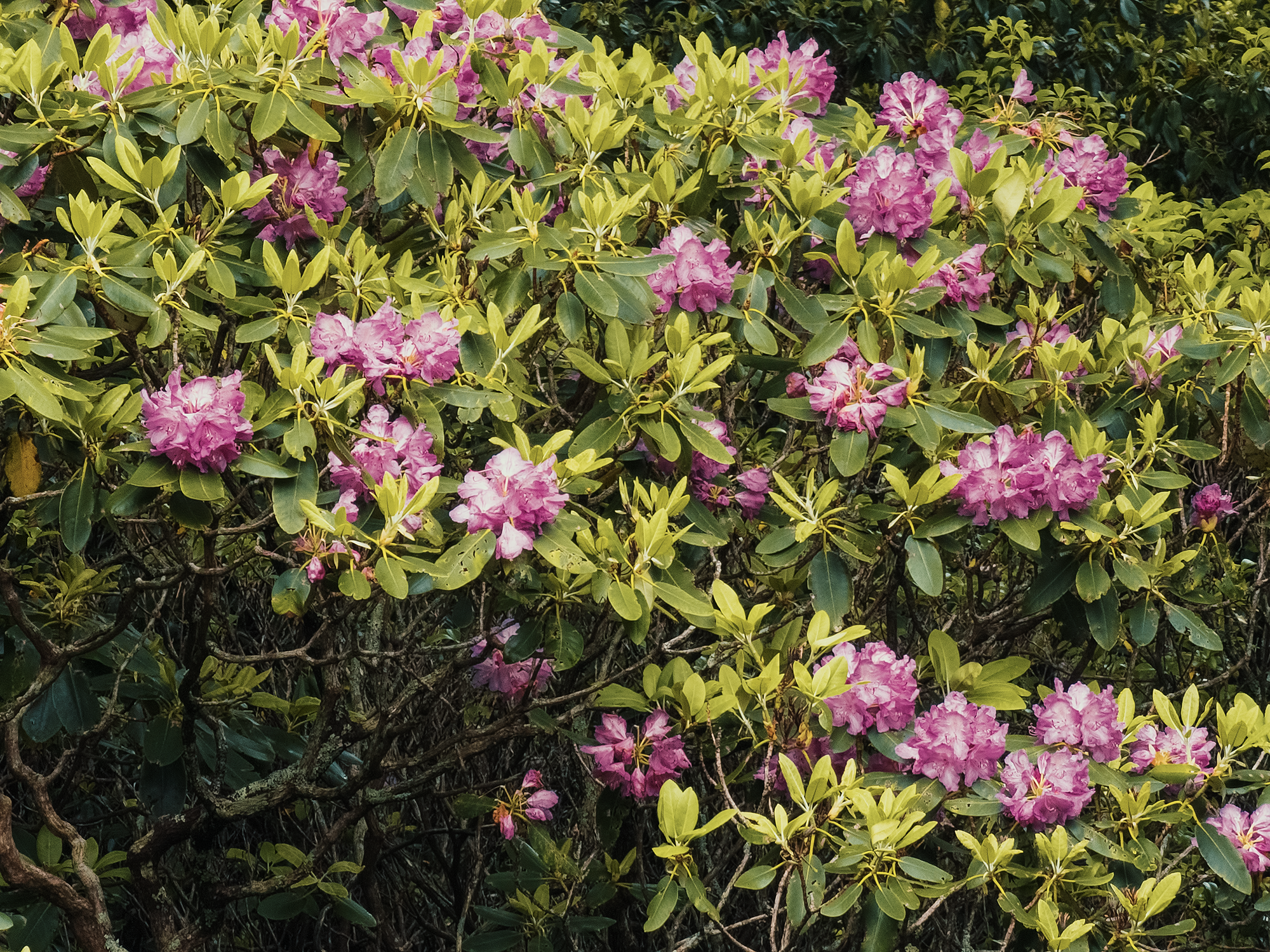
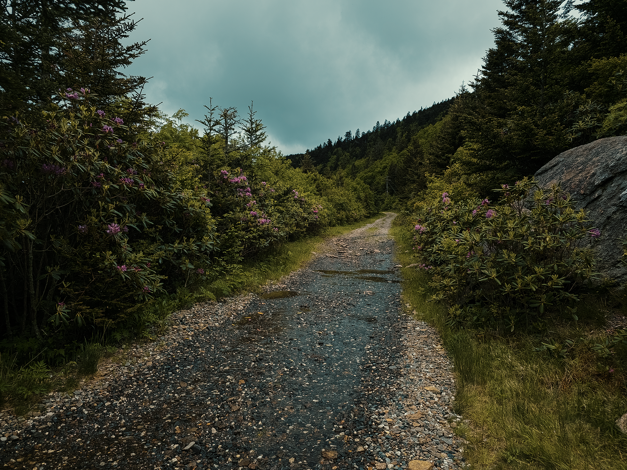
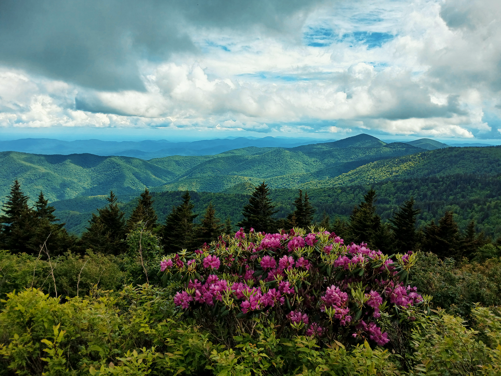
Despite the destruction, this region still holds onto its beauty, too: seemed like you couldn’t shake a stick without hitting rhododendron and mountain laurel blooms! Most of the following photos are from various points along our overall route, but the HBT definitely boasted more than its fair share!
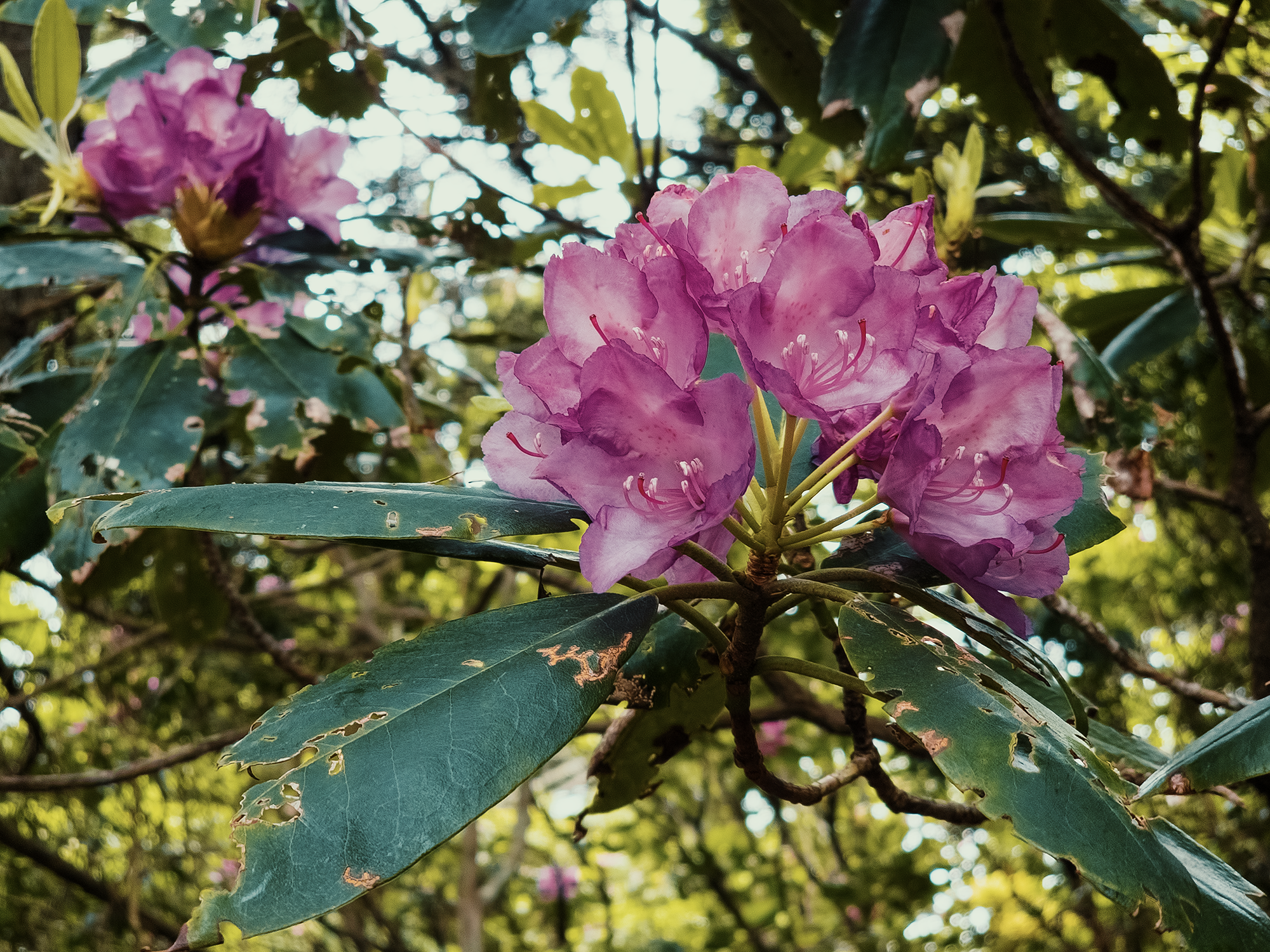
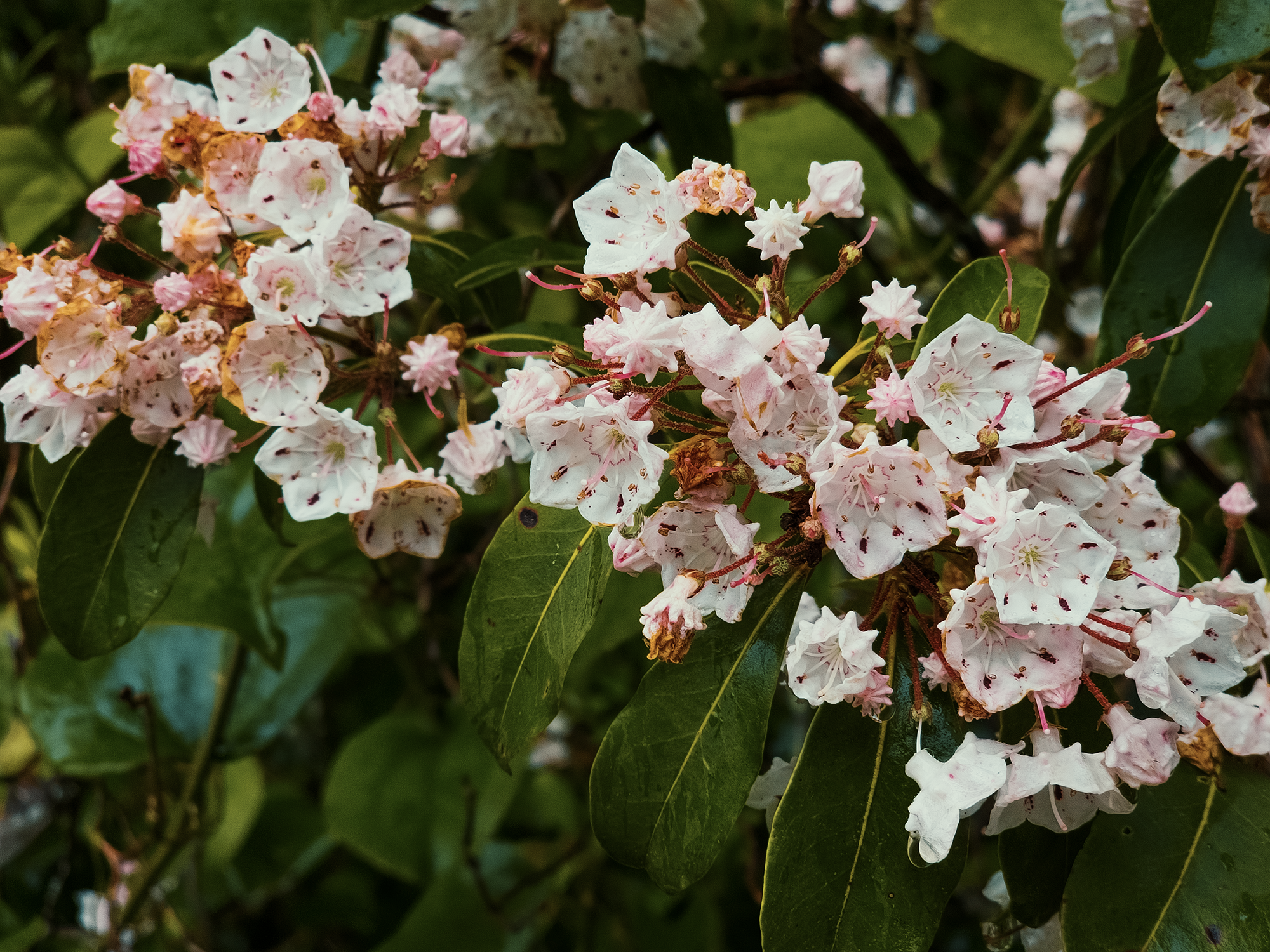
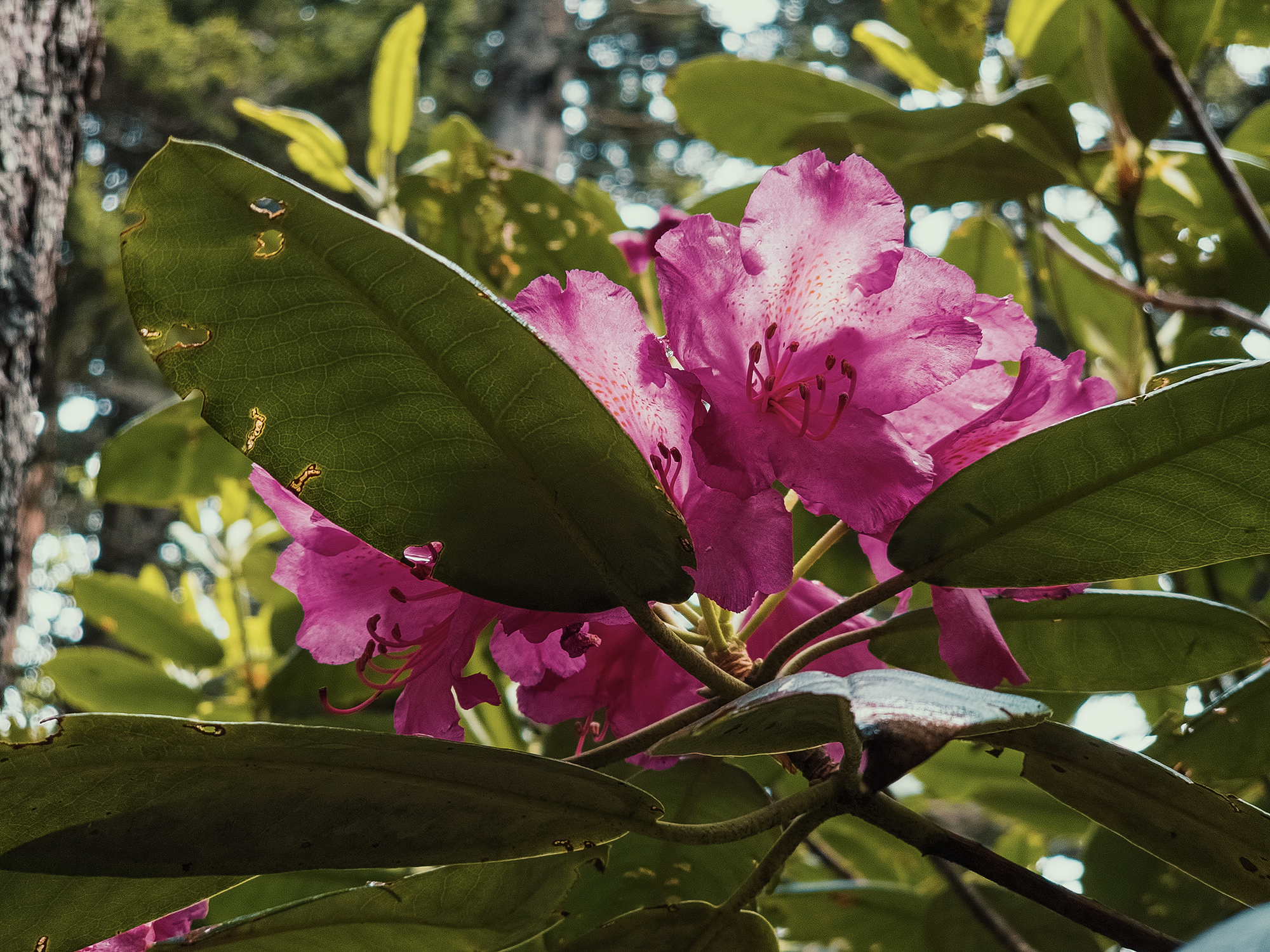
Somewhere along the HBT, we reached a short turnout (maybe 10 ft to 15 ft) that led to something of an “overlook” with the tops of mountain laurel and rhododendron trees below us:
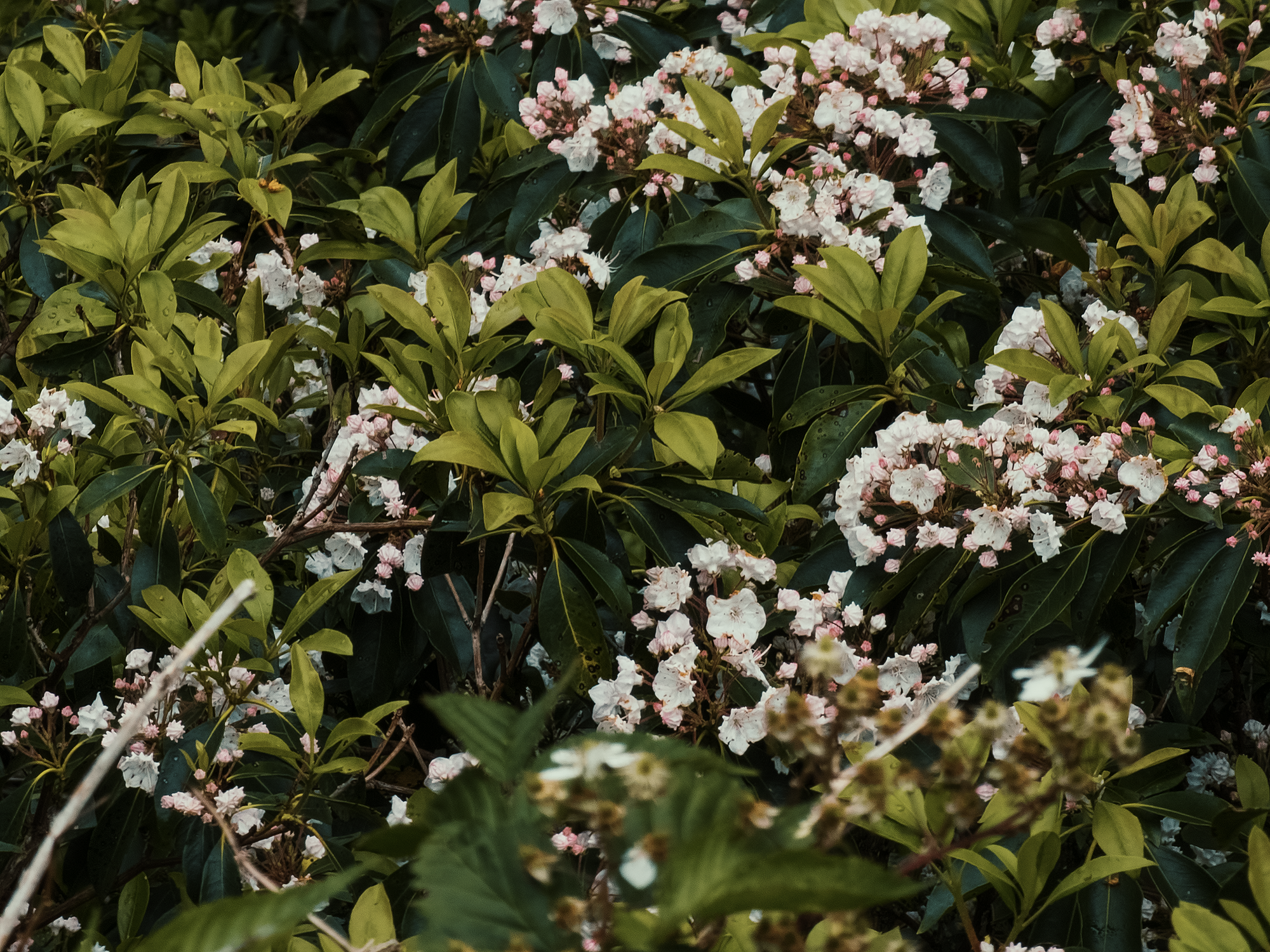
Not all of the previous night’s rain had run its course: there was still quite a lot of fog (or maybe outright clouds) along the HBT, and that, coupled with the trees, gave this trail an interesting quality. Muted, maybe.
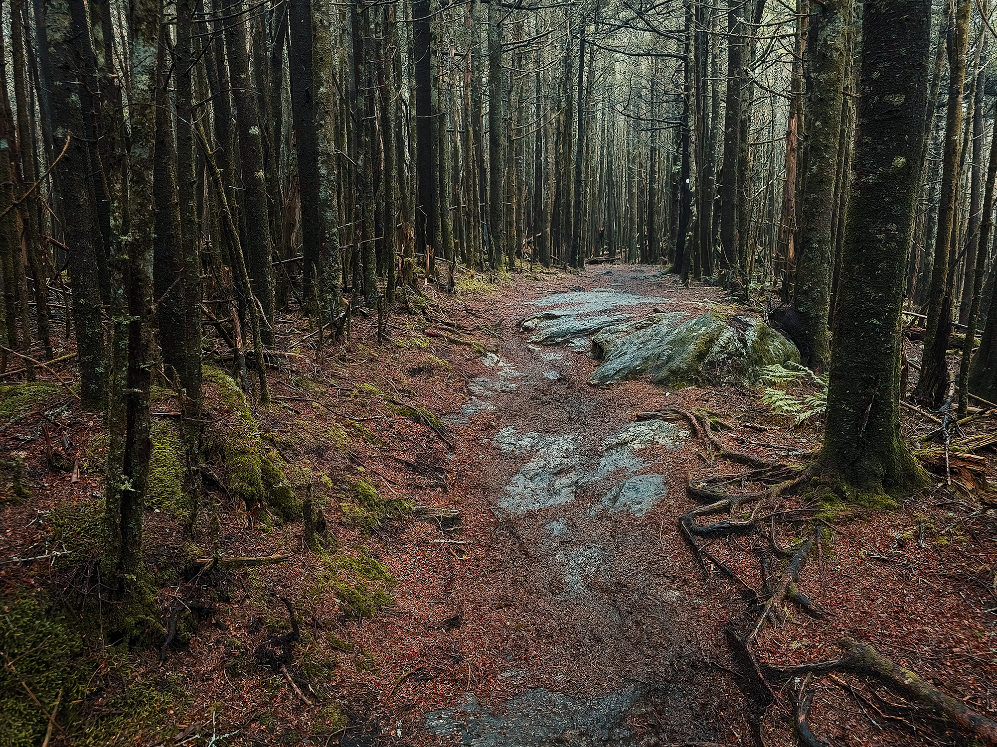
Mount Mitchell Trail (again)
Having completed HBT, we reconnected with the MMT and followed it for the next 1.2 mi. Well, more than that, really, but 1.2 mi after the HBT, there’s another split: cut right to stay on the MMT, stay straight to take the Buncombe Horse Range Trail. Here, we cut right.
Much of the Appalachian hardwood through which we ascended gets replaced with southern Appalachian spruce-fir in earnest around this mark. I mentioned logging (briefly) before: at least into the early 1900s, before the chestnut blight swept most of the southern United States, loggers climbed higher than one might realize to harvest [mostly] hardwoods on Mount Mitchell’s slopes. However, those hardwoods don’t thrive as well in the thinner soils and colder temperatures as one nears the summit. Many Fraser firs died out because of the invasive balsam woolly adelgid, but stands did survive and continue to grow throughout the region.
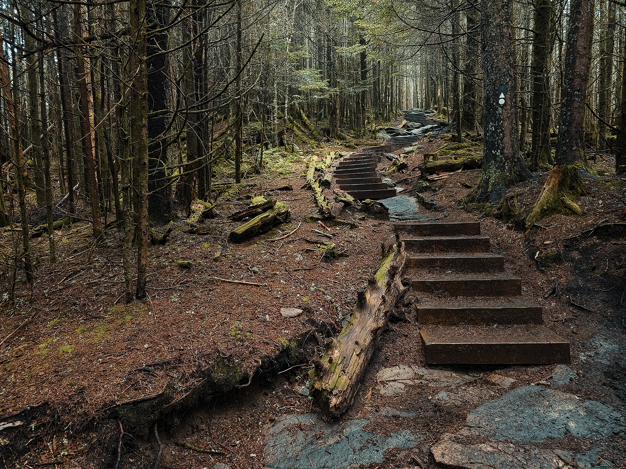
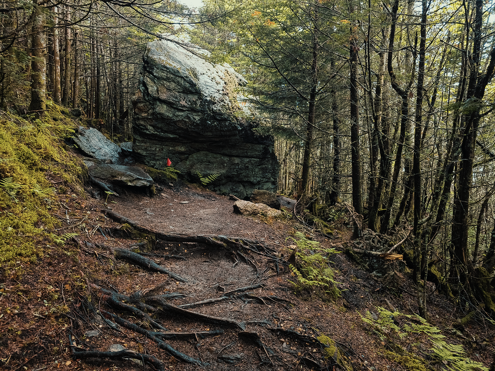
There were several impressive rock formations along this portion of the route, including this specimen:
Or maybe that’s from a different part of the MMT? There were so many switchbacks through this part of the trail.
So. Many. Switchbacks.
After a while, parts of the trail just blend together. The sky (when we could see it) was still cloudy, still foggy. At times, we crossed somewhat open regions where a power line cut through the woods.
And all of these switchbacks reminded me: while today’s Mount Mitchell Trail might not be the same route the Cherokee or early settlers or homesteaders (or even loggers) might have used, it respected the same criteria; that is, it avoided direct ascents against some of the tighter topo lines, and kept its distance from most cliffs.
Somewhere along the next 2.8 mi (from where the HBT connects back to the MMT), I (finally!) realized my camera wasn’t behaving properly. Which is annoying, but it happens sometimes. I did manage a few photos of the trail over the last 1 mi or so:
Before we get to the summit itself, maybe a little Mount Mitchell history is in order? Yes, yes it is.
A very brief history of Mount Mitchell
Before people called Mount Mitchell, well, Mount Mitchell, they called it Black Dome. And before they called it Black Dome, the Cherokee called it Attakulla—well, maybe: records are hard to nail down, but the Cherokee had a chieftan named Atakullakulla, and some claim the mountain once bore his name.
So why Mount Mitchell? Great question. Glad you asked.
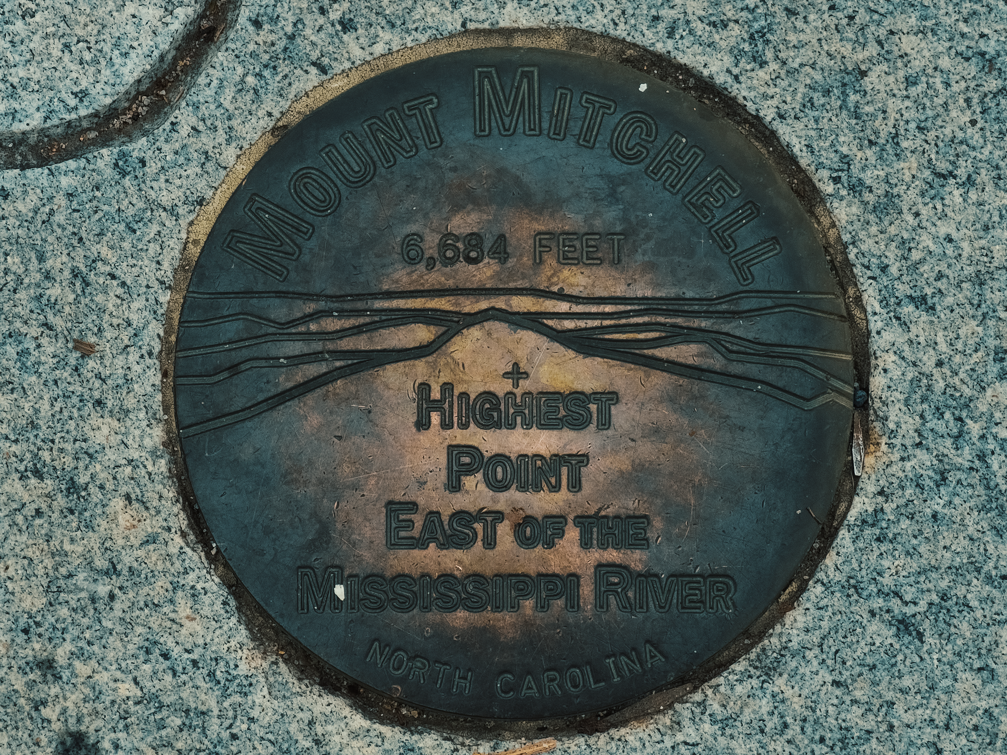
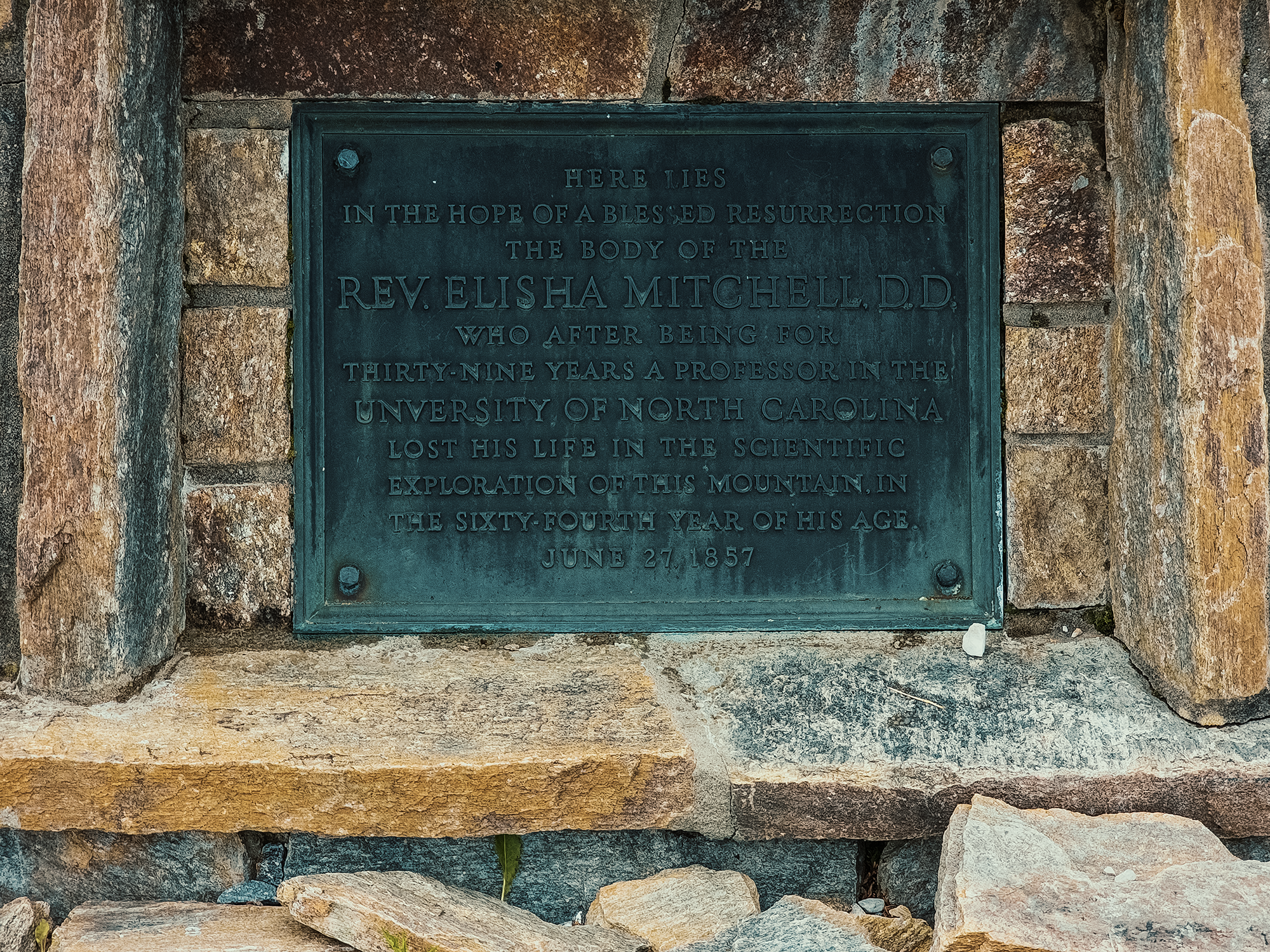
In the 1830s, University of North Carolina at Chapel Hill professor Elisha Mitchell visited the Black Mountains and claimed Black Dome was the highest peak east of the Mississippi River. That was a bold geographic claim in that day: most people believed Mount Washington in New Hampshire was the highest. For whatever reason, something about the Blacks—maybe Black Dome in particular—arrested Professor Mitchell’s interest and would not relent. He became low-key obsessed with it.
Perhaps not to be outdone, a man named Thomas Clingman—politician, battle tactics enthusiast, and all around professional smart guy—insisted Smoky Dome (farther south) was the highest.
For years—decades—Mitchell and Clingman waged a gentleman’s war of sorts, their weapons consisting of published papers and study results. In 1857, perhaps hoping to double check his results or conduct new surveys, Elisha Mitchell returned to the Black Mountains. During the expedition, surrounded by fog and wet weather, Mitchell tumbled to his death having stepped too close to the edge of a slippery waterfall (later named Mitchell Falls—it’s located on private land today). In 1858, the powers-that-be renamed Black Dome Mount Mitchell in his honor, where he was ultimately buried.
In 1859, Swiss-American geographer Arnold Guyot took an interest in Mitchell’s findings. He studied them, refined them, and confirmed what the professor had claimed all along: Black Dome was higher (taller) than Smoky Dome.
By 41 ft.
Mount Mitchell stands 6,684 ft above mean sea level (MSL); Smoky Dome at 6,643 ft. That might sound trivial today, but it helps better understand the passion each man brought to his side of the argument, especially when one considers what limited tools they had available to them.
Maybe the name Clingman sounds familiar? In later years, Smoky Dome (previously known as Kuwohi by the Cherokee) was renamed Clingmans Dome, although in recent years (2023), Clingmans Dome was (re?)-renamed Kuwohi in honor of its Cherokee history.
Mount Mitchell summit
Regrettably, my camera was still misbehaving when we reached Mount Mitchell’s summit. In some respects, that’s not a huge deal: the sky remained solid gray the whole time we were up there:
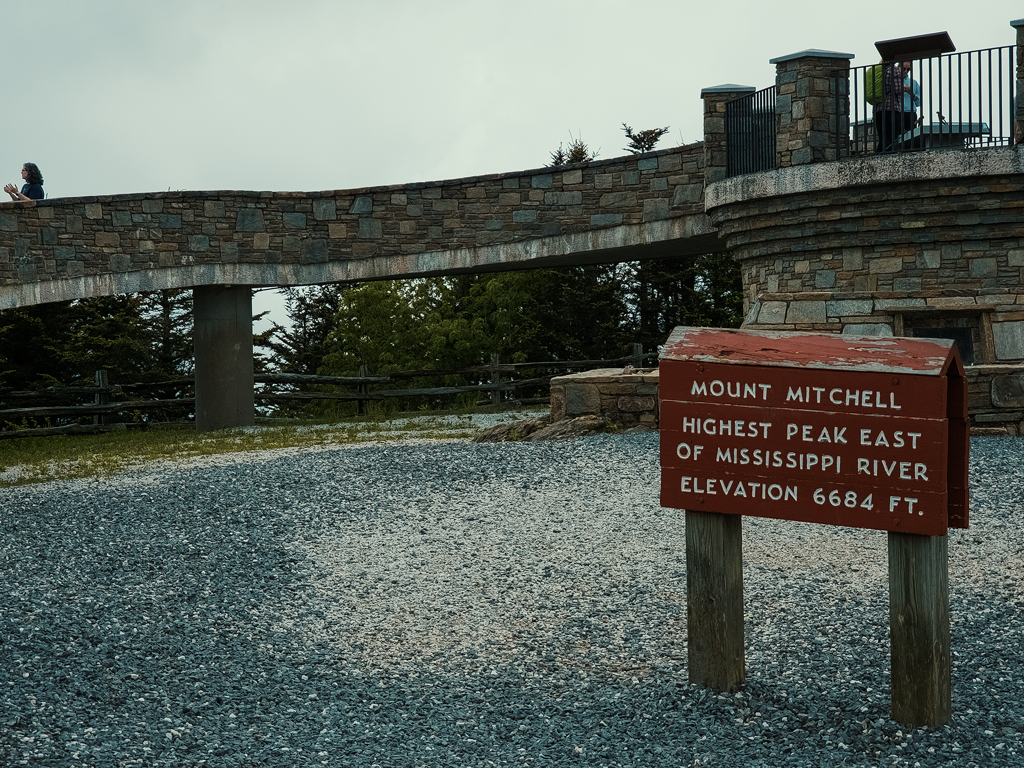
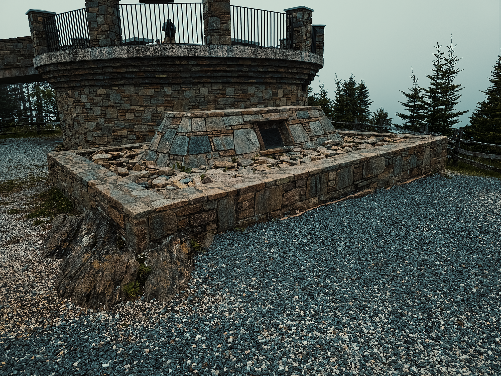
It’s occluded by the sign in the first photo above, but Professor Mitchell’s grave is just beneath the observation deck:
We ate lunch while staring at clouds from the observation deck, then explored the museum, concession stand, and souvenir shop. Most people drive to the summit: there’s a parking lot right there! But where’s the fun in that?!
Between the late 1800s and early 1900s, there was something of a “summit culture” up here. There was no museum or concession stand: there were, at best, rustic accommodations that one could reach only after hard days on horseback under threat of unpredictable weather. Summiting Mount Mitchell wasn’t a day trip: it was an adventure. One enterprising physician named E. B. Gaither helped establish and operate “Camp Alice” up here. More (but not much) on Camp Alice later.
I would have loved to see…anything from the summit, but what can you do? Maybe next time. (And maybe next time, I will just drive up there?!)
Old Mitchell Trail
On the way down, rather than retrace the MMT (we’d end up back on it soon enough anyway), we took the Old Mitchell Trail (OMT) from the summit for about 1,800 ft. We passed several signs saying beyond this, the OMT was closed. I don’t know if it will ever be reopened (I think they were doing water supply repairs?), but we just needed enough of it to reach the Camp Alice Trail, and 1,800 ft was plenty.
Camp Alice Trail
After the OMT, we turned left onto the Camp Alice Trail and followed that for just under 1/2 mi. Portions of this trail get pretty steep, with elements reaching -25% grade in places. It’s still pretty much all spruce-fir on either side of the trail—which reminds me: that’s how the Black Mountains got their name (in part, anyway): evergreen needles appeared almost black against the sky, especially when contrasted with the “bluer” color of ridges at lower elevations.
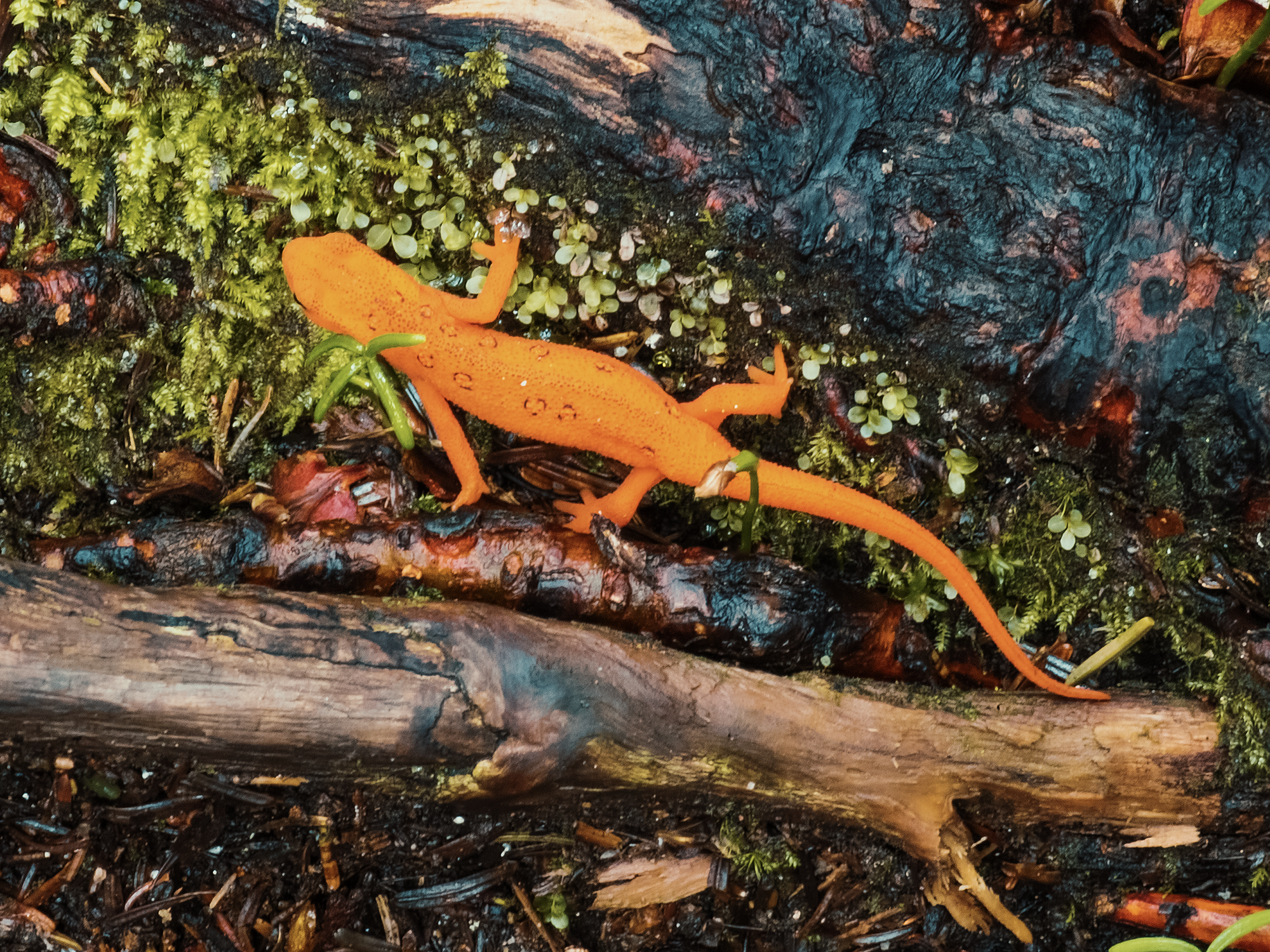
Also, we discovered this little guy on our way toward the Commissary Trail:
Commissary Trail
Where the Camp Alice Trail meets Lower Creek, it forms a T-intersection with the Commissary Trail (CT). I mentioned E. B. Gaither earlier, as well as some of the realities of summitting Mount Mitchell back in his day. Like I said, there was no concession stand, and if you didn’t bring enough provisions with you…you still might have been all right, because Camp Alice maintained a commissary not too far away: while still something of a hike (especially on the way back up to Camp Alice!), retrieving goods from the commissary was far superior to going hungry!
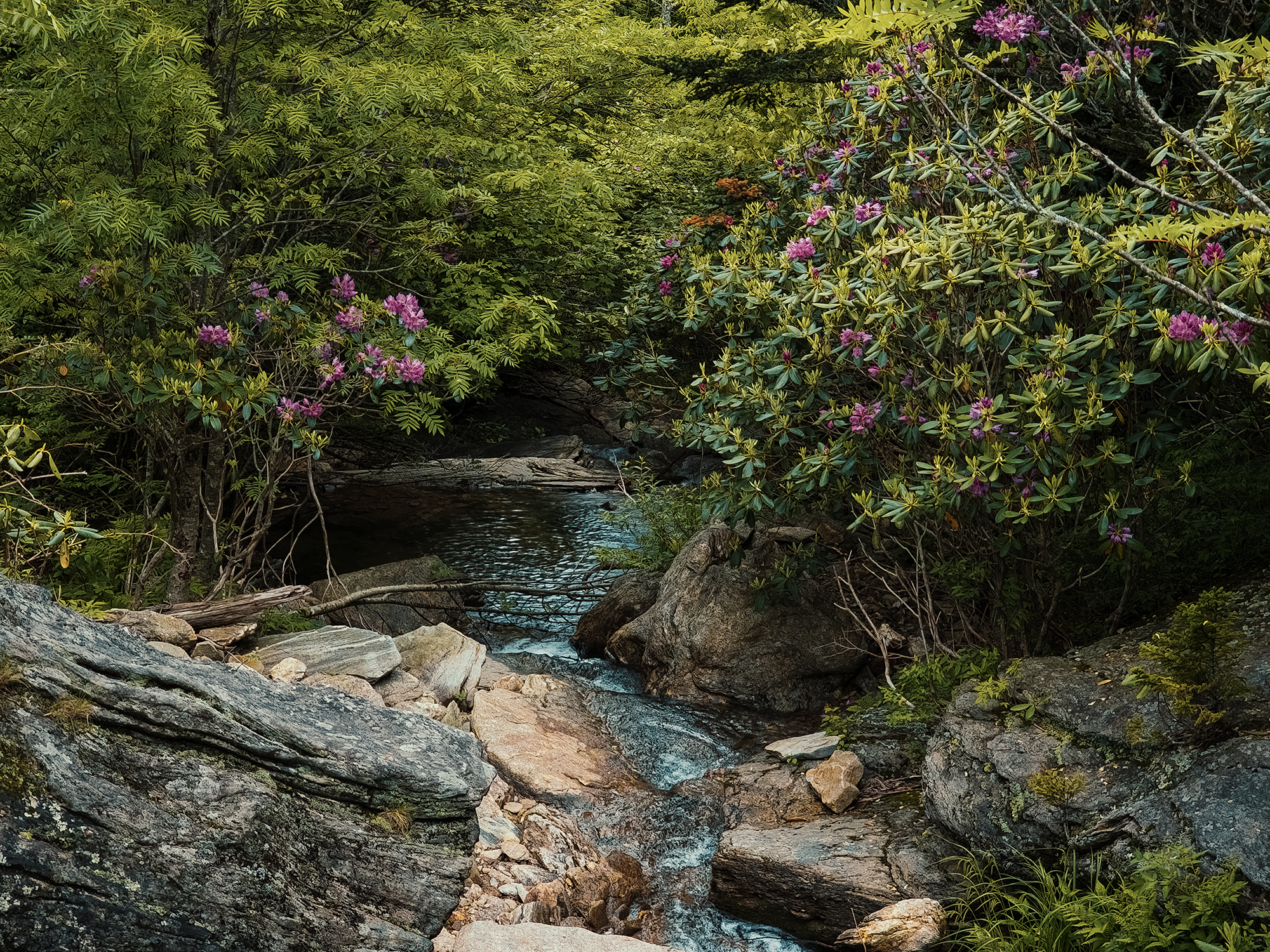
It’s somewhere around here where the sky cleared a little and we actually saw hints of sun. The flowering trees on either side of the CT, especially on either side of Lower Creek, struck me as particularly beautiful:
We only took the almost-completely-flat CT for about 1,700 ft before it merged with the Buncombe Horse Range Trail.
Buncombe Horse Range Trail
I completely missed when the CT merged with the Buncombe Horse Range Trail (BHRT)! Fortunately, I remember most of the BHRT being equally as pleasant as the CT—especially after hiking up 3,300 ft and descending right around 1,200 ft! On our right (vaguely south), we had pretty amazing views of the Lower Creek valley and beyond, probably the Grassy Knob Ridge and the Bearwallow Ridge beyond that. Brian D. took a particularly nice photo here:
It’s probable that the BHRT gets its name from the fact that homesteaders likely would have grazed their stock at higher elevations: letting them forage up here meant more lowland for crops. I don’t know if anything we hiked through today counts as a bald (even Higgins Bald Trail), but even today, people still debate whether southern Appalachian balds are natural or manmade (or really livestock-made?!).
After a little more than 1/2 mi on the BHRT, we reconnected with the Mount Mitchell Trail.
Mountains-to-Sea Trail
I haven’t mentioned it yet, but large portions of today’s route are also part of the Mountains-to-Sea Trail (MST), an 1,100+ mi route from North Carolina’s mountains to its coast—which you probably already figured out! Conceived in the 1970s by journalist Howard Lee, the MST is intended to link all of North Carolina’s geographic features via a singular route. To date, roughly 475 mi of the MST require walking along roads or highways rather than trails, but it’s constantly in flux: as land becomes available or existing private owners choose to permit hikers to traverse their property, the overarching direction is to move more of the trail onto, well, trails!
Mount Mitchell Trail (again, again)
And that’s it for this hike! It’s a shame we couldn’t see anything from Mount Mitchell’s summit, but that’s how it goes sometimes in Pisgah National Forest—right: I don’t think I mentioned that yet! Yes, the same national forest as the Shining Rock Wilderness.
What we did get was a chance for me to realize just how out of shape I am and an opportunity to hike the slopes of a mountain that created one of the 19th century’s most storied geographic feuds.
Because there’s probably tons of those…right?
Catch the whole adventure on YouTube! Please consider subscribing (if you haven’t already). Thanks for stopping by!