
Seems like there are all kinds of “Grand Canyon of X!” Whether it’s Linville Gorge in western North Carolina or Gulf Hagas in northern Maine or…all right, those are the only two that come to mind, but there are probably others.
(I checked. There are.)
I nearly hiked Gulf Hagas twice for this trip. That’s because for the first attempt, I got started later in the day than ideal. I figured I could knock it out anyway and be all right. That might have been true, but I ran into a couple of really cool people and their even cooler dog. We ended up talking for, well, too long! (I hope they got back to their vehicle without any problems! [If you’re reading this, give Nuke a pet for me!]) I hiked until I couldn’t see much through the camera, then took one of the bailout options back to the Tote Road.
For the second attempt, I got a much more reasonable start.
Okay, that’s probably more prologue than anyone needs, so let’s just get into the hike.
Fording the West Branch Pleasant River
About 1,100 ft from the Katahdin Iron Works (KI) trailhead (on the Gulf Hagas Connector Trail), I reached the West Branch Pleasant River. I remember fording it the first time I ever visited Gulf Hagas when it was a little higher. Today, it was only shin-deep in places, shallower in others. The West Branch runs for about 36 miles, beginning up near Fourth and Second West Branch Ponds. Up until it hits the Gulf, it’s, well, it’s a river. By the time it begins its 3 mi run through Gulf Hagas (over which it drops about 500 ft), it gets a little rambunctious.
Wait a minute—this place is miles from any ocean: why is it called a gulf? And what’s a hagas?
In logging parlance, a gulf was steep-walled gorge or canyon-like feature. Think of it in terms of the sheer drop-off rather than proximity to salt water.
Hagas is a bit more difficult to define with any certainty. I think the most popular suggestion is that it originates from an old Scottish word—hag or hagg—that meant something like “a clearing for cutting lumber,” which, given the Gulf’s history, seems more than fitting! Another thought is maybe it’s a corruption of a Wabanaki word, although I don’t think there’s much (if any) evidence for that. And last, some suggest it’s either someone’s surname or a corruption thereof.
Most “modern” history centers around the logging industry and related activities that took place within the Gulf, beginning in 1873 (I think). Much of the wood driven down this river ended up at Katahdin Ironworks.
[All the signage renders it Iron Works, but for whatever reason, I’ve always written it as Ironworks, so please: pardon my inconsistency!]
Before that, however, members of the Wabanaki Confederacy, probably the Penobscot Nation, hunted, fished, and traveled the area. It’s not likely that they kept permanent settlements, given the inhospitable environment, but if one considers the wider region, archaeologists have uncovered burial sites belonging to the Red Paint People, so named because of the copious quantities of red ochre presumably associated with their funerary practices. (Of course, other archaeologists dispute these claims…)
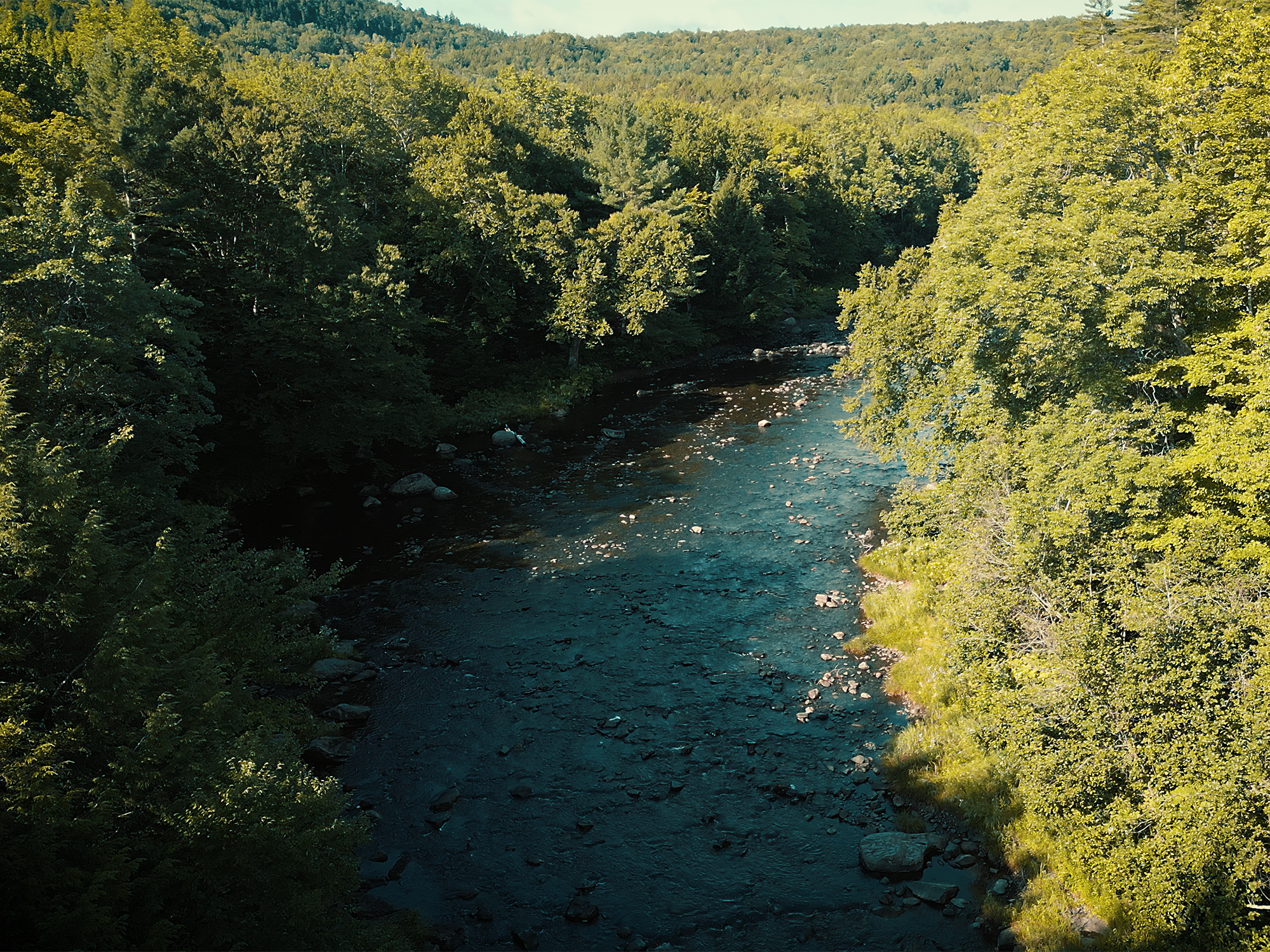
From my truck, I just wore flip-flops until I reached the other side of the river. I’ve forded it barefoot before—and with trail runners—and I think flip-flops work as well as anything else. Once across the river, there are a couple of wooden benches. I left my flops on one of those, put on my shoes, and continued NOBO on the Appalachian Trail (AT) through The Hermitage.
The Hermitage
Almost immediately on this side of the West Branch, I entered a space called The Hermitage. The name likely originates from a solitary character named Campbell Young, a Scottish gentleman who built a cabin somewhere in the vicinity back in the 1890s. I’m guessing he liked his privacy.
That explains the name (maybe), but there’s more unique history regarding these ancient trees as well. Many were here hundreds of years before the logging boom, and many remain standing despite it. We’ll explore this peculiarity later in this post.
Toward the other side of The Hermitage, I reached a T-intersection. I turned left to stay on the AT.
From that intersection, it’s 1.1 mi to another junction: turn right to continue NOBO on the AT; keep going straight to reach Gulf Hagas Brook and the split between the Rim Trail and the Pleasant River Tote Road (often just called the Tote Road).
The Rim Trail
At the split, there’s a Registered National Landmark plaque bolted to a giant boulder. While you could turn right (or stay straight, really) and take the Tote Road, most people cut left and follow the Rim Trail.
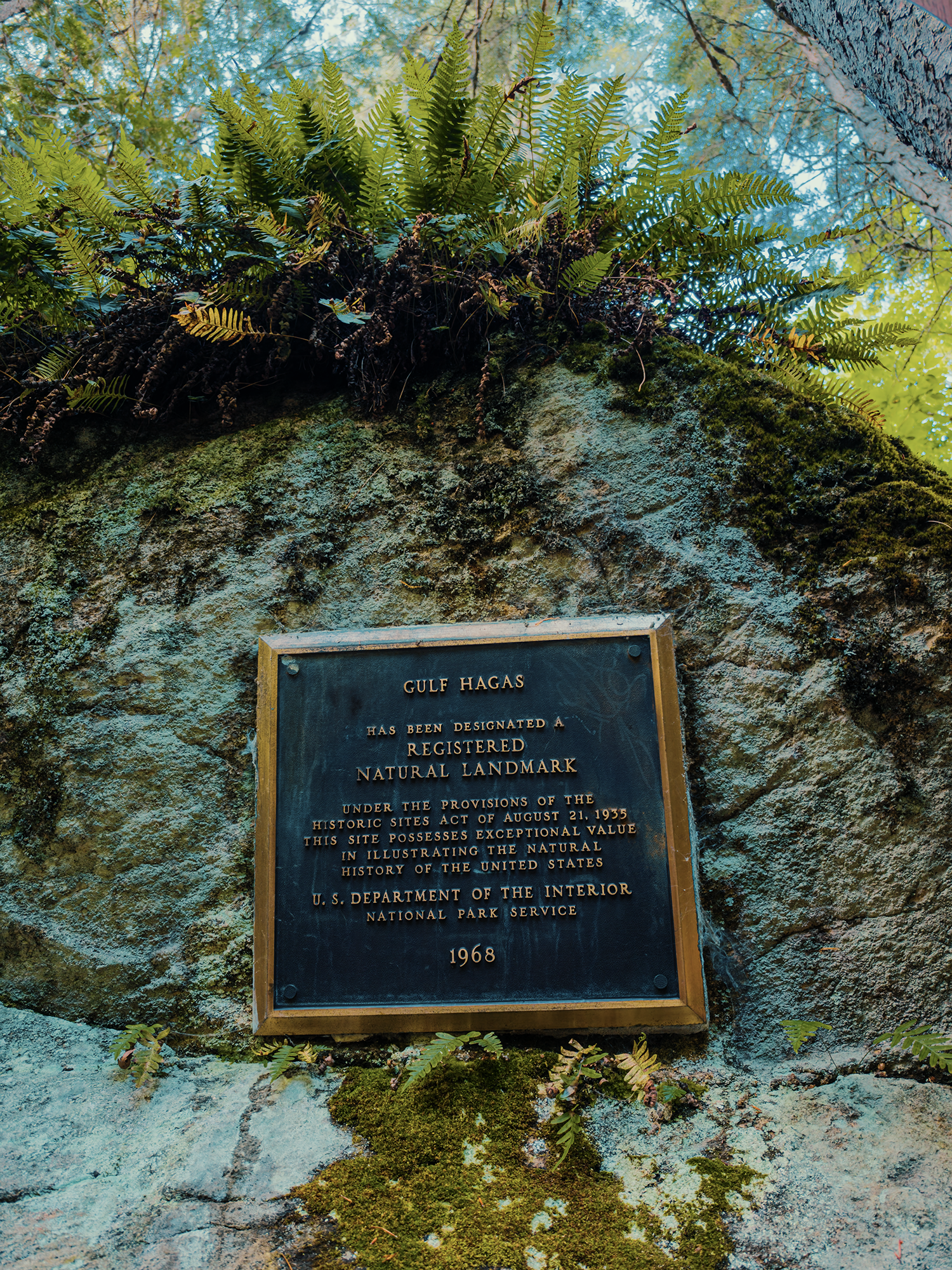
Cut left. Take the Rim Trail. I’ve hiked it the other direction before, and while it’s the same stuff, it’s just…better hiking against the river. Or maybe that’s just my opinion and you can do whatever you want.
If you turn left, you’ll follow Gulf Hagas Brook before it empties into the river. Oddly enough, for this stretch, you’re hiking in the same direction as the water, which might seem a little jarring once you reach the West Branch and find yourself hiking upriver!
Towering gorge walls—similar in structure to the Gulf itself—frame the brook and create the setting through which three-tiered Screw Auger Falls runs.
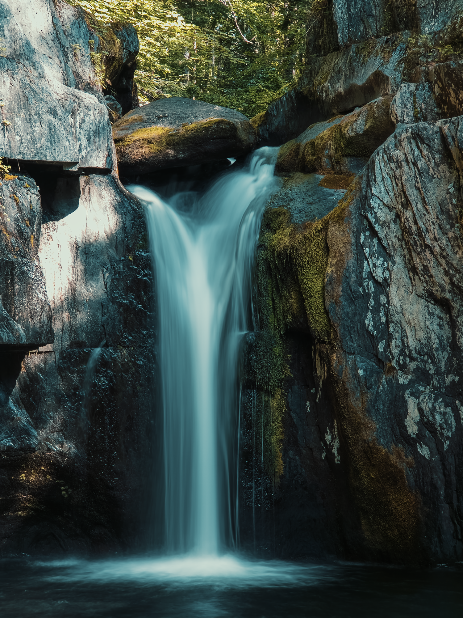
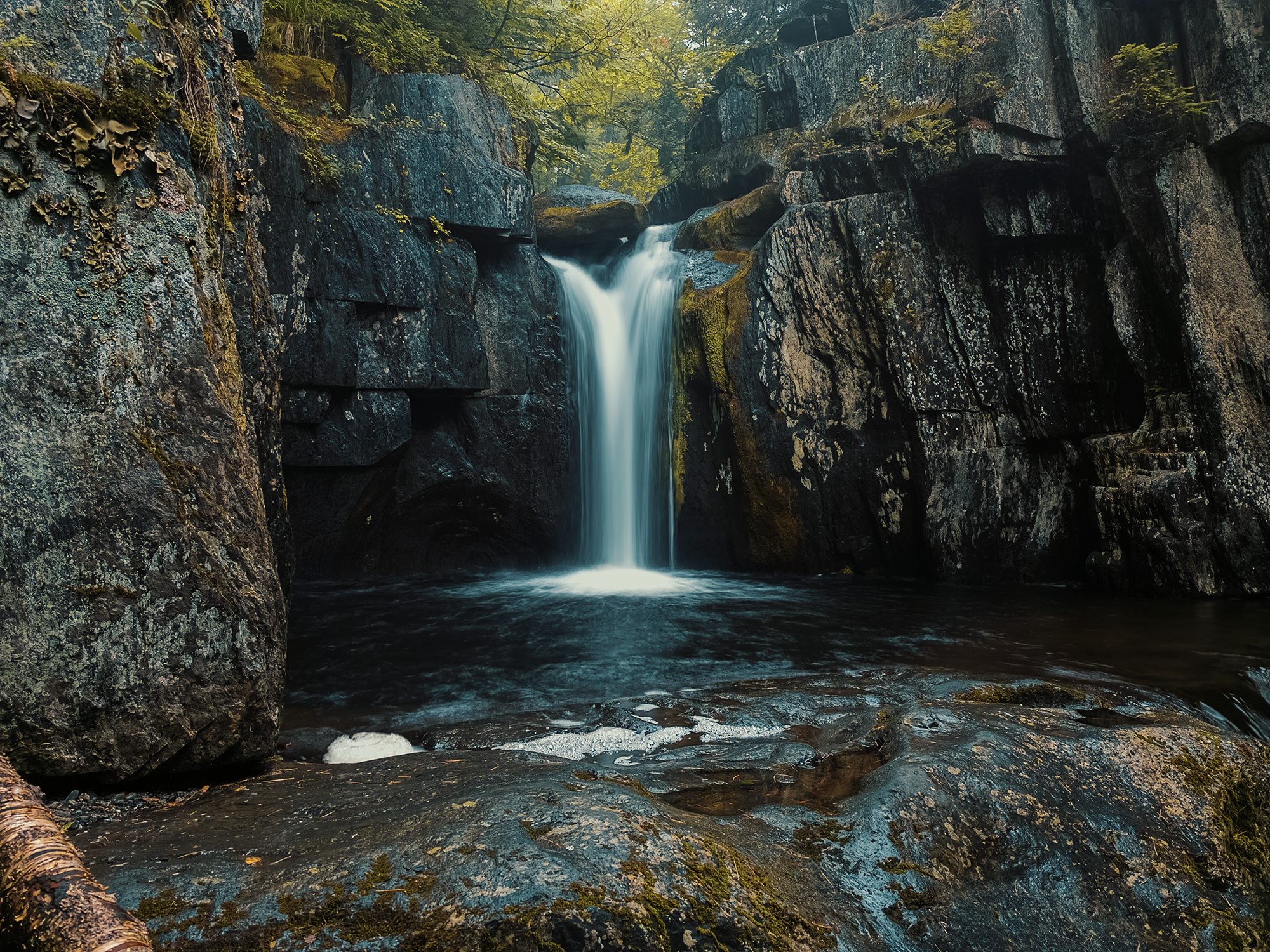
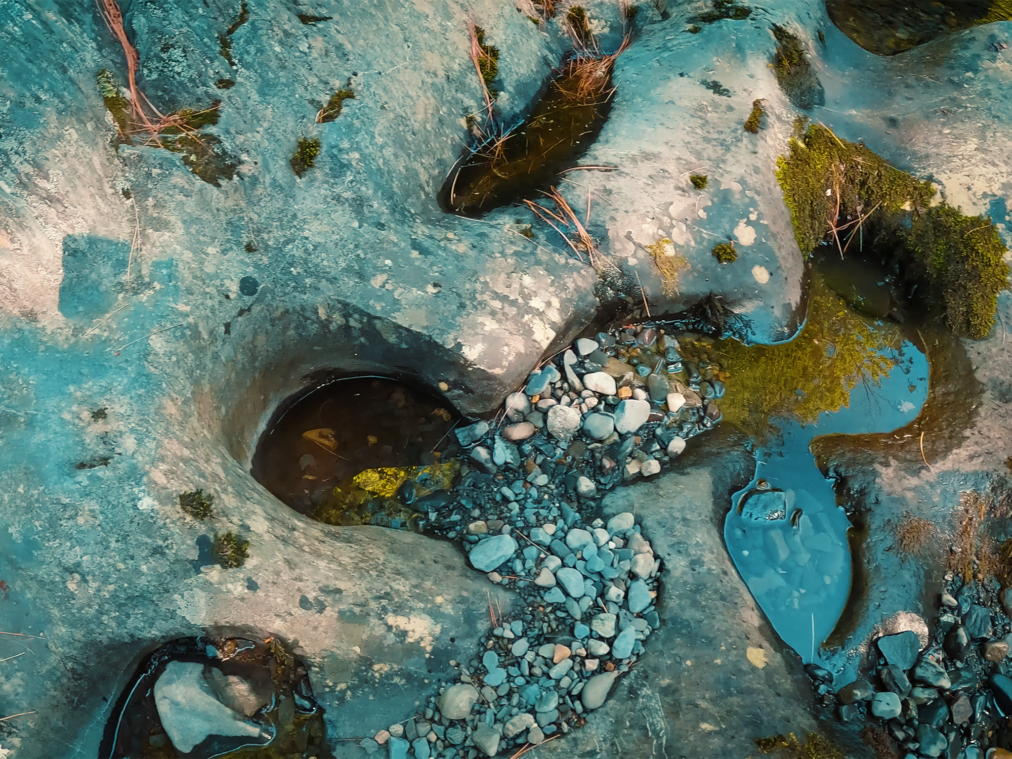
If you’re familiar with other parts of Maine, specifically Grafton Notch State Park (home to Old Speck Mountain), you’ve probably heard the name “Screw Auger Falls” before, because there’s one there, too. Obviously, these are different waterfalls! Yet they likely share the same name because of similar features.
An auger, assuming you don’t already know, is a bladed, screw-shaped tool for cutting holes in something. (I always think of an ice auger first, but there are other kinds!) It wouldn’t surprise me if lumbermen, likely familiar with the wood-boring variety, were thinking of such tools after noticing the “potholes” (see image above) in some of the surrounding rocks. The constant barrage of particulate-laden water likely cut these features (think water jet) or at least augmented them.
Maybe 1/5 mi past Screw Auger Falls, the Rim Trail veers sharply right, and the sounds from Gulf Hagas Brook crossfade into those from the West Branch again.
Hammond Street Pitch
About 1/3 mi from where the trail takes that hard right, there’s a short (less than 400 ft) spur toward an overlook called Hammond Street Pitch. The careful observer will realize there are, in fact, no “streets” in the area!
And what’s a “pitch”?
From the late 1800s through the early 1900s, Hammond Street in Bangor, Maine, was considered the lumber capital of the world. Not just Maine, not just America, but the world! Even back then, Hammond Street was a jumble of activity—much of it focused on the lumber business. It’s not impossible that loggers working this stretch of the Gulf considered the 100 ft cliffs above and the frothing West Branch below reminiscent of the bustling chaos of its Bangor namesake.
And similar to gulf, a pitch—again, at least in logging vernacular—typically meant a steep plunge, usually with water involved along the way.
That’s admittedly conjecture, but it seems plausible to me.
Here, it’s difficult to see the river, but you can certainly hear it! Trees occlude most of the view, but in places, you can see the walls opposite the Rim Trail, and, looking down, one starts to better appreciate the depth of this “canyon.”
I flew my drone over the river, but it didn’t take long before I lost reliable signal. Probably the dense rocks and inconstant line-of-sight. That said, I did manage a brief clip from which I was able to pull a few frames:
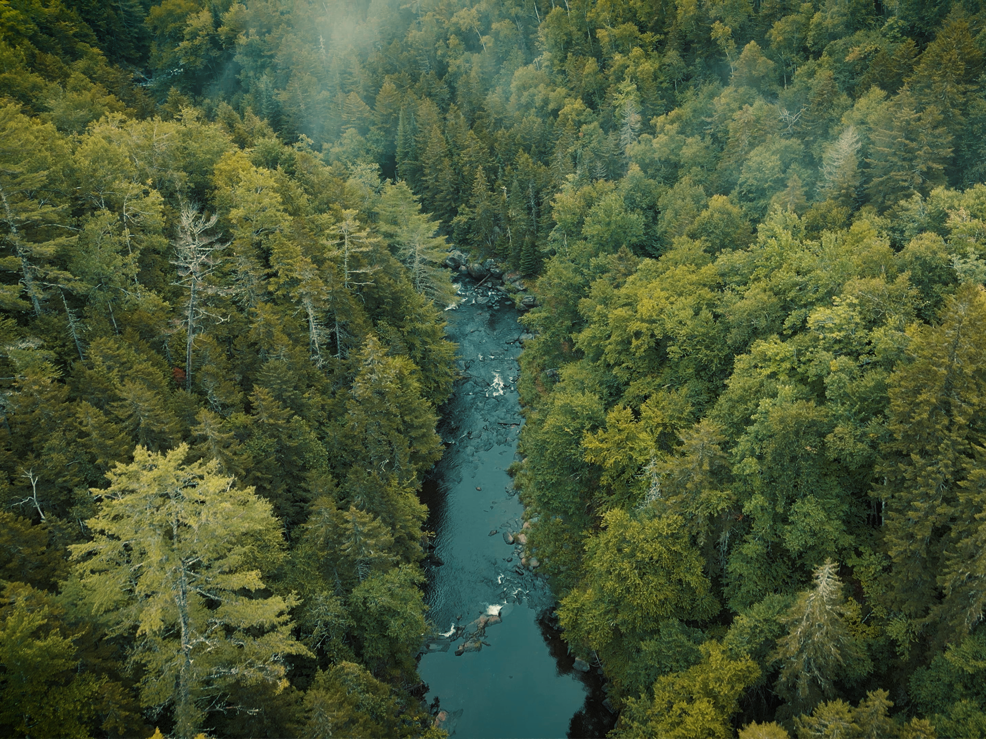

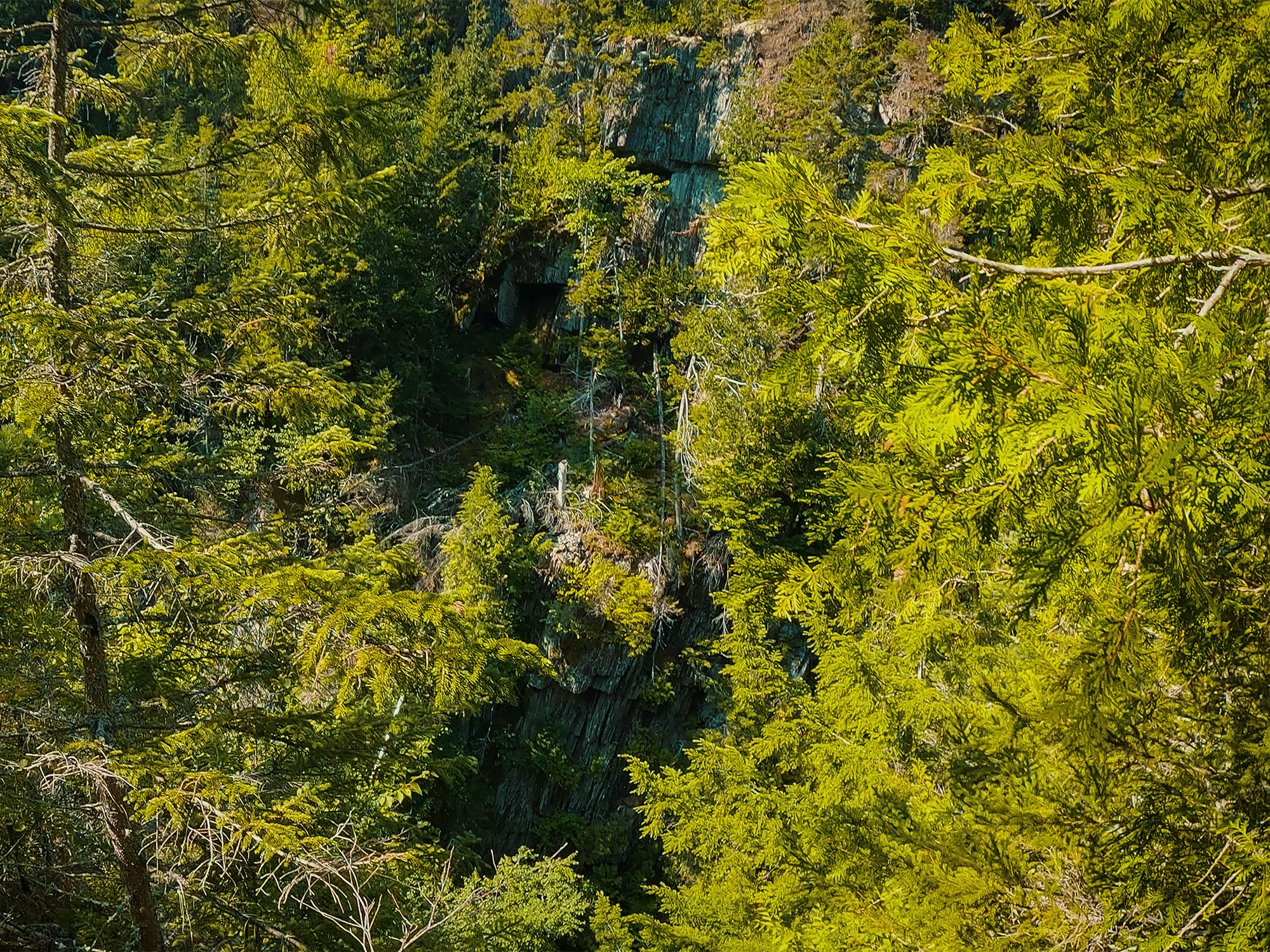
Not quite 1/2 mi up the trail from Hammond Street Pitch, there’s a spur toward a place called Cole’s Corner. I hiked out there on the first trip—at least, I tried to: either the spur is no longer maintained or I got turned around (it was getting dark) trying to find “it,” whatever it happens to be. I didn’t even mention it in the video: all I saw were rocks and trees. Sure, sure: they were “nice” rocks and trees…
About 6/10 mi past Hammond Street Pitch, I reached The Jaws.
The Jaws
The first time I hiked out to The Jaws (named for its maw-like appearance), I thought I was just looking at some cool rock shapes and stuff. Since then, having gained a better understanding of the logging history surrounding Gulf Hagas, I realized I was experiencing something historically richer than just some cool rocks. Before the logging era, the gap between either side of the gorge here was roughly eight feet wide.
Eight. Feet. Wide.
Not long after logging started, people realized that trying to cram literal forests of felled lumber through such a narrow opening was a recipe for logjams. And for the dangers inherent in breaking such blockages apart. I couldn’t find a concrete date, but at some point, loggers blasted The Jaws wider with dynamite. As strange as it might sound, it was usually safer to employ high explosives rather than send people into the river for such tasks! Manually clearing logjams involved substantial risk—whether from drowning or getting crushed or something similarly horrific. And having blasted a wider aperture, they reduced the chances for future jams.
I flew my drone through here as well (this was before I realized my signal was cutting in and out), but the “footage” looks more like a frame every three or four seconds. Instead, I took some ground-based photos:
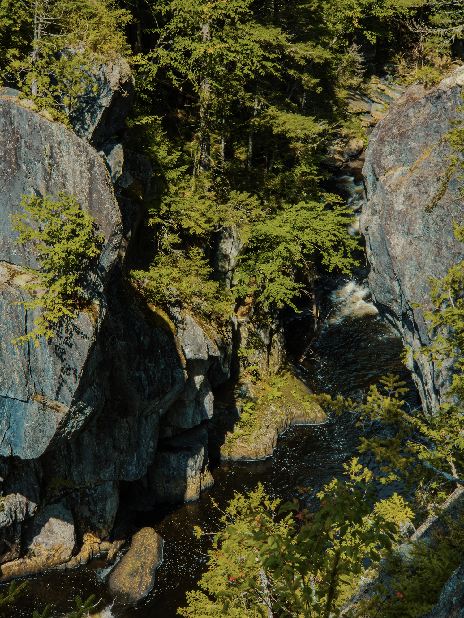
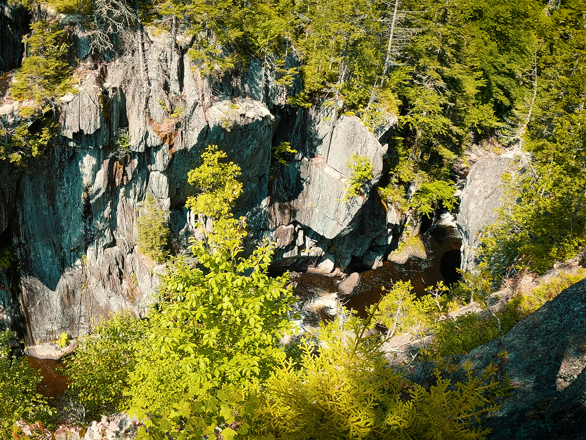
If you’re careful—well, I suppose even if you’re not careful—you can work your way out to the very edge of the Rim Trail side’s “jaw.” I didn’t this time around—trying to be a little more mindful of the time—but from that perspective, even though we’re above the river, you get a truer sense of how narrow the Gulf still is in places.
Just a little more than 1/2 mi past The Jaws, I reached Buttermilk Falls.
Buttermilk Falls
Buttermilk Falls is, I think, the most-photographed feature along Gulf Hagas’ Rim Trail. My photos don’t do it justice. It’s beautiful in the summer, but just imagine the colors during the fall! The trail offers two primary vantages for enjoying Buttermilk Falls. The first is high above, well “in front” of the falls and the sparkling pool at its base; the second is at the end of a short spur that takes you down to the river.
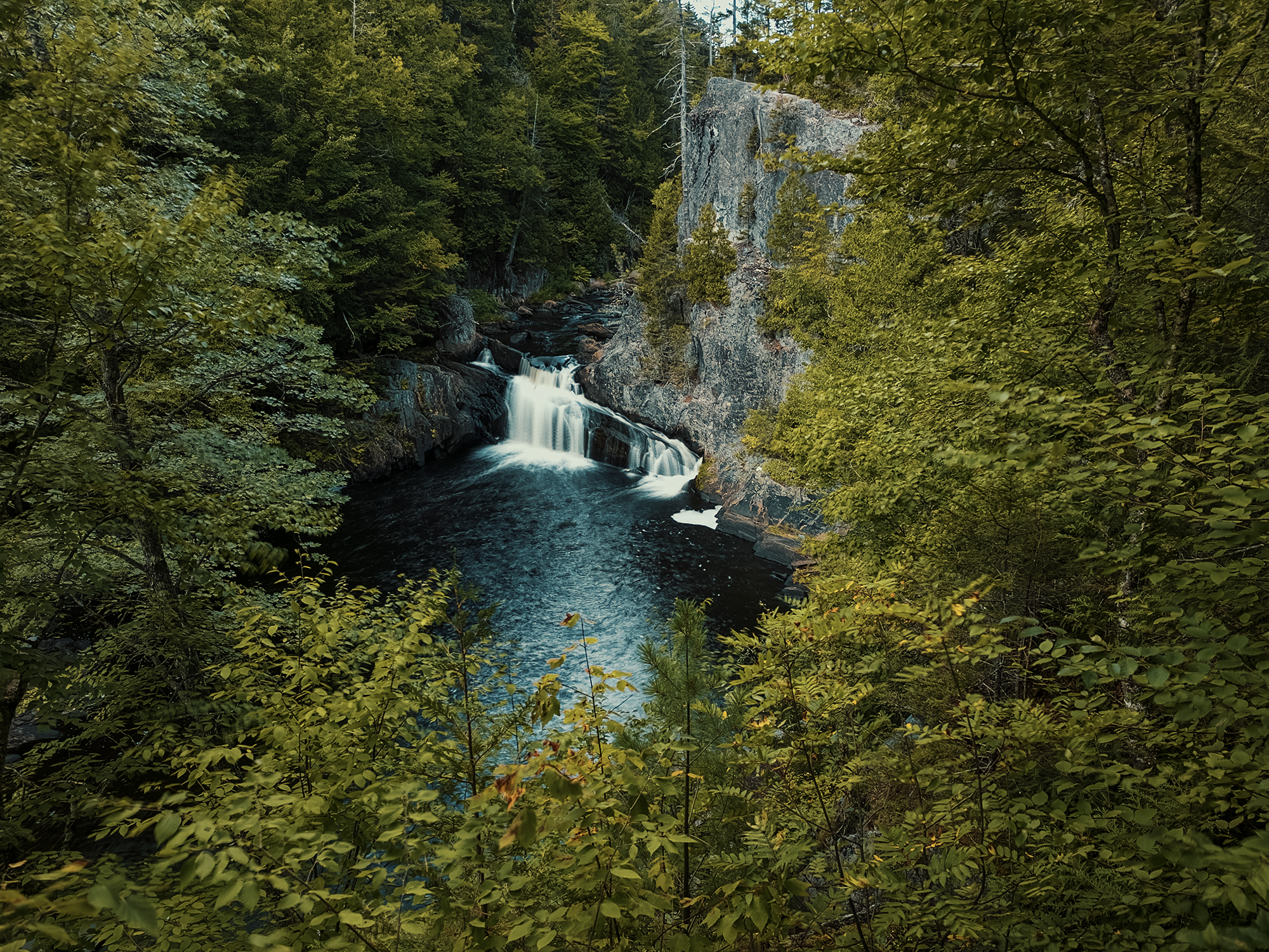
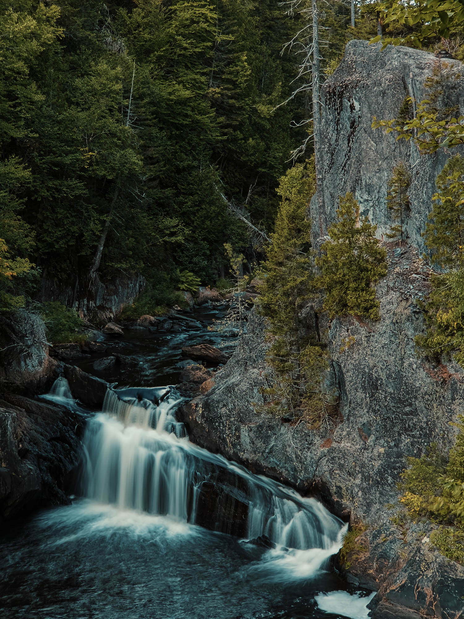
As far as I’m aware, these falls got their name because they reminded someone of buttermilk.
Maybe.
Again, that’s conjecture, but I suppose it’s as likely a reason as any.
I took the short spur down to the river and wished a) that I’d brought a pair of swim trunks and b) that I had time to go for a swim. Since I had neither, reluctantly, I climbed back up toward the main trail and followed it until I reached a path that looked…I’ll say “trail-adjacent.” At the end of that path, I reached the pinnacle of that jutting cliff right above Buttermilk Falls (see the second image above). It’s difficult to get a great view of the falls from here, but it’s definitely a unique perspective standing almost directly “on top” of the West Branch.
Other unnamed views and overlooks
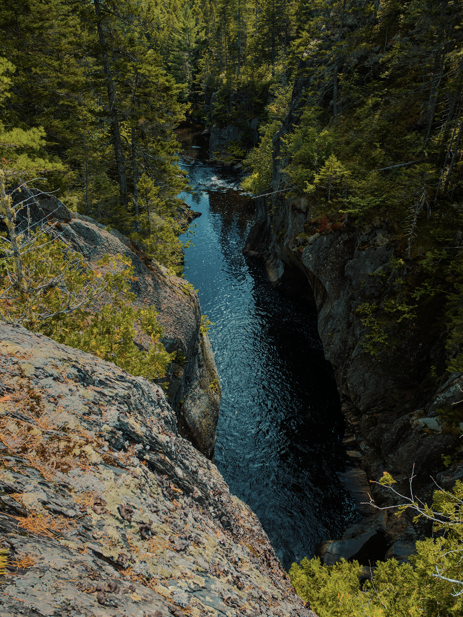
I could have probably put this section anywhere within this post, but in some ways it seems like Gulf Hagas has more views and overlooks than names for them! The Rim Trail typically keeps the river at arm’s length, but in some places it cozies right up to the edge of the cliffs. And in others, there are signs that simply say, “View of the Gulf.”
Billings Falls & Stair Falls
About 7/10 mi above Buttermilk Falls, I reached Billings Falls. About 2/10 above Billings Falls, I reached Stair Falls.
I flew my drone out over Billings Falls, but I was still having signal issues, so despite my best efforts, I didn’t get any aerial footage.
With a name like Billings Falls, I figured their namesake must have been someone named Billings, but I don’t know if that’s true! I did discover that there is at least one Billings (maybe more) associated with Maine’s logging industry during this era, but no definitive evidence that this was the Billings after whom these falls were named.
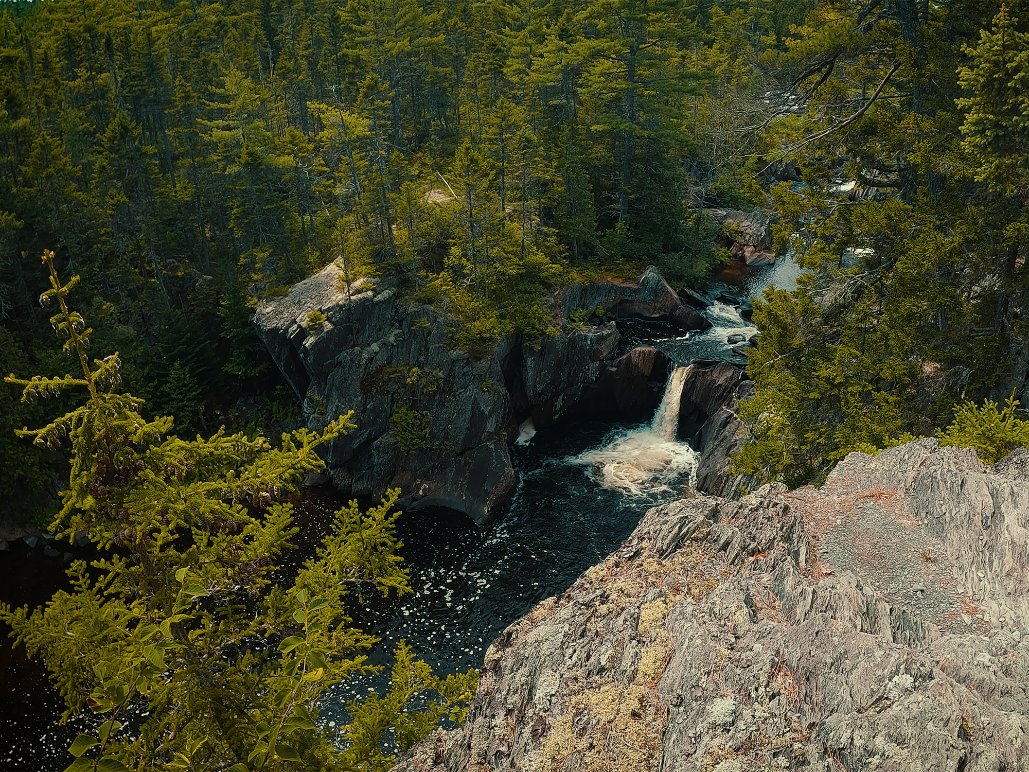
That seems to be the case for a lot of features not only along the Gulf Hagas Rim Trail, but in many other places as well. I made a similar comment about “Wilson” (and “Thompson”) in this video. It makes you wonder—all right, it makes me wonder: when peoples’ names remain long after they’re gone, do future generations give them (the people) any thought?
Stair Falls probably gets its name from the step-like configuration of its runs. It drops in stages (like a square wave) from just below the Head of the Gulf toward the rest of the West Branch.
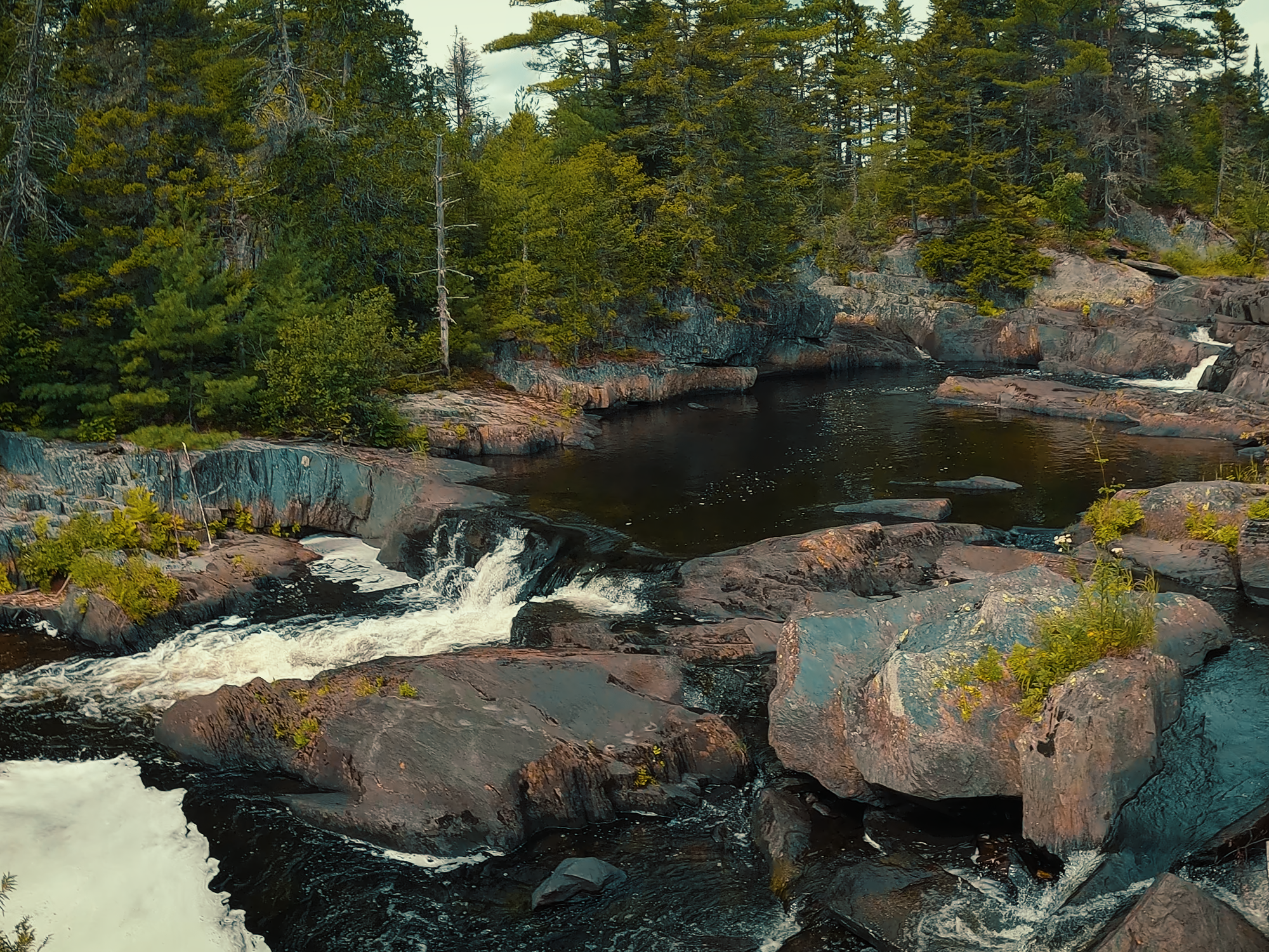
Head of the Gulf
I think I forgot to mention it at the beginning of the video, but the Head of the Gulf is where the West Branch begins its 3 mi traverse through Gulf Hagas. And “Head of the Gulf” is yet another functional or descriptive name versus something emotive or poetic. If one logger said to another, “Meet me at the Head of the Gulf,” there wasn’t a whole lot of mystery regarding where he meant!
I said before that it’s best to start at the KI Gate and hike against the river. One of the reasons I say that is because during a prior hike, I thought it’d be a great idea to avoid fording the West Branch by starting at this end of the Gulf.
It was not a great idea. Just ask my niece.
There’s maybe 1.2 mi from the Head of the Gulf trailhead before you reach the Rim Trail. That also might be true of the West Branch parking area (where I started today, 1.1 mi from the Rim Trail), but I prefer that brief stint on the AT to the Head of the Gulf Trail.
I thought about resting here for a while and enjoying the food I’d brought with me, but about the time I reached the parking area, I realized I’d left all my water behind.
Do not leave all your water behind!
Maybe it was the dehydration talking, but at that moment, all I wanted was something to drink. I figured the sooner I got back to the truck, the sooner I could pop into a gas station or something. Instead of eating something, I just finished the Rim Trail and started back on the Pleasant River Tote Road.
Pleasant River Tote Road
Don’t let the name fool you: the Pleasant River Tote Road (or just the Tote Road) is not a road! At least, not anymore. Cut as a route for transporting equipment, supplies, and even workers themselves up from the river by horse-drawn vehicles (including sleds in the winter), this “road” reverted to trail conditions long ago.
It does offer a somewhat shorter and much less up-and-down path back to The Hermitage. (2.2 mi versus 2.6.) For a road, it’s pretty terrible, but for a trail, I’ve hiked worse.
Back at The Hermitage
Near the beginning of this post, I mentioned that The Hermitage was never logged. While I can’t say with certainty why that’s true, one of the reasons is Romanzo Kingman, a wealthy Bangor lumberman who forbade anyone to harvest anything from the region. I don’t know how or why he reached that decision, but it’s possible there were economic factors involved. It’s also possible that people’s opinion of this stand of forest underwent a perspective shift: rather than a source of material for fueling a blast furnace, maybe they started to view it as something to be preserved and protected.
Wait—blast furnace?
That’s right! For context, let’s visit Katatahin Ironworks, right across from the KI gatehouse where I paid my usage fee.
Katahdin Iron Works
Katahdin Iron Works (KI) has its own history, and I don’t think this is the place to dig too deeply, but I do think a basic understanding of its operation helps make sense of all the activity surrounding Gulf Hagas in this era.
The primary source for ore for KI was from nearby Ore Mountain. Ore isn’t all that useful fresh out of the ground: it needs to be smelted, and for that, you need a blast furnace capable of reaching the necessary temperatures—and holding them long enough to complete the process.
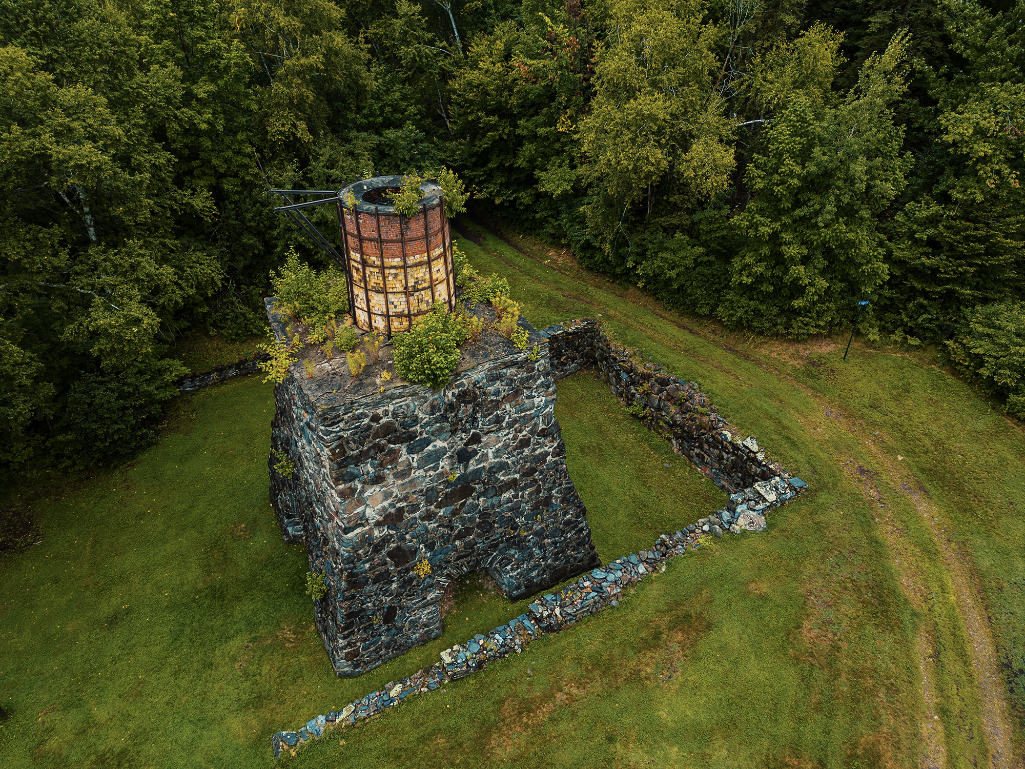
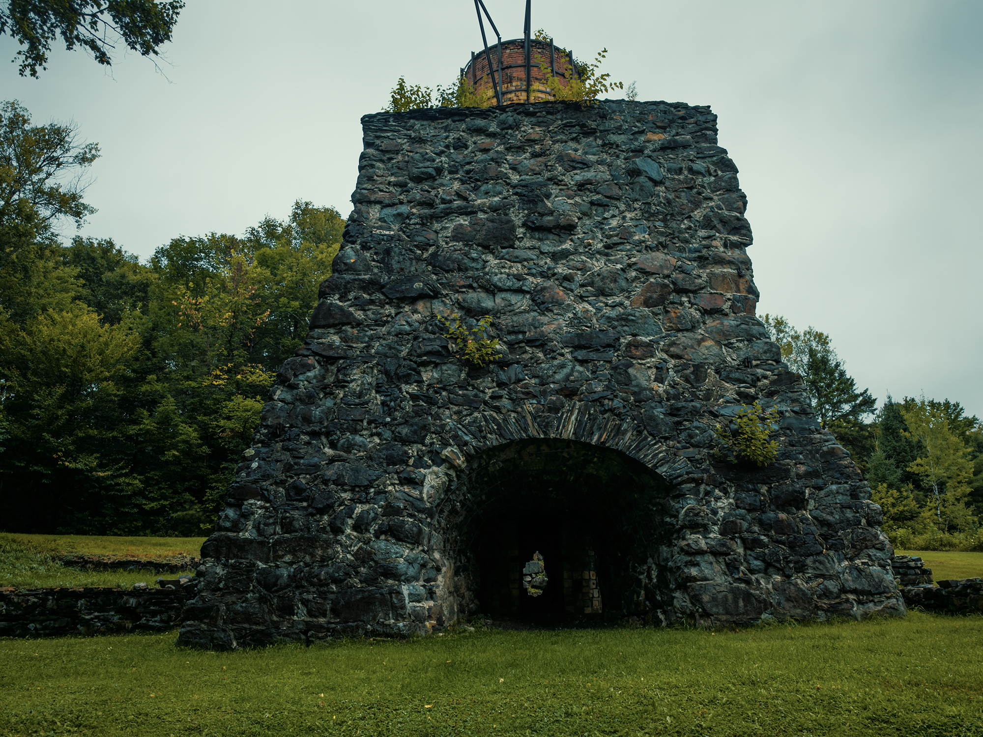
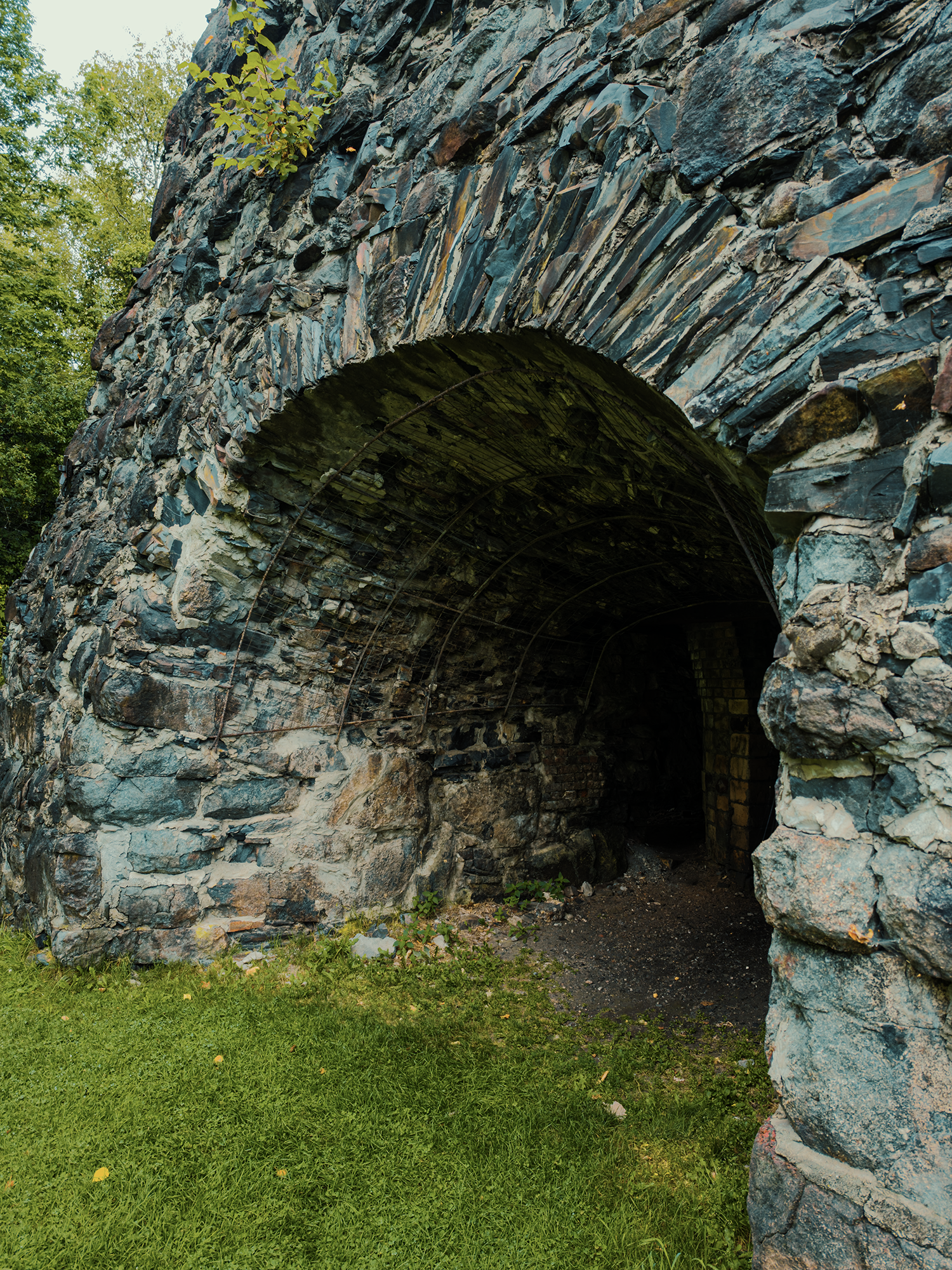
Wood alone usually doesn’t provide consistently high heat for this purpose. Instead, KI workers would “cook” logs in a low oxygen environment inside these “beehive”-like kilns:
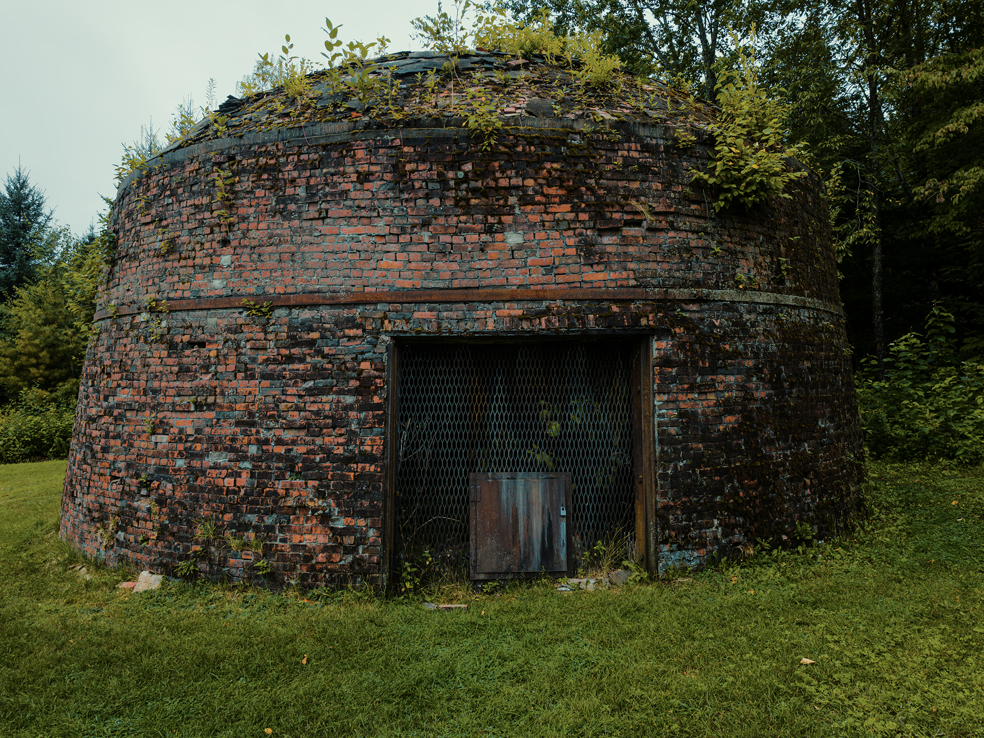
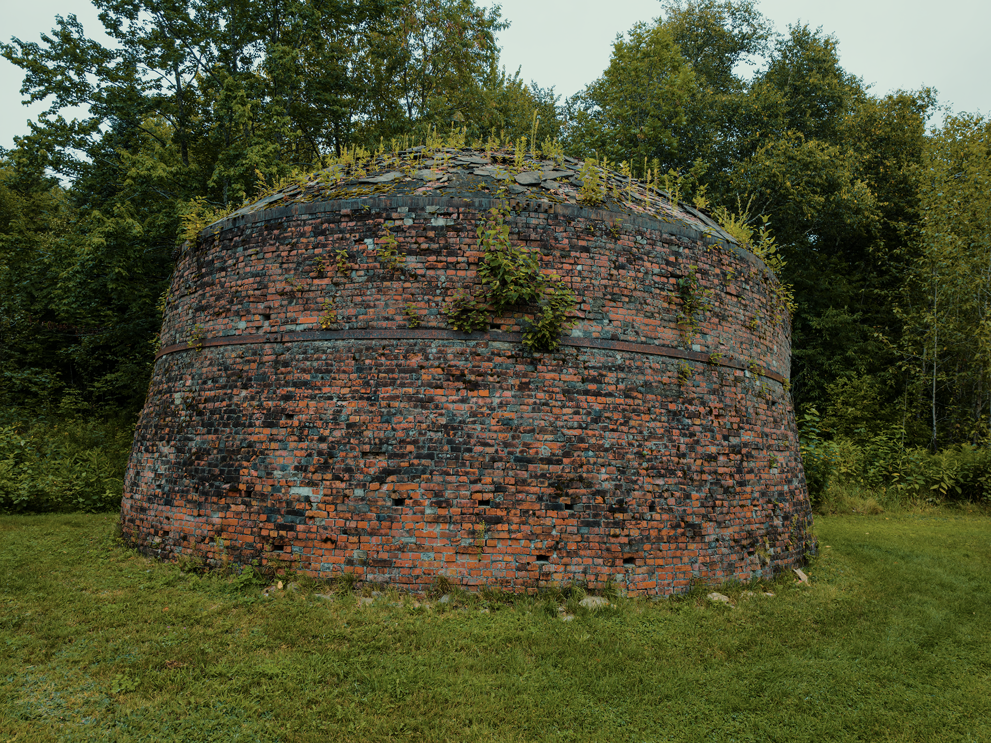
I don’t have exact numbers for the “charcoal-to-iron” ratio from X amount of wood and Y amount of ore—there are a lot of variables, and I’m no metallurgist—but from what I read, it required literal forests of lumber converted into charcoal to maintain a profitable smelting operation. That’s one reason so many trees made their way through Gulf Hagas, down the West Branch Pleasant River, and ended up here.
With a better understanding of how much wood the Ironworks needed, the fact that The Hermitage remains untouched seems that much more remarkable.
Wrapping up
I enjoyed this hike—well, technically, these hikes, since I mismanaged my time on the first attempt. There’s just something about hiking a trail with roaring water below and the warm scent of evergreens above. Having hiked Gulf Hagas before, prior to understanding its relationship to KI, I definitely think there’s a benefit to hiking it afterward.
I wonder what convinced Romanzo Kingman not to cut down The Hermitage? I wonder why Campbell Young decided to build a cabin there rather than somewhere—anywhere—else?
Whatever their reasons, I appreciate being able to hike through this section of old-growth forest (both ways) on the way through Gulf Hagas. And it’s just a touch ironic: this hike, spanning regions vital to logging operations, begins and ends in a place where logging never happened!
Catch the whole adventure on YouTube! Please consider subscribing (if you haven’t already). Thanks for stopping by!