My wife and I drove to Portland, Maine, for a concert the night before this hike. We got back to my parents’ place around two in the morning, and my brother intended to pick us up around four. I didn’t get a lot of sleep, but I tried to nab a few winks en route to Baxter State Park. I think I got a little shut-eye in the car, but I also got a Red Bull somewhere along the way. I’m not sure which helped the most.
We pulled off of Park Tote Road (near the Slide Dam parking area), I drained the last of my Red Bull, and we started up Marston Trail, the route that traverses Mount Coe’s summit and provides access to both the South Brother and North Brother spur trails. That’s where we (me, my brother, my nephew, my oldest son, and one of his friends) would spend most of our time today.
Marston Trail
The first little bit of the Marston Trail isn’t too bad, but less than a 1/4 mi later, we crossed a stream, and all of that changed. Running on fumes and Red Bull (which I normally don’t even drink), I probably overstretched every muscle, ligament, and tendon in my legs, but I made it. Everyone else outpaced me—but they weren’t stopping to rant and rave in front of a camera. Yeah, that’s gotta by why. Gotta be. For most of that uphill, I heard an unnamed creek—a tributary of the Nesowadnehunk Stream—off to the left generating white noise for about the next 1/2 mi, maybe more.
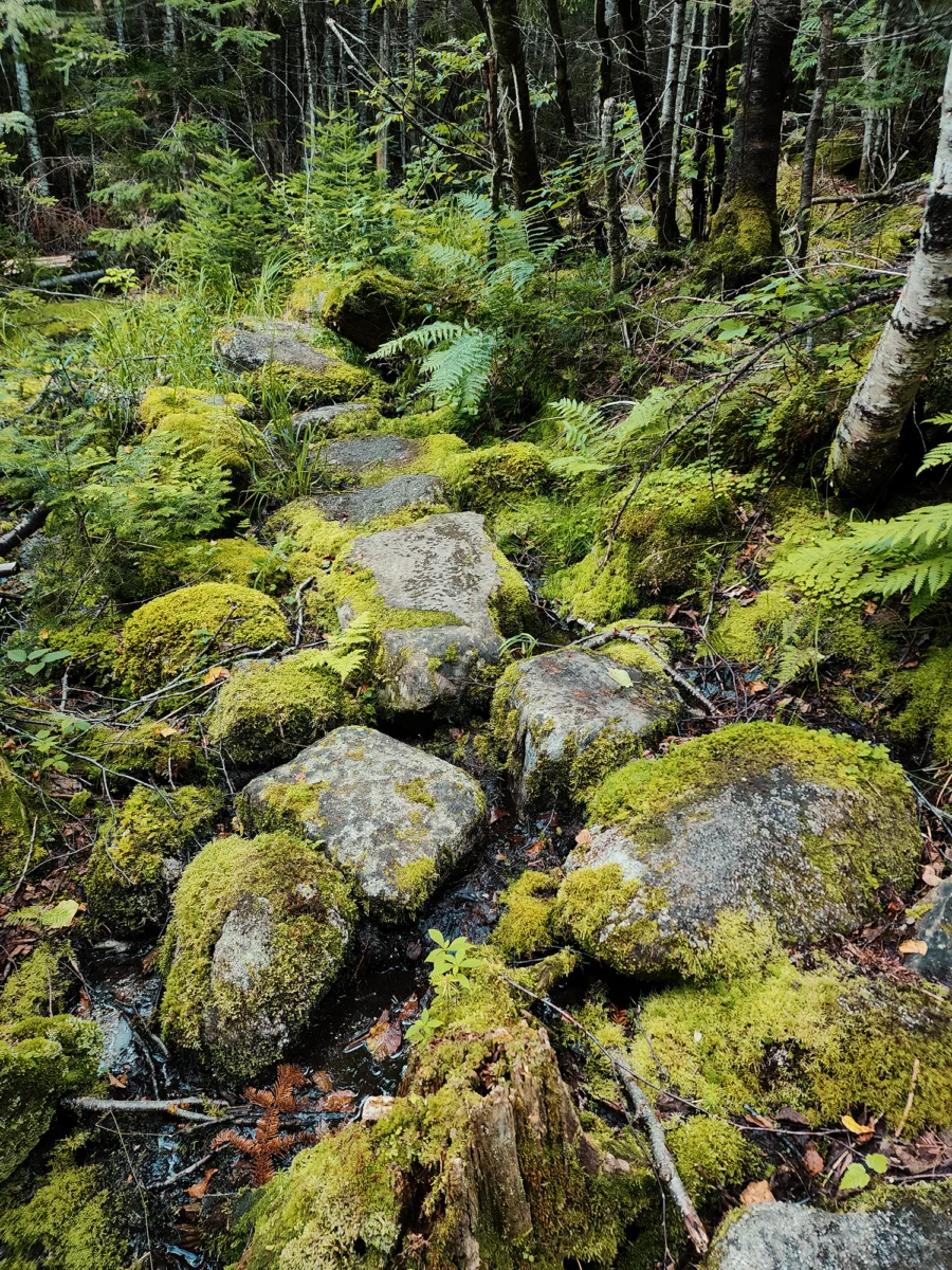
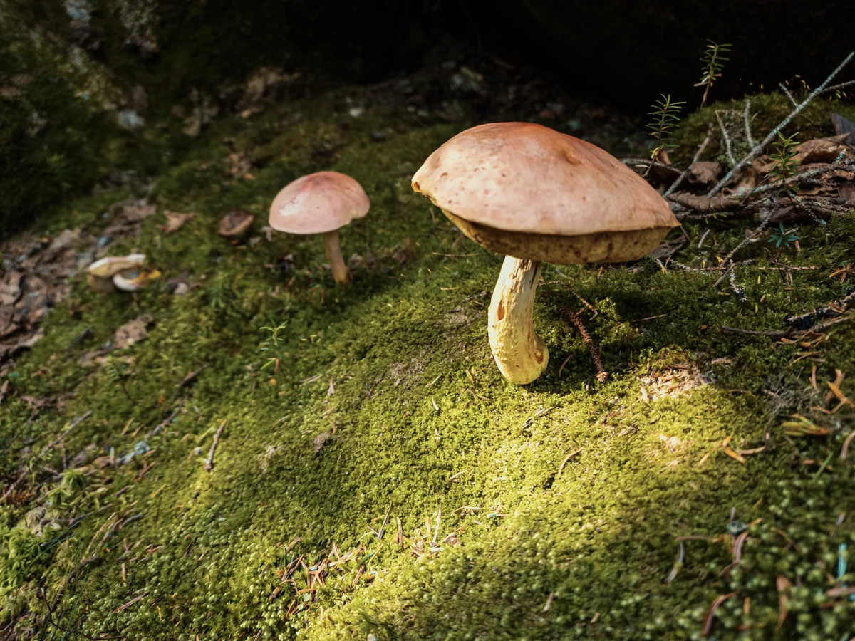
After about 8/10 mi from the parking area, Martson Trail levels out a little—for a brief distance, anyway. I think it’s here that the flanking forest felt like something out of a Brothers Grimm fairytale: situated between dense firs and pines, mosses blanketed the ground on either side of the pebble-strewn path. I snapped a quick photo of a pair of mushrooms framed by the still-rising sun’s light.
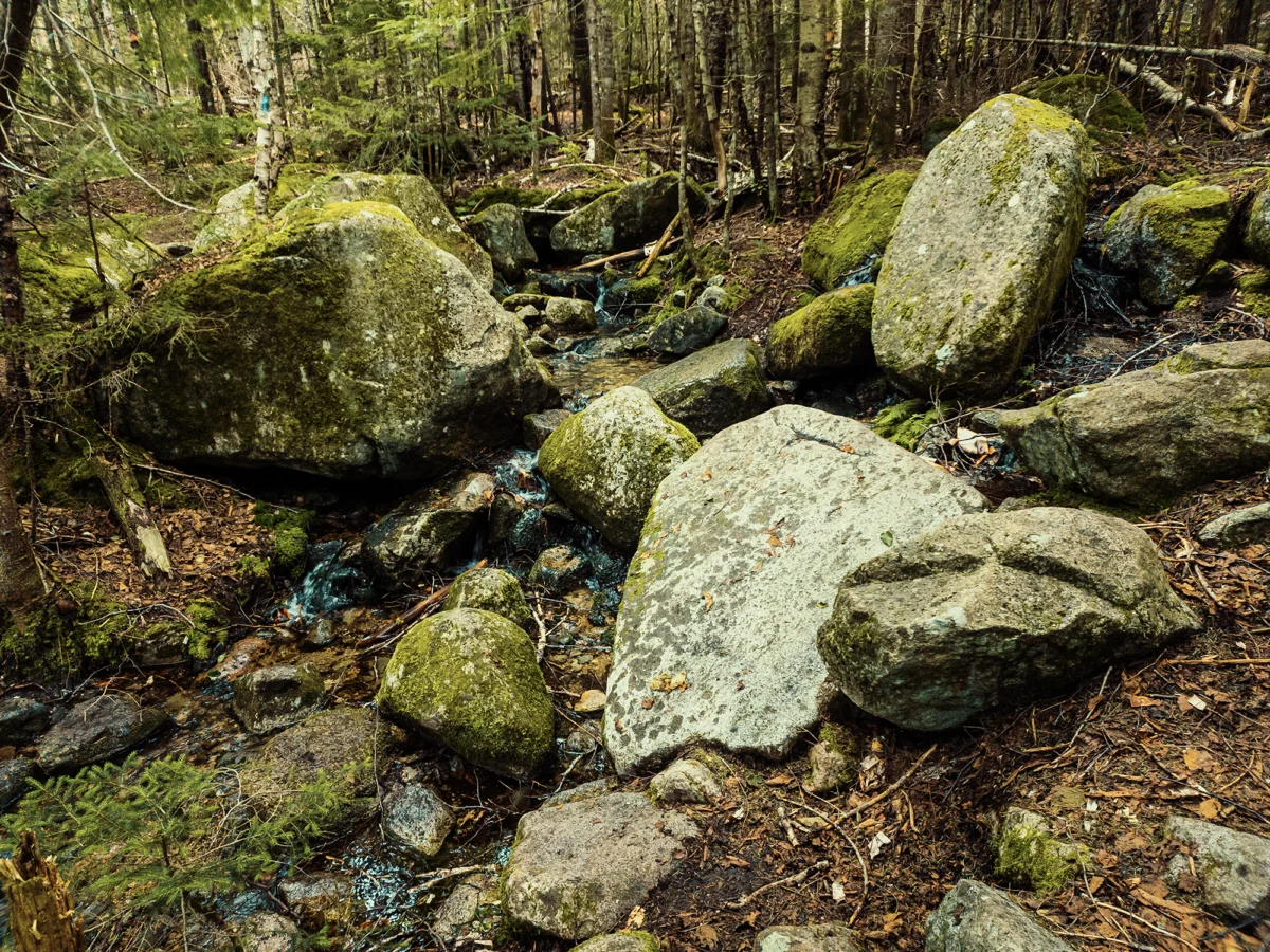
At about 1.2 mi, we hit a T-intersection and turned right. (Marston Trail is a giant lollipop loop.) For the next 7/10 mi, the grade felt much less intense than what we’d just come up through. Here, too, the trees thinned out a little as boulders of varying size separated the forest from the trail—to the west of us, anyway. It must’ve rained not too long before we got there that morning, because I remember slipping in the mud around here somewhere.
Once finished with that 7/10 mi, you’re standing in front of the northern end of a steep ridge. Along that ridgeline runs the O-J-I Trail, which crosses the summit of Mount O-J-I before linking up with the Marston Trail (unless you’re headed in the opposite direction, of course!). Mount O-J-I wasn’t on our itinerary today, but it’s named after a rock face that once formed the letters O-J-I. It’s gone now, apparently destroyed in the Great New England Hurricane of 1938.
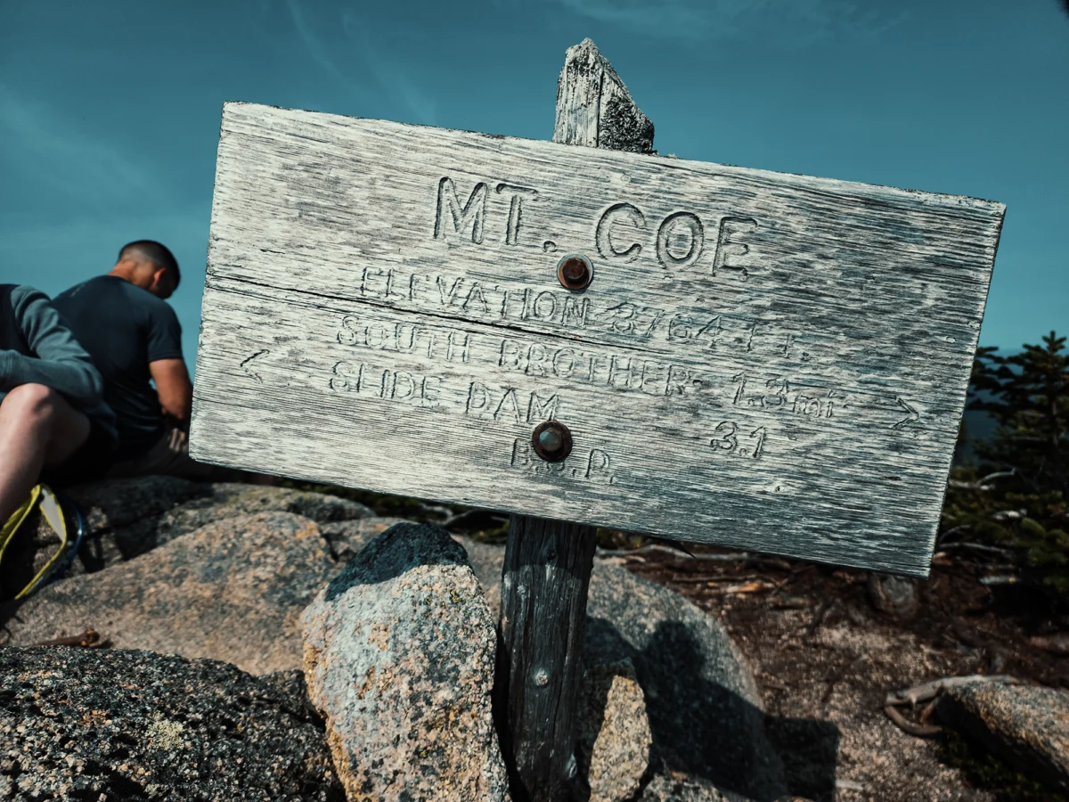
Mount Coe
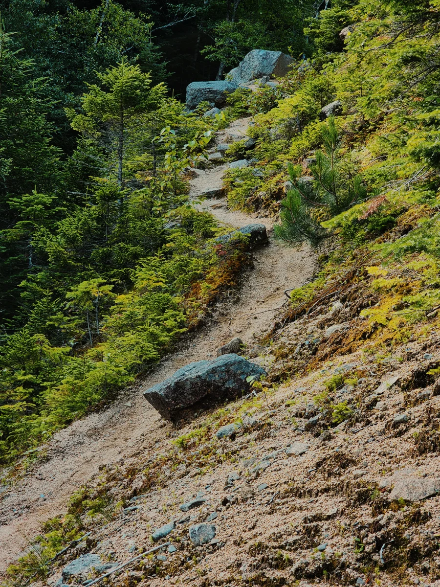
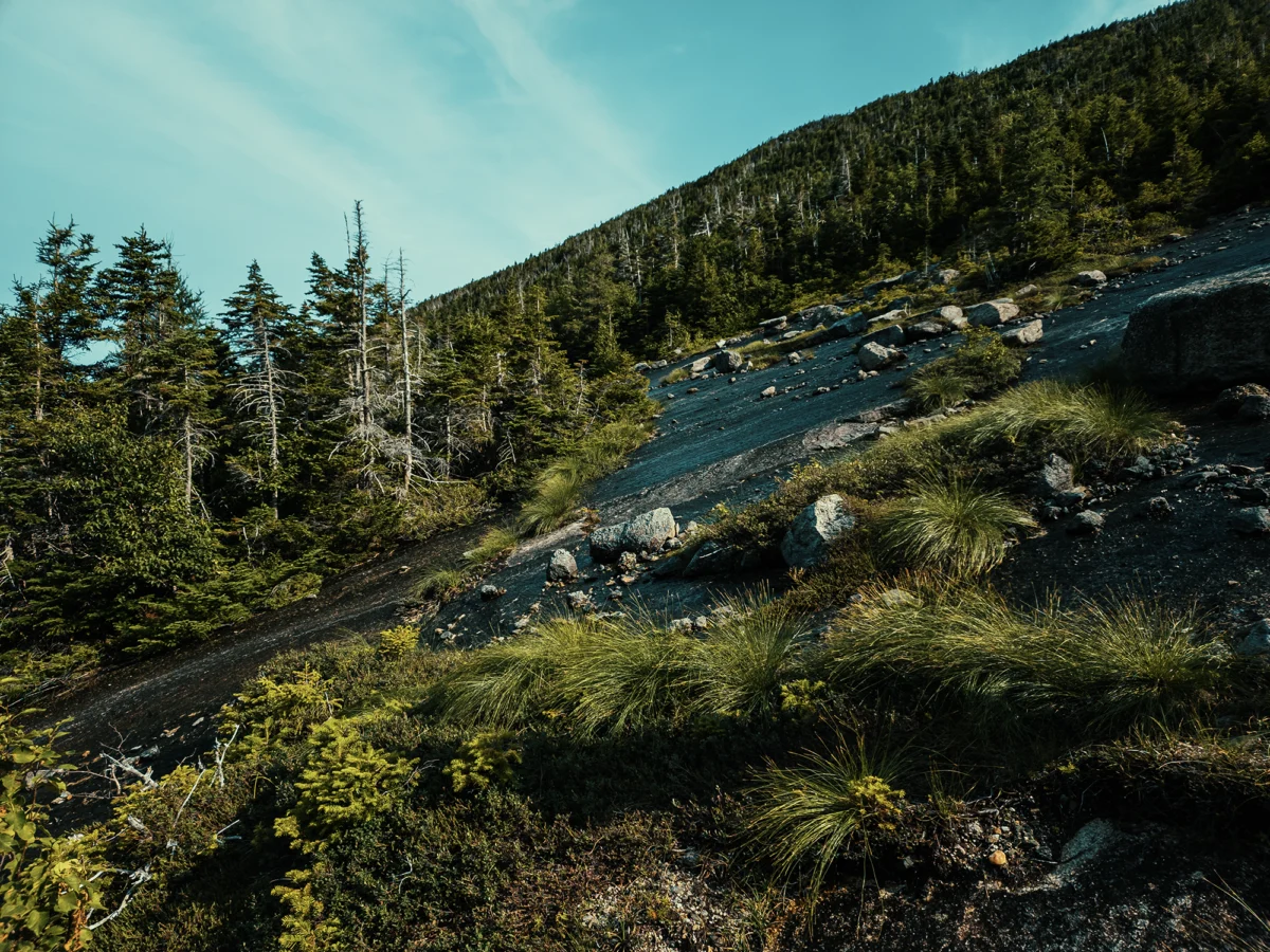
The ascent up Mount Coe is about half a mile, and the trail traversing its slope is, well, it’s something. It’s steep—50% grade, strewn with patches of loose rock and gravel, and, today, still slick from that aforementioned rain. We spent a little extra time here, searching for safer routes in places that seemed unnecessarily dangerous. As we gained elevation, we crossed paths with others who must have had similar thoughts. Looking back toward the direction we’d come from, my brother pointed out Doubletop Mountain to the west. We’d been pretty near its base at the parking area; now, it seemed much farther away!

Oddly enough, the forest reasserts itself just shy of Mount Coe’s summit. A couple of fir boughs smacked me across the face as I tried to get past them. The summit (3,760 ft) is about 2.8 mi from the start of the Marston Trail. Look to the east-southeast and you might glimpse Mount Katahdin‘s Baxter Peak, the northern terminus of the Appalachian Trail. I brought my drone with me on this trip. Even flew it across the valley a little. But because I’m awesome, I forgot to press record, so for all the proof I have, I could be lying about the drone. (I’m not though.) Shucks.
South Brother
The wind started picking up atop Mount Coe, and we needed to move on anyway, so I packed up the drone (no, really!), slung my pack across my shoulders, and we started down the Marston Trail toward the spur for South Brother. The trail quickly dips back down below the timber line, and it becomes an inconstant mix of rocks, roots, and downed trees. All right, that probably describes most New England trails. I remember hiking over vast blocks of granite with curious fissures in places that almost seemed artificial. This is beautiful country.
Maybe 1.1 mi later (3.9 mi total), we reached the South Brother Trail. It’s a 3/10 mi spur (on the right) that feels like twice that on the way up (we gained about 100 ft for every 1/10 mi). This route—especially closer to the summit (somewhere near 3,970 ft)—becomes a maze of boulders and stiff, unforgiving shrubs, but the views are worth it. I’ve hiked Katahdin a couple of times in the past, but until today, I’d never seen this side of it.
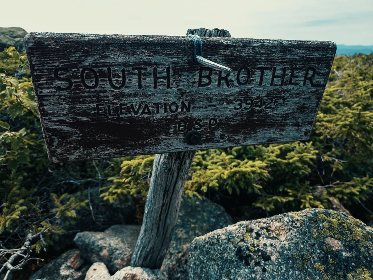
You’ll notice the sign says South Brother is 3,942 ft in elevation. Above I said it was around 3,970 ft. I suspect that sign draws elevation data from an earlier survey. I didn’t even try to fly the drone from South Brother’s summit: the wind up here was ridiculous, and I’m pretty sure I never would have seen it again. I guess I’ll just have to try some other time. We spent a few minutes enjoying the view before returning the way we came. The hike down that 3/10 mi feels a lot more “realistic.” I’m sure the fact that it’s downhill has nothing to do with it. That put us back on the Marston Trail toward North Brother. It’s about another 6/10 mi to the North Brother Trail.
North Brother
Down from South Brother, the Marston Trail looks a lot like it did down from Mount Coe: dense mixed forests on either side of a rocks-and-roots footpath, punctuated here and there with exposed granite slabs. The first 3/10 mi past the South Brother Trail drops between 100 ft and 150 ft before it levels out somewhat. Even after we started the North Brother Trail, the terrain maintained a pleasant grade for the next 1/3 mi or so before ratcheting up again.
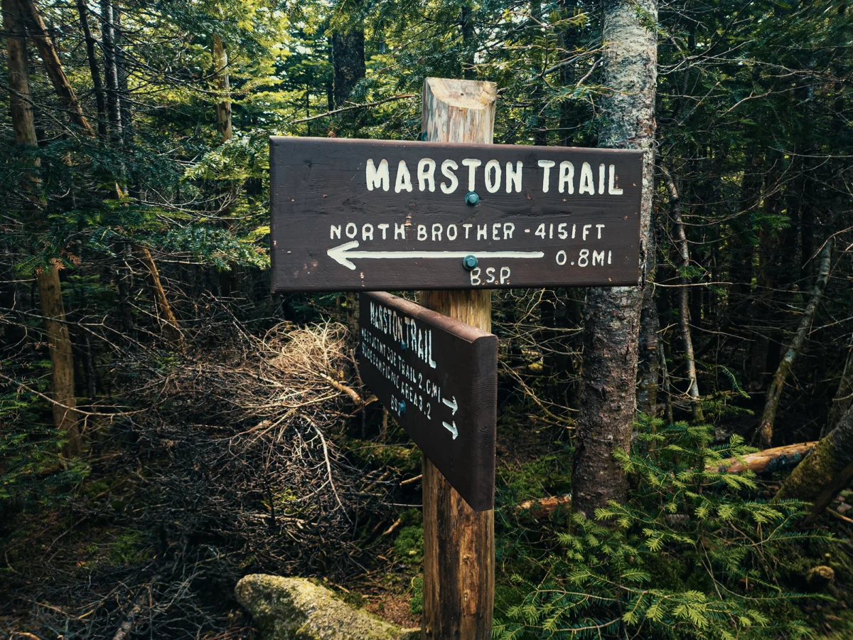
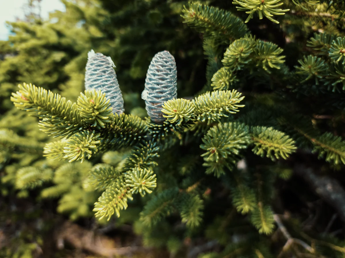
We stayed straight to take the North Brother Trail—the Marston Trail turns sharply to the left here. After that relatively gentle start up the North Brother Trail, North Brother itself rises roughly 600 ft over the next 3/10 mi. Trees still flank the trail for most of this distance, but they start to thin out at around 4,000 ft. Before that, though, I took a poorly-focused photo of these spruce cones, sticky with sap. (It’s normal to see some sap, but too much could mean the tree’s in trouble. I’m no botanist or arborist or whatever though.)
The wind at the summit of South Brother was crazy: the wind at the summit of North Brother was insane! We crossed paths with a couple of other hikers up here: they told us park staff had shut down Mount Katahdin (nearly 5 mi southeast of us, as the crow flies) because of strong gusts! We endured the wind (it really wasn’t that bad, although my microphone couldn’t handle it) and took a few minutes to enjoy the view (and some snacks).
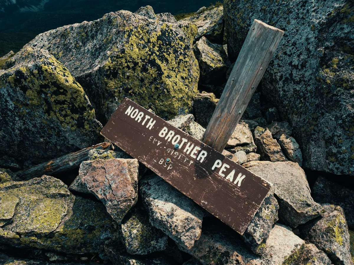
North Brother stands about 4,150 ft above mean sea level, making it one of Maine’s fourteen 4,000 footers. (It’s number 6 on that list.) Granted, anyone west of the Mississippi is probably laughing right now, but hey: not all of us have the Rockies or whatever in our backyard! From the above photo, you can see that the sign is no longer attached to its post. It looked like it had been that way for a while, like someone just said, “yeah, close enough,” and left it like that. Nice.
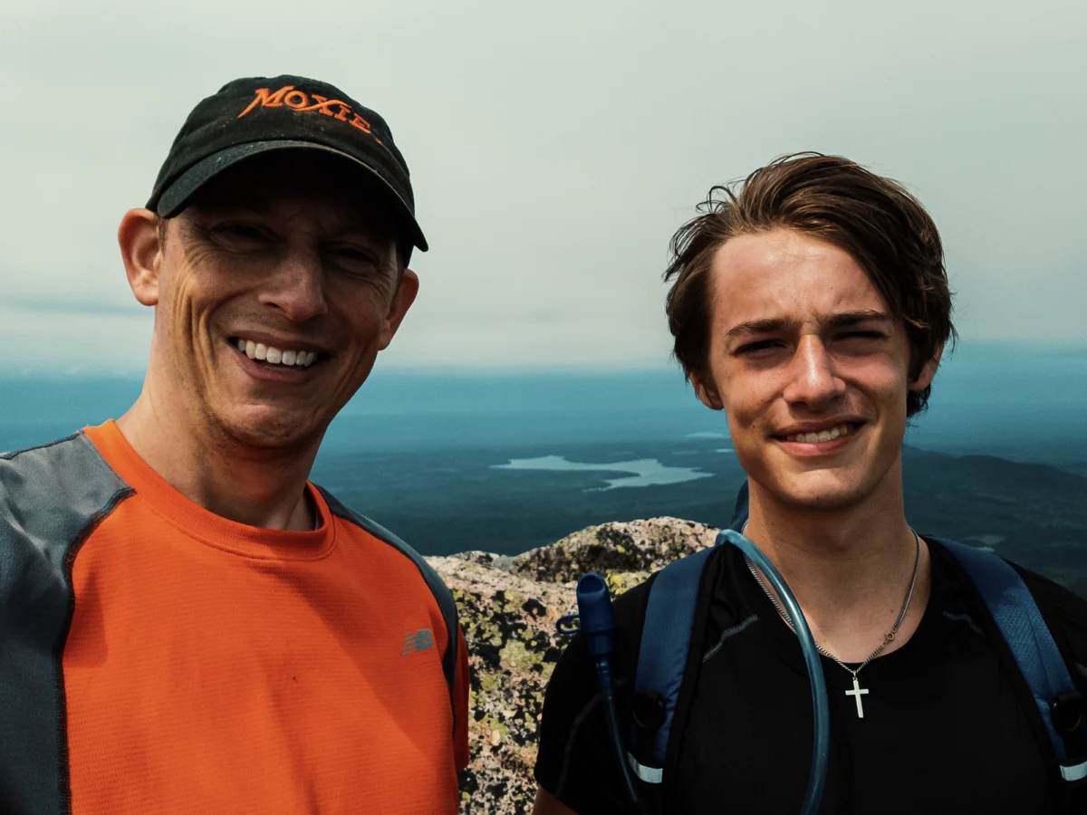
Before descending North Brother and ultimately heading back to the car, I snagged a selfie with my oldest son. He doesn’t often come with me on hikes or camping or backpacking trips, and I’m grateful that today he made an exception:
On the way down, it started sprinkling. The rain never got too intense, but I put my jacket back on: the combination of precipitation and an overcast sky dulled the sun’s earlier warmth. Once back on the Marston Trail, it’s about 3/4 mi of somewhere roughly between -10% to -15% grade; the next 3/4 mi hit -40% in places! By that time, I definitely felt it in my knees.
One and a half miles from the North Brother Trail we came across an unnamed pond on our left. Neat. From there, we hiked another 7/10 mi back to the junction where we turned right earlier in the day, losing maybe 250 ft of elevation along the way. At the junction, we hiked the remaining 1.2 mi back to the parking area.
I used to think of Baxter State Park as “Mount Katahdin and maybe some other stuff,” but it really offers so much more to enjoy. Revisiting this trip (I’m writing this a few years after the fact), I want to get back there again and spend more time exploring the areas I ignored (or never knew about!) as a kid.
Catch the whole adventure on YouTube! Please consider subscribing (if you haven’t already). Thanks for stopping by!