[Note: this trip covers four days (well, three and a half, really), but rather than write a separate post for each day of our Tricorner Loop trip, I’m going to consolidate my thoughts into a single post. On YouTube, I posted each day as its own video, but in the future, I think I’ll edit even multiday adventures into an amalgamated whole. That’s my longwinded way of saying this’ll be a lengthy post! And with that out of the way, let’s go.]
The night before
I’ve earned a reputation among my circle of hiking friends for putting together masochistic routes without regard for daily distance and elevation considerations. I’m trying to get better about it, but it’s a fair criticism. That (deserved) reputation probably originates with the circumstances surrounding this trip. I publicized the route a couple months prior: two people expressed interest, one who’d never done any sort of backpacking before. Anyway, at the end of September 2023, the three of us headed west toward Great Smoky Mountains National Park. It’s a 5+ hour drive, and by the time we pulled into Big Creek Campground, it was already dark. We ate and went to bed.
Day 1
Chestnut Branch Trail
After packing everything up at Big Creek Campground, we drove toward a different parking area, then headed up the Chestnut Branch Trail. And when I say up, I mean up. Over the first 5+ mi, we gained well over 3,000 vertical ft. A few years prior, six of us (including Matt M., one of this trip’s participants) hiked rim-to-rim through the Grand Canyon: hiking to the South Rim from Indian Garden wasn’t as much elevation gain as this!
Starting out, I got stuck in a horse gate. Gate might not be the right word: it’s not an actual barrier so much as a zig-zagging corridor designed to prevent horses from passing through. After that, we followed the trail along the Chestnut Branch, passed some pretty cool rocks, and ultimately turned left (SOBO) onto the Appalachian Trail (AT).

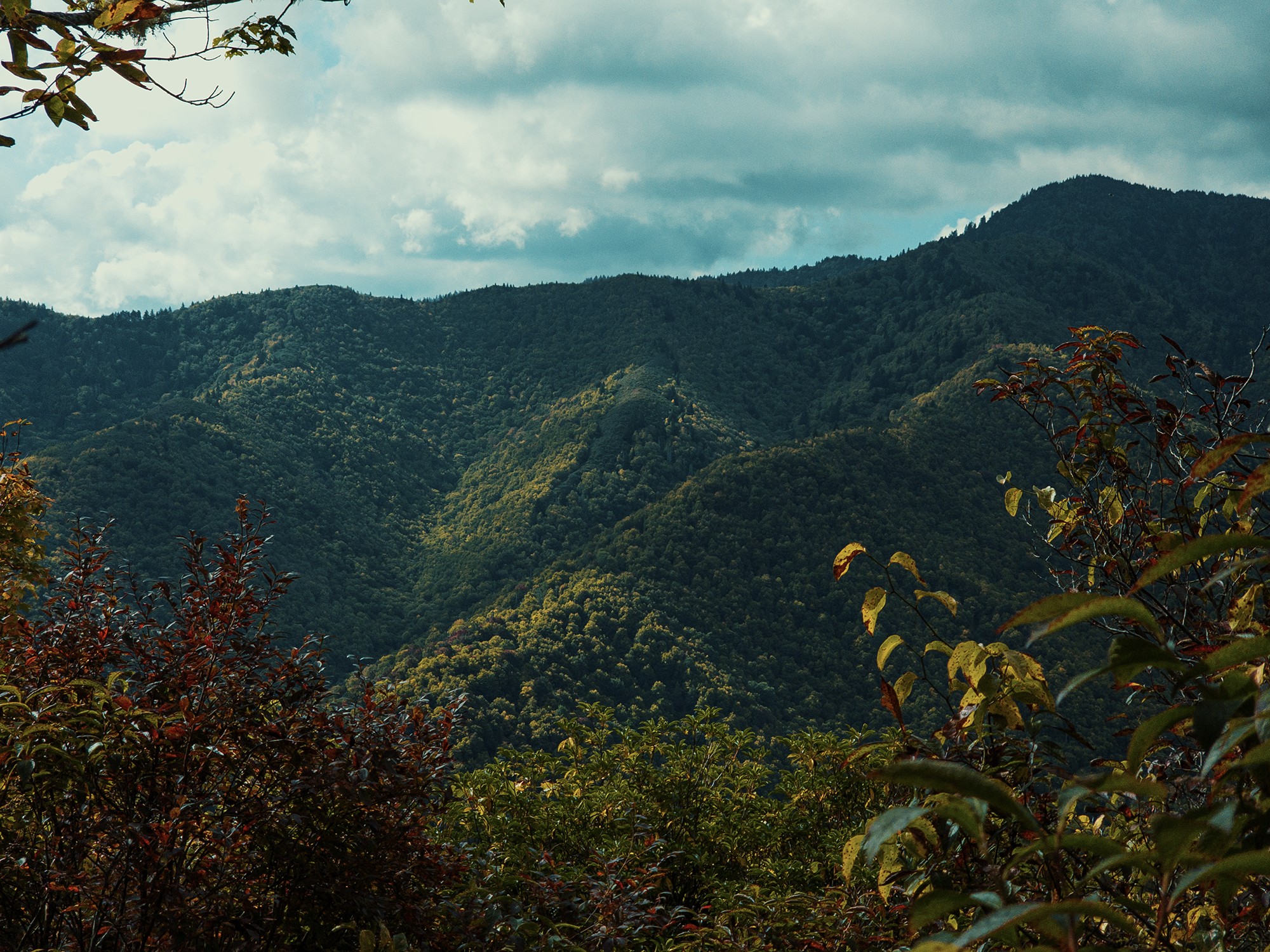
Most of the trail here is flanked by a mix of hardwoods and evergreen trees and pockets of rhododendron. Other than the incline, it’s a pleasant walk: the trail is relatively wide, shored up by rock walls in some places, and in others, offers views through the trees into valleys below. I still get a kick out of being in North Carolina one moment, Tennessee the next, then back again. I’m easily amused.
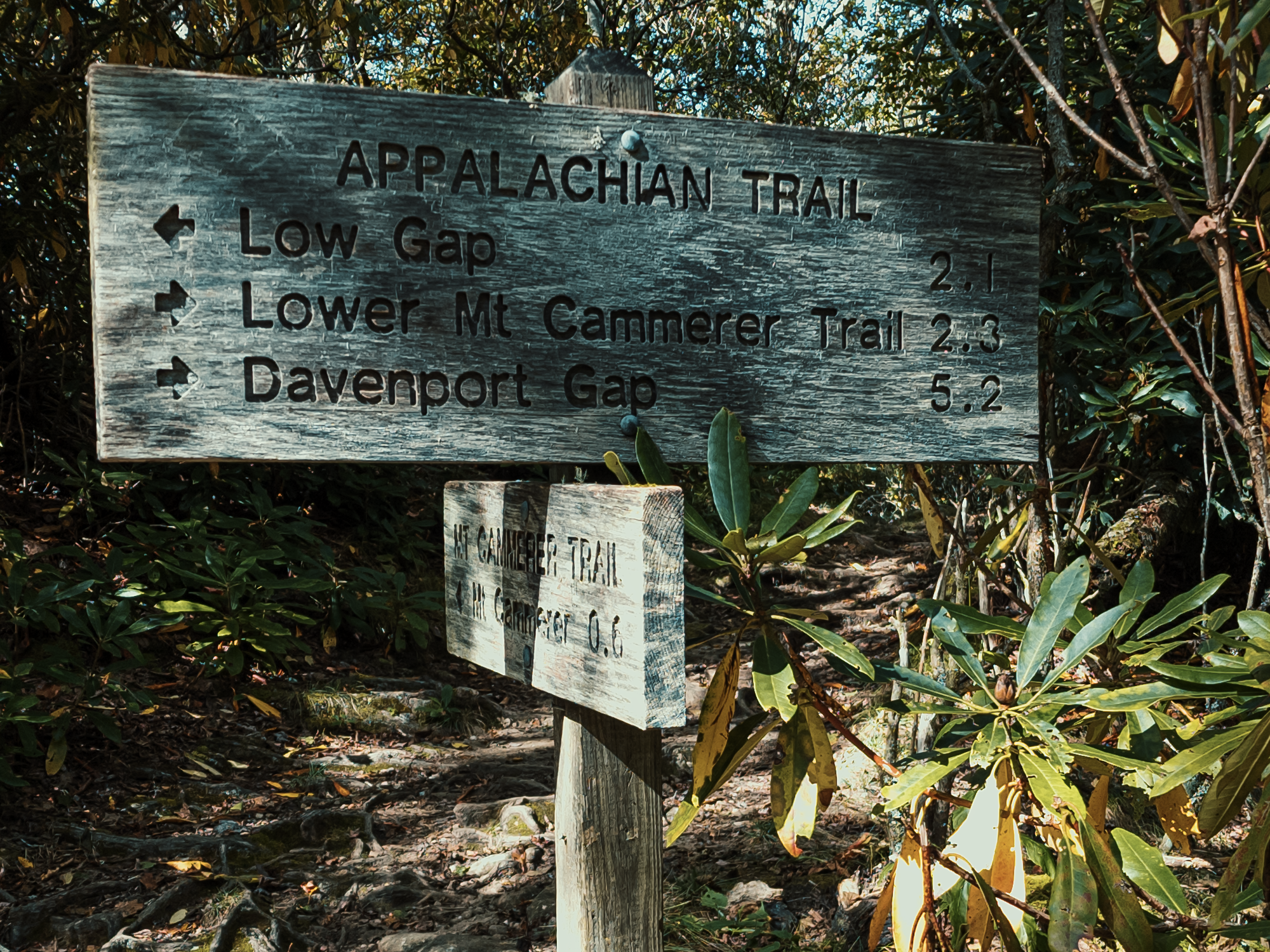
Mount Cammerer
About 5.8 mi up from the base of the Chestnut Branch Trail (roughly 3.1 mi on the AT), we stashed our packs and hiked the 6/10 mi spur toward Mount Cammerer (4,928 ft; named for Arno B. Cammerer, the National Park Service [NPS] Director from 1933–1940). Mount Cammerer features an octagonal observation tower (constructed by the Civilian Conservation Corp [CCC] in 1937) atop a stone base built in part from local materials. [In the video, I mistakenly state that the stone base dates from 1934.] People used to call Mount Cammerer White Rock or Sharptop; the USGS geodetic survey marker up here still bears the latter name. Despite its elevation, Mount Cammerer seems “shorter” because of its diminutive (8 ft) prominence, its perceived height relative to other nearby peaks. That’s an insufficient description of topological prominence, but there’s a lot of math involved, and I’m not good at it.
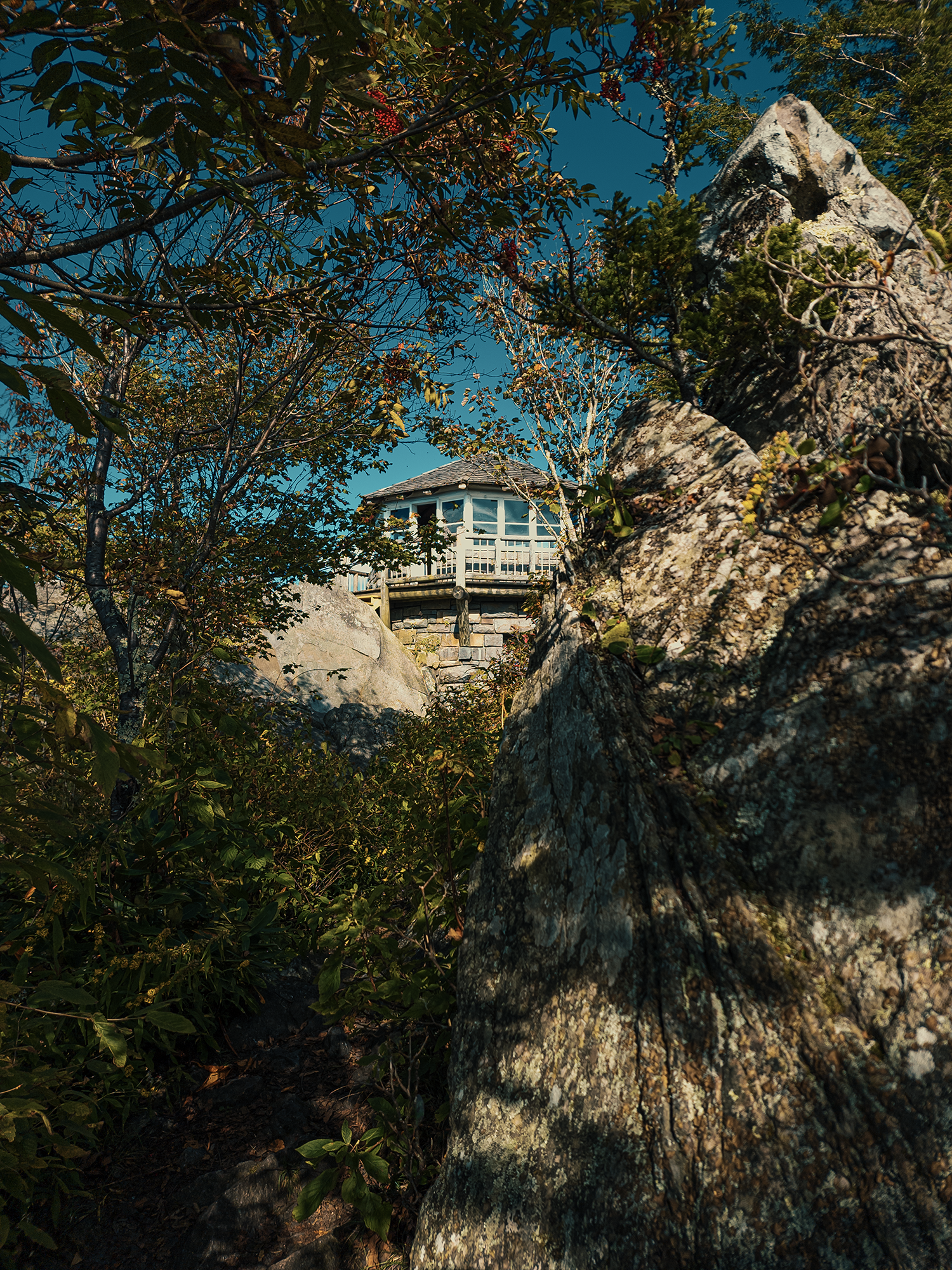
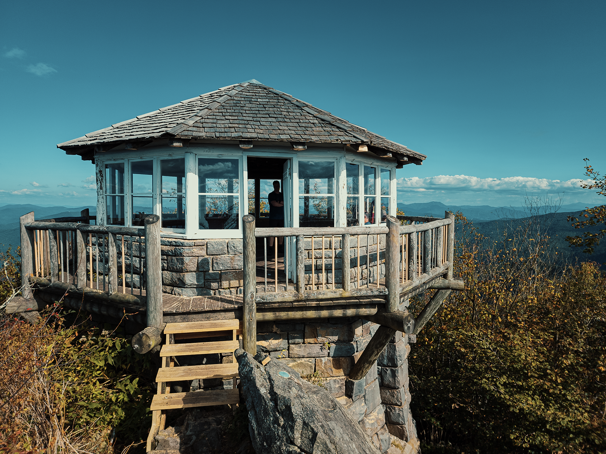
A fire ranger manned the tower here until the 1960s, by which point it suffered from neglect. In 1996, however, the NPS restored the tower. This seemed like a great place for lunch, so we rested for a bit and enjoyed the cooler atmosphere inside the lookout (I’m using “observation tower” and “lookout” interchangeably). Afterward, we hiked back to the AT, retrieved our packs, and hiked the remaining 3-ish mi to the Cosby Knob Shelter.
Cosby Knob Shelter
Somewhere along these three miles, I started getting really angry at whoever suggested this route. Oh wait, that was me. These 9+ mi worked us over, that’s for sure! I think at this point Matt M. and Eric S. started cursing my name. Silently or otherwise, I don’t remember. I deserved it. By the time we reached the Cosby Knob Shelter, the sun was gone. By the glow of our headlamps, we set up camp just below the actual shelter, ate supper, then collapsed in our tents.
Day 2
Back on the Appalachian Trail
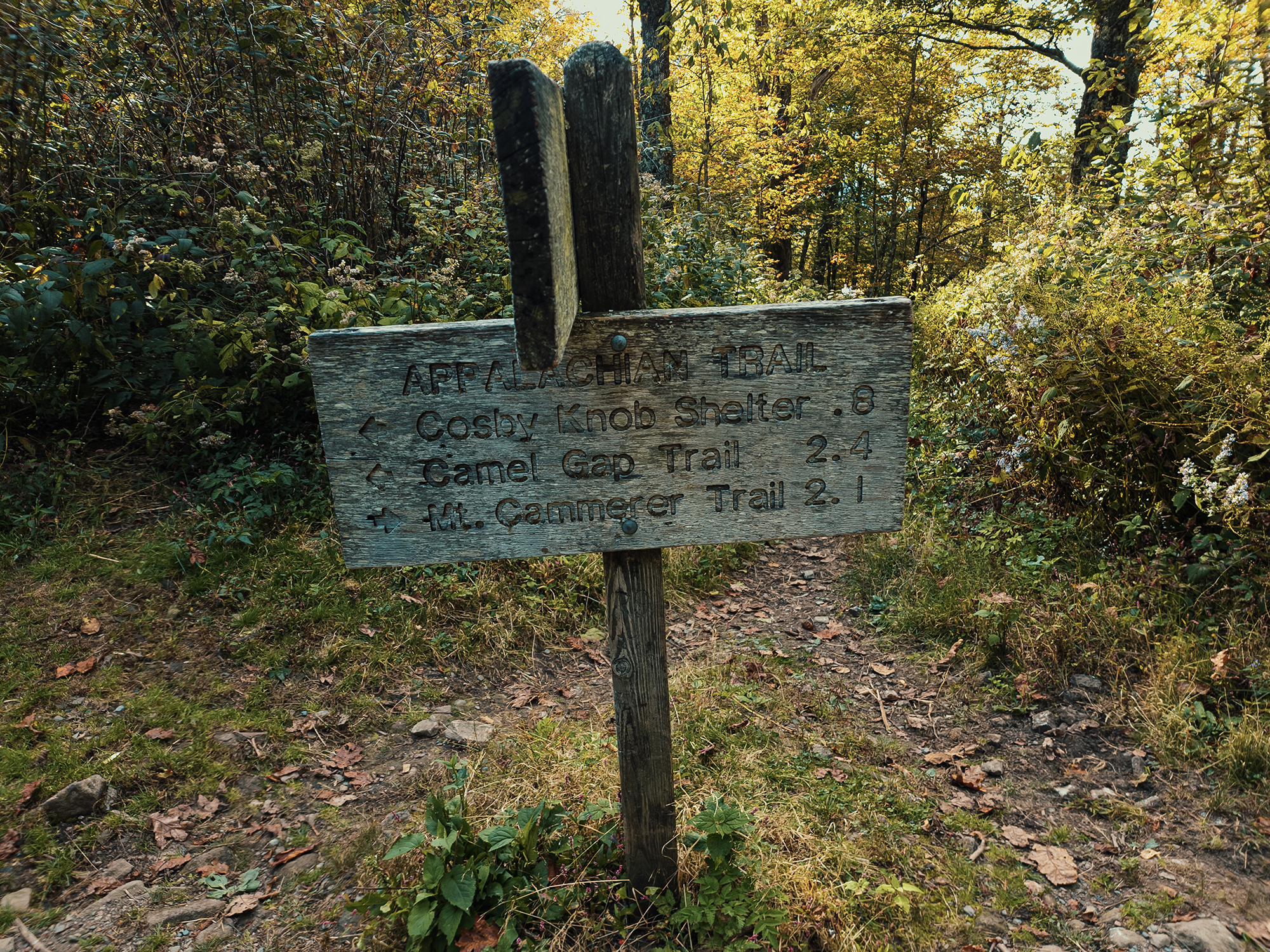
During the night, something sliced a hole in my sleeping pad. And in the dark, it seems I pitched my tent over a rock, which now drove itself into my hip. I used wadded-up clothing in lieu of a pad and eventually fell back to sleep, but it wasn’t a great night. I did get some sleep—I guess: I don’t remember being awake the whole night—and in the morning, we made breakfast, packed everything up, and started for the Tricorner Knob Shelter, not quite 7.8 mi away. In the video, I suggested we were feeling better after a night’s sleep. Eric S. disagreed.

Back on the AT, we hiked in between Cosby Knob and Ross Knob, past the Low Gap vista and around Camel Hump Knob, weaving in and out of Tennessee and North Carolina along the way. I wish I’d paid better attention to the peaks surrounding us…Probably still fatigued from a poor night’s sleep. At points the trees opened up, affording us actual views (probably near Low Gap, but again, I’m not certain). We started out descending ever so slightly, then the next few miles took on a gradual ascent—nothing compared to Day 1!
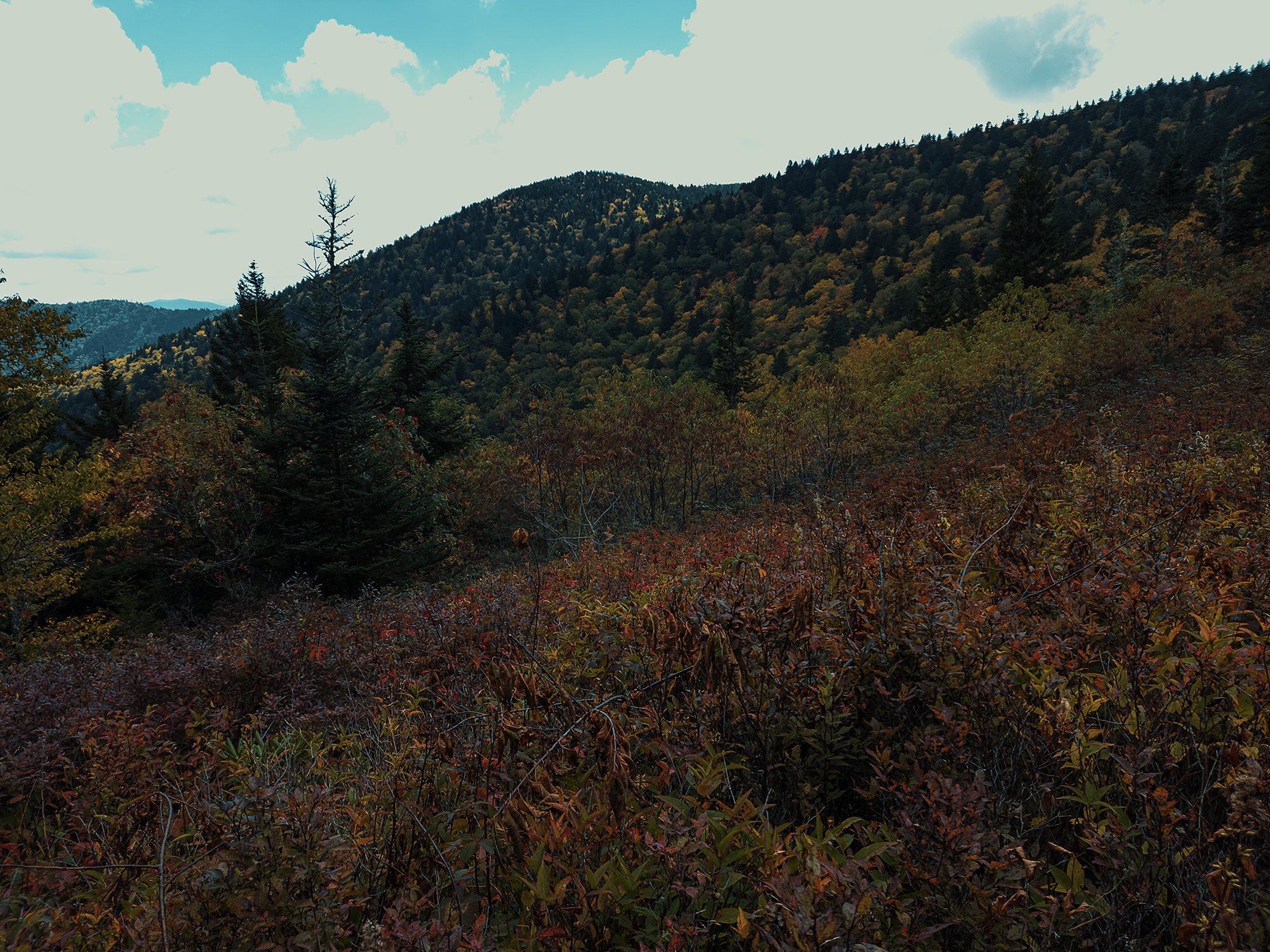
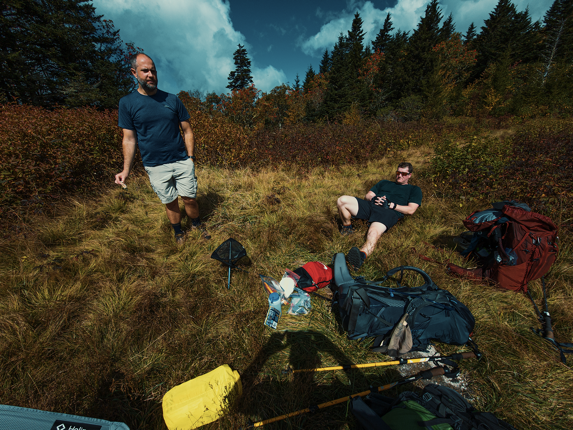
After about 5.7 mi, we found ourselves in a meadow-like environment, likely between Old Black and Mount Guyot. At about 1300 hrs, we dropped our packs and enjoyed lunch surrounded by an open field with peaks on either side. With only a couple miles left in the day (I’m not a total monster when it comes to route planning!), we spent a significant amount of time here. I think. I just remember feeling a lot better afterward, whether from resting or eating, I can’t say.
Packs back on, we continued down the AT for the remaining 2.1 mi, give or take. Here, most of the hardwoods gave way to older-looking evergreens, and the atmosphere took on an ancient feeling, which is probably not accurate, but the trees here were taller, thicker, and mossier. That lasted for maybe 1 mi, I’m guessing, before American beech, yellow birch, various species of oak, and others returned and we approached the Tricorner Knob Shelter.
Tricorner Knob Shelter
With plenty of daylight remaining, we set up camp in the nearby woods, then investigated the shelter. Most shelters in the Smokies stand out from many others along the AT. Like typical Smokies shelters, Tricorner boasts a fireplace built into the mortared stone structure. I also took advantage of the flat sleeping surface here to find and patch the leak in my sleeping pad. Nearby, there’s a water source piped (I think) out of the hillside. Weak when we were there, we were still able to filter from it and fill our bottles and bladders.
Quite a few hikers showed up at the Tricorner Knob Shelter while we were checking things out. We decided to cook supper boil water up there with them before ducking into our tents and calling it a night. Sometimes through-hikers (or maybe even section-hikers) receive trail names; of the hikers at Tricorner that evening, I remember three, so if Jimmy Leg, Easy Rider, or Thrift Shop ever read this: hello!
Day 3
Balsam Mountain Trail
No hikers remained at Tricorner by the time we got up in the morning! (We didn’t sleep that late!) The patch I installed on my sleeping pad held up, so I actually got some real sleep. We had the place all to ourselves as we made breakfast and topped off our water supply.
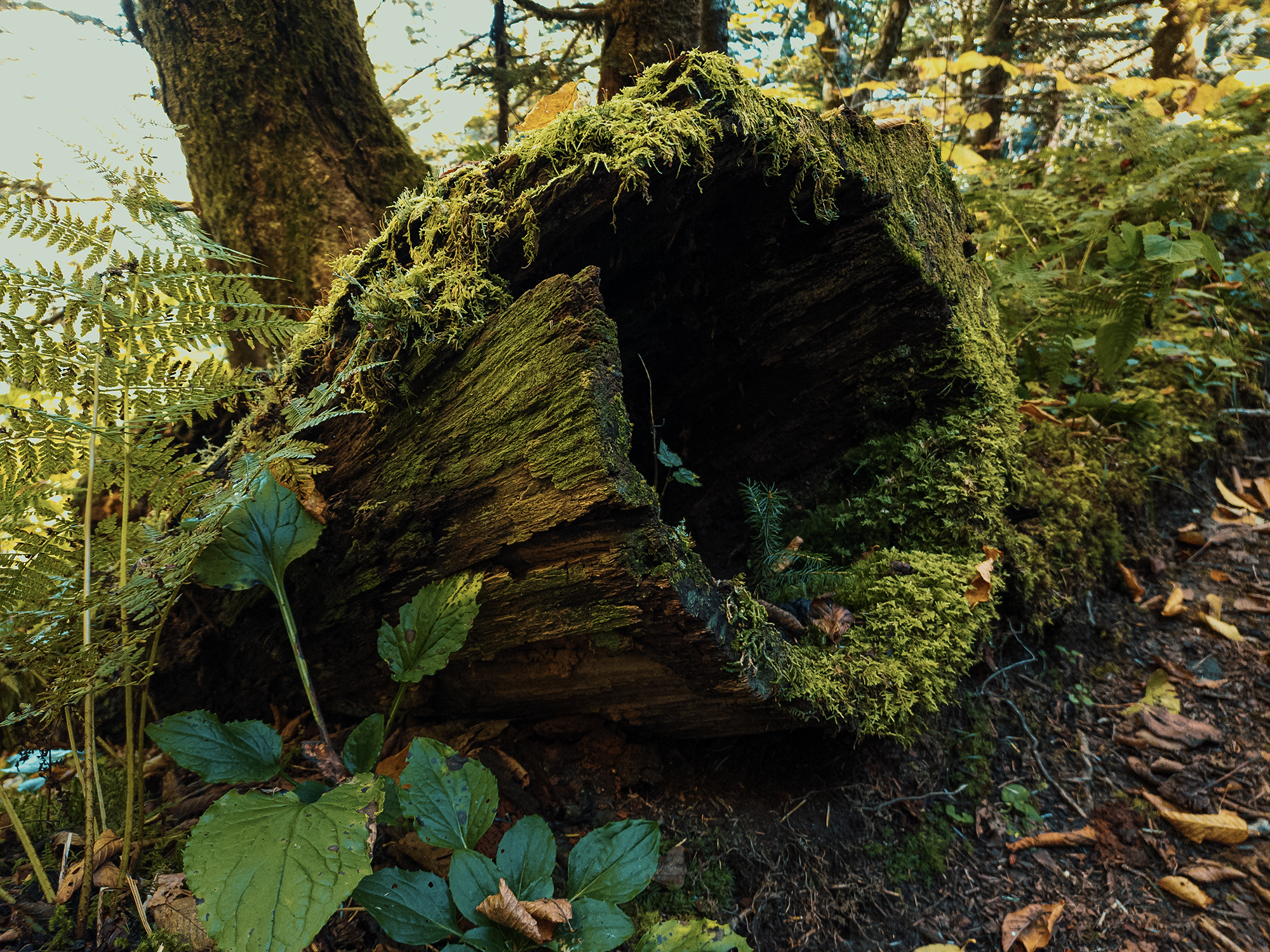
After that, we broke camp, then hiked the short distance up the AT and turned right onto the Balsam Mountain Trail. This trail is narrower than the Chestnut Branch Trail and other portions of the AT we’d taken so far. Like most of the trails we traveled over the last two days, the Balsam Mountain Trail starts out with trees on either side. There’s not much else to see. Speaking of trees, I did come across these beauties: old-looking specimens now overgrown with moss:
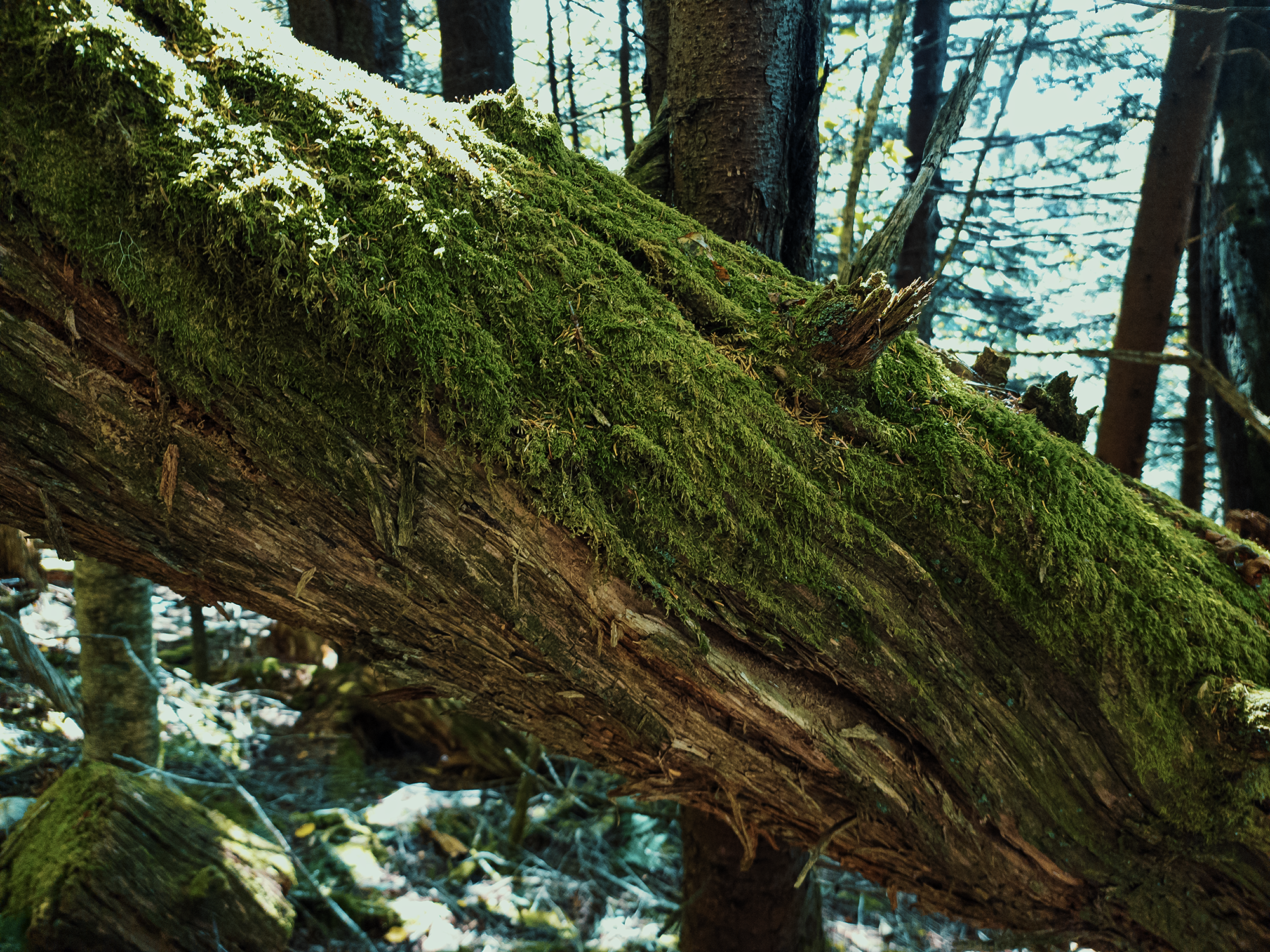
Not long after passing the trees pictured above, I reached a downed trunk that blocked the trail. All right, it would have been pretty simple to duck under it, but I was too far ahead of the other guys and I’d been carrying a saw this whole time, so I dropped my pack, retrieved my saw, and cut this tree out of the way. (I really needed to justify having that thing with me!)
The left side of the trail (hiking east, toward Mount Sterling) drops off abruptly. It’s really narrow through here, so it’s important to watch your step! Earlier trails—like the Chestnut Branch Trail—had sections with steep sides, too, but I think the sides of this trail are steeper. Soon I came to another downed tree, so I assembled by saw again and started hacking away at it. That’s when Matt M. and Eric S. caught up with me.
Mount Sterling Ridge Trail
A little after that, we passed through another section of older-looking forest. The sides of the trail abandoned their prior severity, the trail itself bore fewer roots and more rocks, and the trees on either side took on a well-worn appearance. A little after that, we lost enough elevation—right around 400 vertical ft—for the forest to revert to hardwoods and rhododendron hells.
We reached the spur toward the Laurel Gap Shelter, which I’d considered for our destination for Night 3, but that would have made Day 3 only 6 mi, give or take, and Day 4 nearly 11 mi! Right here is where the Balsam Mountain Trail ends and the Mount Sterling Ridge Trail begins. We’d remain on the Mount Sterling Ridge Trail for about 5.4 mi.

Not long after passing this junction, we stopped for lunch. I think I rehydrated some mango sticky rice that I probably won’t buy again before we continued the hike. We enjoyed a few relatively easy miles (especially when contrasted with Day 1!), but with about 1.8 mi to go, the Smokies reminded us that they are, in fact, mountains.
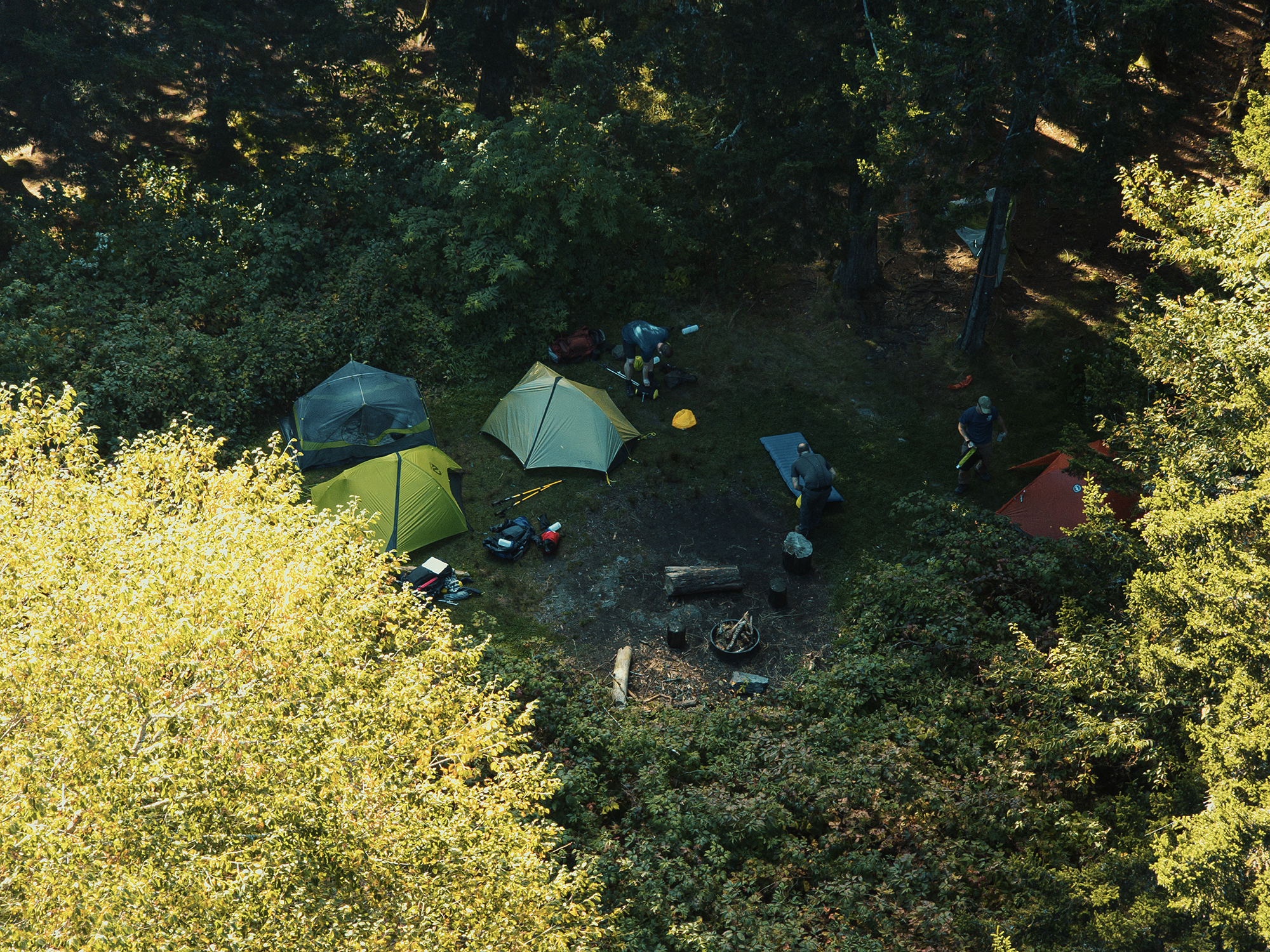
I think the steepest it gets through here is maybe a 25% grade, but after the last 27.5 mi, it demands your attention. When we finished those 1.8 mi, we reached Backcountry Site #38 at the summit of Mount Sterling (just over 5,840 ft). After setting up our tents one last time, and with about an hour of light left in the day, I scrambled up the nearby radio tower to take a look at our surroundings.
Mount Sterling (Backcountry Site #38)
This 60 ft fire tower, constructed by the CCC around 1933, stands at the highest elevation of any remaining fire tower in the eastern United States. People described it as “rickety,” but I thought it was sturdy enough. Even without this tower, Mount Sterling boasts a “clean prominence” of 663 ft, making it feel as tall as it is. I’m calling it a radio/comms tower because what remains of its cab is now decked with numerous instances of communications equipment. And speaking of the cab, I climbed through the hole in its roof (likely cut by whoever mounted or maintains the electronics up there) for a better view:

Mount Sterling gets its name from a 2 ft seam of silvery metal that early area settlers discovered. Regrettably, that metal wasn’t silver: it was lead. Later, during the Civil War, deserters tried to disappear among its forested slopes: both Union and CSA detachments frequently raided the area to find them. Before returning to the ground, I took another photo of our campsite from 60 ft up:
We needed water. The marked water source for Backcountry Site #38 is really quite some distance away: it’s maybe 8/10 mi round trip. We made the trek, filtered what we needed, then headed back up the trail.
Even though we could’ve had fires at the Cosby Knob or the Tricorner Knob Shelters, tonight was the only night we actually bothered to light one. Which is shameful, really, because I love campfires. (I guess it was too dark at Cosby Knob, and there were lots of people at Tricorner…)
One thing about the backcountry sites in the Smokies (and the shelters, now that I think about it): if you’re not through-hiking, you need reservations for every night. While researching this route, I learned that Backcountry Site #38 is extremely popular—and after getting here, I understood why! I sawed through a few logs, and the five of us—another couple had also reserved this site—enjoyed a low, crackling campfire. As the sun dropped lower in the sky, most of the others headed off to their respective tents.
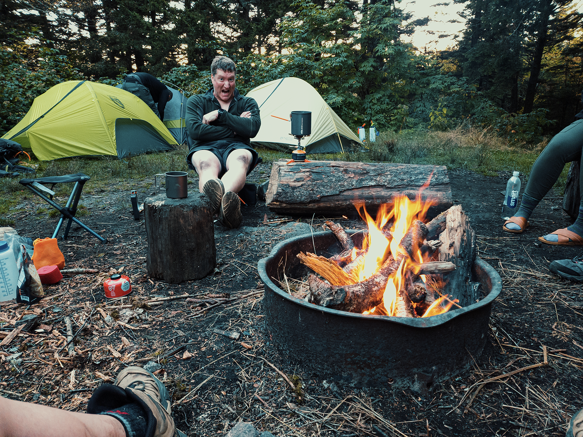
I stayed up a while longer, leaning back and staring at the stars. I don’t know if I could see the thicker bands of the Milky Way that night or not. With or without company, there’s something satisfying about a campfire combined with a starry night. Soon, the fire died down, and I realized my back was getting sore. I stirred the ashes to make sure I didn’t set the woods on fire overnight, then I returned to my own tent.
Day 4
I’m not much of a morning person, but Eric S. set his alarm to wake us all up before sunrise. Bundled up, the three of us crowded into the tower’s tiny cab and watched and waited until the sun broke over the horizon. I don’t remember what the temperature was, but it was cold! We probably could’ve slept another 15, 20 minutes, but whatever. When the sun did appear, what a scene it revealed!
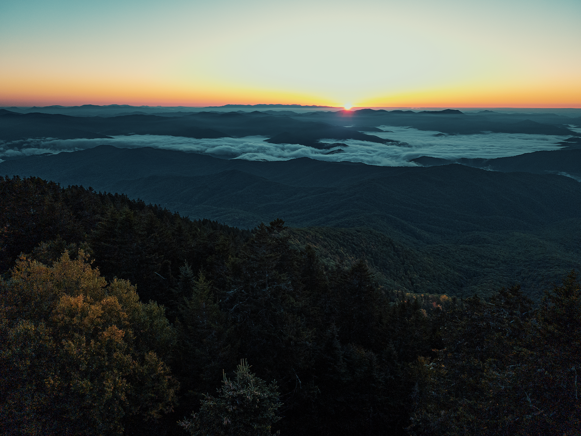
Like most things stored on digital media, neither the video nor the photo justly portrays being there. I’m not a great photographer, and that’s okay, but I really like the shot posted above (blown out sky and all). I think the three of us just stood there for a while as the cloud inversions rolled over the lower ridges before the sun slowly burned them away. Once the sun was well above the horizon, we returned to Backcountry Site #38 for breakfast. After breaking camp and packing everything up, we started down the Baxter Creek Trail.
Baxter Creek Trail
It’s a little more than 6 mi back to the parking area (and after that, it’s another 7/10 mi or so to the truck, but we’re not there yet). The Baxter Creek Trail starts out with another mix of hardwoods and evergreens. Each type seems to vie for dominance on the way down: we passed through regions that looked more like hardwoods and others that looked more like evergreens.
After less than a mile, the cold in the air seemed to vanish, either from exertion, waxing sunlight, or maybe both. I didn’t intend to, but I lost Matt M. and Eric S. behind me. The Baxter Creek Trail is wider than, say, the Balsam Mountain Trail, but descending it wreaks havoc on your knees. My knees, anyway.
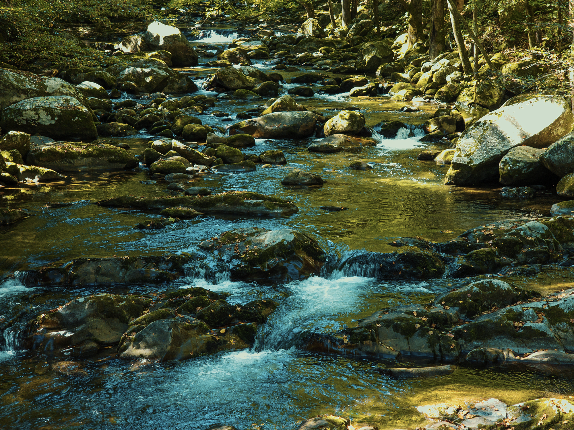
More than halfway down—I really don’t remember how far, exactly—I crossed Baxter Creek and paused for a moment to appreciate a “waterfall.” It’s not really a waterfall, but I wanted to slow down for a moment and breathe in the cool surrounding air. I think we had enough water from the night before, so we didn’t need to filter. There was another couple here on their way up to Mount Sterling’s summit. I asked them how much farther to the parking area.
Not far, they said.
Nice! Soon after, I reached a less-obscured-by-trees spot through which I think I saw Mount Cammerer (all the way back from Day 1!). Topographically, I’m pretty sure that checks out. A little down from there, I saw this rock just off to the right of the trail:
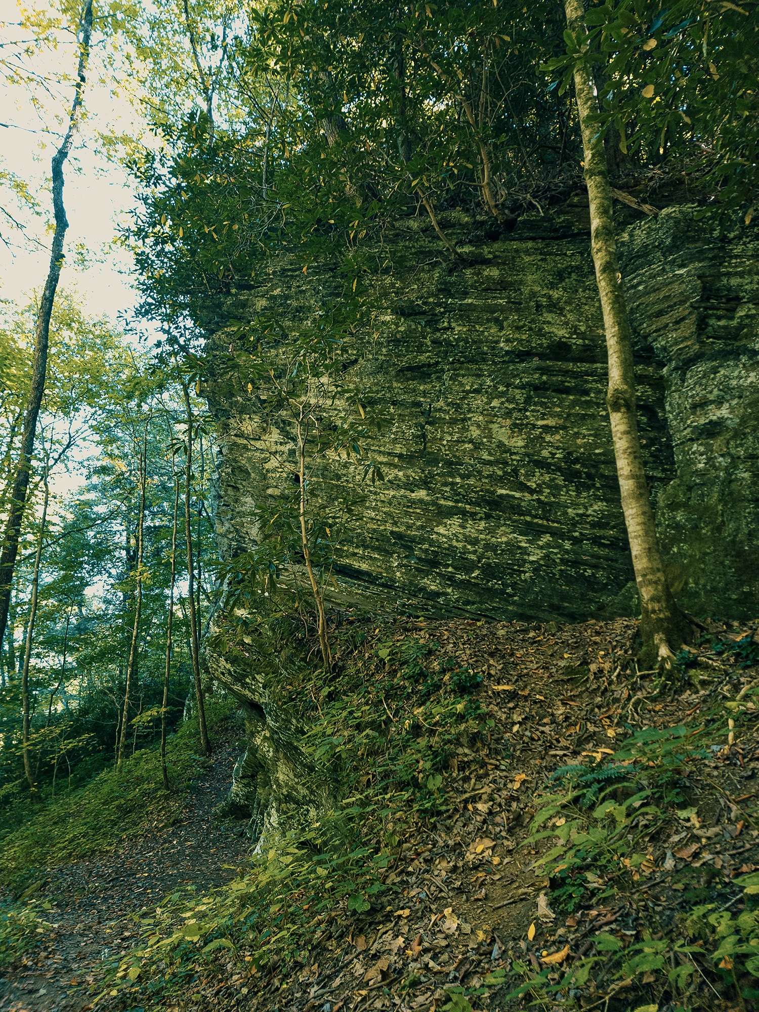
I think that must have been part of a larger system: just beyond that I came to a towering cliff-like feature that reminded me of Raven Rock (near Lillington, NC). I have no idea if this feature has a name, nor how high it stands above the ground, but I think it’s really cool.
With just about 1 mi to go, I heard the sound of Big Creek off to the left. I thought the trail paralleled Big Creek the rest of the way, but the creek veers left here; about 1/3 mi later, it returns and parallels the trail for the last 2/10 mi or so. That’s when the trail cuts a hard left and crosses over Big Creek. Once I crossed the foot bridge that separates Baxter Creek Trail from the Big Creek Campground, I was done!
Big Creek Campground
That’s what I thought—for a moment. Then I remembered that I’d parked about 7/10 mi away, closer to the Chestnut Branch trailhead. I didn’t know how far ahead of the others I was, but I had cell coverage here. I texted them to cross the bridge and wait at a picnic table: I’d get the truck and pick them up.
I’m embarrassed to admit it, but I got lost trying to get my bearings and back to the truck. After stumbling around for a bit, I found the correct road. Once back at the truck, I changed clothes (there’s a privy at the end of the parking lot) and returned to collect Matt M. and Eric S.
I don’t know how many miles of trail crisscross the Smokies. More than 35, which is about what we did over the last four days. I liked this trip—or maybe I mean I liked finishing this trip. We got a few good views—from Mount Cammerer and Mount Sterling, but if that’s what you’re after, there are simpler routes to both. Mostly, we saw trees. I don’t know if I’d ever hike this route again. Maybe in the winter, when the leaves are gone? Maybe. Regardless, it’s still beautiful out here, and I’m grateful for the time spent in the Smokies—and with friends.
Catch the whole adventure on YouTube! Please consider subscribing (if you haven’t already). Thanks for stopping by!