July in central North Carolina is not really the time to go hiking at lower elevations. Not unless you get a charge out of sweating too much and sleeping too hot, all while feeding the biting insects with copious quantities of your sweet, sweet blood. I don’t enjoy any of those things, but I was going to take a trip to the Birkhead Mountains Wilderness and do it anyway just because I wanted to sleep in the woods. Fortunately, Chip B. talked me out of that nonsense and suggested we go farther west and higher up. When he was younger, Chip B.’s backyard was Pisgah National Forest and its surroundings. Plus, he’s hiked the entirety of the Art Loeb Trail (ALT) before, so I’d be hard pressed to have a better sherpa out here!
Day 1
We got started later in the afternoon, pulling into the Sam Knob Trailhead parking area probably between 1700 hrs and 1800 hrs. After checking the weather and hoping for the best, we started hiking mostly north on the Ivestor Gap Trail.
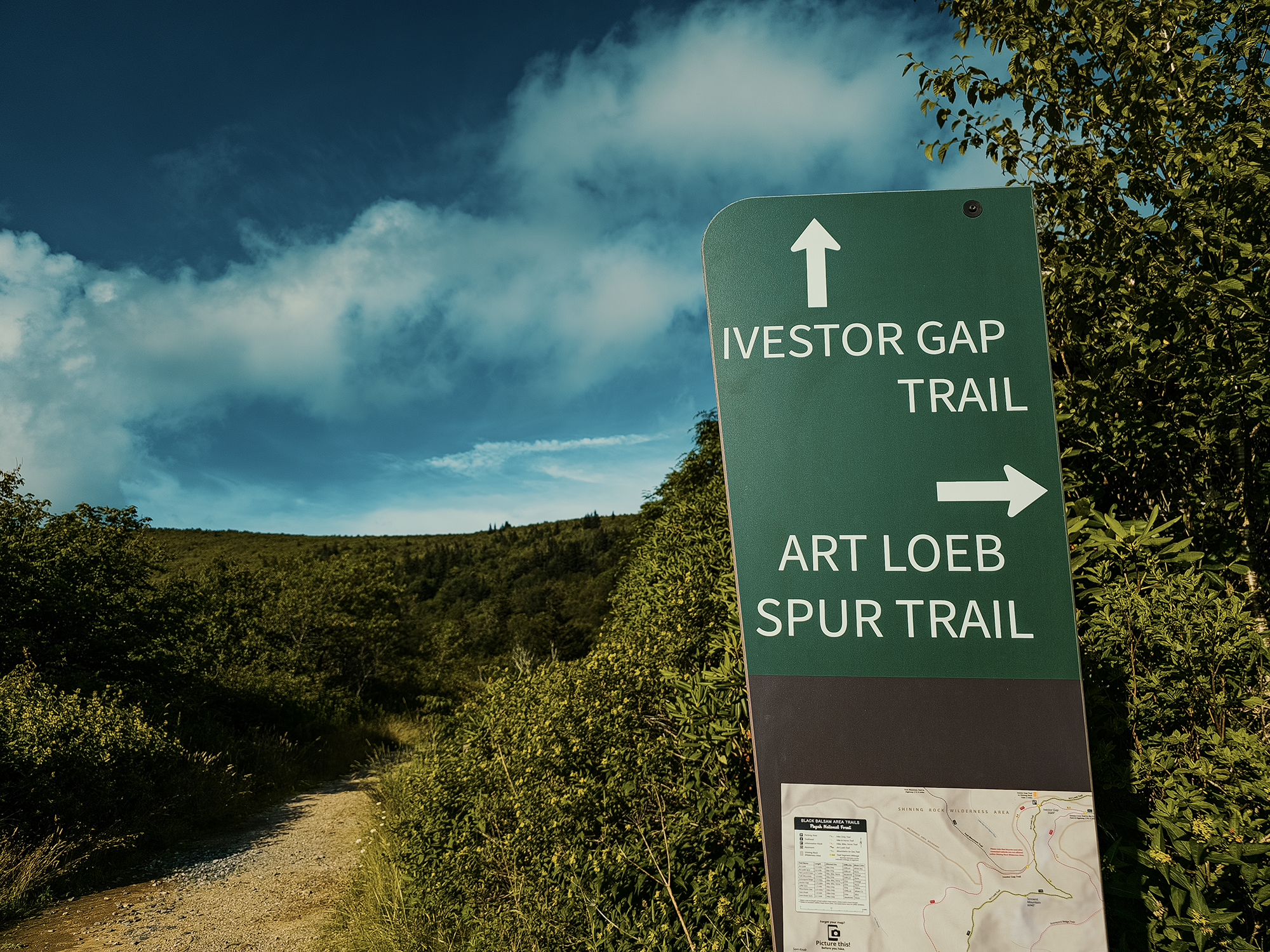
Ivestor Gap Trail
The Ivestor Gap Trail started out as a logging route, cut in part by the Civilian Conservation Corps (CCC) in the 1930s prior to the pre-wilderness boom in the Great Balsam and Shining Rock region. (When the Wilderness Act was passed in 1964, the Shining Rock Wilderness was one of the first eastern U.S. areas designated as such, and the former Ivestor Gap Road gradually reverted to trail.)
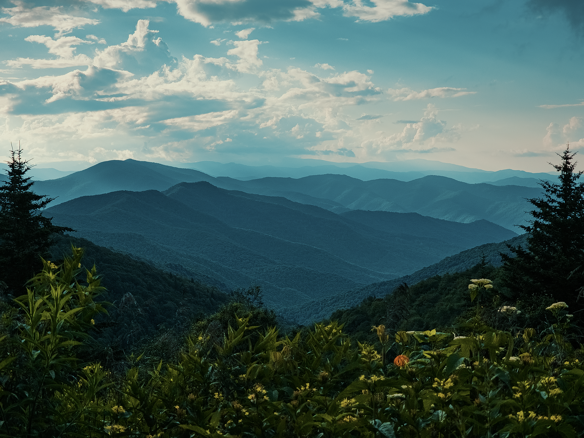
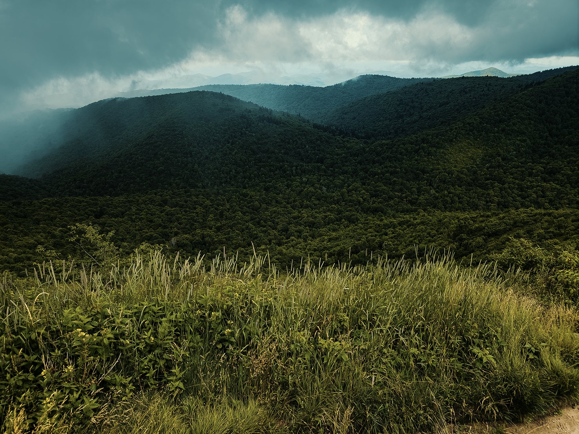
We didn’t have to hike far before we caught views of the surrounding mountains. The following photo might depict Sam Knob (6,050 ft) in the distance; the one after that, I’m not sure (possibly Richland Balsam [6,401 ft], but I wouldn’t bet on it):
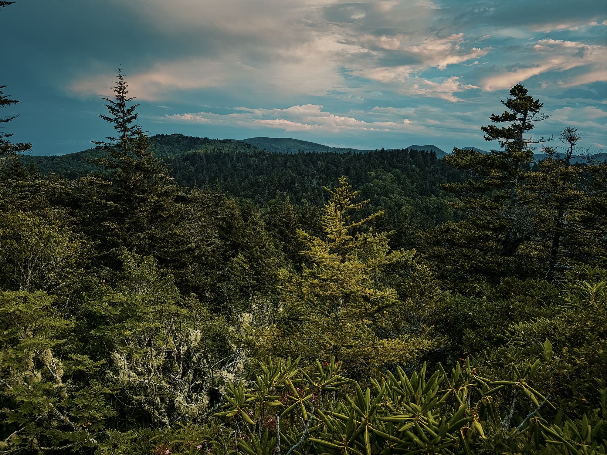
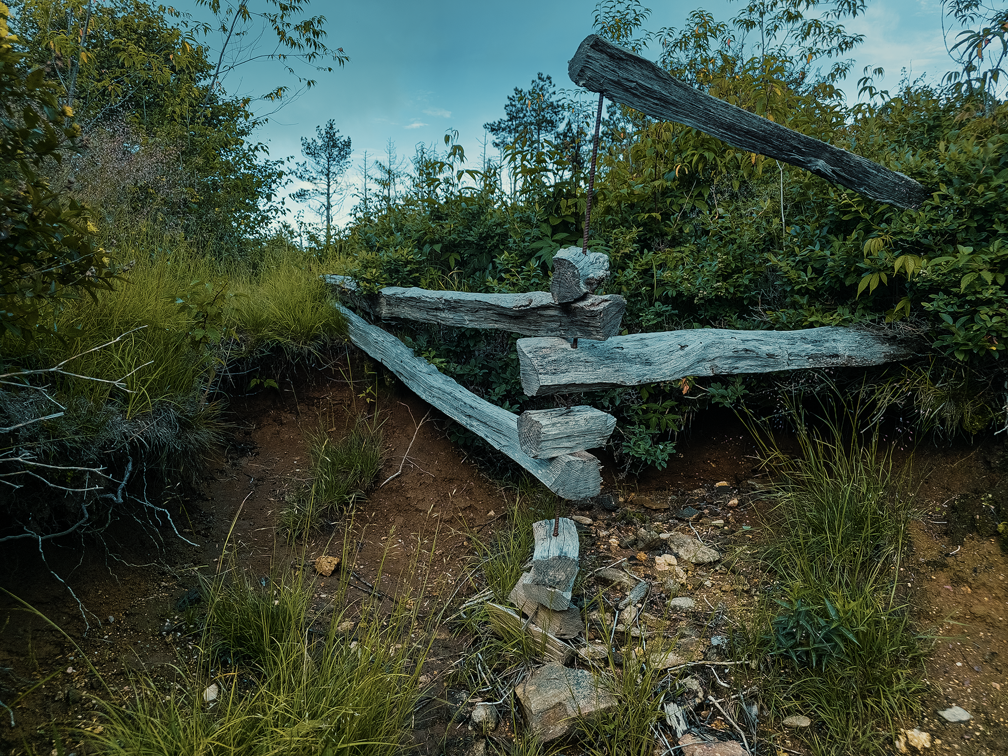
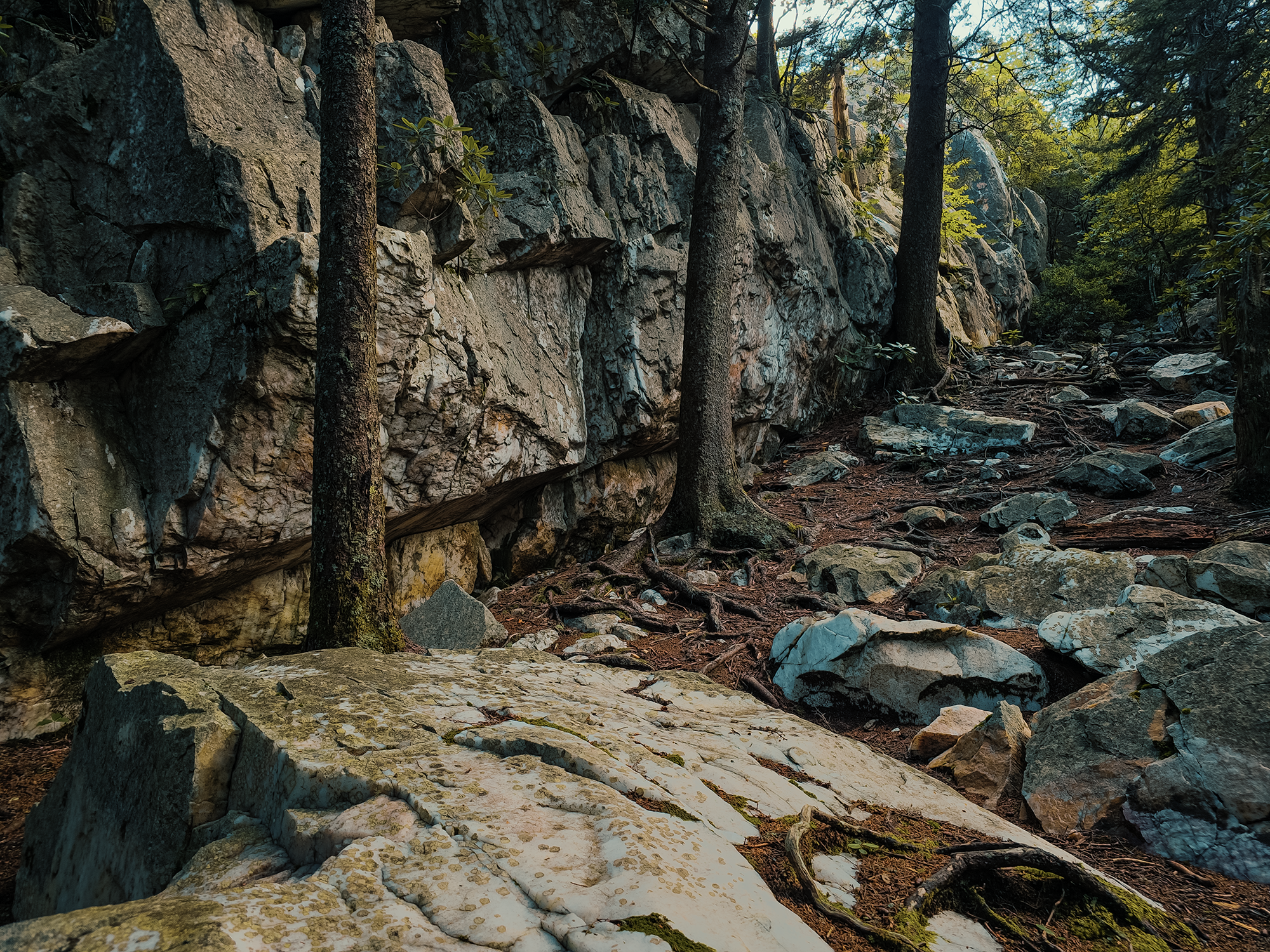
On the way up, it’s interesting to see the subtle remnants of the transition from one-time active logging land back to wilderness: there are lots of stands of older-looking evergreens here and there, mostly surrounded by balds and younger-looking hardwoods. And flowers! (Early- to mid-July is a great time to glimpse these beauties.) I also saw what’s left of an old wooden fence along the way (its timbers pinned together with rebar).
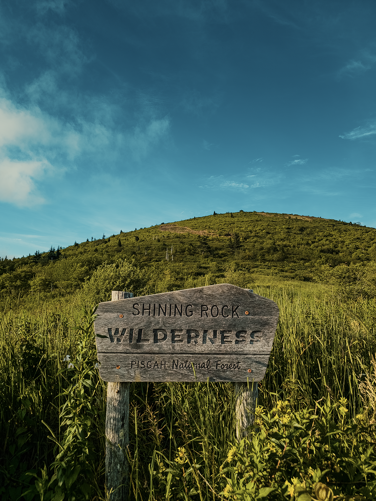
At about 2.3 mi in, we reached Ivestor Gap (5,689 ft)—an intersection with connectors to the Art Loeb and Graveyard Ridge Trails. We’d be on a small part of the ALT in the morning, so we continued north on the Ivestor Gap Trail toward Shining Rock. Here, we were “officially” entering into the Shining Rock Wilderness.
The Ivestor Gap Trail here disappeared in a sea of tall grasses: we ended up on the Graveyard Ridge Trail for about a hundred feet before we realized we’d missed it! It took us a minute to “discover” the route we wanted—Chip B. referred to it as a “pig trail”—but after that we were on our way again.
Little East Fork & Old Butt Knob Trails
All this time, we’re gaining elevation, but it’s so subtle that it almost feels like a not-too-strenuous walk (even with 40+ lbs. on our backs). It’s surprisingly pleasant, despite the weight and the heat. Just shy of 3.9 mi in, having completed the Ivestor Gap Trail, we merged onto the Little East Fork Trail. We’d only be on this for about 1/2 mi before we’d reach a T-intersection with the Old Butt Knob Trail.
I’m an eternal 12-year-old. I still laugh at trails with names like “Old Butt Knob.” But since most people are probably more mature than I am (including some 12-yeard-olds), it’s probably worth mentioning that the word “butt” here shares the same etymology as, say, butte, a geographically larger, steep-sided isolated feature. Anyway, we turned left here, hiked past Shining Rock Gap (5,764 ft), and continued toward Shining Rock itself.
At least, that’s what we meant to do. We explored a few potential campsites off the trail while still trending north. I got sidetracked when I saw some shiny rocks off to the left. I thought I was recording the whole time I was getting slapped in the face by tree branches and spider webs, but after I got home and checked my footage, I realized I had nothing.
(Not quite) Shining Rock
I burned through more daylight than we had remaining on that little excursion, so Chip B. and I hurried toward Shining Rock proper. My original goal was to camp in a marked clearing just below Shining Rock, but by the time we got there, almost every square inch of land had someone else’s tent pitched on it. (There’s no reservation system for this site: it’s first come, first served, and we were not first!)
It had rained earlier in the day, but we were so close to Shining Rock that we stumbled through dripping rhododendron hells—I don’t think it’s really fair to call what we walked through a trail except in the most general, vaguely suggestive terms! I think I had to raise my arms in front of my face just to be able to see a few feet ahead of me. After maybe a couple hundred feet of soaking wet staggering, we opted to turn around and seek out one of the earlier campsites we passed on the way up. I think right around here is when I realized I’d lost my sunglasses to the rhododendron. I figured that was the last of that pair…
Chip B. took the lead on the way back toward the campers who’d stolen our spot—that’s a joke: they had every right to be there!—and against the odds, I saw my sunglasses wedged between some branches! Of course, the sun had set a while ago and we were coasting on twilight, uh, fumes (pardon the mixed metaphors). We thought we found a place quite close to the “real” clearing where we might get away with setting up our tents, but after more than a couple of seconds’ reflection, we realized the spot might have accommodated one tent, but no way would it hold two.
We continued backtracking.
By now it was getting dark dark. After not quite 2/10 mi down from the clearing, Chip B. suggested we check the side of the trail for something relatively flat. I agreed: that 2/10 mi had done precious little to wick away the damp aftermath of those hells, and with the sun gone, it’d start to cool down soon. By headlamp, we pitched our tents just off the trail and hoped for the best. After a quickly rehydrated supper, we called it an evening.
Day 2
When I woke up, I felt like someone had slammed me against a tree. Oh, right: apparently, while setting up in the dark, I pitched my tent on a ridiculous slope, and when I moved in my sleep, I rolled off my sleeping pad and…into a tree. At least I got some sleep, even if it wasn’t great!
Each of us made a quick breakfast, and after finishing mine, I walked across the trail toward some big rocks almost hidden in the woods.
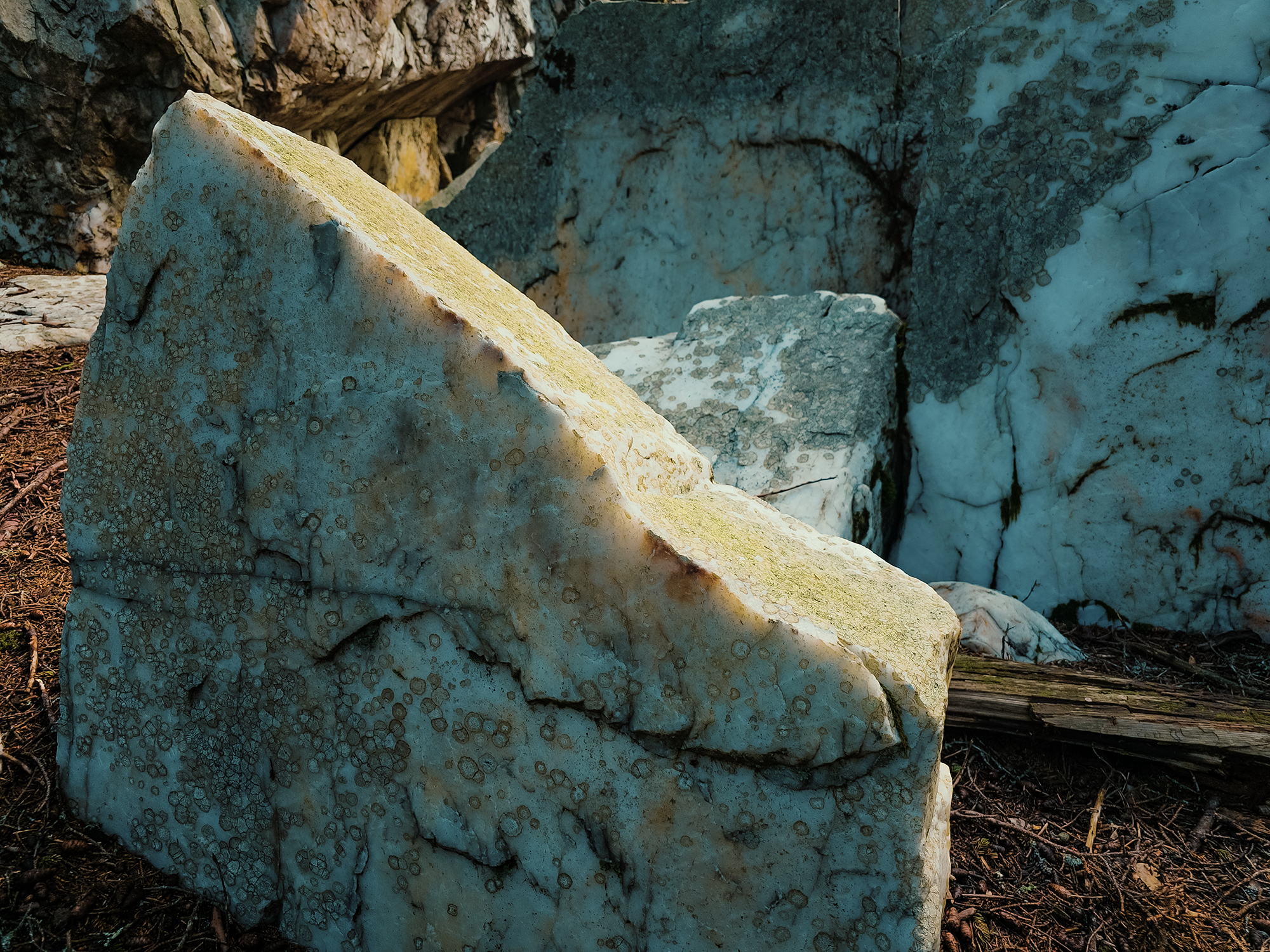
Maybe you’re wondering why this place is called Shining Rock? That name comes from the quartzite boulders near the summit—yes, the summit we missed last night! The Cherokee considered this elevated space with its peculiar rocks sacred, possibly even a vision quest destination. Also, according to the Cherokee, Shining Rock is home to the Yunwi Tsunsdi—the little people. These kind, shy folk rarely reveal themselves to others, unless perhaps if someone were in dire need, or in deep communion with the land.
All right, all right—that covers the Rock bit, but what about Shining?!
During certain moments of the day, typically just after sunrise, or maybe before sunset, depending on the season, sunlight touches the edges of these stones, which seem to absorb it and hold it inside until they begin to glow from within. Sure, it’s really a physical phenomenon called subsurface scattering—quartzite’s crystalline structure bends and diffuses the light passing through it—but it still looks surreal!
Back at “camp,” Chip B. and I talked (very briefly) about maybe returning to Shining Rock proper, but the thought of fighting against those rhododendron—probably even wetter than yesterday from overnight condensation—didn’t appeal to either of us, so we just headed back down the Old Butt Knob Trail.
Had we hiked another 500 ft the night before, we would have reached one of the camping spots we’d scouted earlier. Ha ha.
Art Loeb Trail
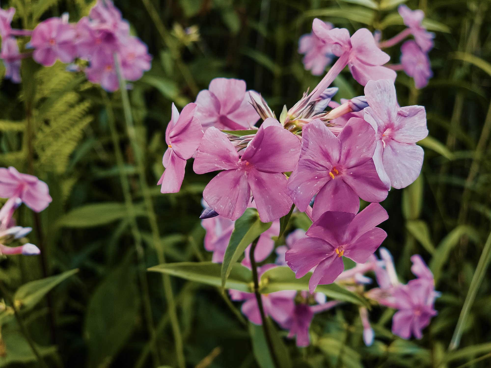
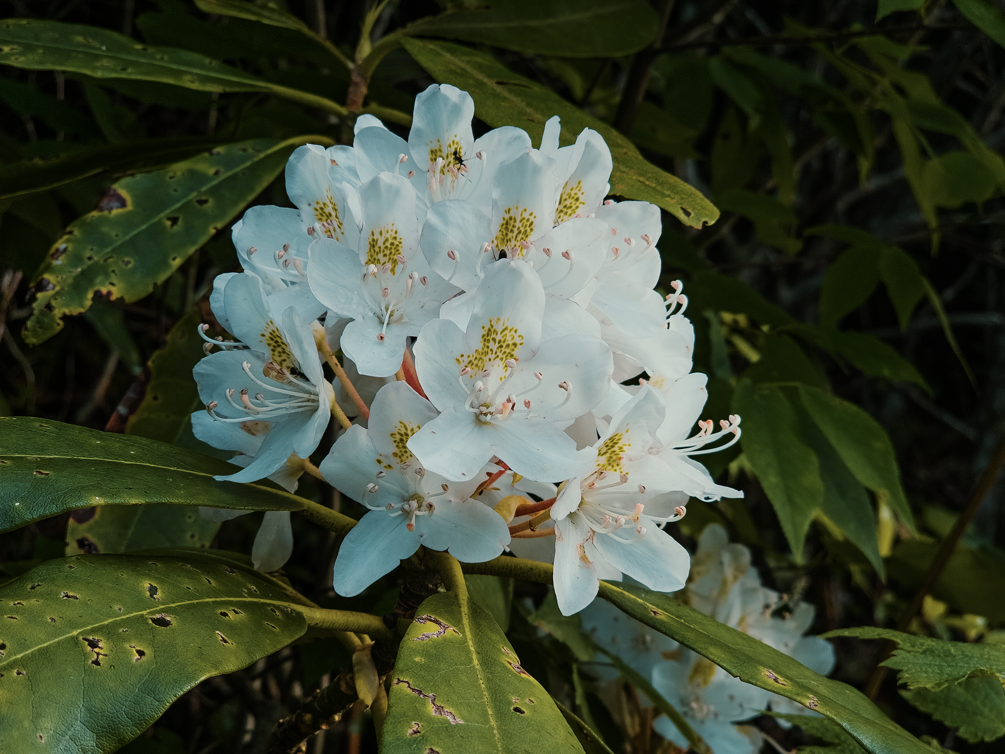
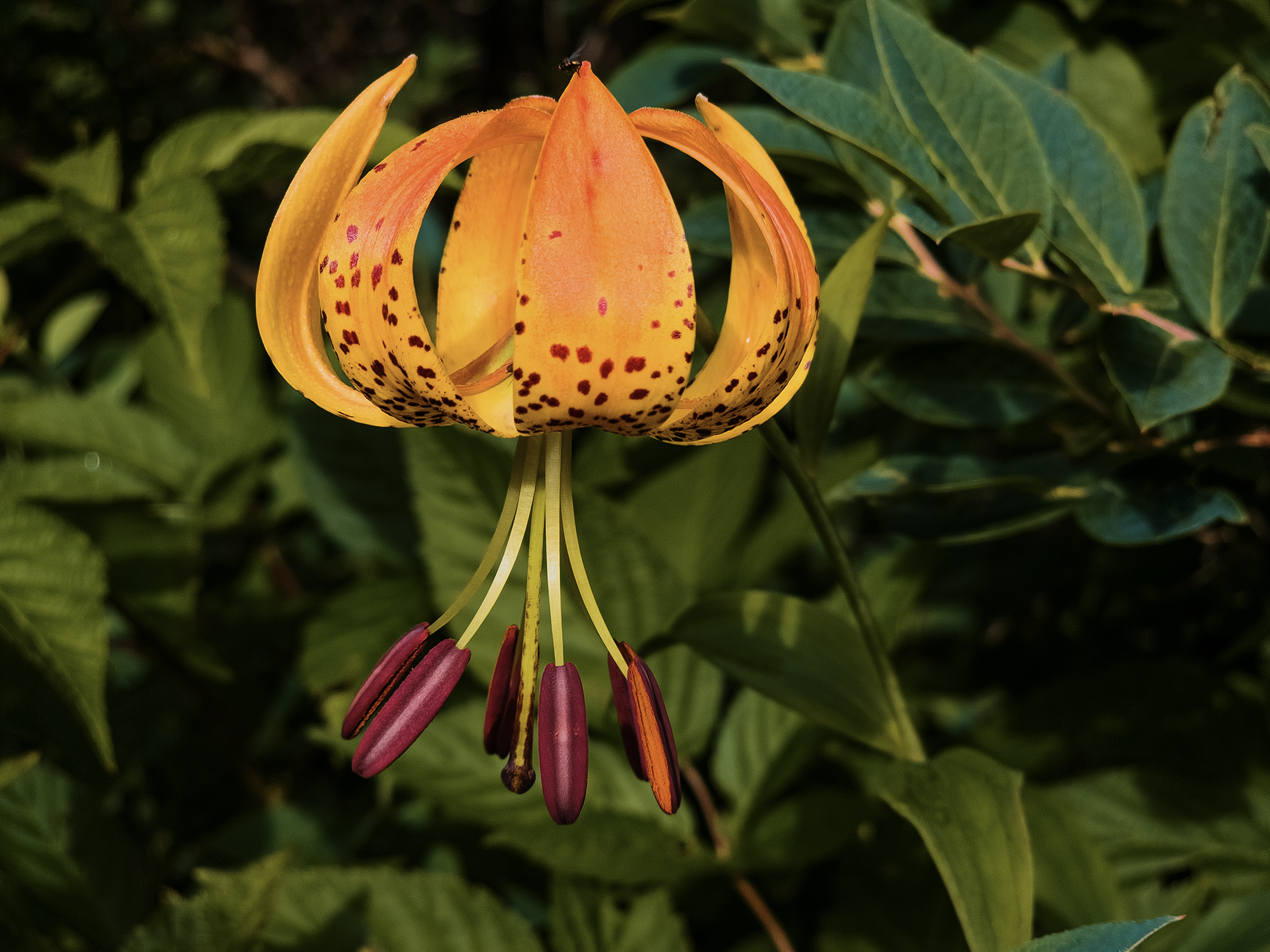
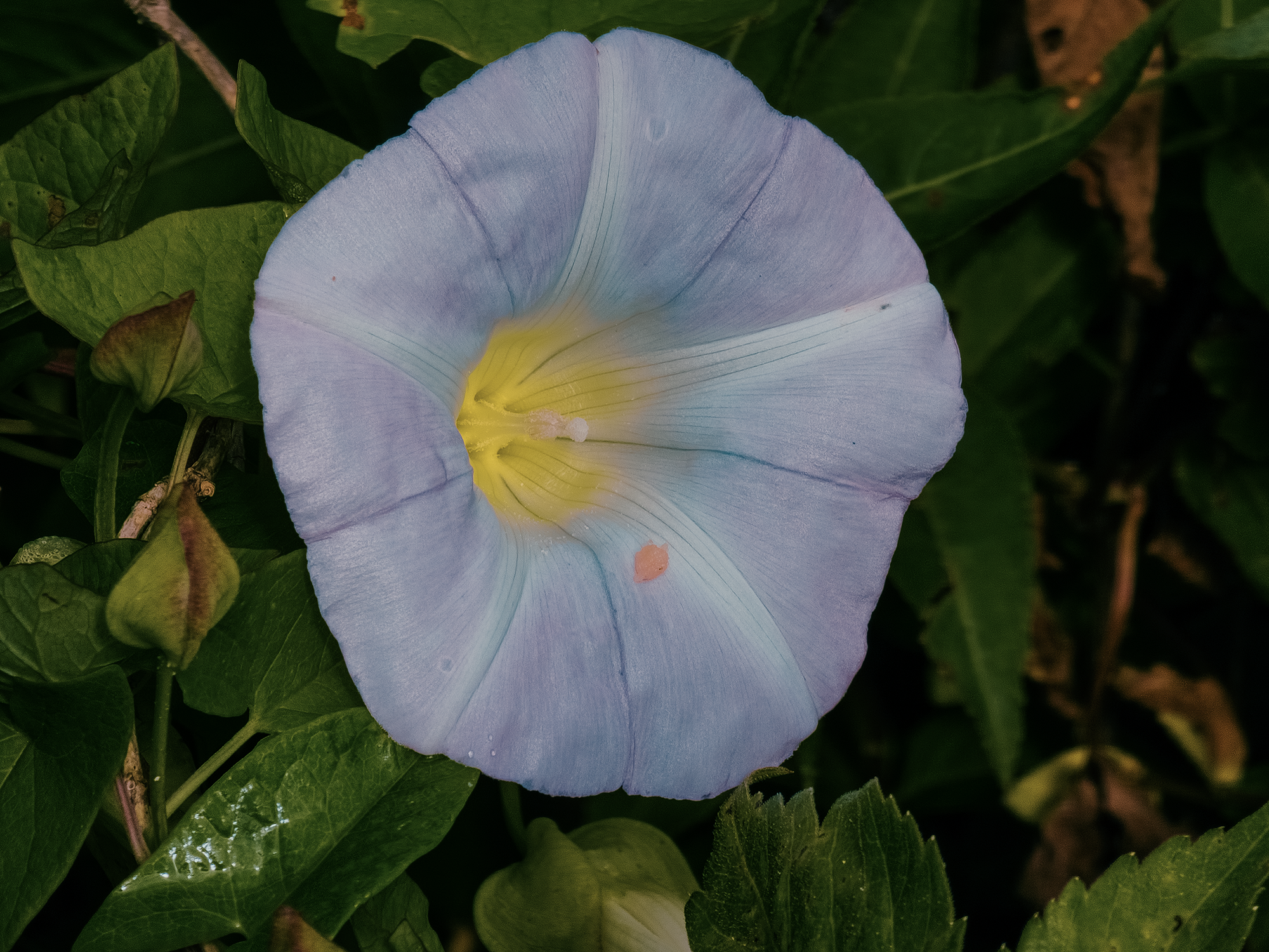
After about another 150 ft (not quite 600 ft from where we spent the night), we passed the Little East Fork Trail and joined up with the Art Loeb Trail (ALT). Right around 6.2 mi total (1.6 mi today), we entered Flower Gap (5,787 ft), a subtle dip between Flower Knob (5,889 ft, behind us, on our right when we passed it) and an unnamed knob (6,000 ft) just ahead of us. Flower Gap is generally bald-like, and, true to its name, boasts numerous varieties of flowers. I thought the Turk’s cap lily was the most unique specimen up here, although morning glories abounded as well:
From Flower Gap, we hiked just over 1/2 mi to a fork in the trail. Truth be told, I missed it: I originally planned to take the right fork up and over Grassy Cove Top (6,050 ft), but I suspect this branch was another “pig trail,” as Chip B. might have called it! Later, we learned Grassy Cove Top was actually “closed” because of terrain damage and microecological considerations—had we approached from the other side, nearer Ivestor Gap, we would have seen signage explaining as much. Instead, we continued along the ALT, enjoying the views across the valley.
Right around 7.6 mi (total), we returned to Ivestor Gap. We still had decent weather here, so I launched the drone—and only later realized its zoom settings were messed up, resulting in somewhat blurry images. Shucks.
We didn’t stick around Ivestor Gap for too long; instead, we continued down the ALT toward Tennent Mountain, just about a mile south of us.
Tennent Mountain
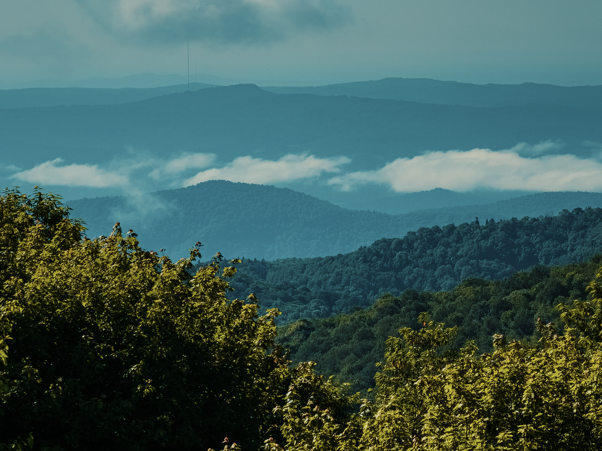
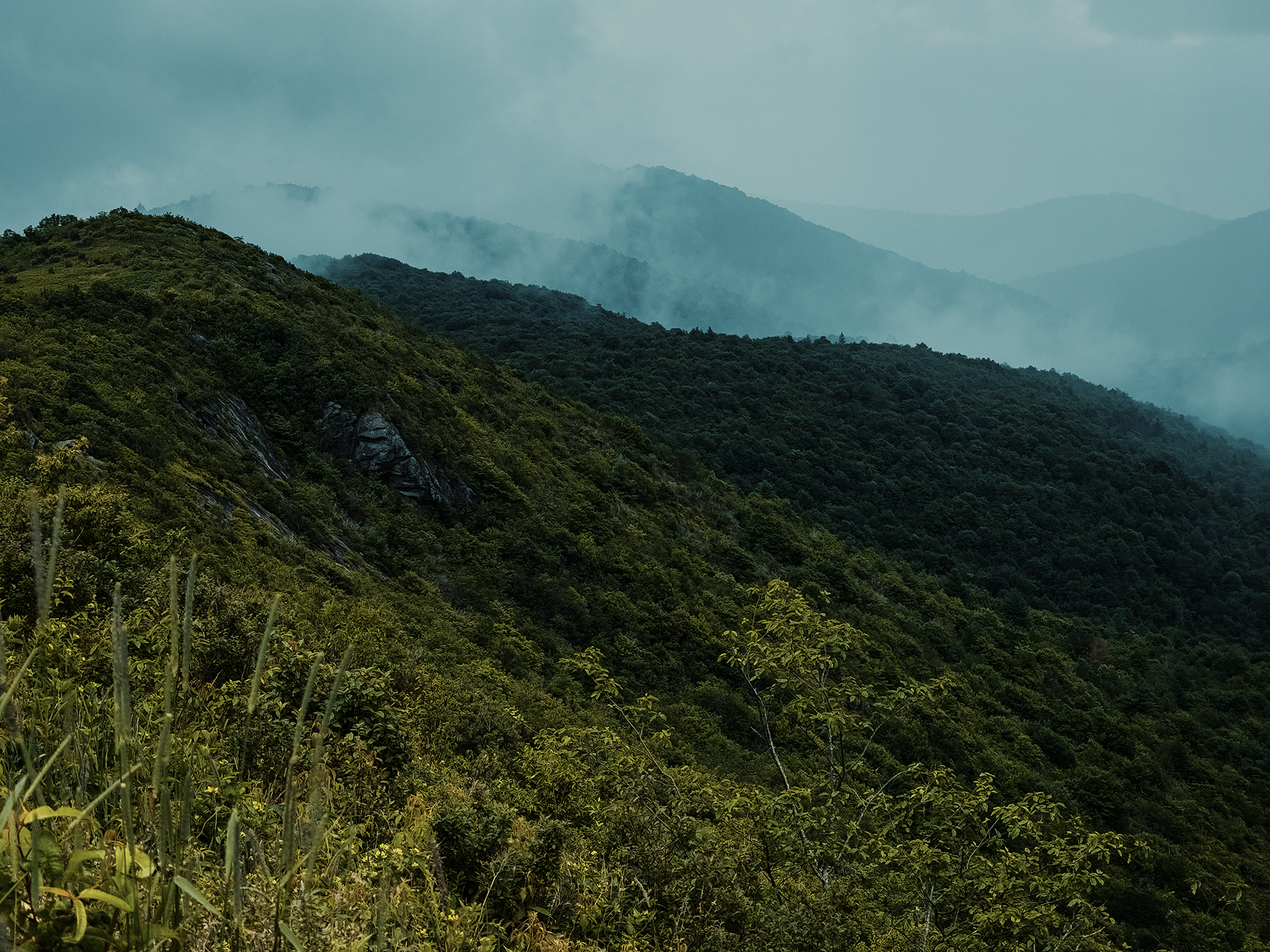
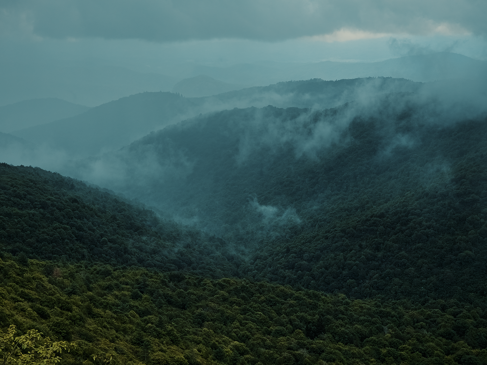
As we continued to hike, the weather turned increasingly threatening. All the way up the trail clouds got thicker, darker, and closer. Uniquely, we could look beyond the clouds toward a line of bright, sunny sky on the other side of the coming storm. The following photos show a couple of different perspectives on the way toward Tennent Mountain’s summit:
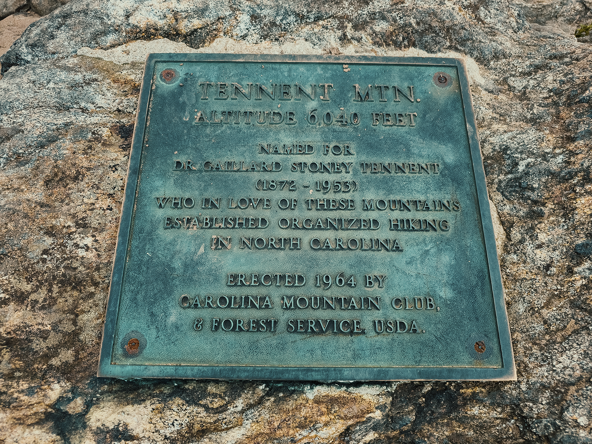
Tennent Mountain (6,040 ft) gets its name from an area physician and conservationist, Dr. Gaillard Stoney Tennent. The U.S. Forest Service officially named this peak in 1946 in recognition of his efforts to protect surrounding forests from excessive logging (likely pre-wilderness boom: see my earlier comment above).
The trail to the summit (which features a plaque honoring Dr. Tennent) isn’t completely clear, but it’s generally flanked by lower vegetation, a reminder that soon after logging ceased, open-range sheep and cattle likely grazed these slopes. That ended by the 1950s: natural processes and limited manual- or fire management clearing efforts maintain today’s balds and bald-like regions.
We didn’t stay at the summit for very long: I think it might have started sprinkling a little while we were up there, and while I did have my rain jacket, I wasn’t in any hurry to put it on.
On the day down, maybe a couple hundred feet southwest of the peak, it looked like someone, uh, blew out the back of his (or her?) shorts and left the evidence strewn right along the trail. Look, I understand sometimes nature doesn’t call so much as breach the front door with flashbangs and tear gas, but I can’t conceive of an acceptable excuse to leave your business blowing in the wind like that. Gross.
I didn’t take any photos. You’re welcome.
Black Balsam Knob
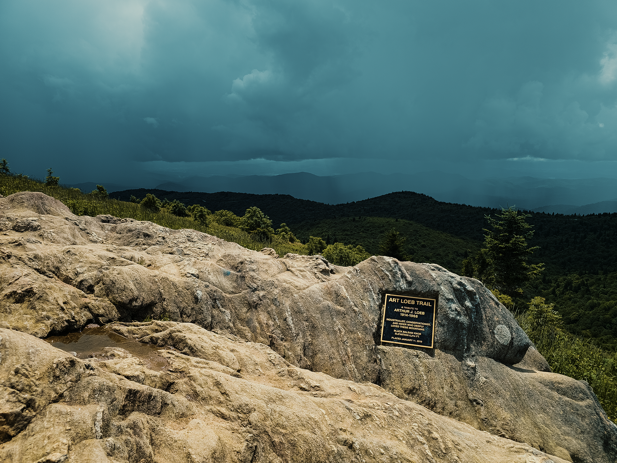
We hiked the ALT for another mile through patches of mixed forest and highland balds until we reached Black Balsam Knob (6,214 ft). It’s one of the highest peaks in Pisgah National Forest and lies just beyond the boundaries of the Shining Rock Wilderness. It’s most likely named for the dense stands of balsam fir that grow on the lower slopes surrounding the bald. Oh yeah: Black Balsam Knob is a bald. I haven’t mentioned that yet! Like other places in this region, this knob was also historically logged, but now it’s protected as wilderness.
There’s a plaque up here commemorating Art Loeb, an avid outdoorsman and hiker who loved this region. He was also a member of the Carolina Mountain Club, and some of its older members—people who likely knew Mr. Loeb—say some of his favorite hikes ended on Black Balsam Knob, where he’d watch the light fade on the ridges. I wondered why the Carolina Mountain Club placed the plaque here, as opposed to either end of the 30.1 mi trail. After looking into it…I get it.
From Black Balsam Knob, it was just about 7/10 mi back to Chip B.’s truck. Our original plan was to stop for lunch, drop some unnecessary gear (or garbage!), and hike maybe another 8 mi between here and the next day. But the approaching weather visible from Black Balsam Knob and the brief shower on the way back to the Ivestor Gap Trail gave us pause. Chip B. checked the weather, and radar didn’t predict a great scenario.
Instead of eating lunch out of the back of Chip B.’s truck, we drove to the nearby Pisgah Inn for something not rehydrated. There, we figured we’d wait out the storm for a while and see if the radar was wrong.
It was not.
Our two-night trip turned out to be an overnighter instead. The places where we would have hiked and spent the night did end up getting pounded with rain. This region is infamous for its wet summer weather, but there are still the shoulder seasons, and if we were in a situation where we didn’t have the luxury of bailing out, getting drenched isn’t the end of the world.
At least before the bottom fell out of the sky, we got to hike along a historic logging route, investigate—well, almost—a place sacred to the Cherokee, and observe an approaching deluge from one of Pisgah National Forest’s highest elevations. There’s so much more to explore around here that I have to come back some day!
Catch the whole adventure on YouTube! Please consider subscribing (if you haven’t already). Thanks for stopping by!