Borestone Mountain is the first mountain I ever climbed. Hiked. Walked up. One of those. I was eight, in third grade, and I didn’t know it at the time, but it would prove to be life-changing. All right, that’s a little grandiose, but it would prove to be an important developmental milestone.
As an eight-year-old, I wasn’t all that interested in history or ecology. No, I was more interested in squinting for a glimpse of the distant shore of Sunrise Pond; or, standing on the well-used dock just across the trail from the Visitor Center, maybe a peek at the narrows that led to Midday Pond. I was more interested in that one really cool tree whose gnarled and twisted roots had woven themselves between the presumably unforgiving rocks along the Summit Trail. I was more interested in looking down at all three ponds from the West Peak, marveling at how high I’d climbed since then, and in conquering the East Peak, Borestone’s true summit.
I’m a little older now. All right, maybe a lot older, depending on who you ask, but in the intervening years, I’ve discovered that understanding the history of the trails and terrain over which one travels engenders a richer appreciation for those who’ve come and gone before, whether Wabanaki peoples or conservation-minded fox fur purveyors.
Base Trail
From the small parking area on the opposite side of Mountain Road, there’s a narrow opening in a typically closed gate. Oh, that’s right: the Maine Audubon Society owns and maintains Borestone Mountain. That gate is for their vehicles. Just after passing through that opening, I turned left onto the Base Trail. When I was eight, the only route to the Visitor Center (and the ponds) was a poorly-maintained collection of switchbacks paved in patches of broken asphalt and loose crushed rock. The Base Trail is vastly superior!
The Base Trail is just under a couple of miles of mostly uphill punctuated by moments of slightly less uphill. All right, it’s not that bad, but if—like me—you tend to hit the gas hard at the start, you’ll feel it after the first few stone stairways. After that (or maybe in between?), I crossed a stream—yeah, let’s call it a stream—interrupted with moss-covered stones (some wobble—watch your step!) before reaching a relatively flat region. It’s here that you’ll see signs for Greenwood Pond Overlook and another directing you toward the Summit Trail. If you’ve got a minute, it’s worth the brief side hike to the overlook. Just bear in mind that you’ll have to hike back up what you hike down. This spur crosses the aforementioned “road” before ending at a large, angled flat rock with a view of Greenwood Pond below. Take a photo or two (I didn’t this time out) and return to the Base Trail.
Back at the junction, I turned right and continued toward the Summit Trail. A little farther, and I stepped off the Base Trail onto a brief stretch of the crushed rock road that would connect me with the Summit Trail. Not too far from the end of the Base Trail, there’s a privy on the right: if nature’s calling, here’s your last chance to answer (there are no facilities at the Visitor Center).
The entirety of the Base Trail snakes and winds through mostly pines and firs (although there’s a healthy number of deciduous trees, too), and the scent—especially on a warm summer day—reminds me of Christmas trees.
The Visitor Center is a small structure, maybe—I’m guessing here, and probably not very well—15 ft x 20 ft? Maybe smaller? It was open the day I hiked it, but I got distracted by the Peregrine Ridge Trail: by the time I descended it, whoever had been running the Visitor Center had shuttered shop and headed out. Let’s talk about the Peregrine Ridge Trail instead.
Peregrine Ridge Trail
Eight-year-old me never had an opportunity to explore the Peregrine Ridge Trail…because it didn’t exist. During the mid-to-late 1980s (and maybe prior), the Maine Audubon Society (I think) hosted peregrine falcon rehabilitation efforts on the sheer cliffs below Peregrine Ridge. Now that the Peregrine Ridge Trail existed, I had to check it out.
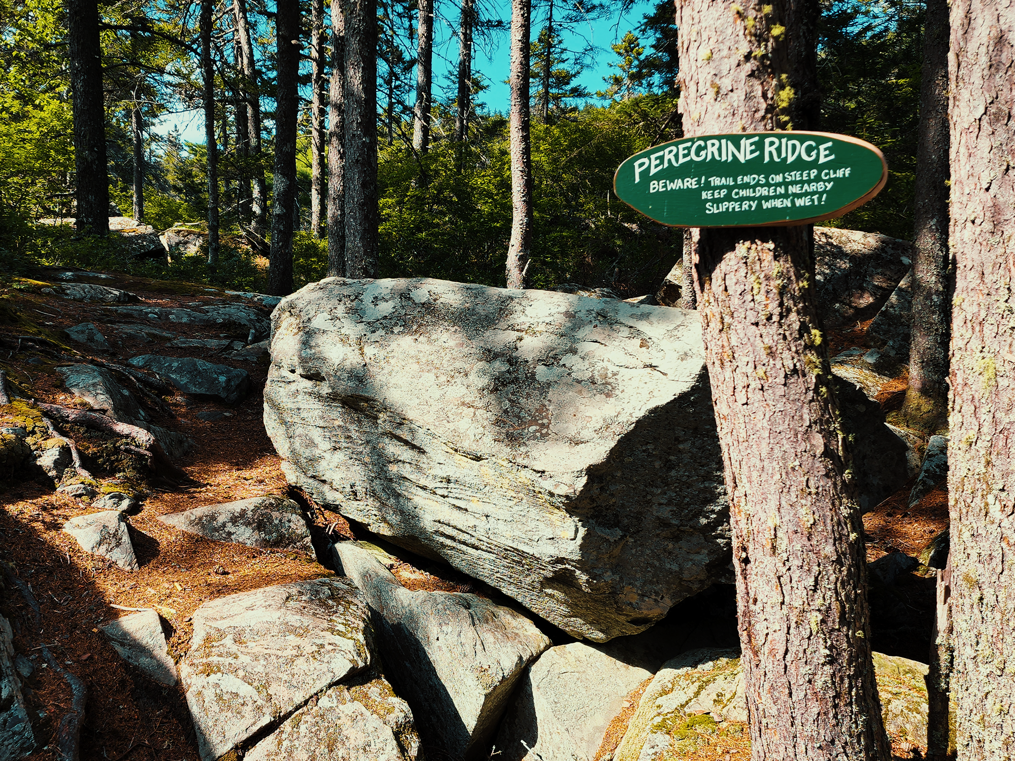
The Peregrine Ridge Trail starts out something like the Base Trail, but you can’t escape the sense of water just to the right. It parallels Midday Pond for a while before forking to the left. (To the right is staff access to the Borestone Lodge, which I didn’t get to visit.) Here, the trail gains a lot of elevation in a relatively short distance, passing over large, almost rectilinear rocks jutting out of the ground, through more pines and firs, and ends—suddenly—on a stony outcropping.
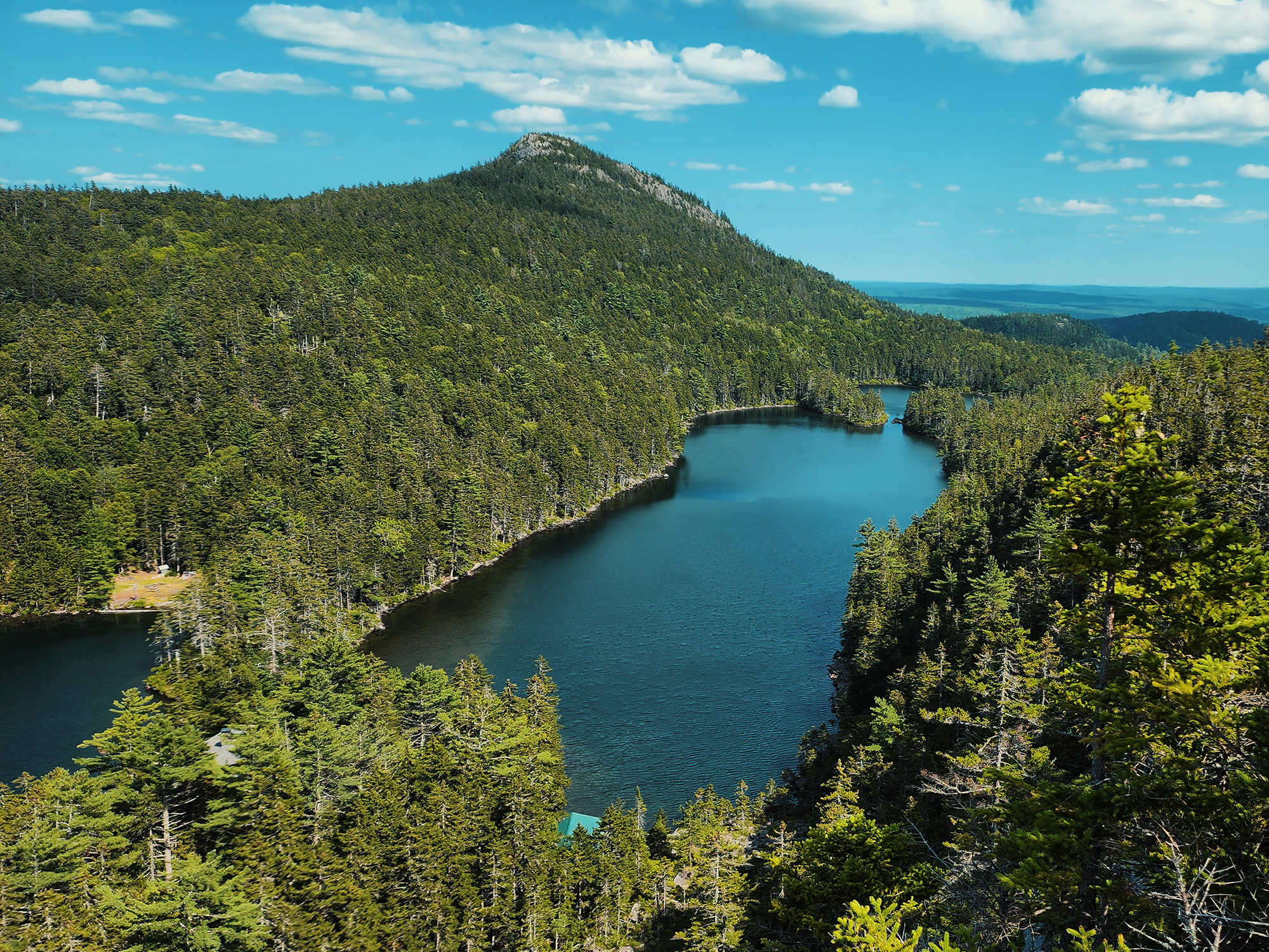
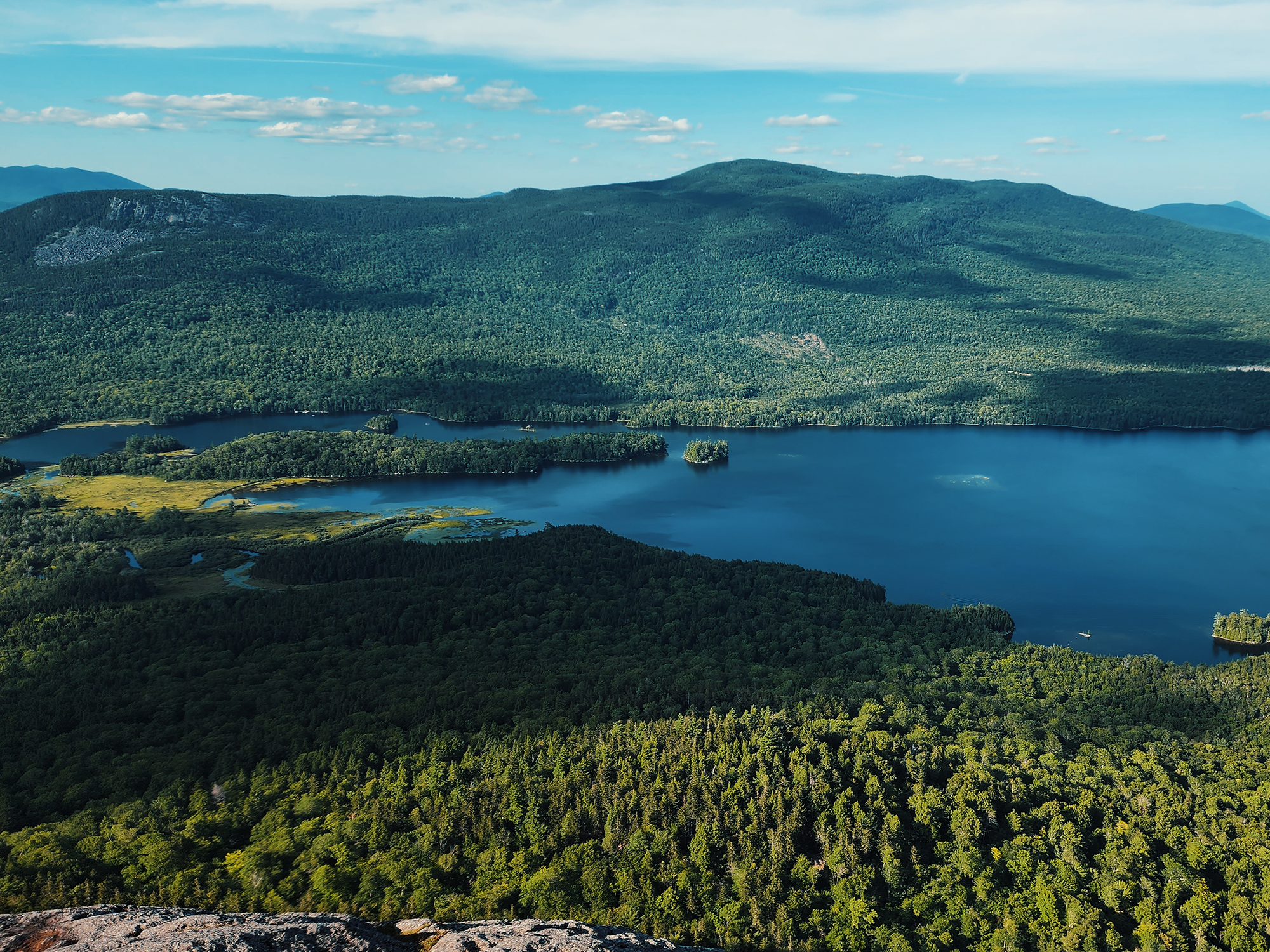
What an incredible view! At its end, Peregrine Ridge offers a nearly 180° panorama of Sunset, Midday, and, if the sun is just right, the sparkling surface of Sunrise Ponds. Beyond the opposite shore, one sees the steepest parts of Borestone rising in such a way that its roughly 1,900+ ft seems starker than it should. From the very edge, look down, and you’ll see the gray roof of the Borestone Lodge tucked into the corner of Midday Pond (and other structures not too far away). These ponds are reputed to be fishless, although waterfowl (including the occasional loon) sometimes hunt frogs from them.
I wanted to spend more time just appreciating the view from Peregrine Ridge, but I’d gotten a late start, and I knew the sun would drop before I finished everything if I delayed, so I hiked back down to the Visitor Center. That’s when I realized it has closed maybe fifteen minutes before I got down from the ridge. Maybe next time.
Summit Trail
That reminds me: there’s a small fee for climbing Borestone. $5. Up from…whatever it was when I was eight, but still not unreasonable. There’s also a sign-in logbook. I signed in and paid my $5, stood on that wooden dock for a moment, then took the Summit Trail, which is also just under a couple of miles.
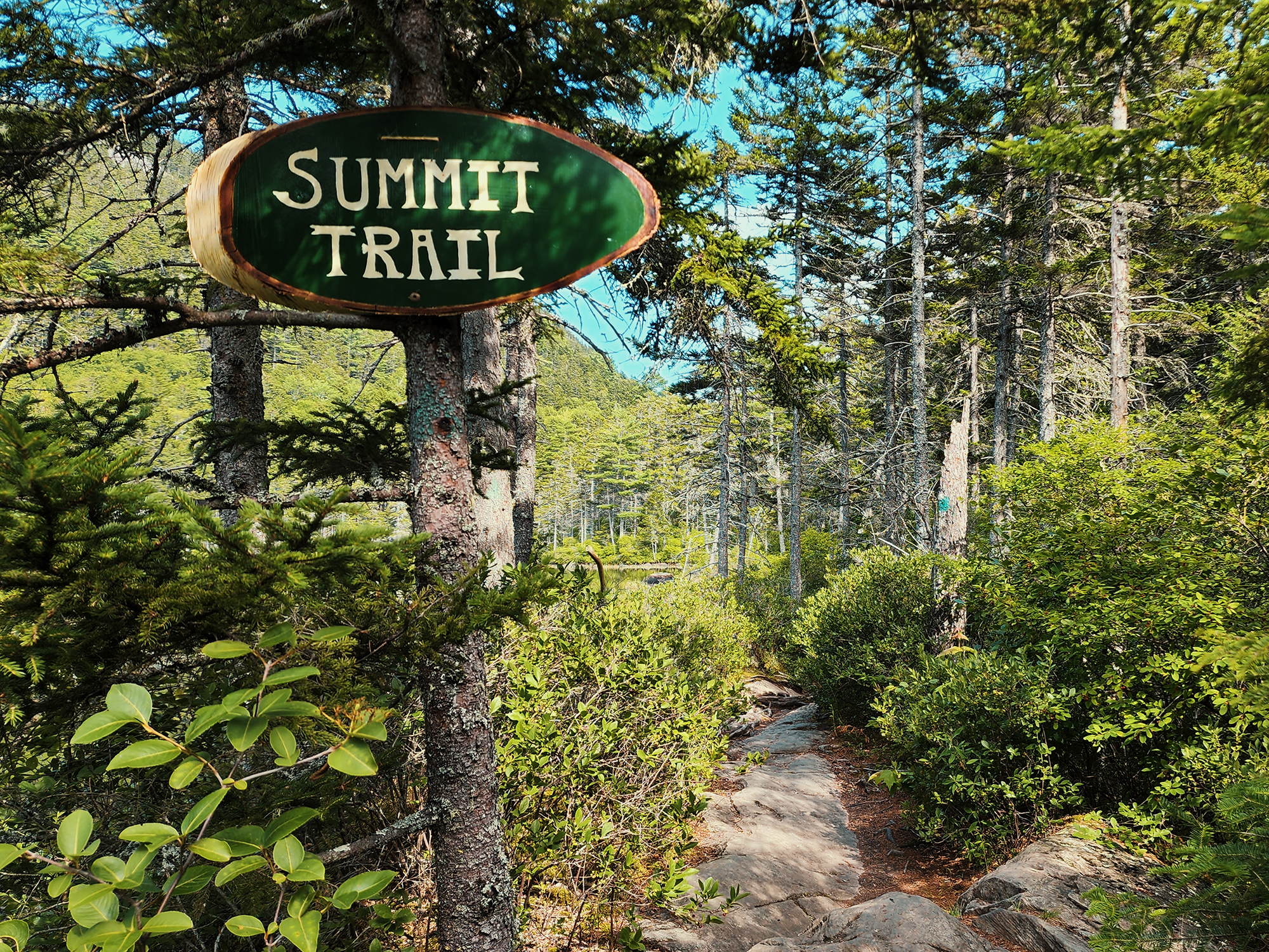
The Summit Trail starts by following the southern edge of Sunrise Pond. I crossed over the remnants of a concrete dam of sorts: these ponds flow into Little Greenwood (yes, the one we viewed from the overlook). This is the last “flat-adjacent” section of trail before the real uphill starts. The Base Trail has its steep moments, but the Summit Trail is almost exclusively steep moments. In fact, portions of it have iron rungs and railings to assist those who might need a little extra help. We’re not there yet though.
I can’t remember how many times I’ve climbed Borestone, nor when I first noticed this tree, but at some point, as crunchy as it sounds, I started thinking of this tree as a constant friend who lives about halfway up the Summit Trail.
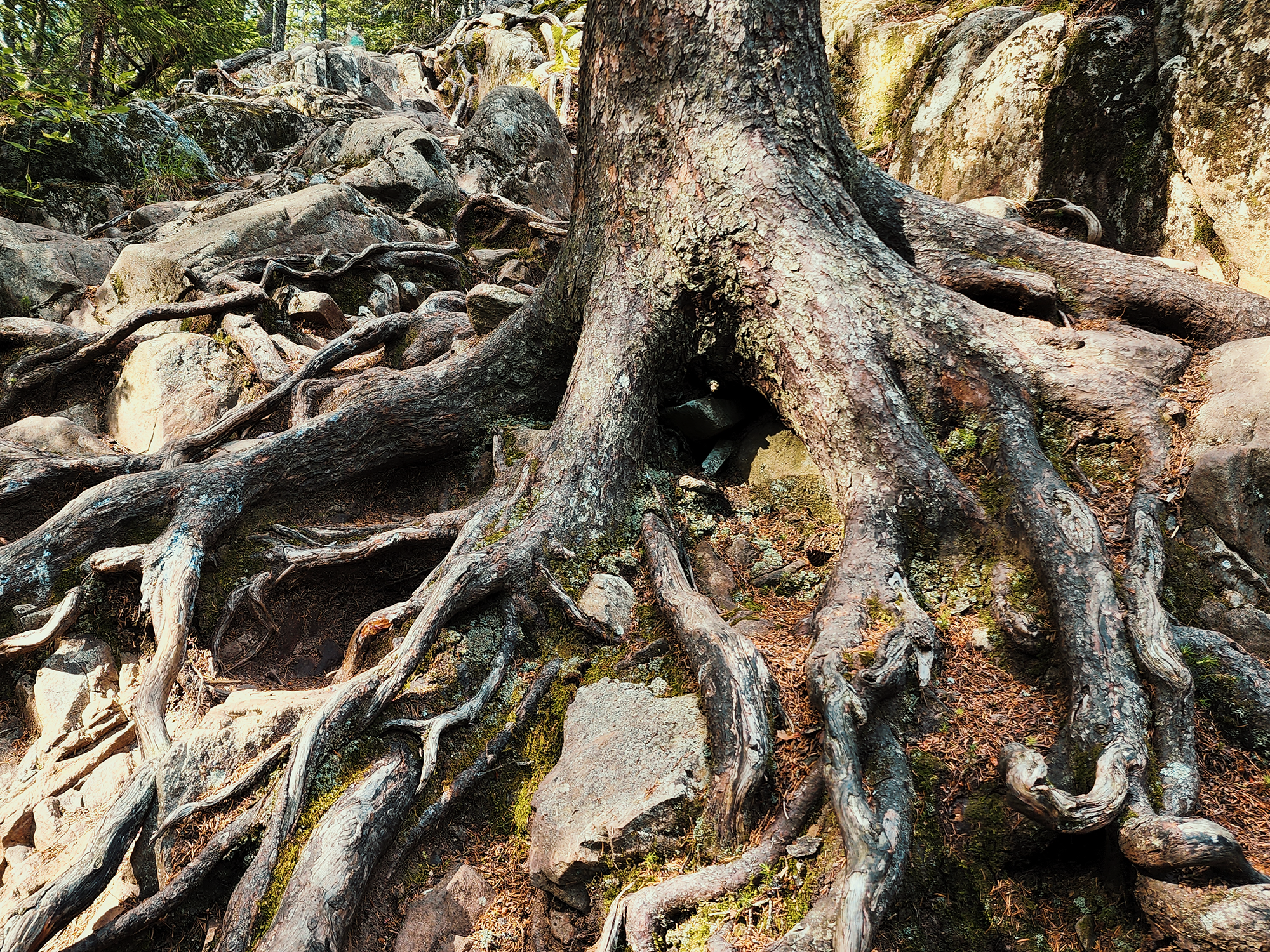
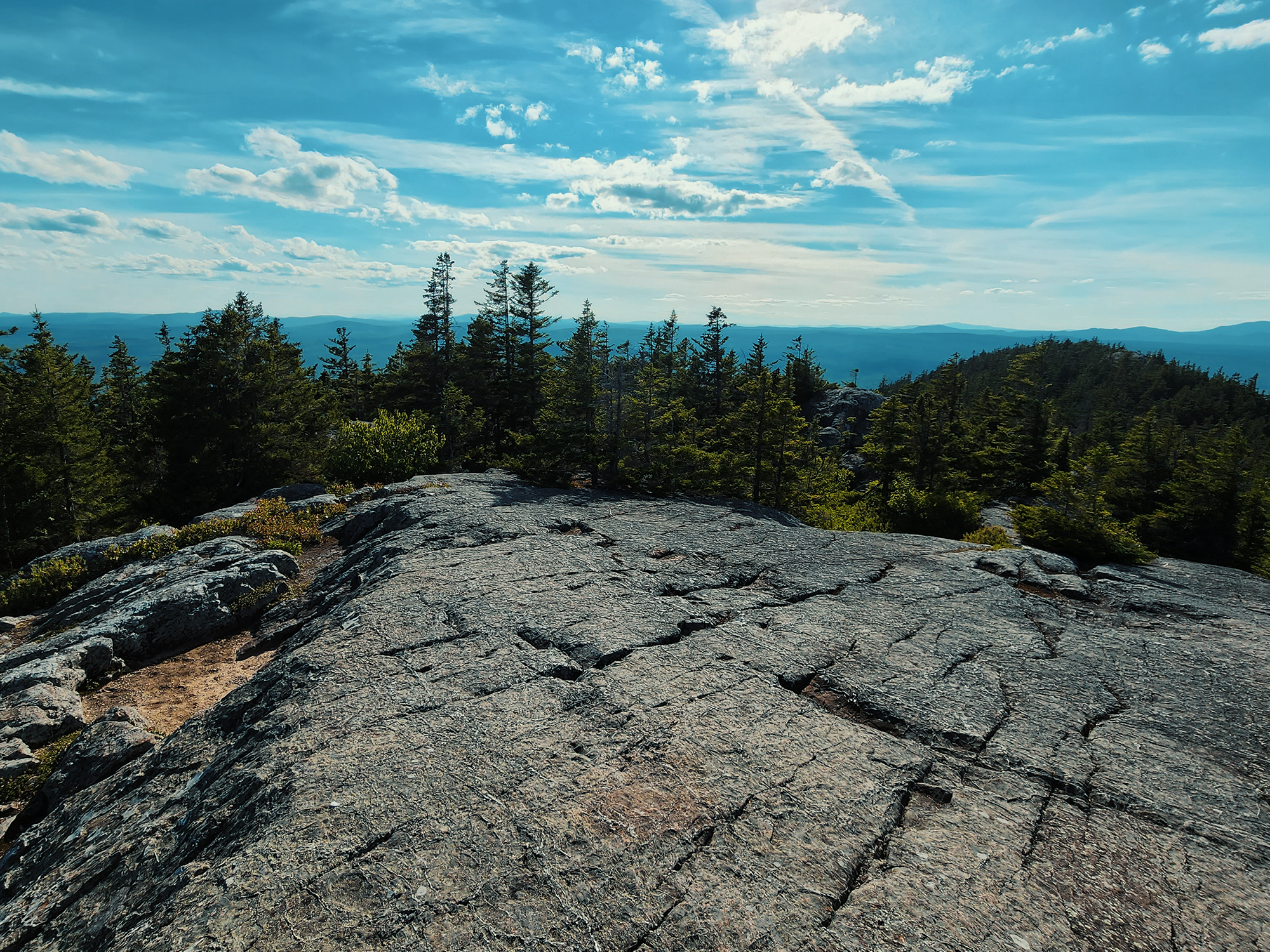
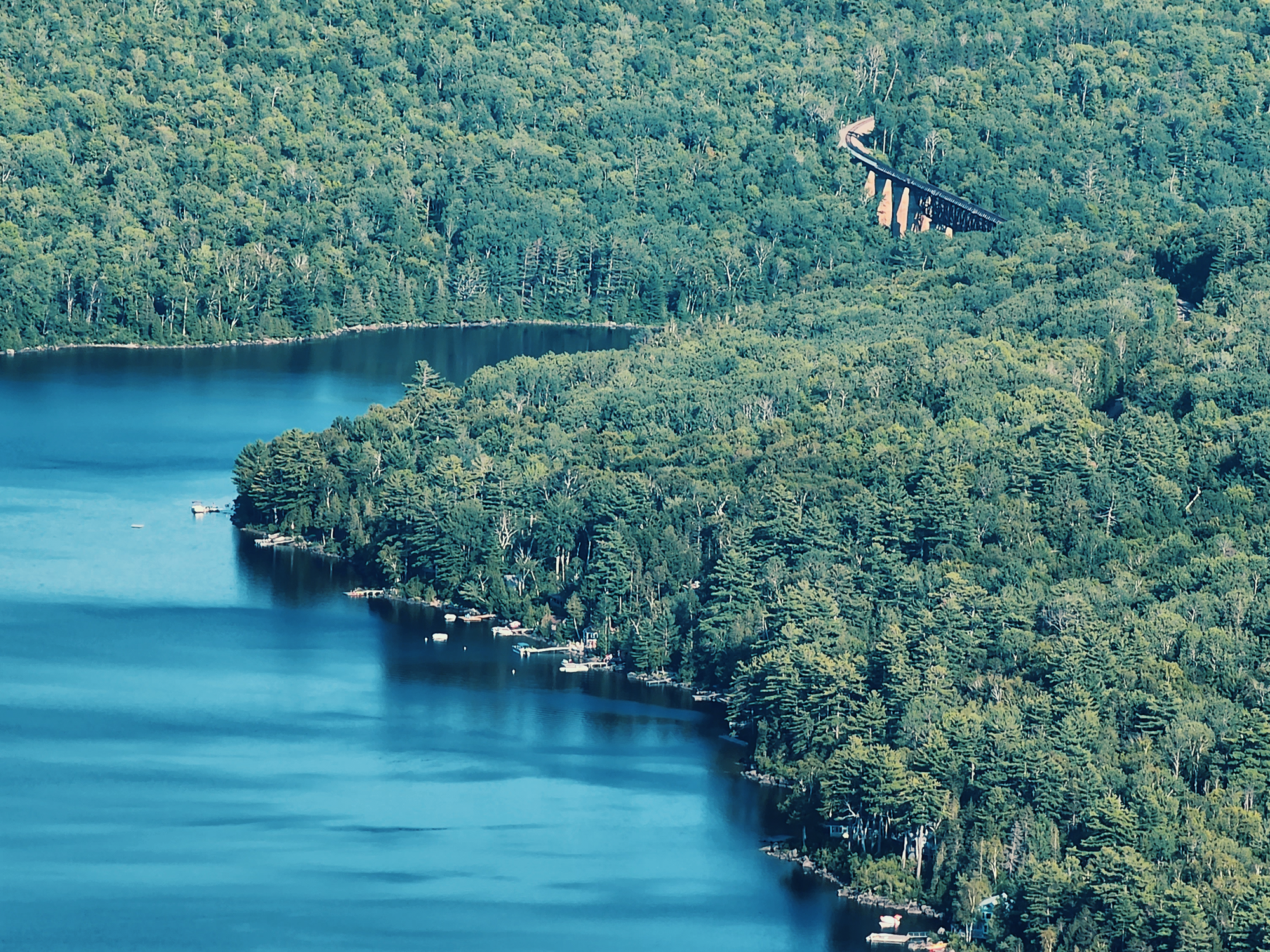
This is just before the “iron rungs” segment. Or maybe it’s more before that than I remember. Either way, from here, it’s not much farther: there’s a brief section that requires a little bouldering, but then you’re above the timber line. Even from the West Peak, Borestone’s “false summit,” there are incredible views of the ponds, as well as the cliff face beneath Peregrine Ridge. I didn’t take photos of any of that this trip out. Shucks. I did, however, snap a shot of the northern end of Lake Onawa from here:
When I was eight, I remember looking toward the East Peak (from the West Peak) and seeing Dad and my brother all the way over there. At the time, it seemed so far away, like I had to cover so much more distance before I could join them. I don’t remember if that was true in 1984, but it seems false now. I think it’s maybe 20, 25 minutes from West Peak to East Peak on a good day (and today was a great day). After not taking any pictures of anything from the West Peak, I ducked below the timber line for a minute, then reappeared on the East Peak.
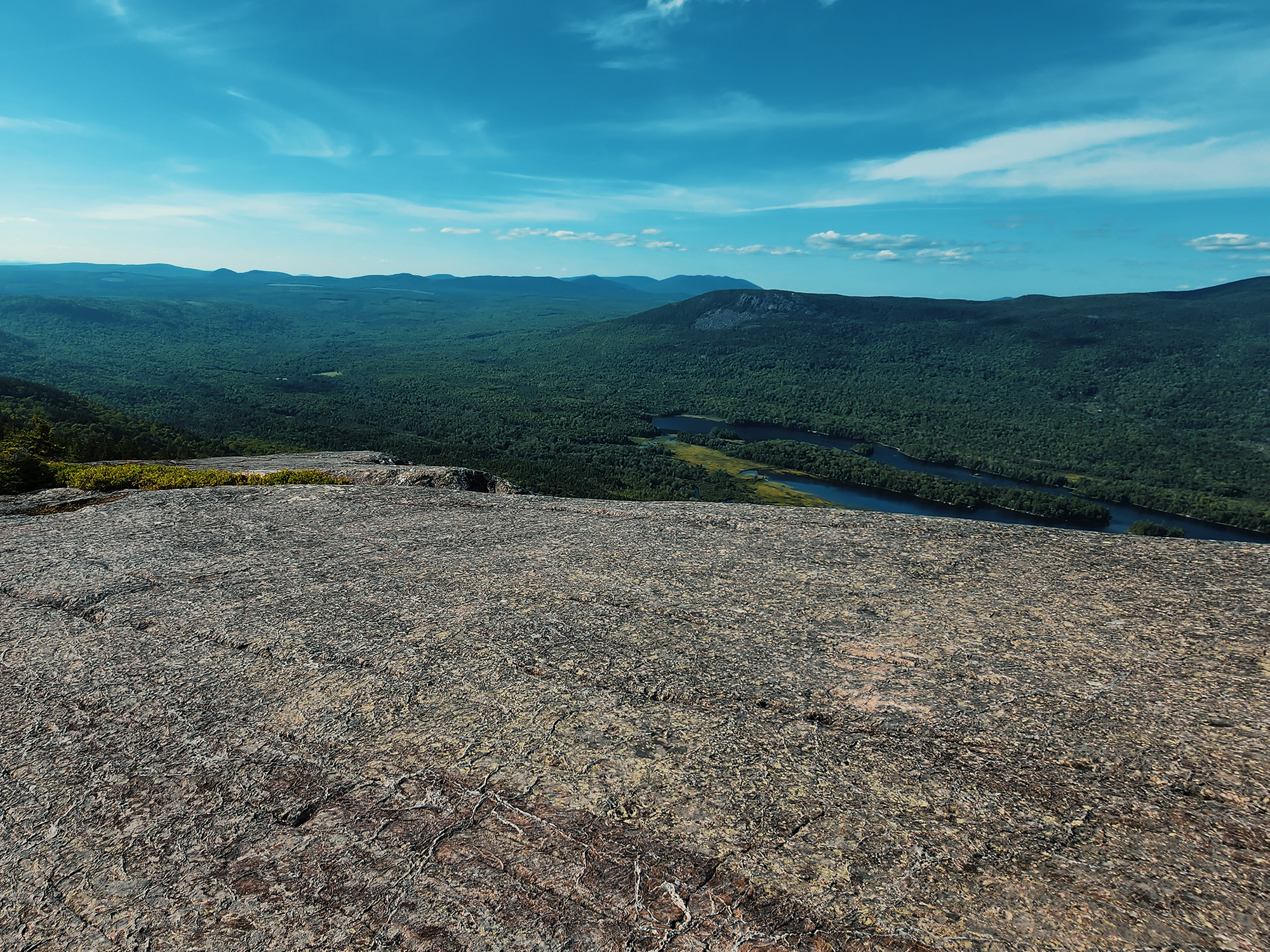
The above image is looking west, back in the direction we came, but to the north, you can see Barren Mountain across Bodfish Valley and Lake Onawa. To the east, you can see the Onawa Trestle (a.k.a. the Ship Pond Viaduct). [More on both of those in later posts!] Also atop the summit, there’s a circular map of sorts bolted into the granite. It wasn’t there when I was a kid, and it’s hard to read now: water seeped beneath the acrylic and blurred some of the labels. Speaking of bolts, there are also two large mounting studs and rust-frozen nuts where a fire watch structure (a “ground house”) used to stand.
By now, the sun had started setting, if subtly, so after too brief a stay at the summit, I descended and headed back in the direction of the Visitor Center, stopping short to take the last trail of the day.
Fox Pen Loop Trail
In 1909, Robert Thomas Moore, then Borestone Mountain’s owner, commissioned Bangor architect Wilfred E. Mansur to construct the Lodge we saw from Peregrine Ridge. In the 1950s, he donated the Lodge and the land to the Maine Audubon Society. One of Mr. Moore’s business endeavors was a fox pelt farm tucked along the slopes of the mountain. Today, the Fox Pen Loop Trail is a lollipop loop down toward a boggy area with questionable boardwalks, then up onto firmer ground. Go right or left, it doesn’t matter: you’ll return here either way. I think I went right. After a while, you’ll pass the remnants of a handful of fox pens, most thoroughly unusable today but still discernible. It’s an interesting glimpse into the mountain’s not-too-distant past. There’s also a brief spur (too brief to properly call it a spur, really) that leads to Big Greenwood Overlook, which is downstream from Little Greenwood (which is what the Greenwood Pond Overlook off the Base Trail…overlooks).
After completing the Fox Pen Loop Trail, I headed back toward the Visitor Center to sign out. I intended to take the Base Trail back to the parking area, but Mom called (yes, you get service up there!), and I got distracted and missed the turnoff.
All in all, the trails available at Borestone Mountain might amount to five to six or seven miles. Not a lot. That said, Borestone remains one of my favorite hikes. And even on this day, I happened to hear snatches of conversations where other hikers expressed much the same (well, at least regarding hikes in Maine).
Catch the whole adventure on YouTube! Please consider subscribing (if you haven’t already). Thanks for stopping by!
Pingback Hiking part of the AT over Barren Mountain (ME)
Pingback Hiking the Eagle Rock Trail (ME)
Pingback Spending the night on a little island in Lake Onawa (ME)
Pingback Hiking Borestone Mountain—but in the winter this time! (ME)
Pingback Hiking through (parts of) Uwharrie National Forest (NC)
Pingback Spending the night next to Little Wilson Stream in Maine’s 100 Mile Wilderness (ME)