My brother and I originally planned to hike Old Speck, ranked #5 out of Maine’s fourteen 4,000 footers. That was before we spent almost the entire day prior installing flooring above his garage. When I woke up, I felt like I just finished hiking Old Speck! I think my brother must have been feeling it too, so we opted for something significantly simpler. That’s what led us to Camden Hills State Park and the highest mainland coastal mountain in Maine—Mount Megunticook.
It’s about 2.5 hours to Old Speck (part of Graton Notch State Park) from my parents’ house and 1.75 hours to Camden Hills State Park. I can’t remember what time we left in the morning, but we arrived at the park around 0900 hrs, swapped street shoes for trail shoes and grabbed our day packs, and started up the trail.
Megunticook & Nature Trails
Off of Mount Battie Road, we parked at the Mount Megunticook trailhead, which makes sense, since that’s where we were headed. (Had we continued up Mount Battie Road, we would have arrived at—you’ll never guess—Mount Battie.) We began on the Megunticook Trail, which ascends gradually through northern hardwood forest, about 60 vertical ft over a little more than 550 ft.
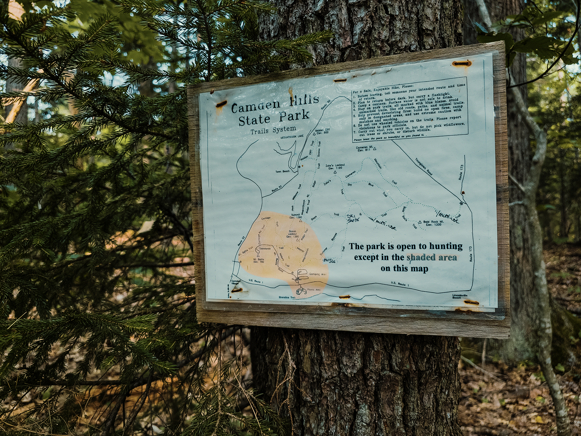
At the end of that 550+ ft, we took a sharp left onto the Nature Trail, which essentially parallels Mount Battie Road for 7/10 mi. The Nature Trail connects the Megunticook Trail with the Tablelands Trail. There are a handful of steeper sections along the Nature Trail, but nothing too strenuous, and there are stone steps here and there. (If you’ve read elsewhere on this site, you know I like stone steps!)
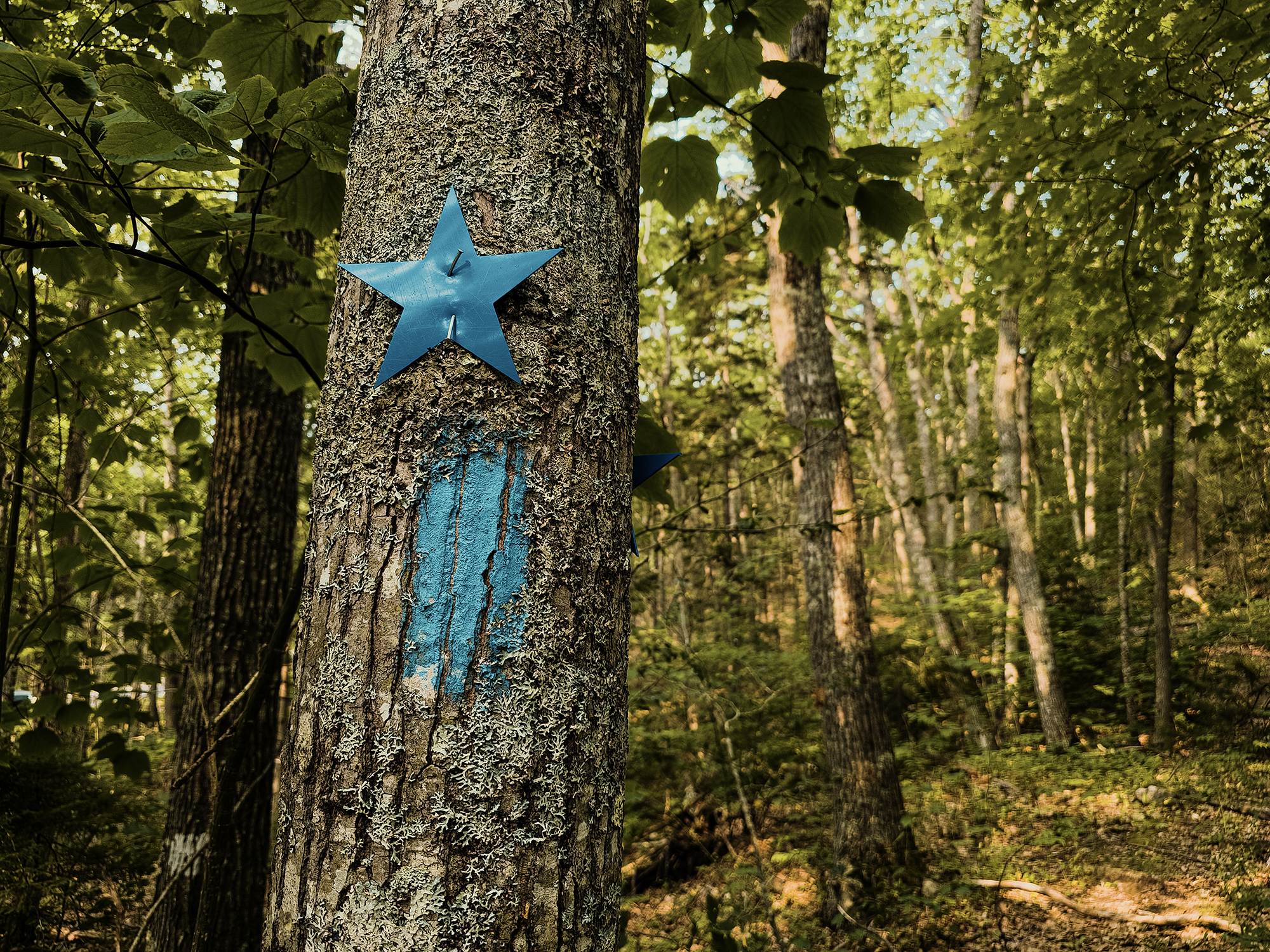
On some hikes (not all), I’ve mentioned the different blazes trail clubs or maintainers use to differentiate one trail from another. One unique thing about the Nature Trail—and nearly every trail we hiked at Camden Hills State Park—is the different shapes and colors (cut from plastic) used in conjunction with painted blazes. I guess that’s great if you’ve got kindergartners running wild through the park! Still, these blazes are definitely harder to miss than others!
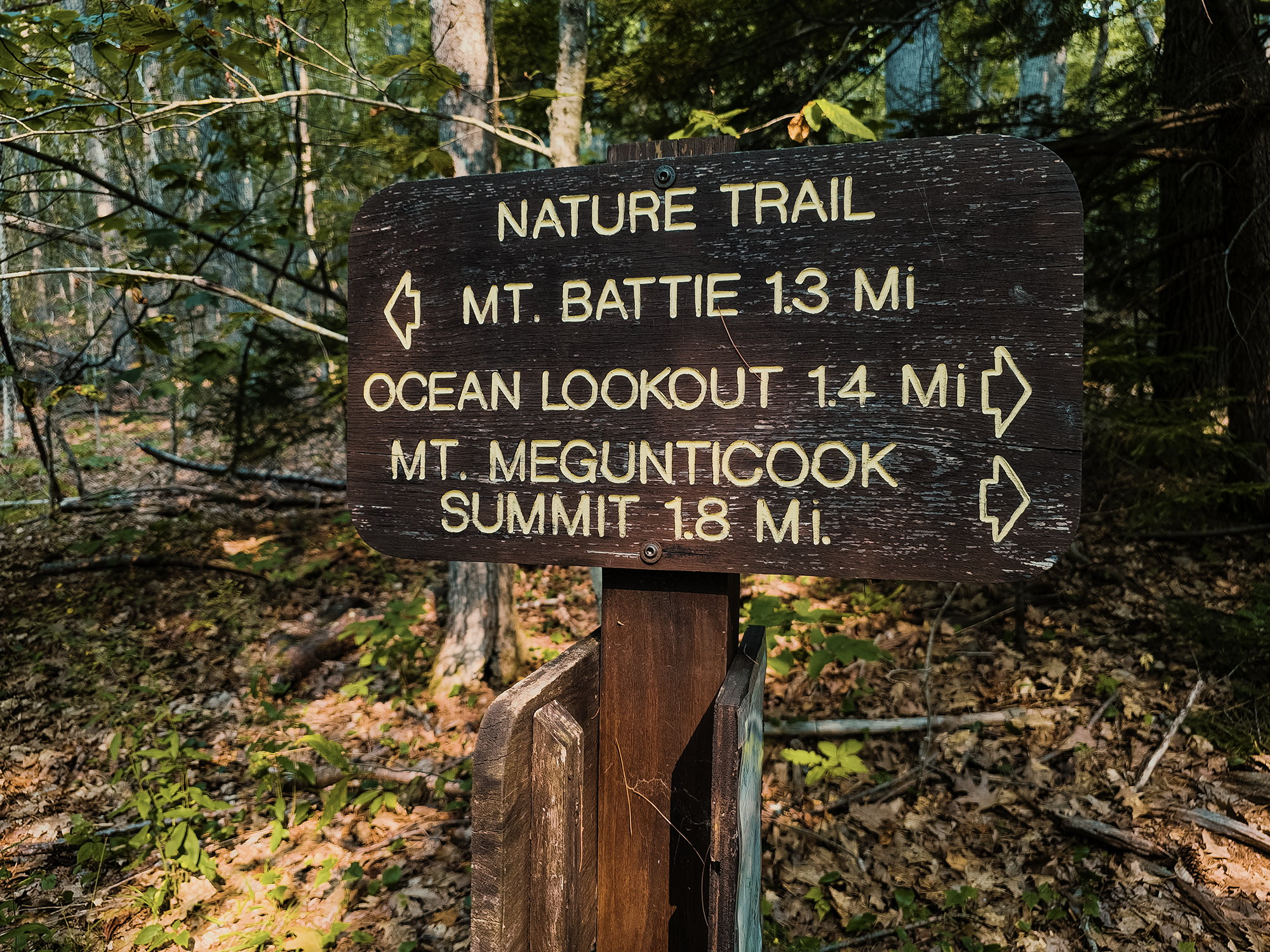
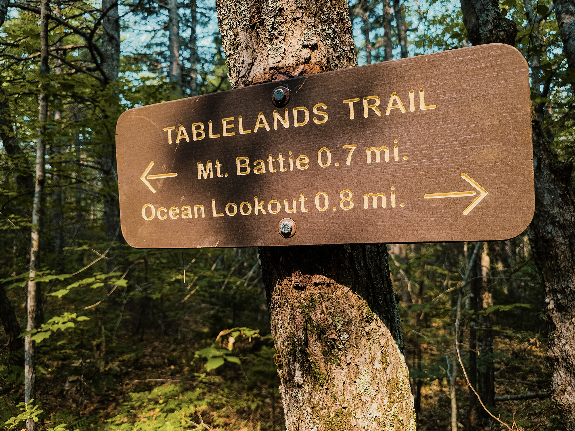
At the T-intersection where the Nature Trail meets the Tablelands Trail, we could have turned left and hiked toward Mount Battie (780 ft), which, in hindsight, we probably should have: it would have added just 2.6 mi to our overall mileage. But there are other trails here that we didn’t hike, so there’s plenty of “re-hike” value for a future visit. Instead, we turned right and hiked the Tablelands Trail.
Tablelands Trail
The first 700 ft of the Tablelands Trail are relatively gentle, just a few rolling ups and downs. After that, just past the intersection with the Carriage Trail, the slope increases dramatically. In fact, I think it’s right around here that in addition to the standard blazes (red rectangles), there’s a painted arrow on a rock step indicating UP (I didn’t get a still shot, but you’ll see it in the video!). I’ll admit, that might be a touch dramatic, but it’s also a good—if unsubtle—warning that warmup time is over.
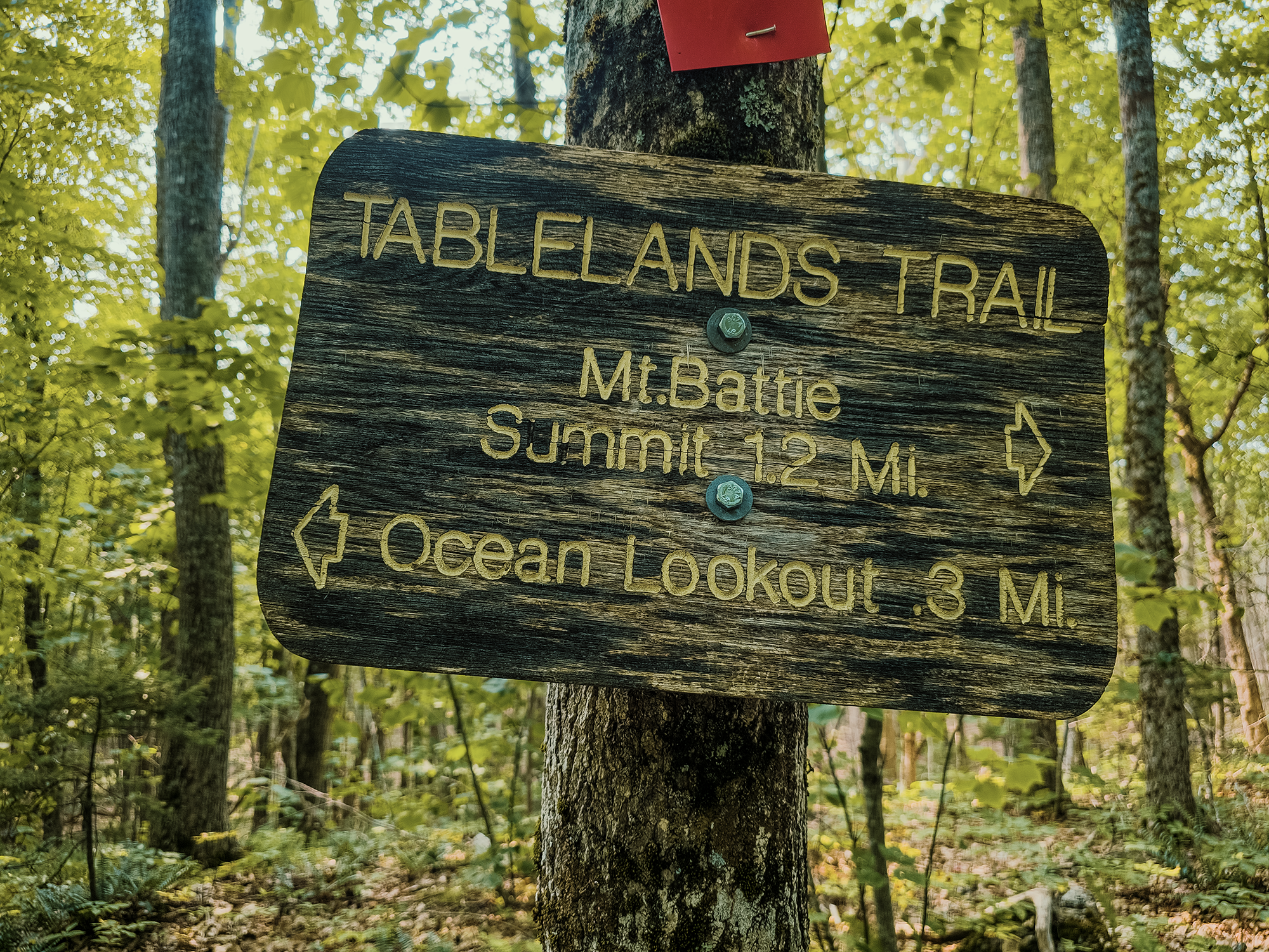
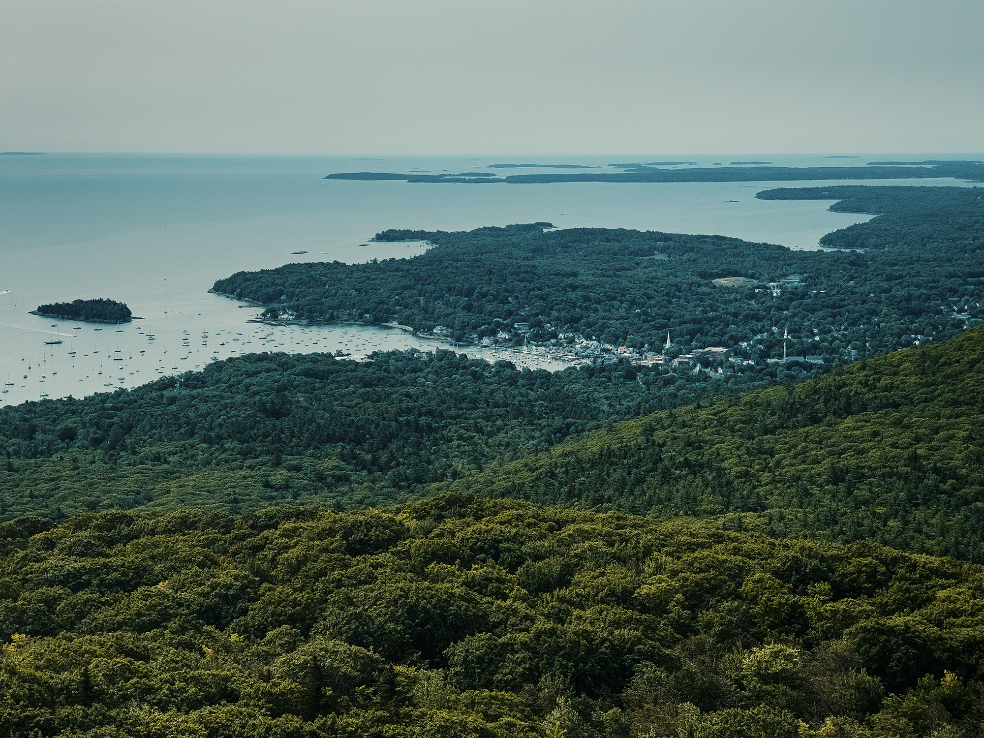
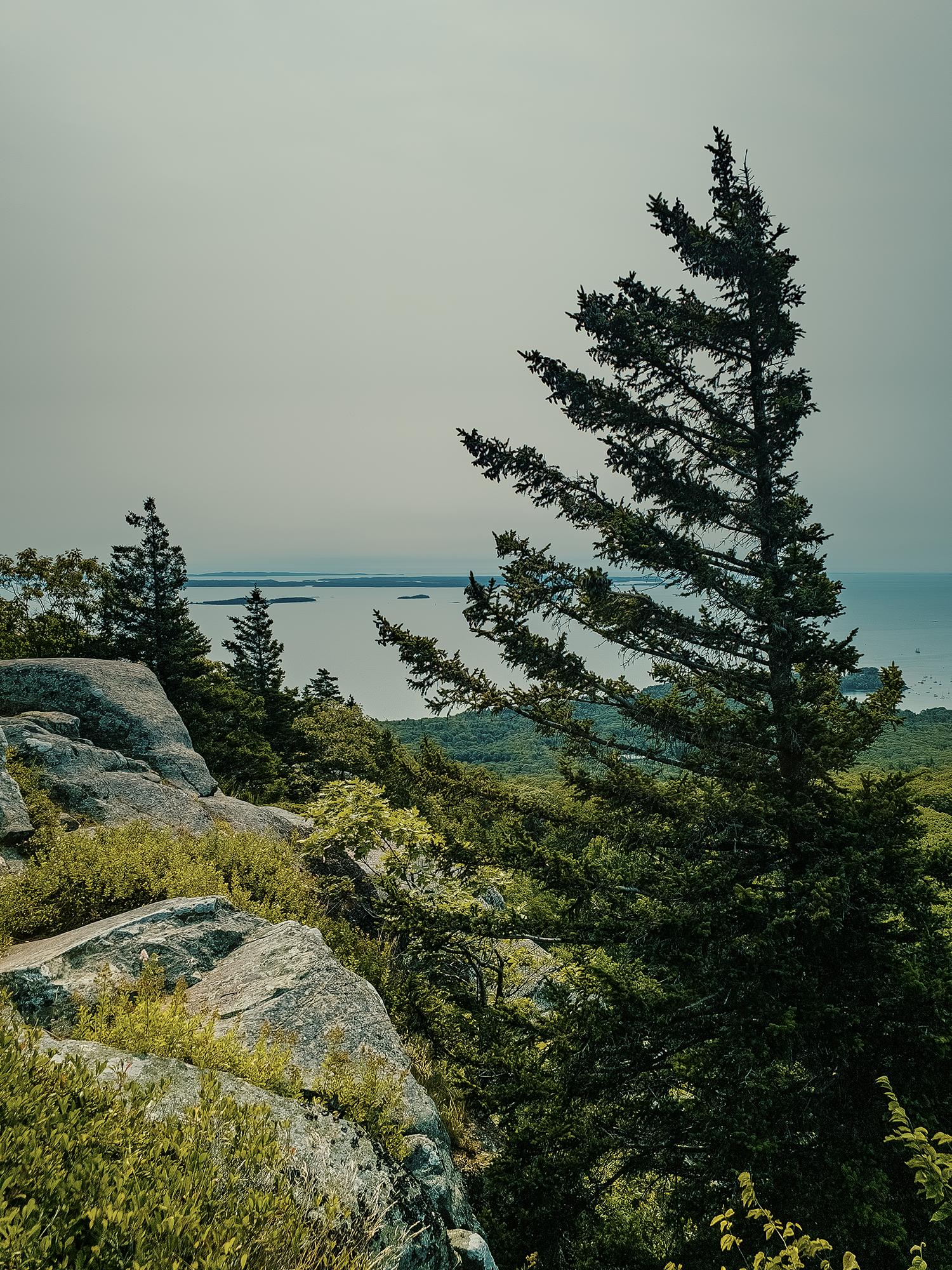
Not quite 6/10 mi up from where we turned onto the Tablelands Trail, we passed the Jack Williams Trail; maybe 250 ft after that, we turned left onto the Adams Lookout Trail, which is really a slightly lower elevation “short circuit” between points on the Megunticook Trail. It also takes you closer to the edge of the massif that includes Mount Megunticook itself. From what I’ve read, it offers a different view of West Penobscot Bay.
Adams Lookout Trail & Ocean Lookout
We were only on the Adams Lookout Trail for just shy of 2/10 mi before we reached Ocean Lookout. If memory serves, there are lots of large rocks in this region, meaning that much of the “trail” is across the surface of these features. We’re still surrounded by trees, but less so for a while along this stretch.
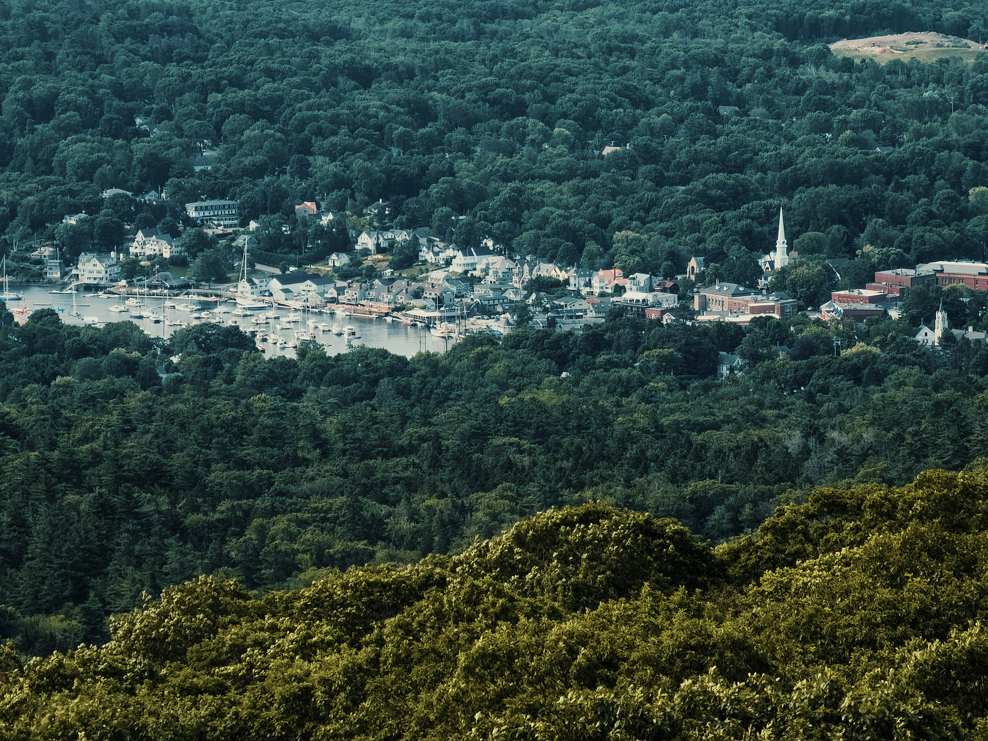
Stepping through the last bits of the Adams Lookout Trail, we reached Ocean Lookout. Here, we could look out over West Penobscot Bay and even down into Camden Harbor. That’s maybe a long-winded way to say that this point of interest is aptly named!
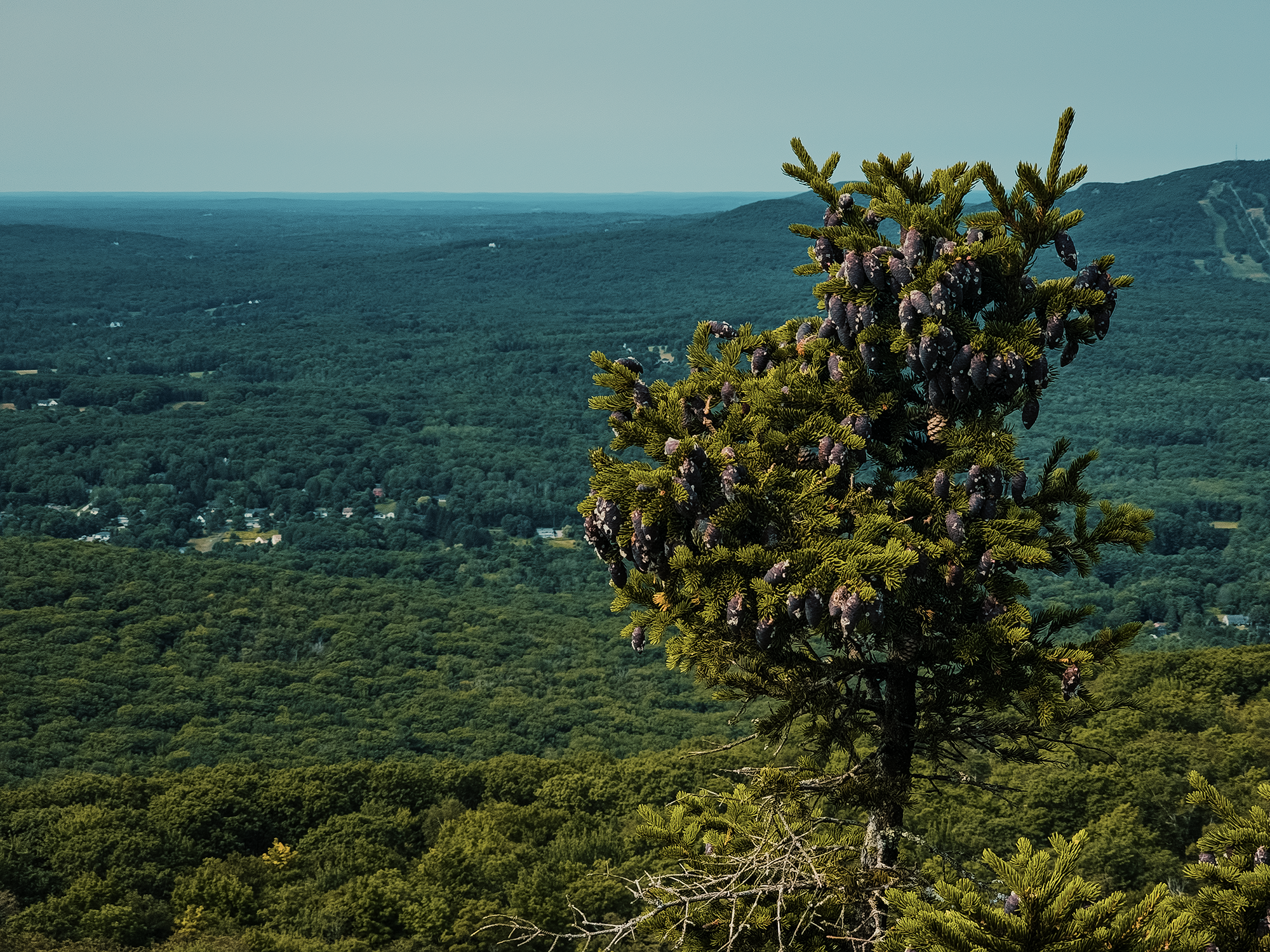
During the ascent, we started seeing more spruce and pine mixed with the hardwoods. Even at just over 1,200 ft above sea level, at these latitudes, such evergreens thrive. The southeast has scattered pockets of similar trees, but only at much higher elevations (usually above 5,500 ft or so).
There were already a handful of people up here when my brother and I arrived, and while we were enjoying the views, still more people came and went. Camden Hills State Park was busy today! (In all fairness, it was nearly perfect weather for a short hike like this.) I don’t know how long we stayed at Ocean Lookout, but our next stop was Mount Megunticook itself, via the Ridge Trail.
Ridge Trail & Mount Megunticook
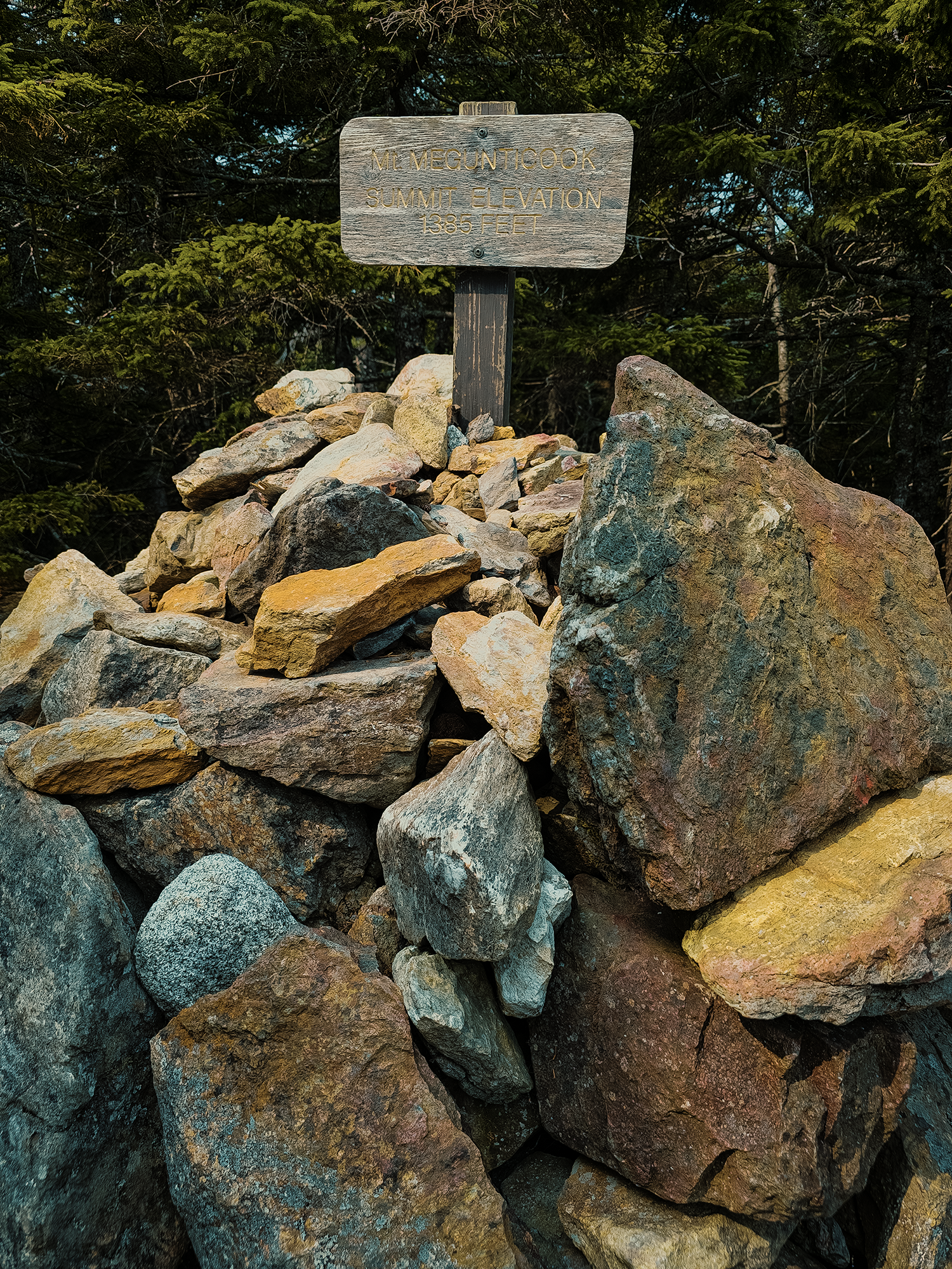
The Ridge Trail is just about 1/2 mi from Ocean Lookout to the “summit” of Mount Megunticook (1,385 ft) (and just over 100 vertical ft). Here, the hardwoods are largely gone, displaced by evergreens. I think I most enjoyed this part of the hike: dark-colored trees, lichen-covered trunks, and moss-blanketed forest floor on either side of the trail.
I refer to the “summit” of Mount Megunticook in quotes because it’s completely covered with trees! Yes, it’s the highest mainland coastal mountain in Maine, but it’d be so easy to miss without the giant cairn supporting a wooden sign! It really just feels like another bump in the trail. Here, the Ridge Trail continues vaguely northwest toward Maiden Cliff (popular with rock climbers) and splits north-northwest and becomes the Slope Trail.
I haven’t said anything about the name Megunticook yet, but maybe, like me, you’re wondering what it means? This region of Maine sits within the traditional territory of the Wabanaki Confederacy. Uniquely, territory never officially ceded via treaty. Megunticook is a Penobscot word that means “great swells of the sea” or “at the bay where the sea swells,” perhaps referring to both the ocean and the land features surrounding it.
From here, we retraced our steps back toward Ocean Lookout. On the way, I took a little side trip toward some exposed rocks with views of Ragged Mountain toward the west. Before I could turn my camera on, at least three peregrine falcons flew overhead! They probably would have been little more than blurry gray blobs in the recording, but peregrines are awesome.
Megunticook Trail (again)
When it was time to move on, we veered left and took the Megunticook Trail back to the parking area. In this direction, it’s steadily downhill, but not aggressively so. My knees don’t tolerate steep or drawn-out downhill stretches, and I don’t remember them feeling any worse for wear on the way down. Like the upper end of the Adams Lookout Trail, the Megunticook Trail here consists of mixed hardwoods and evergreens. As we got closer to the parking area, hardwoods dominated the forest’s composition.
Today was quite the pivot from our original plan! We had less than 12 hours to plan—and I don’t think I’d call it a plan anyway. Still, we got to hike through land the Wabanaki still consider culturally and spiritually significant, we got to view West Penobscot Bay from Maine’s highest mainland coastal mountain, and I got to sneak in a roughly 3.7 mi hike with my brother.
Maine has 35 state parks. I’ve only been to a few of them, and until the night before this hike, I didn’t know Camden Hills State Park was a thing! Now that I know, however, I’m going to have to come back when I can spend a night or two and take in more of the trails. This place is beautiful!
Catch the whole adventure on YouTube! Please consider subscribing (if you haven’t already). Thanks for stopping by!