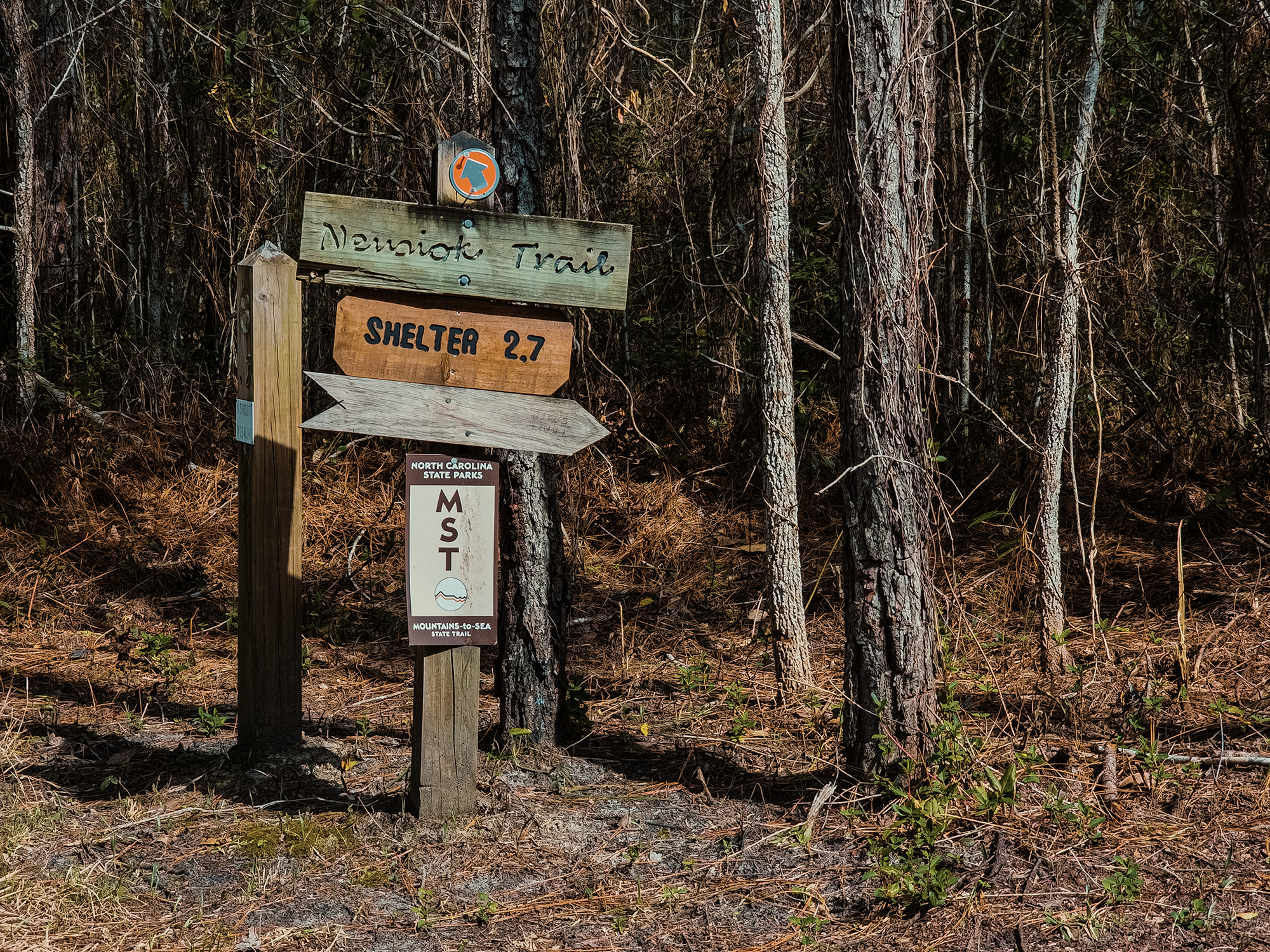
The Neusiok Trail, one of the last segments of North Carolina’s Mountains-to-Sea Trail, runs through Croatan National Forest in southeastern North Carolina. It’s in the vicinity of the Weetock Trail we hiked the year before. (It’s the trail we wanted to hike then but got washed out.) On paper, the trail is just about 21+ mi. In practice, you need to hike a little more than 24 mi to do the whole thing. Access to the northern trailhead doesn’t exist anymore, so you have to park at the Pinecliff Horse Trailhead and hike around 3 mi north until you reach the actual start of the Neusiok Trail. I blame Brian D. for that oversight: he’s familiar with the region—he’s the one who suggested we tackle this monstrosity in the first place—and he conveniently forgot to mention those extra 3+ mi!
Like the year before, we set up a shuttle between the Neusiok Trail’s southern terminus and the Pinecliff Horse Trailhead parking lot. They sky was overcast and dense fog hung in the air, but at least the rain wasn’t trying to drown us standing up this time! Six of us were out here today: Zack B., Brian D., Alan H., Matt M., Blair R., and me. Only four of us would finish the trail. Spoiler alert: I was not one of those four.
Foster & Wright Trails
From the parking lot, we started on the Foster Trail. About 9/10 mi later, we crossed Hope Road where the route becomes the Wright Trail. We followed the Wright Trail for another 2.1 mi where we joined up with the Neusiok Trail, which really starts about 1 mi east of where we met up with it. (Apparently, the Pine Cliff Recreation Area is closed.)
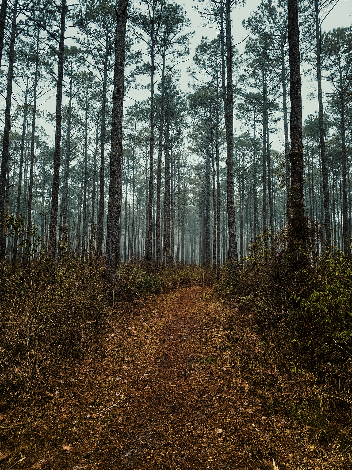
The thick fog and diffuse light imparted an eerie quality to the atmosphere, but at that point in the morning, we had the trail(s) to ourselves. The entirety of our route featured a few hundred feet of elevation change—at most—over its entire 21 mi 24+ mi length. After that first 3 mi, we reached the banks of the Neuse River.
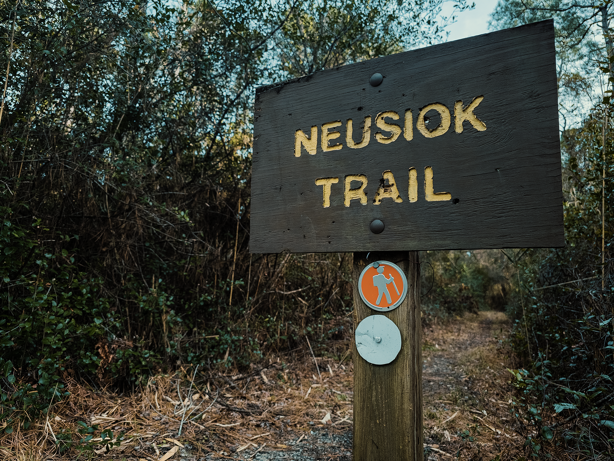
Neusiok Trail
Maybe you’re noticing some similarities between Neusiok and Neuse? This region gets its name from local indigenous people—either Algonquian or Iroquois. The word Neusiok was first recorded in 1584 by the Amadas-Barlowe expedition that preceded the Roanoke Colony. That’s where the Neuse River gets its name. The Neusiok people eventually disappeared (ca. early 1700s), possibly merging with the Tuscarora (perhaps members of the nation that once frequented the Cape Fear River near Raven Rock).
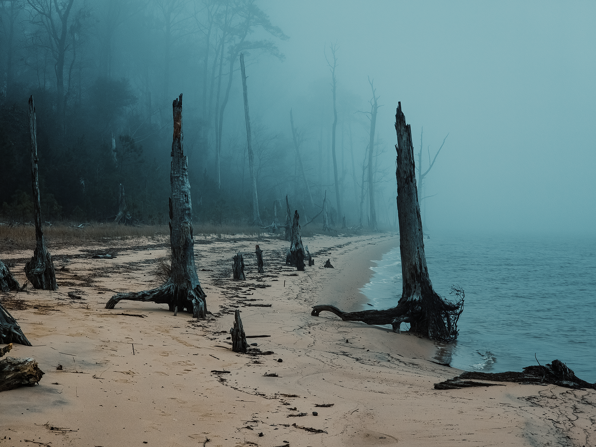
Coupled with the sight of ancient cypress trees draped with Spanish Moss, the still-lingering fog set the stage for what could have been an epic haunted pirate ship scene. We didn’t see any pirate ships, haunted or otherwise. Instead, we turned left and hiked past the edge of a steep (if not too tall) cliff along the Neusiok Trail.
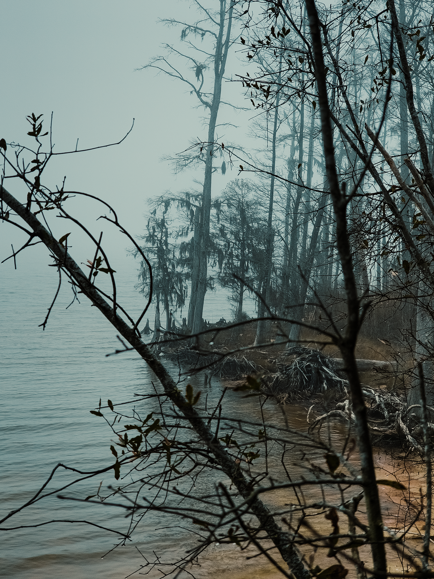
There are a few confusing intersections not quite 700 ft from here: we took the Neusiok for those 700 ft, then ended up back on the Wright Trail. We followed the Wright Trail for about 1/3 mi until we reached a campsite that catered to people on horseback. (I suppose anyone could have used it, but it had a hitching rail.) Here, the Neusiok Trail drops you right onto the bank of the Neuse River. I’m not used to rivers that empty almost straight into the ocean (there are a few creeks and sounds that technically separate the two), but it’s almost like being at the beach—if the beach were spooky and strewn with cypress trees and Spanish moss.
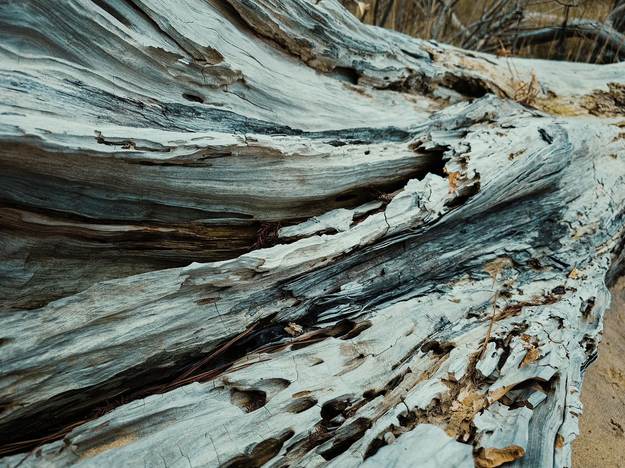
I wonder how long these cypress trees (in the photo below) will remain standing. They’re clearly dead, but they must have what’s left of their root systems holding them upright. Just how sturdy are those roots?!
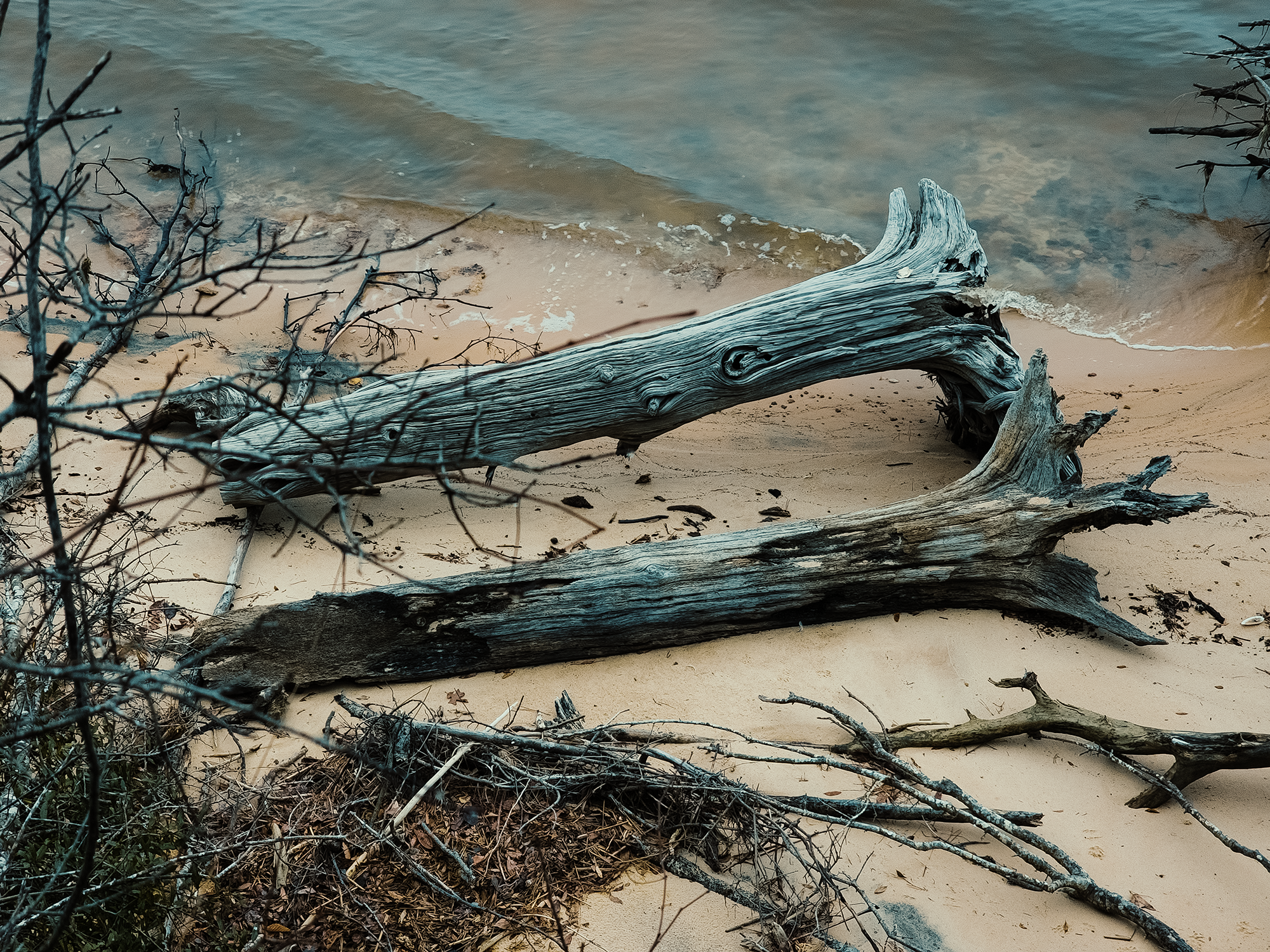
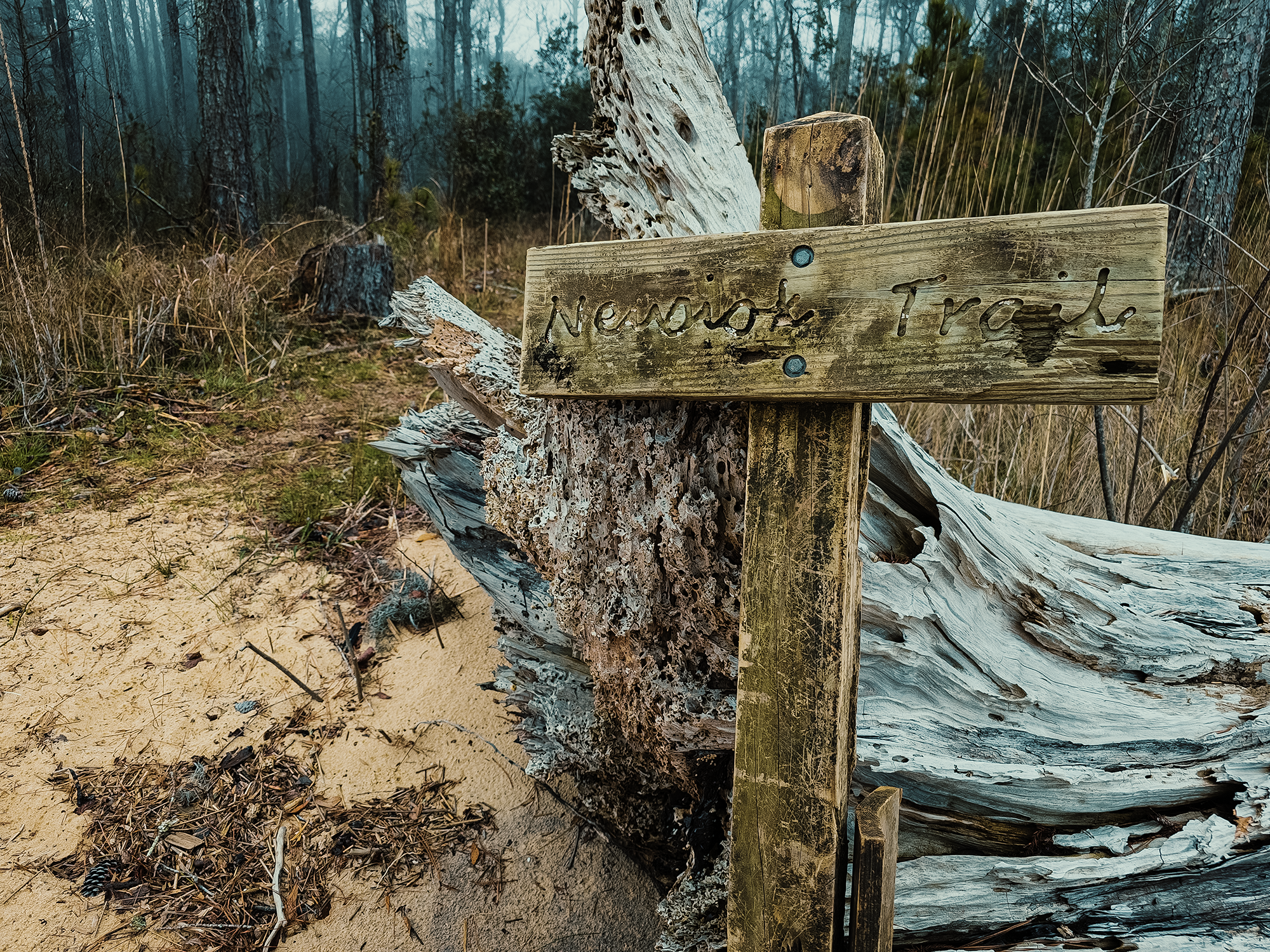
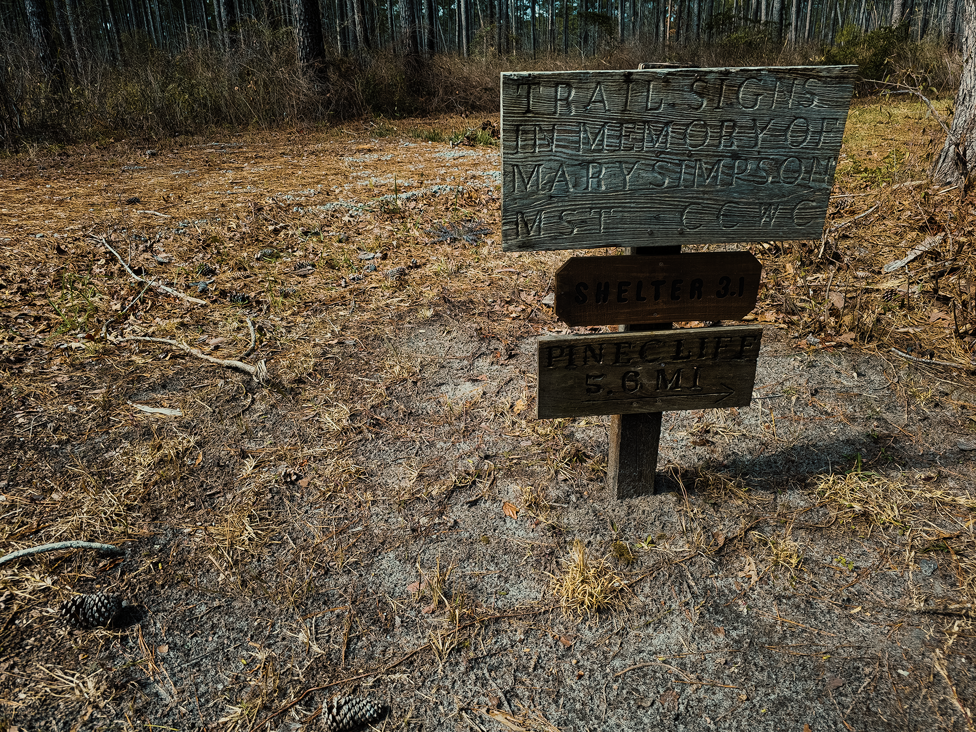
The Neusiok Trail veers sharply left here, “ascending” (barely) back into the woods. Given how sandy the river bank is—you can even see rows of debris formed from tidal activity—it’s probably a good thing there’s a sign right around here. At one point, someone probably drove its base into the ground; now, however, someone had just leaned it up against this super cool, super large chunk of driftwood.
The lettering on the sign is cursive—well, “cursive adjacent,” so I suspect it’s only a matter of time before successive generations see it and think it’s hieroglyphs. Ha ha ha. Oh yeah, I think it’s right around here that we crossed paths with a couple of hunters (maybe?), probably scouting the area.
We hiked back up the subtle ridge that ultimately separates the river from the woods. Croatan National Forest lies entirely within the middle Atlantic coastal ecoregion, which stretches from southern New Jersey in the north toward Georgia in the south, and largely consists of temperate conifers. And much like our hike along the Weetock Trail the year before, we didn’t come across any Venus flytraps, pitcher plants, or sundew on this trip either.
Nor alligators.
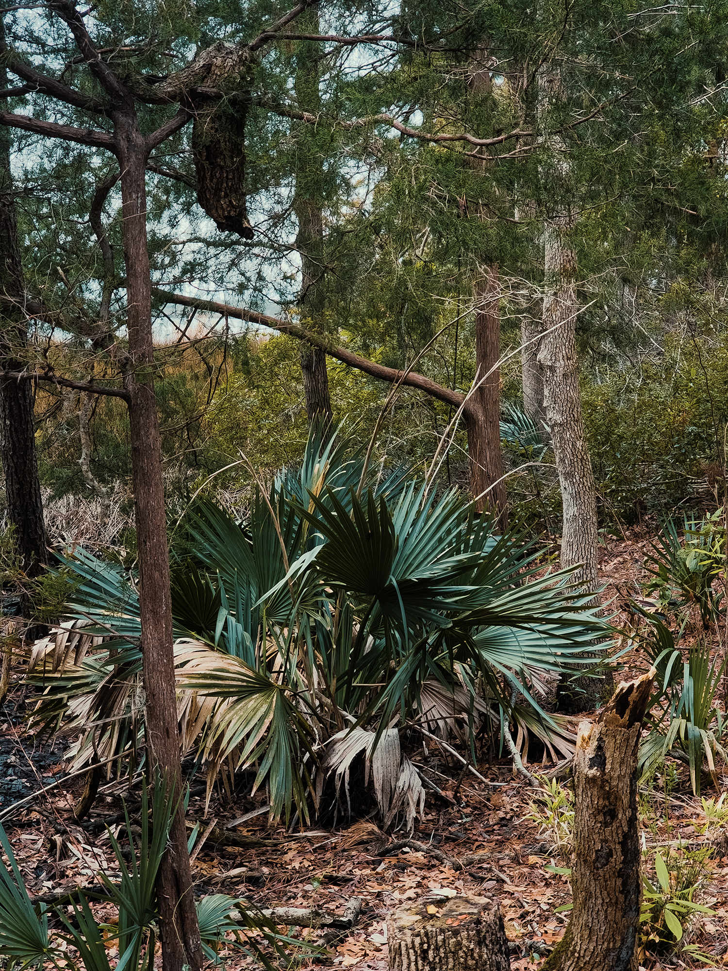
About 6/10 mi after leaving the riverbank, the trail parallels Hancock Creek for not quite 1/2 mi. Looking toward the right (hiking southbound), I could see it through the trees—including the occasional palm.
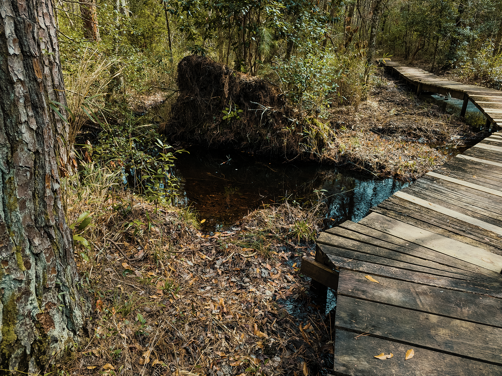
The Neusiok Trail veers toward the right here for a while, and when it veers left again, it parallels Cahoogue Creek (a tributary to Hancock Creek). It’s right around here that we started seeing boardwalks (although it’s possible there were others before—I just don’t remember). At first I thought it was odd that many of these boardwalks had hardware cloth stapled across their surfaces, but then I realized the uneven mesh offered additional traction, particularly helpful in wet weather. Neat.
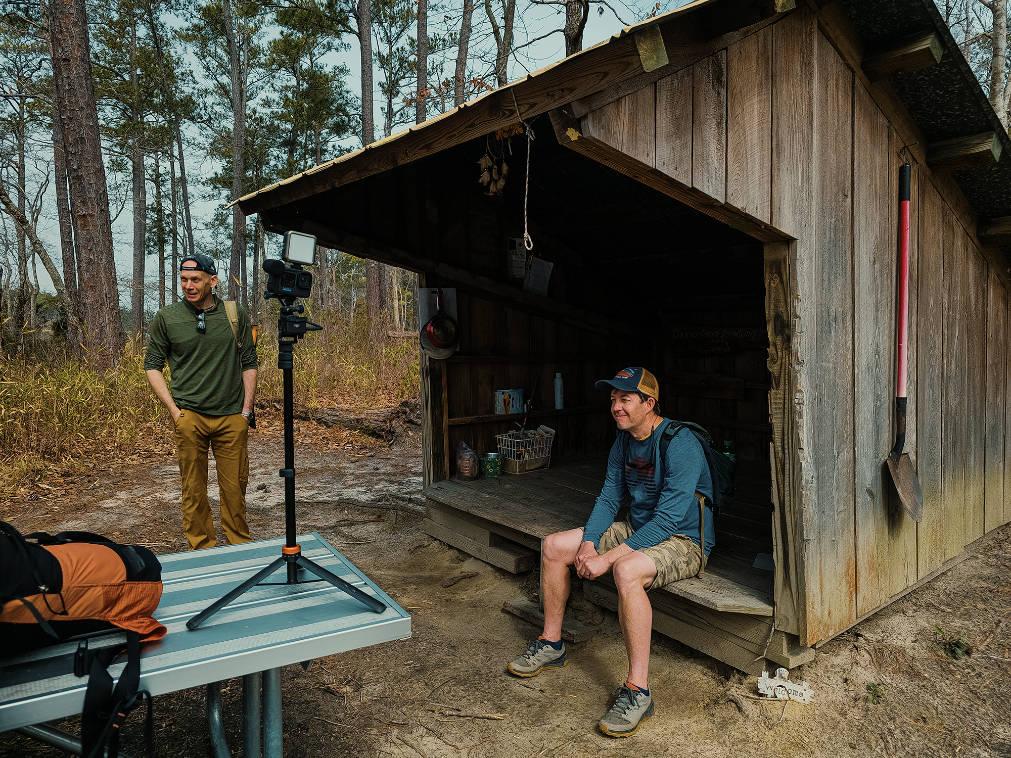
Right around the 7 mi point, we reached the Copperhead Landing Shelter, the first of three along the Neusiok Trail (and the only one that doesn’t require a significant side quest to reach!). It takes me some time to set up my camera, get a shot, then walk back and retrieve it, and I’d been doing that all morning, so many of the other guys had already been waiting here for a few minutes by the time I reached the shelter.
We—well, I—didn’t stick around too long, and in a couple of miles (right around 9.2 mi), we crossed NC 306 (Ferry Road) and stopped in that parking lot for lunch.
I brought a sub sandwich that I’d bought—and refrigerated!—the night before. When I unwrapped it, I discovered that it had become a mushy wad of disintegrating gluten-free bread and meat, cheese, and toppings. Consider this a public service announcement that probably no one but me needs (or needed) to hear: don’t get oil and vinegar on your sub if you’re going to go hiking with it a day later! I was hungry, and the nutritional content my sandwich was probably none the worse for wear, so I powered through and washed it down with water (with some kind of electrolyte powder added—I think it was lemon-lime flavored).
Up until this point, I’d been feeling all right, but here is where I think I started noticing the first hint of blisters. I took my boots off during lunch, hoping the combination of fresh air and freedom would mitigate the hotspots.
It didn’t.
Reluctantly, I put my boots back on and continued southbound with the rest of the guys.
I don’t want to badmouth my boots here: I think it’s probably because of my oversight, but I was wearing my trusty Salomon X Ultra 4 GTX boots. Even though they’re Gore-Tex, I wore them through the Grand Canyon without any problems! I’ve worn them through a bunch more miles since then…and here’s where I started putting things together.
South of NC 306
Nine plus miles was still a little early for my feet to get blisters, but all my hikes in these boots prior to today’s Neusiok Trail excursion had been limited to no more than 12 mi per day. Even on multiday trips, the overnight rests seemed to be enough to satiate any growing blisters’ anger. I thought back over the course of my miles in these shoes and remembered the last couple of days in the Smokies during our Tricorner Loop hike. I don’t think I said anything in that video, but on Day 4, my feet were not doing too well.
It’s also right around this point we realized we weren’t hiking 21 mi—we were hiking 24 mi! Normally, by the time you’re into the 20s, a few more miles doesn’t seem too bad. But today, especially given my feet, another three miles sounded terrible.
In roughly 2.5 mi after crossing NC 306, we crossed NC 101, and I think it’s somewhere around here that I admitted what I hadn’t wanted to for the last couple of miles: I didn’t think my feet would make it the remaining distance. We’d hike just over 12 mi here, and with twice that distance to go, I wasn’t looking forward to what might happen to my feet between now and then.
At least after we crossed NC 101 we were back in the pines. The fresh fragrance of pine sap reminded me—as it always does—of Christmas trees. And Maine. Technically, I’m pining—wow, that pun was not intended!—for the smell of balsam fir needles, but pine will do in a pinch.
The morning’s fog was long gone by now. I think it burned off a little before lunchtime. Maybe even before that. Anyway, the temperature was in the 70s (°F) now: pleasant hiking weather. We hiked past the spur that would have led us to the Dogwood Shelter, the second of three, but none of us—least of all me!—wanted to tack on extra miles just for fun! After that—I don’t remember how many miles more—we also passed the sign for the Blackjack Shelter.
Right around 15 mi, the Neusiok Trail turns left and follows Billfinger Road (FR 142) for a while. I launched my drone here for some aerial footage: while I was goofing around in the air, Blair R. took a brief nap. Smart! Soon enough, we needed to get moving again.
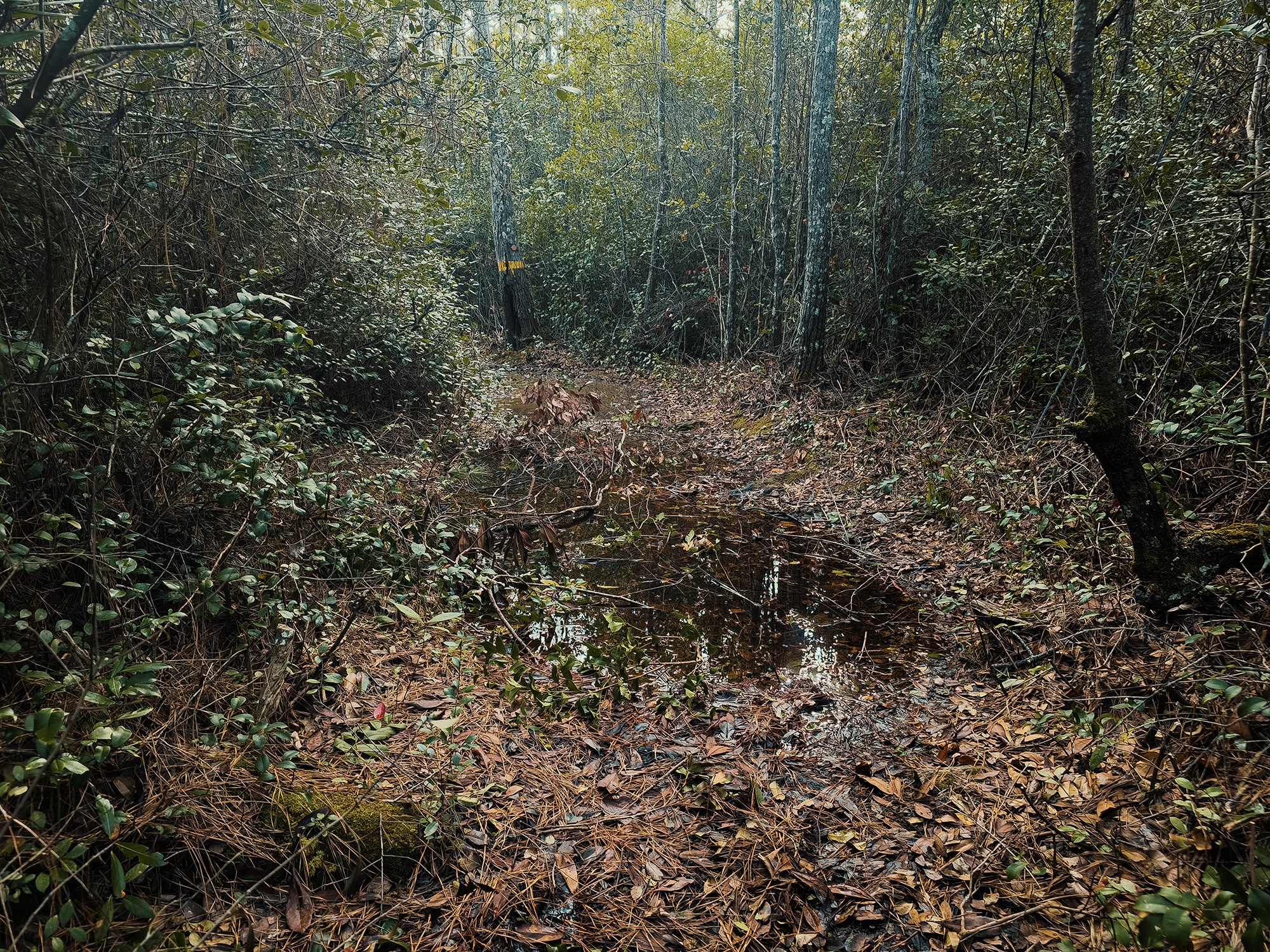
Billfinger Road ends in a T-intersection with Little Deep Creek Road (FR 147). We needed to turn right here and take Little Deep Creek Road for 2 mi until our route cut left back into the woods. I’m pretty sure this portion of the Neusiok Trail would have benefited greatly from some boardwalks: more than a few places were submerged and bordered by thick scrub.
Alligator Tram Road (FR 124)
I managed another 2.5 mi until we reached Alligator Tram Road (FR 124). Part of me wanted to push on and conquer the remaining 4+ mi, but the saner part of me prevailed, and I told the other guys I’d wait here for them to come pick me up once they’d finished. Blair R., who’d been kind enough to hang back with me for the last few miles, agreed to wait with me. He said it was for “selfish reasons,” but I choose to believe he was being kind!
I hiked a total of 20.6 mi. That’s the most I’ve ever hiked in a single day, and it’ll be a while before I attempt something like that again. The other guys hiked just over 24 mi total. I’m pretty sure none of them want to repeat this, uh, “adventure” again anytime soon, either.
I can’t remember how long it took the four who’d gone ahead to return to us. I don’t remember the hour, but I do remember longer shadows by the time Brian D.’s 4Runner bounded over the road. We drove back to the Pinecliff Horse Trailhead parking area to pick up our other vehicle.
Later, after I had a chance to examine my toes, at least eight of them had blisters (some more than one), and I could already feel it in my nail beds that I was going to lose my pinky toenails.
And I did, a week or so later.
I took pictures, but don’t worry! I’m not going to show anyone those crime-scene-looking photos! Well, no one who wasn’t on that hike! Anyway, both pinky toenails are fine now. Hopefully this is the last hike where that’ll happen, although it’s probably extremely improbable to hope for no more blisters ever?!
Croatan National Forest is a pretty cool place. I said as much in my Weetock Trail write-up, and that still holds true, even after “losing” against the Neusiok Trail for the second time in as many years! The others suggested I come back some time and finish out the last 4 mi. I think I should, but I’d feel like I was cheating if I just did 4 mi instead of all 24+ mi in a single hike…
Catch the whole adventure on YouTube! Please consider subscribing (if you haven’t already). Thanks for stopping by!
Pingback Hiking (part of) the Weetock Trail in Croatan National Forest (NC)
Pingback Hiking through (parts of) Uwharrie National Forest (NC)