When I was in high school. a friend invited me to hike Barren Mountain with him and one of his other friends. Back then, the fire lookout was still intact—I remember napping in the cab. It’s gone now—it had been before the last time I climbed Barren, which was…I don’t remember. I had a flip phone at the time…Anyway, the three of us took some pretend route until we reached the Appalachian Trail (AT), half bushwhacking, half getting scraped by thick bushes. I didn’t want to mess with all of that today, so for this hike, I took the “real” trail.
[Note: there’s a different Barren Mountain (with no trail to the summit) in Baxter State Park, about 39.5 mi north-northeast.]
At the parking area, I saw a couple of guys hauling gear out of the back of a trailer and setting up picnic tables, grills, and camp chairs. One guy noticed my NC license tag and asked me about it: turns out he’d spent some time in the Tar Heel State himself. We talked for a bit, and I learned they knew some through-hikers who planned to meet up with them for barbecue later that afternoon.
Almost immediately after getting started, I wondered if I should have tried to find that trail my friends made back in high school. The first 1/2 mi or so of this access trail is pretty much pure mud. Deep, thick, sticky mud that’s hungry for hiking boots. I tried some of the detours where people have attempted to bypass all this mud, but even the detours are horrible now. As carefully as possible, I picked my way through the muck l until I ascended above the worst of it. About 7/10 mi in, I reached the junction with the AT.
My original plan for this trip: park the truck, hike past Barren Mountain’s summit, and spend the night at the Cloud Pond lean-to about 1 mi farther down the AT; then, in the morning, retrace my steps and maybe take a side trip to Slugundy Falls. But there’s a big, impossible-to-miss sign at the parking area that explicitly states NO OVERNIGHT PARKING. It’s possible no one would have done anything if I’d ignored it, but at the end of the day, I didn’t want to be “that guy” and ruin it for everyone else: the access trail from Bodfish Valley to the AT is on private land: one too many bad apples, and the landowner might opt not to let anyone use it.
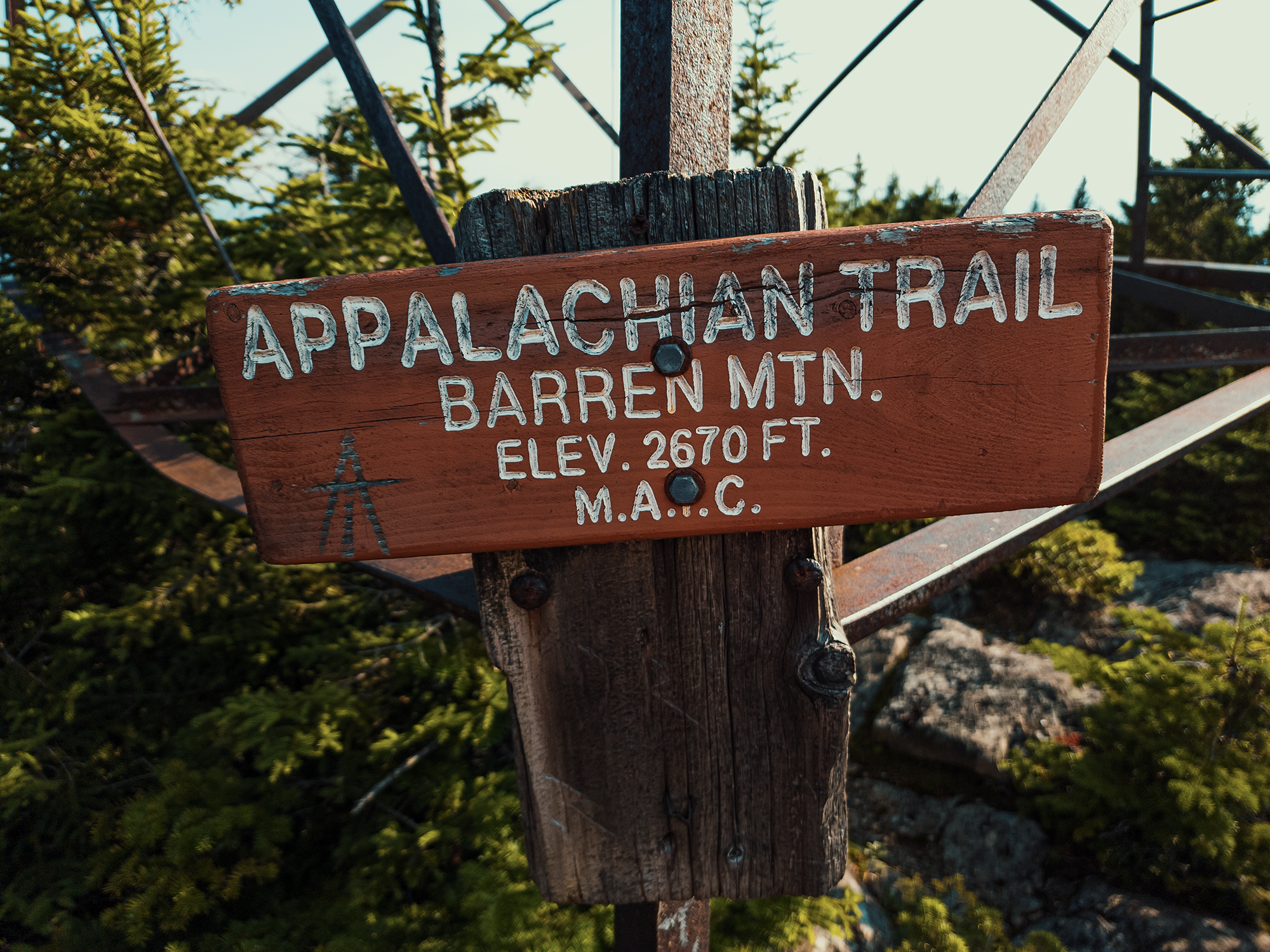
Appalachian Trail
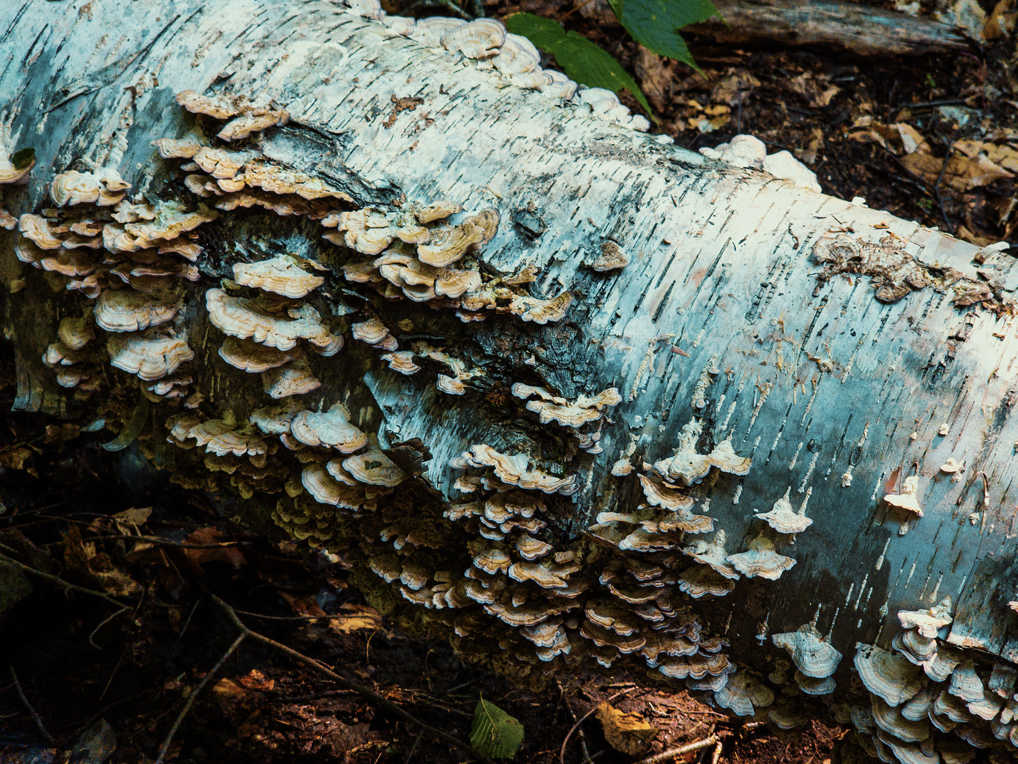
This part of the AT runs through Maine’s 100 Mile Wilderness—some consider it the wildest section of the entire trail. It starts just under 10 mi west of where I was standing now, off of Greenville Road (ME 15/ME 6) in Monson. Here, there’s a cairn that marks the junction. Soon after turning right onto the AT, I discovered this downed birch tree covered with mushrooms. Pretty cool. I hopped over it (it had fallen across the trail) and kept hiking.
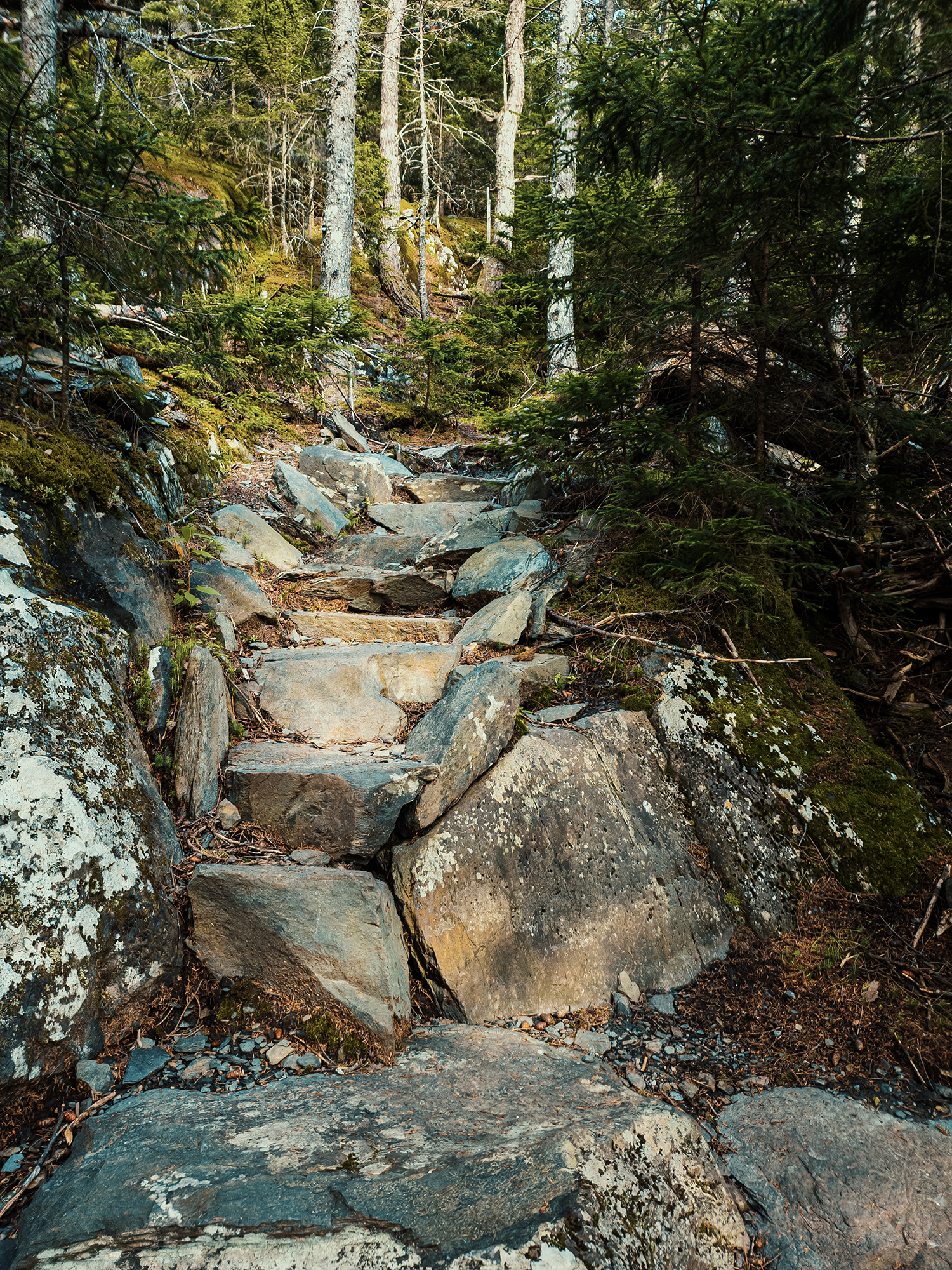
In some steep places, rocks and roots did act like “natural stairs,” negating the need for the human-crafted variety. Here, most of the trail runs through pine and fir trees. Late afternoon sun filtered through their boughs and needles. We’re not that far “off the ground,” but even here, it’s starting to feel “mountain-y,” and not just because of the trees and rocks. There’s some other, indescribable quality here that just feels like mountains.
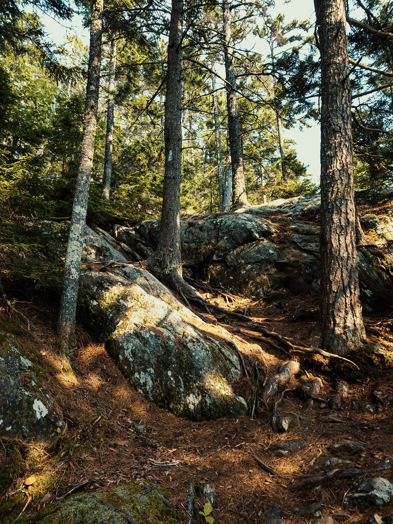
Barren Mountain isn’t particularly high—a little more than 2,430 ft—but after about 1/2 mi on the AT, the grade increases, reaching 35% in places. Fortunately, the Maine Appalachian Trail Club (MATC) built stone steps into portions of the trail (at least, I think they built them!). Harder on the quads, but safer during wet weather. Plus, stone steps that look like they’ve been there forever just look cool.
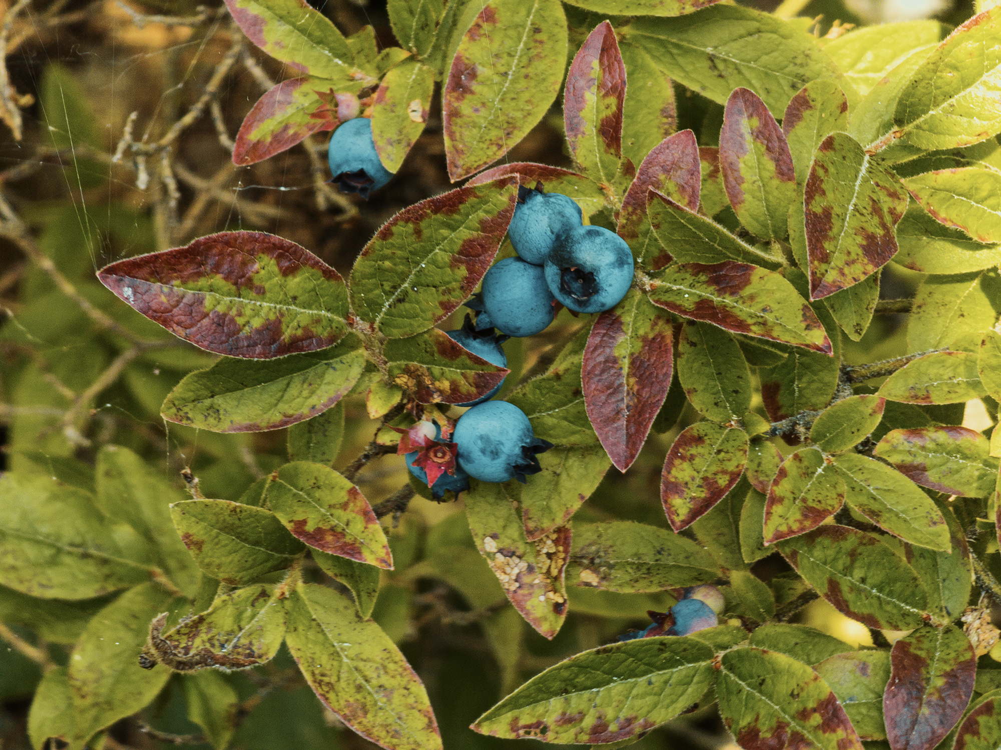
Maybe it’s because I got a late start and felt compelled to hurry, or maybe I was still feeling the impact from Mount Coe and the South and North Brothers earlier in the week (or maybe the week before?), but I needed a rest. I found a nice, comfortable rock and sat down to catch my breath. Not too far from there, however, I discovered a patch of wild blueberries. Sometimes I’ll find them across the valley, near Borestone’s summit, too (assuming bears and birds haven’t devoured them all!). Wherever they grow, these things are delicious. I picked a small handful and ate them in a single bite.
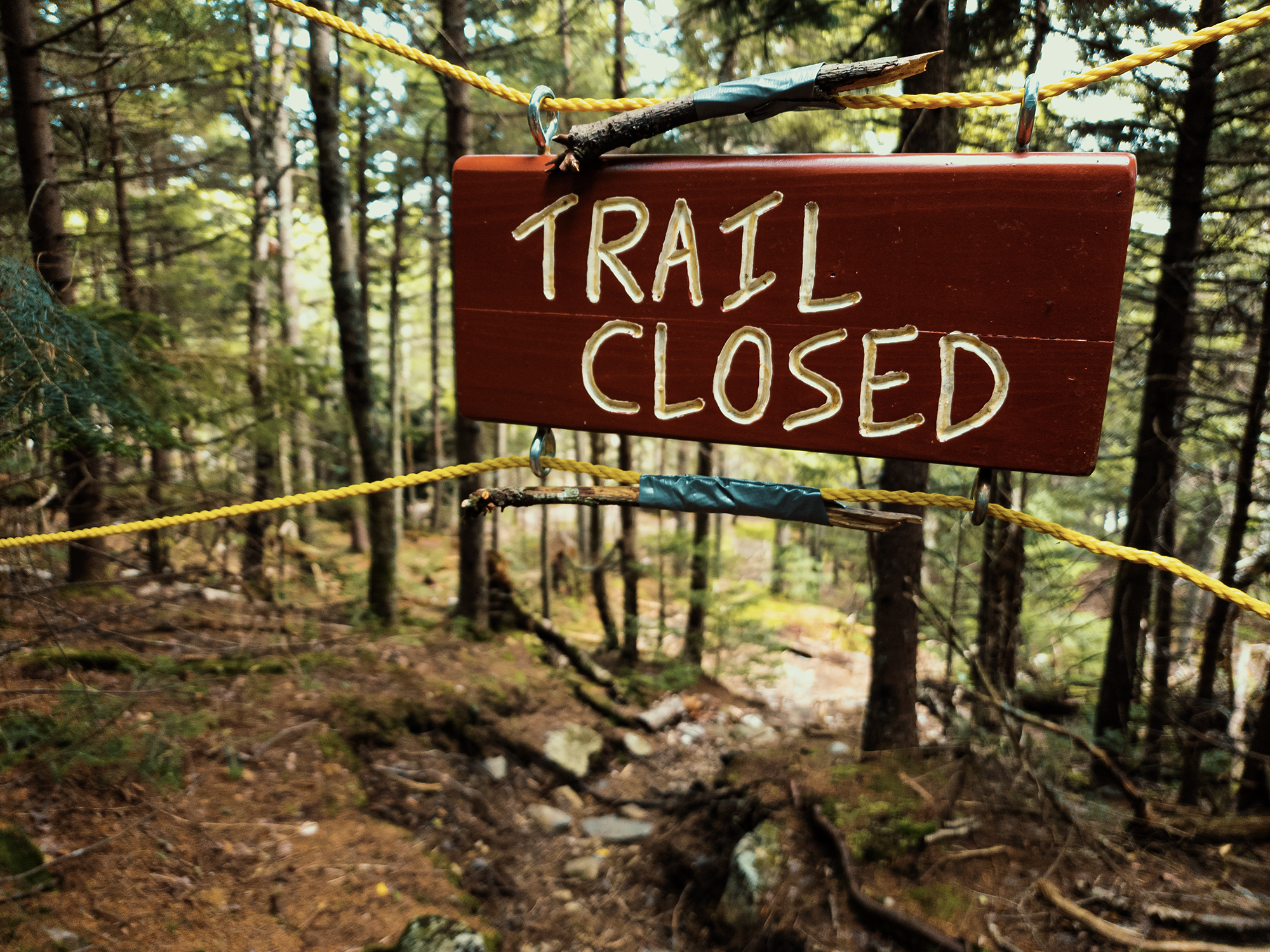
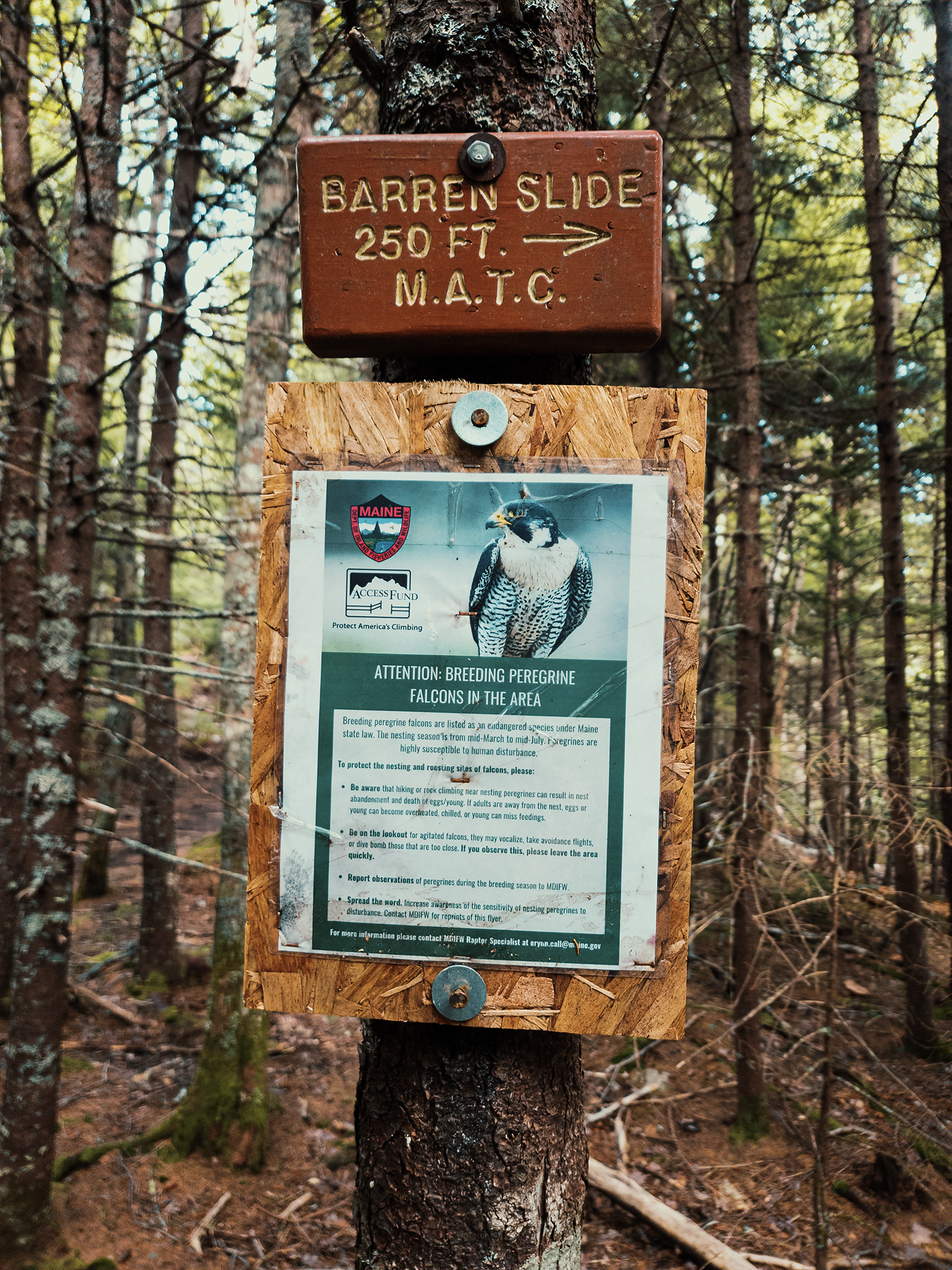
After that little blueberry snack, I hiked onward until I reached the spur to the Barren Slide. It’s probably my favorite feature on Barren Mountain: a massive pile of enormous rocks, some forming “caves” that I’ve always enjoyed exploring. Today I had to skip it.
Barren Slide
While hiking Borestone Mountain, I mentioned peregrine falcon rehabilitation efforts the Maine Audubon Society hosted there during the 1980s; now, it seems that some of the peregrines have made a home close to the Barren Slide. These falcons intrigue me, so I didn’t want to risk spoiling their potential nesting grounds—or worse, frighten them into abandoning any chicks. I don’t know how long the MATC will keep the Slide closed—I don’t even know if it’s the MATC or someone else who determines when to shut down a site over peregrine concerns—but hopefully someone will reopen the Slide before the next time I hike Barren!
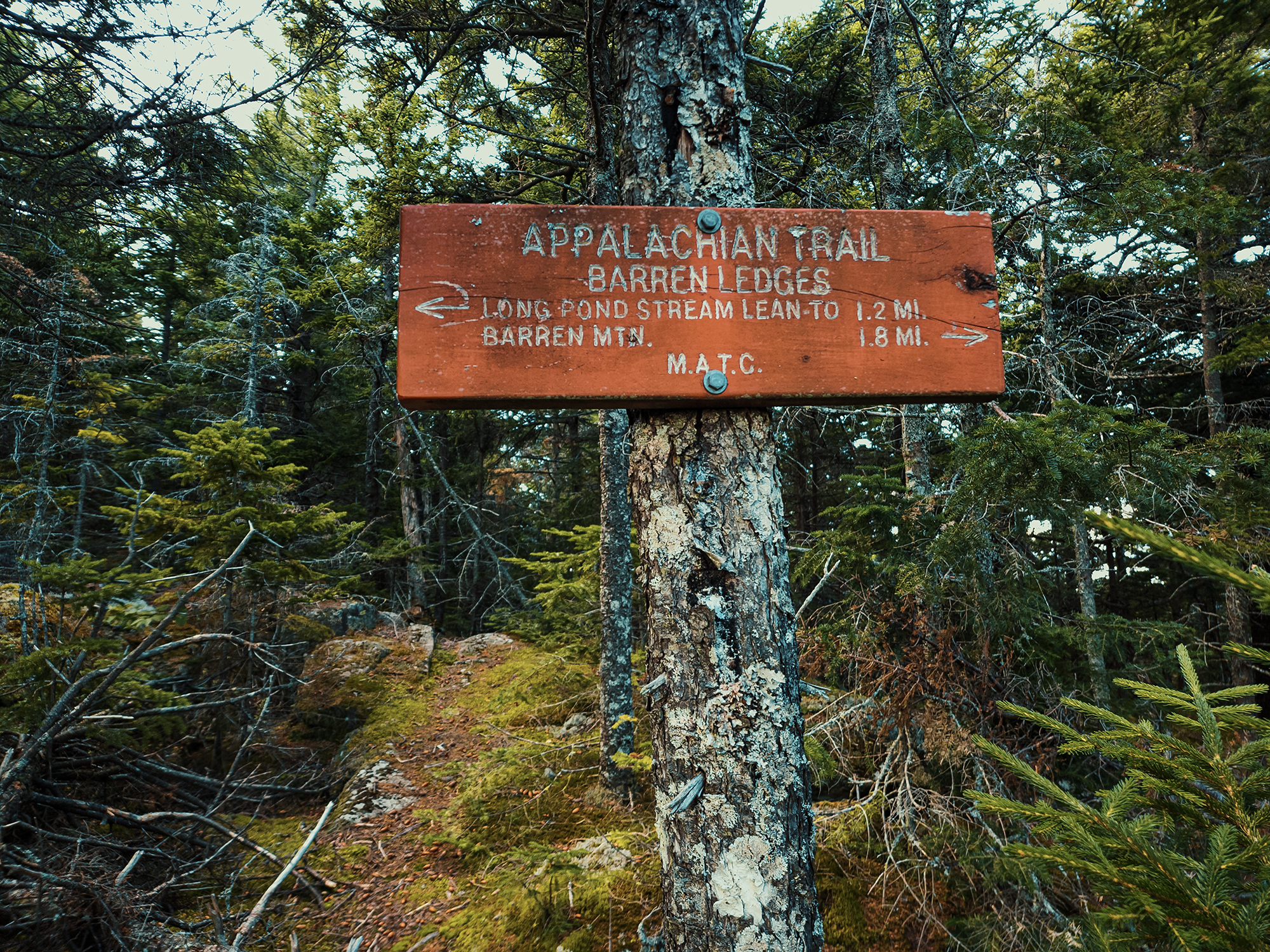
Barren Ledges
By the time I reached the spur toward the Barren Slide, the terrain leveled out a little. It’s still all uphill, but the grade decreases. Not quite 700 ft up the trail from the Slide I reached the Barren Ledges. Stepping off the AT for a minute, I looked out over Bodfish Valley, across Lake Onawa, and toward Borestone Mountain’s forested northern slope. I think it’s right around here that I caught the scent of smoke. North of me, wildfires were ravaging parts of Canada: that’s most likely what I smelled (and why the atmosphere was so hazy).
After enjoying the view for a few minutes, I returned to the AT and continued NOBO toward Barren’s summit. A little more than 1 mi after the Ledges, the trail hits a 25% or greater grade. I’ll be candid: I originally intended this to be an overnight, so I brought my full, 40+ lbs. pack. I was tired (the blueberry magic must’ve burned itself out) and a little annoyed with myself for not anticipating not being allowed to park overnight. I thought about turning around. I’m glad I didn’t though: not long after that, I ran into a SOBO hiker. I asked him about the summit (I guess I forgot about—or stopped trusting—my GPS), and he told me it wasn’t that far, maybe a few tenths of a mile.
Close enough.
Knowing I was going to turn around and head back this way in just a little while, I probably could have ditched my pack behind a rock or a tree around here, but I didn’t. Instead, still fully loaded, I climbed the next 3/10 mi over steep rocks and thick fir and spruce trees and finally reached the summit.
Barren Mountain summit
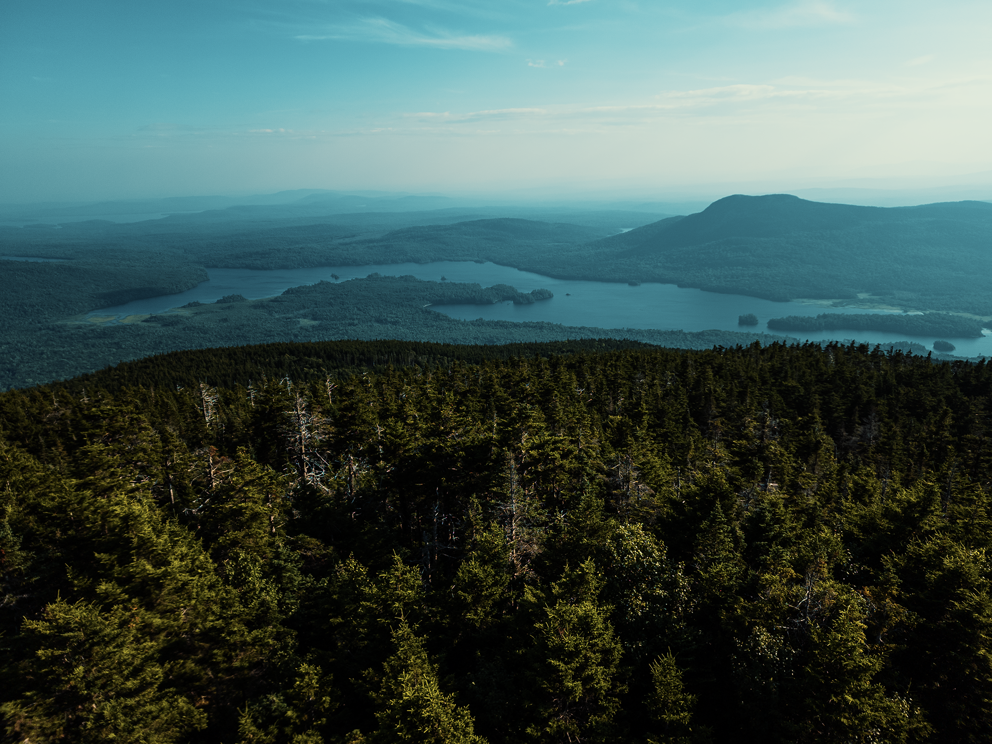
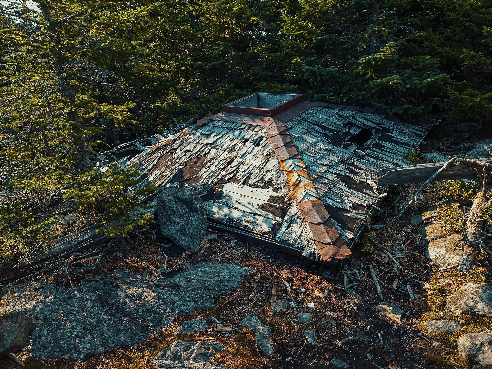
Without the fire lookout tower, Barren’s summit is treed in, offering no views. With the lookout tower—even without its cab—you get an additional 40 ft, elevating you above all the trees and providing 360° views of the surrounding environment. In 1955, someone (I don’t know who) moved the Pleasant Pond fire lookout to Barren Mountain. In the early to mid-1990s, the 8 ft x 8 ft cab was still in place. By the early 2000s (I think), it had collapsed. What’s left of it is still up there on the ground—for now (mostly its roof).
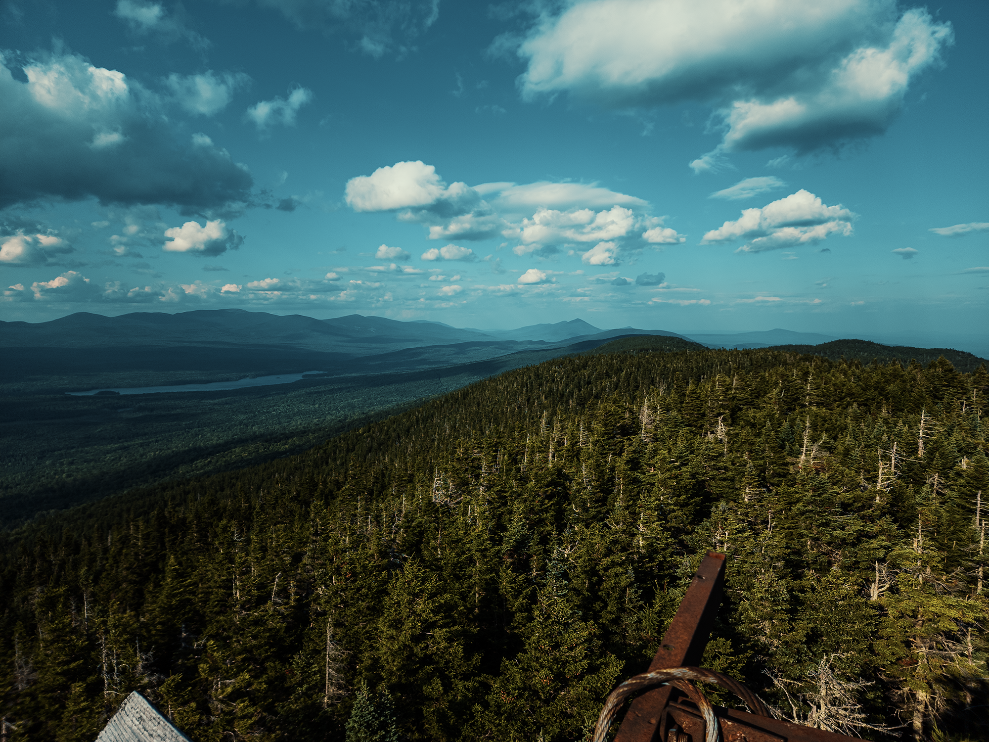
I climbed the steel structure (the ladder’s still there) and leaned into a rusty bar for balance. Up above the trees, the wind picked up (I wore my hat backward to prevent it from blowing away). Looking north, you see Long Pond, and beyond that, a bunch of mountains. Out of all of them, I know I’ve climbed White Cap before. Not sure about the others. Regardless, from the “tower,” I spent a few minutes appreciating everything around me. I’m glad I crossed paths with that SOBO hiker—without his assurance that the summit was close, I might have bailed.
The shadows lengthened by the minute. Plenty of daylight to reach Cloud Pond (about 1 mi away), but a questionable amount to hike the 5.5 mi back to the parking area. At least it’s all downhill from here! Down from the tower, I slung my pack across my shoulders and headed south. Sometimes I’m surprised at how much faster it (usually) is hiking down the side of a mountain versus hiking up! I don’t remember how long it took, but those guys I met at the beginning had kept busy: six or seven through-hikers crowded around the picnic table, feasting on pulled pork, Brunswick stew, and other stuff. One of the cooks must have seen a look in my eyes, because he asked if I wanted a barbecue sandwich or something. Grateful, I accepted (and devoured) a polystyrene bowlful of smoked meat before I hopped back in the truck.
I want to hike the entire 100. Eventually. I’ve hiked parts of it in pieces here and there, but maybe at some point, I’ll find a way to string together enough days to do it right. Until then, I’ll rely on hikes like Barren Mountain to tide me over.
Catch the whole adventure on YouTube! Please consider subscribing (if you haven’t already). Thanks for stopping by!
Pingback Hiking Borestone Mountain (ME)
Pingback Hiking the Eagle Rock Trail (ME)
Pingback Spending the night on a little island in Lake Onawa (ME)
Pingback Hiking Borestone Mountain—but in the winter this time! (ME)
Pingback Spending the night next to Little Wilson Stream in Maine’s 100 Mile Wilderness (ME)
Pingback Hiking Maine’s coastal high point (Mount Megunticook via Ocean Lookout) (ME)