We were supposed to hike the Neusiok Trail today. We set up a shuttle near Oyster Point Campground, then parked at the Pine Cliff Equestrian Trailhead. The rain was still pounding down, and within a few feet of trail, I stepped in puddles three to four inches deep. Some of us didn’t have weather-appropriate footwear or clothing, so after a brief conference, we collectively bailed on the Neusiok Trail. Later that afternoon, the weather lifted, so we opted to hike the Weetock Trail.
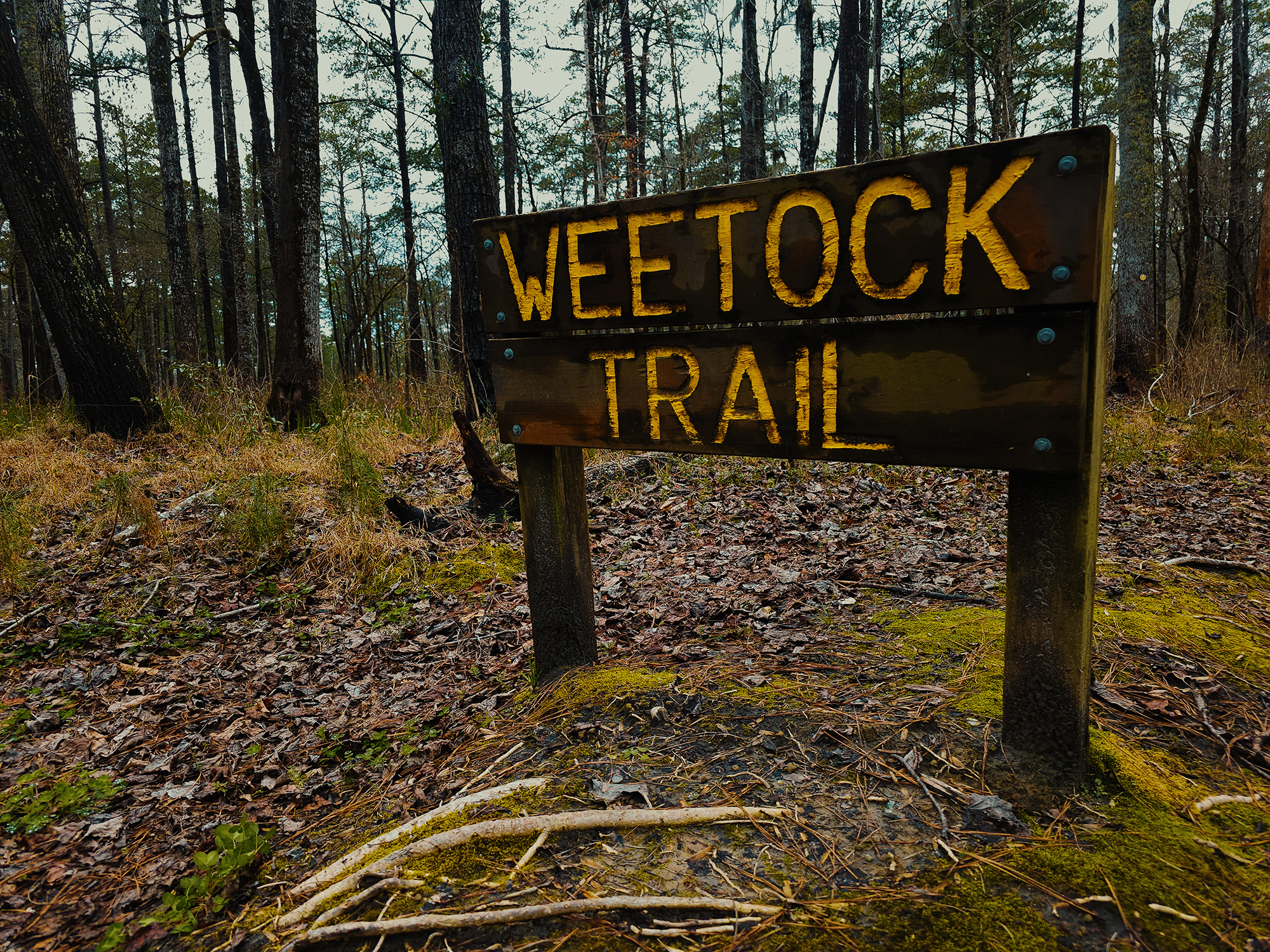
Weetock Trail
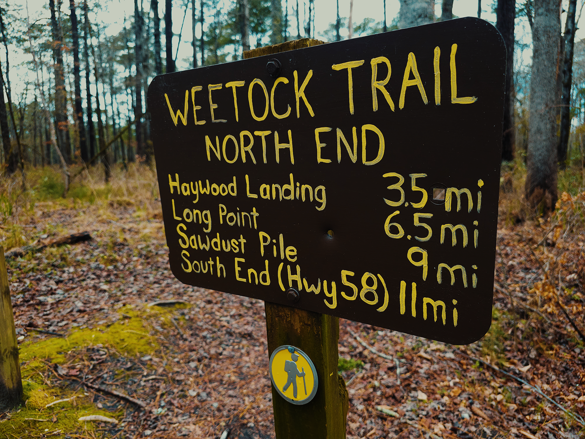
The way we decided to tackle this trail didn’t require a shuttle: we parked at the north end trailhead off of NC 58 in Jones County and planned to finish there after 7+ mi. The full Weetock Trail spans just about 11 mi (and requires a shuttle—or a 1.5 mi walk back to your vehicle); given the time of day, we opted for an abbreviated version. The threat of rain still lingered in the sky, but glimpses of the sun poked through the clouds here and there. I wore my rain jacket just in case.
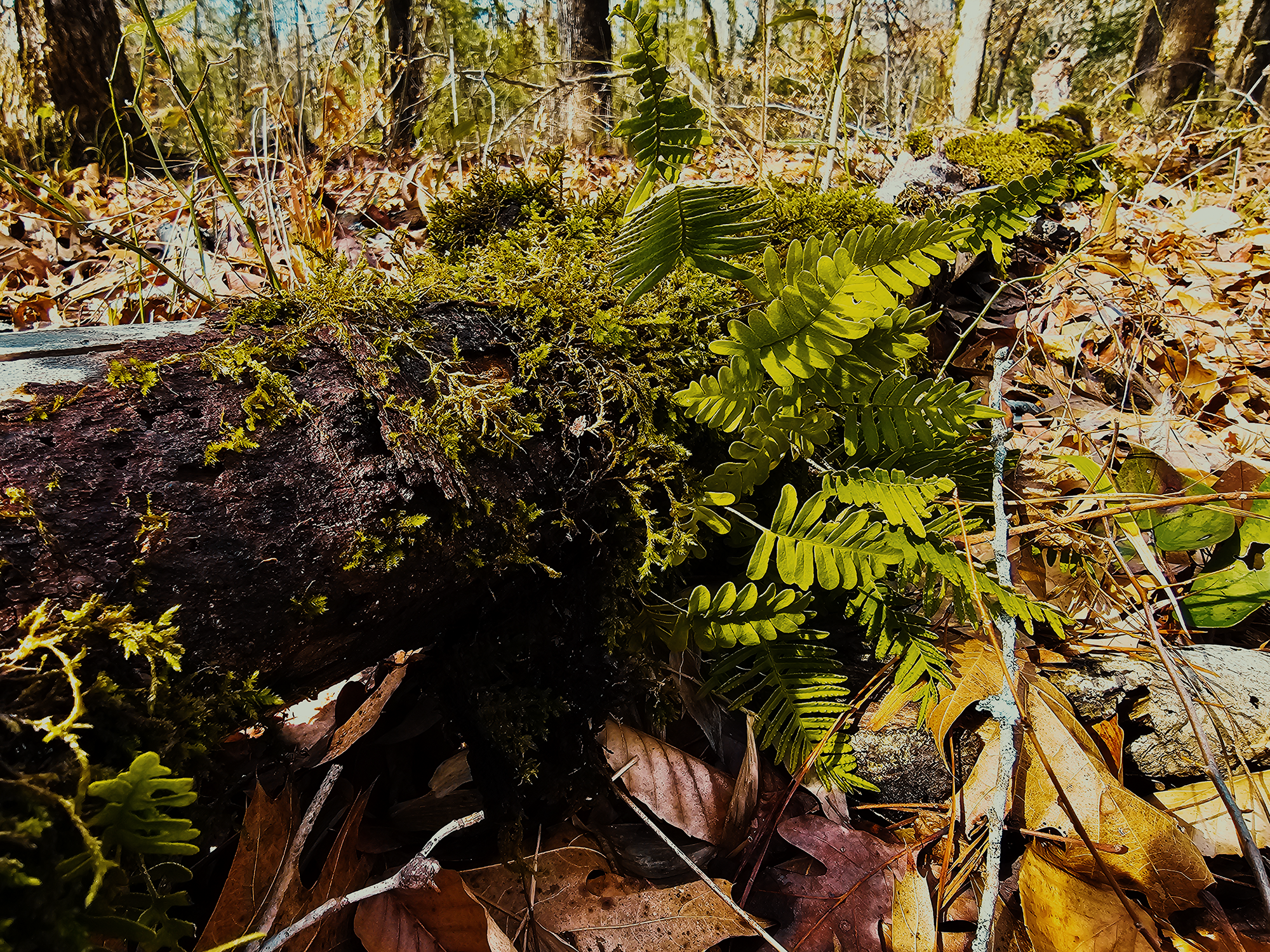
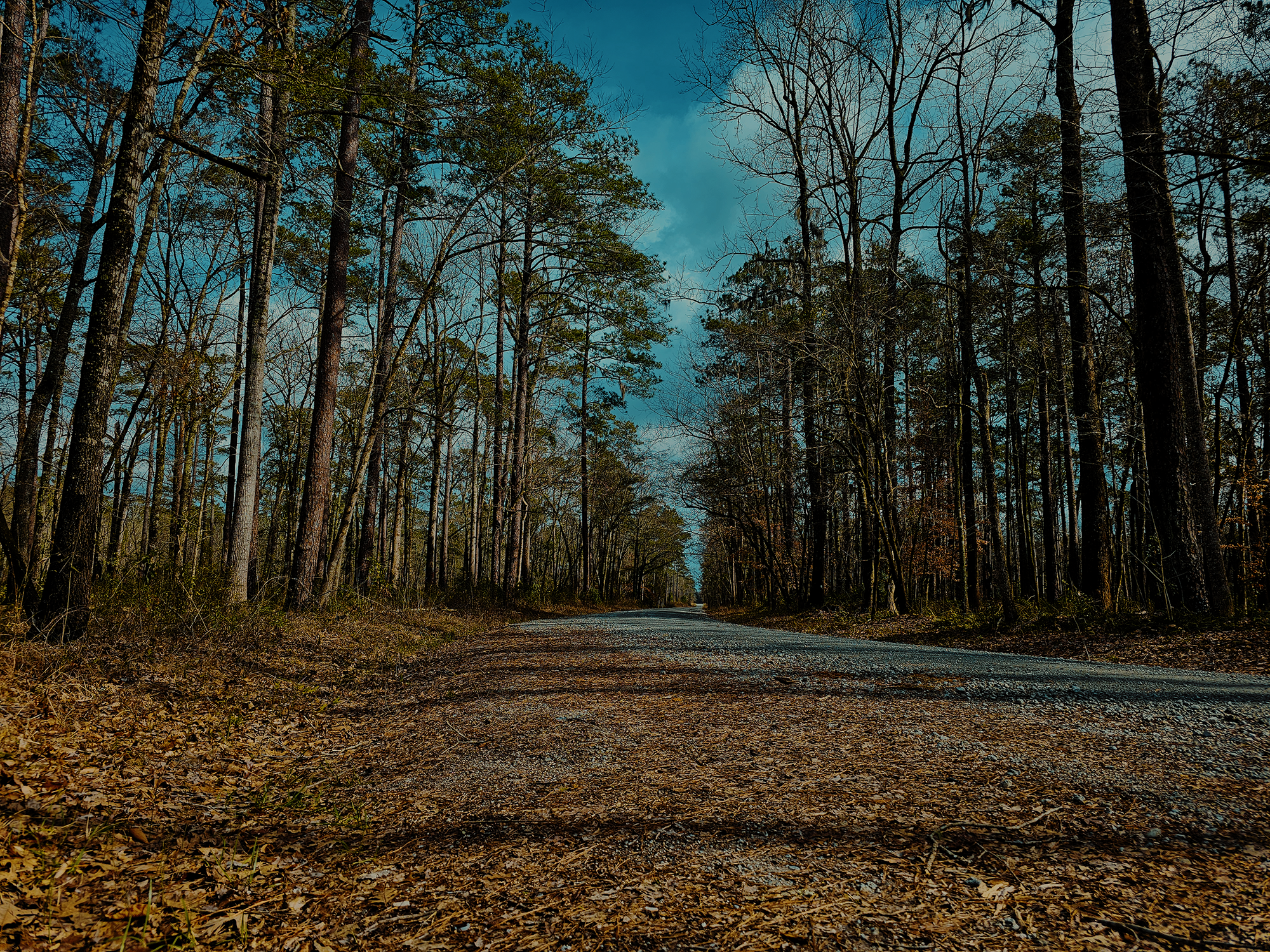
The Weetock Trail sits squarely within the Croatan National Forest—one of four national forests in North Carolina. Encompassing right around 160,000 acres, Croatan National Forest is the only true coastal forest in the eastern United States. Compared to most forests with which I’m familiar, there’s something intriguing about how far apart most trees are from one another. That might be the result of reforestation efforts after 1936, when the federal government established it as a national forest.
Right off of NC 58, the Weetock Trail crosses an unnamed tributary to Holston Creek, then runs adjacent to it for about 1/2 mi before taking a more westerly tack. At about 1.5 mi, it turns right onto Loopy Road (FR 157); roughly 160 ft later, the Weetock Trail takes another sharp right and returns to the woods. Now’s as good a time as any to state that there’s virtually no elevation change along this trail: maybe 30 ft in total? Thinking back to, say, that 4-day hike on the Tricorner Loop in the Smokies, I didn’t mind the flatness!
Odds that the rain would start back up seemed to lessen by the minute, so I packed away my rain jacket and continued hiking. Walking. This trail reminds me of a longer, wetter version of the Peninsula Trail at Harris Lake County Park—with a chance of alligators. (We didn’t see any alligators. Sad.)
Pocosins—“raised swamps”—run through parts of Croatan National Forest. I don’t think the Weetock Trail traverses any such regions, but the ground did get swampy in places: maybe from the recent rain, maybe from coastal topography. Such places might be home to carnivorous flora like pitcher plants, sundew, and Venus flytraps. We didn’t see any of that, either.
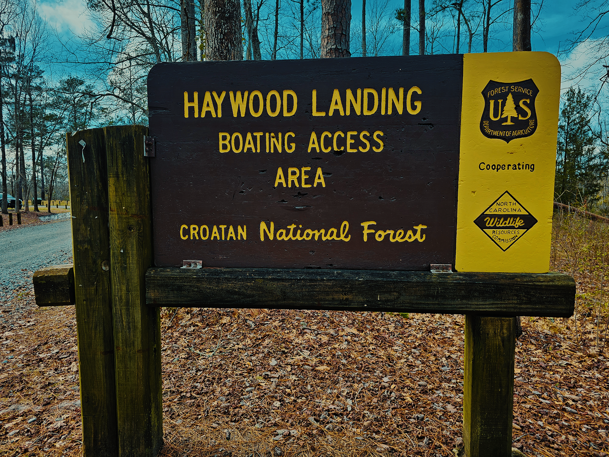
Haywood Landing
About 3.6 mi in, the trail converges with Haywood Landing Road (FR 146). There’s a boat launch here, and several signs of dispersed campsites in the nearby trees. That’s another cool thing about national forests: you’re typically allowed to camp wherever, although it’s best practice to reuse established sites (even if they’re otherwise unmarked or informal) rather than create new ones. We did see a few campers setting up along the way.
After Haywood Landing, I think the terrain dopped maybe half a topo line (I guess it depends on your map’s resolution) as we returned to the woods. The trail crossed another unnamed stream or creek not quite 5 mi in. I can’t remember if this one had a boardwalk. Maybe just a log?
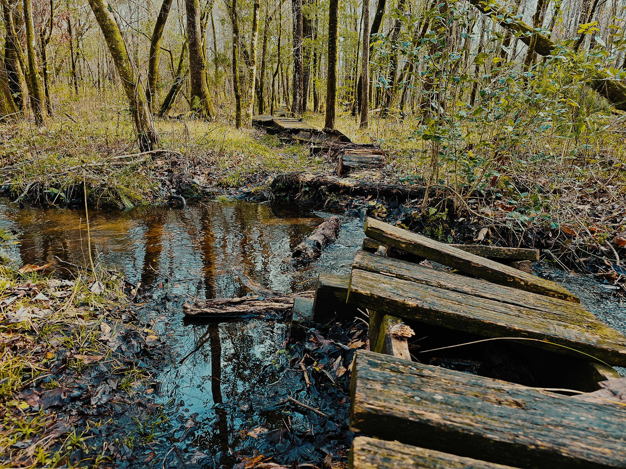
Looking back, there were at least a few unnamed waterways that intersected the trail. Most had a log or something to help you cross, but some were just…run and jump and hope for the best. And even in places where there were no streams or creeks, puddles from the morning’s rain persisted: I remember one spot that was around 3 inches deep. (I stepped in it—on purpose!) I’m pretty sure all of us avoided such obstacles without too much trouble.
Long Point Road
Not quite 6.5 mi in, we took a hard left onto Long Point Road (FR 120): the Weetock Trail continues straight and runs for another 4.7 mi or so toward the south end.
I managed a couple of drone shots from here, and it’s interesting to see the “fields” scattered within the perimeter of the Weetock Trail. Portions looked like someone had recently bushhogged them: I think I even remember seeing a tractor attachment stashed in the woods near one such clearing.
We stayed on the Long Point Road for another 1.2 mi until we reached NC 58 and the van. The fire road isn’t quite as picturesque as the forest proper, but in the early spring (we did this hike in March), before most shrubs, understory, and hardwoods put out leaves (and attract biting insects!), it’s a pleasant walk.
I suspect the rest of the Weetock Trail is much like the first 6.5 mi. I don’t know if I’ll make it a priority to finish it any time soon, but I do think it would be a great excuse to spend the night in the woods near the coast.
And hey, who knows? Maybe the south end is where they keep the Venus flytraps and alligators?!
Catch the whole adventure on YouTube! Please consider subscribing (if you haven’t already). Thanks for stopping by!
Pingback Hiking through (parts of) Uwharrie National Forest (NC)
Pingback Hiking (most of) the Neusiok Trail (NC)