I tested a different camera set up for Stone Mountain. Two cameras are better than one, right? Wrong! At least for the way I’ve settled into doing things. I learned from this experience, but the video suffers for it. That said, I’m still including it, because Stone Mountain State Park is an amazing place, and it’d be a shame if my cinematic ineptitude dissuaded anyone from visiting!
Stone Mountain Loop Trail
Four of us spent the night at Stone Mountain Campground the night before this day hike. We set up Matt M.’s Tent Mahal, which is what he (justly) calls this nylon monstrosity that could probably sleep seventeen people. At least three. (The fourth guy slept in his vehicle.) Let’s ignore the fact that the Taj Mahal is a mausoleum…
After that we made supper. All right, Gabe M. made supper: legit Argentinian asado with “imported” short ribs and homemade chimichurri. Holy smokes, it tasted so good. After a pancreas-bludgeoning number of s’mores (well, just toasted marshmallows and chocolate for me, since gluten hates me), we staggered into the tent (or the back of the 4Runner) and called it a night.
In the morning, after breakfast (I think it was scrambled eggs, bacon, and gluten-free pancakes that no one [except me] wanted), we drove to the parking lot just off of Stone Mountain Road and started out on a connector that joined up with the Stone Mountain Loop Trail (SMLT). The connector itself is a mostly gentle upward slope. Near where it meets the SMLT, there’s what’s left of a homesteader’s chimney and some benches (most definitely not from the homesteading era). If memory serves, I think someone had placed a modern fireplace screen atop the hearth at the base of the chimney. Ha.
We turned right and followed the trail for just about a mile before the gentle uphill became decidedly ungentle. That’s where the switchbacks begin in earnest, and it’s a haul to Stone Mountain’s summit (just shy of 2,300 ft).
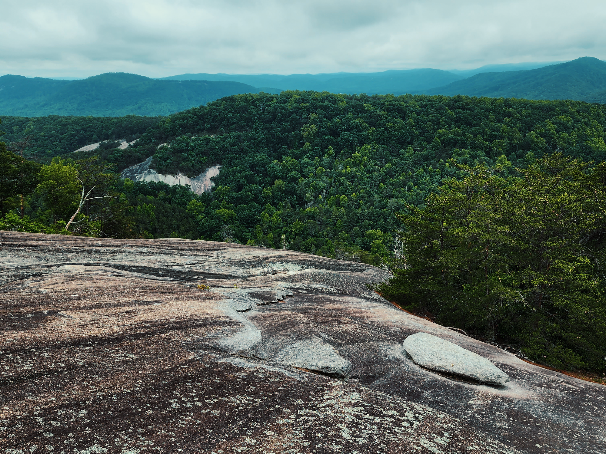
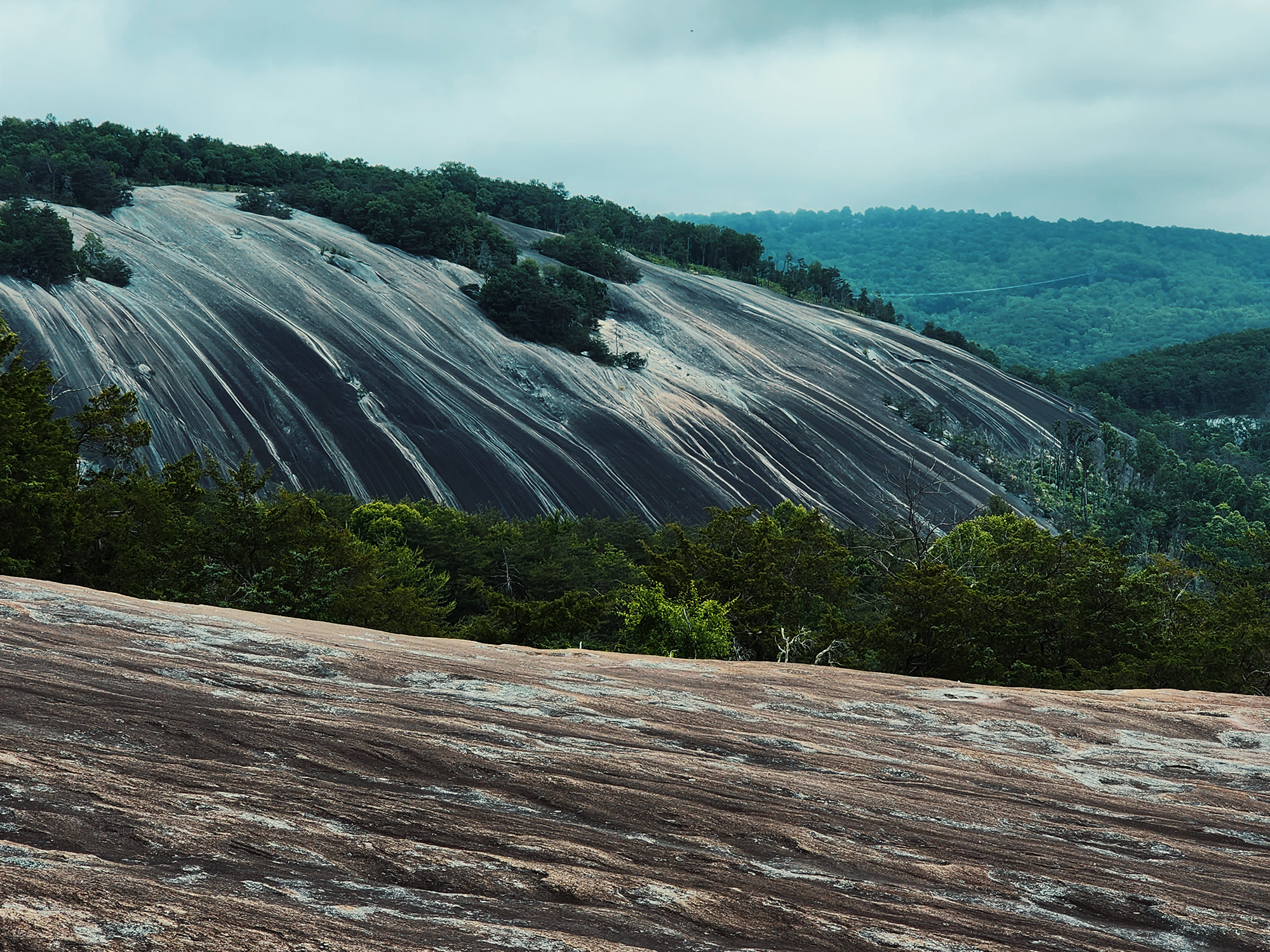
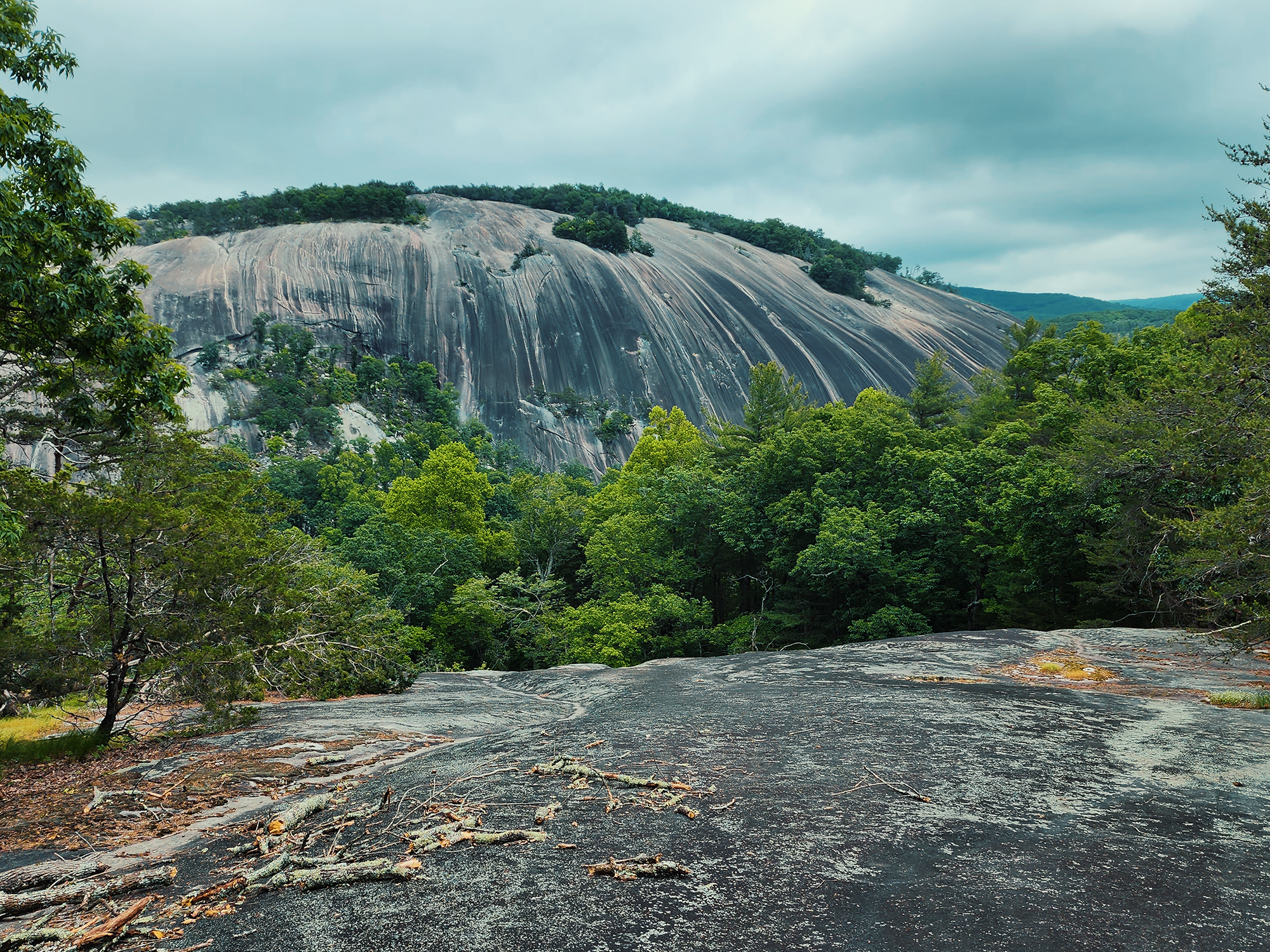
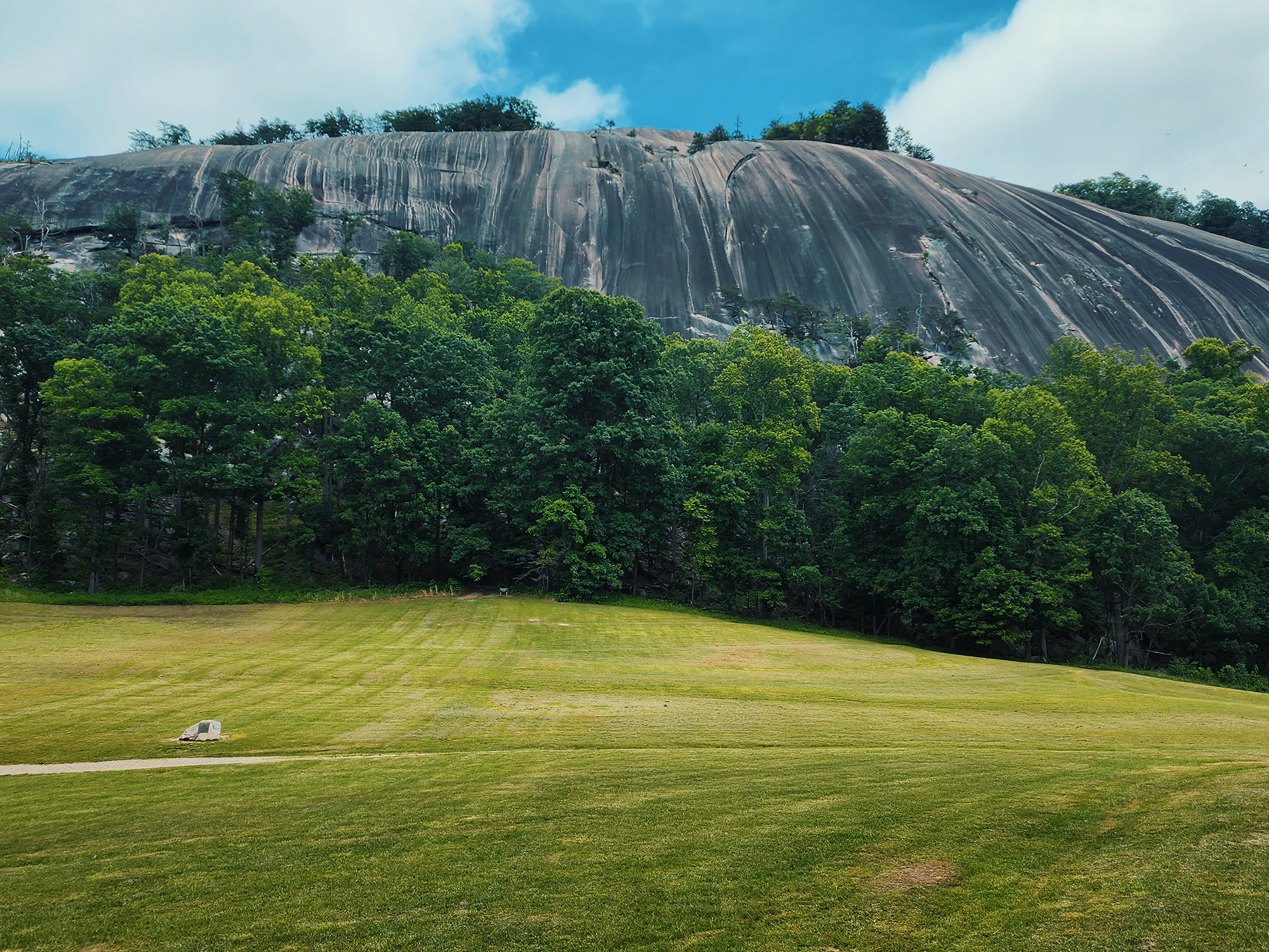
Stone Mountain is a granite pluton, a mass of solidified magma left behind after glacial activity. So are most of the other “rocks” in Stone Mountain State Park. (Wolf Rock. Cedar Rock. Maybe others?) Plutons generally have something of a dome-like shape, and I got the bright idea to walk down toward the south face (where people climb the rocks with harnesses and ropes and stuff): I just wanted to be able to look into the valley at the Hutchinson homestead. More on that later. Of course, having walked down the face of the pluton, I had to walk back up. That…was a long walk.
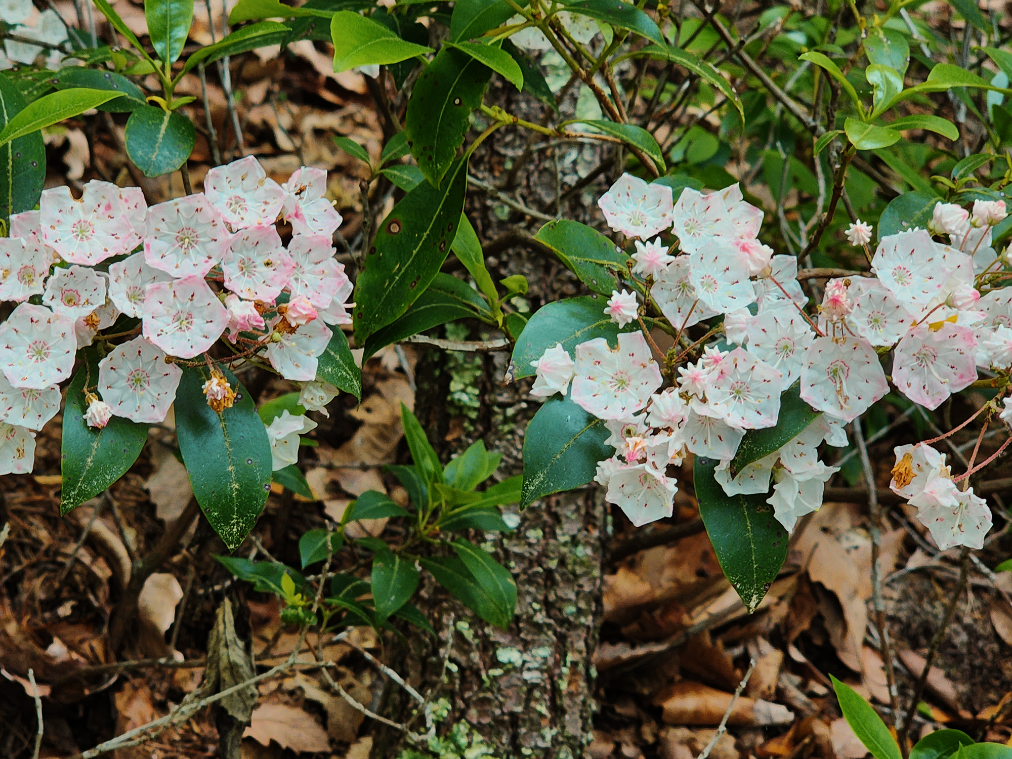
Back on the trail, we hiked down what I’ll call the northwest slope for about another mile, passing through beautiful mountain laurel over an occasional boardwalk.
At the base of the SMLT, there’s a spur to the right that leads to a different parking area with almost direct access into the valley. We went left for a short distance, then, instead of cutting left again to stay on the Stone Mountain Loop Trail, we kept going straight onto Wolf Rock Trail.
Wolf Rock Trail
Wolf Rock Trail (WRT) starts out much like the SMLT, which makes sense, since it’s another granite pluton just across the valley from Stone Mountain. Mercifully enough, the trail here is less switchback-y and the ascent feels more gradual. After about 3/4 mi, we reached the junction for the Mountains to Sea Trail (MST). (The WRT is part of the MST, which cuts through Stone Mountain State Park.) Maybe 4/10 mi after that, we reached Wolf Rock.
Wolf Rock, standing at just over 2,000 ft, offers views down into a forested vale. Rain sprinkled off and on throughout the morning, giving the sky an iron-like appearance, but I still remember a sense of otherworldliness walking the 1/4 mi across its weather-stained surface.
As I got closer to the southern edge of the rock, just shy of where the forest takes over again, a crow cawed at me. Strange that I’d remember that.
Maybe 2/10 mi farther along, Wolf Rock Trail becomes Blackjack Ridge Trail, but we turned left and followed Cedar Rock Trail.
Cedar Rock Trail
Cedar Rock Trail (CRT) is roughly 1/2 mi long, its highest point roughly 1,950 ft. It’s really a shortcut back to SMLT that cuts out the Blackjack Ridge Trail. (If we’d had more time, we probably would have explored it.)
Depending on where you are along the CRT, you get a few different views: the first looks out over another forested vale surrounding either Big Sandy Creek or a lesser tributary flowing from somewhere between the plutons. The second looks out across the valley toward Stone Mountain again, and even with the space between the two, Stone Mountain looks—or maybe feels—more commanding than you’d think, given that it’s maybe just another 300 ft higher.
It makes sense when you consider all the granite covering this region, but as we hiked the CRT toward the Stone Mountain Connector, portions of the trail looked like someone had paved them. Whether from intentional construction or erosion from uncounted footsteps, some sections resembled pleasant, consistent stone “sidewalks” flanked by forest on either side.
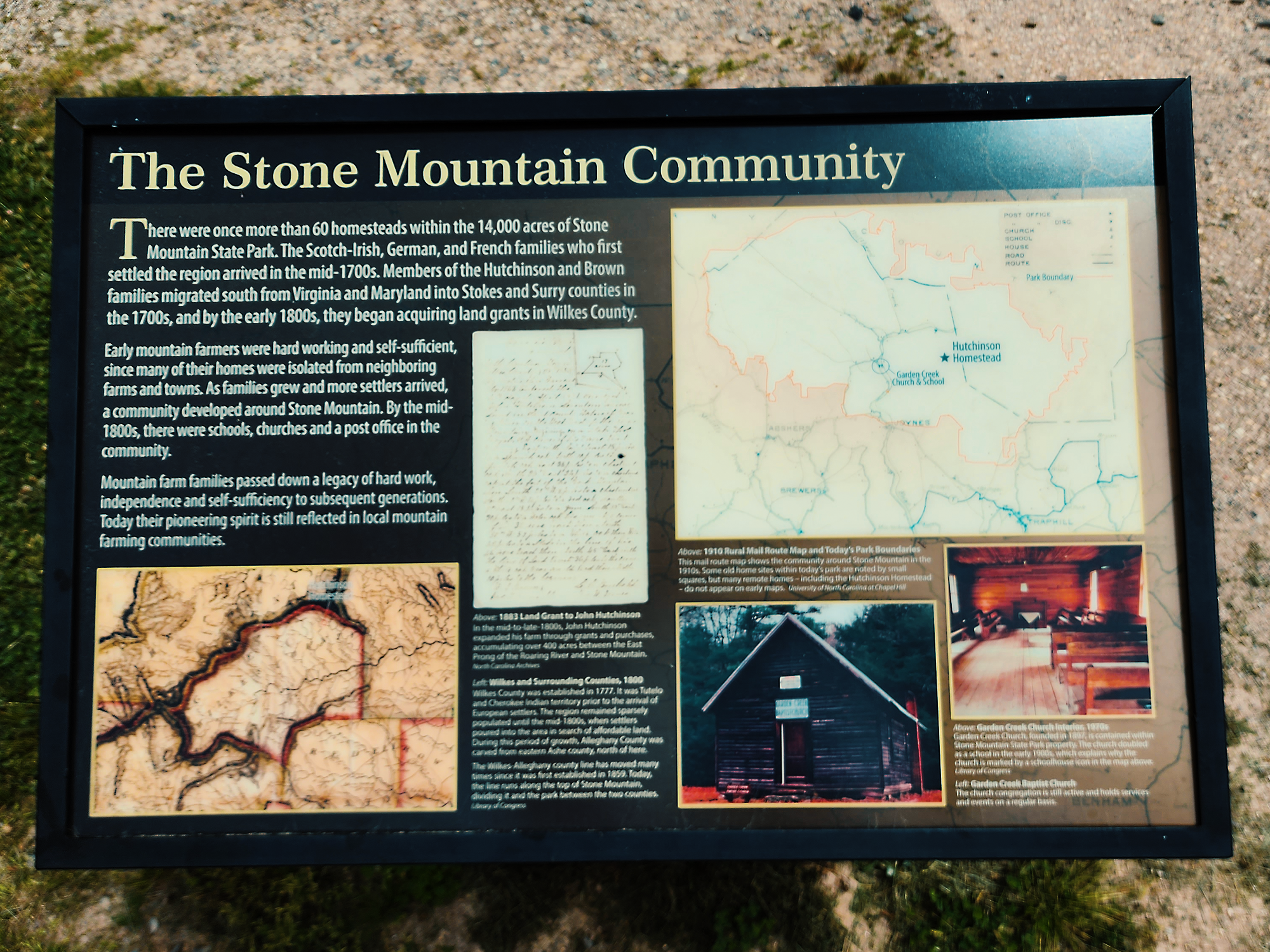
Hutchinson Homestead
We reached the Stone Mountain Connector and turned left toward the interior valley we’d been circling all day. A little more than 3/10 mi later, our path was no longer rocks and roots—or granite sidewalks: instead, the connector gradually became a gravel road between grassy fields, recently mowed. Up ahead were remnants of the Hutchinson homestead.
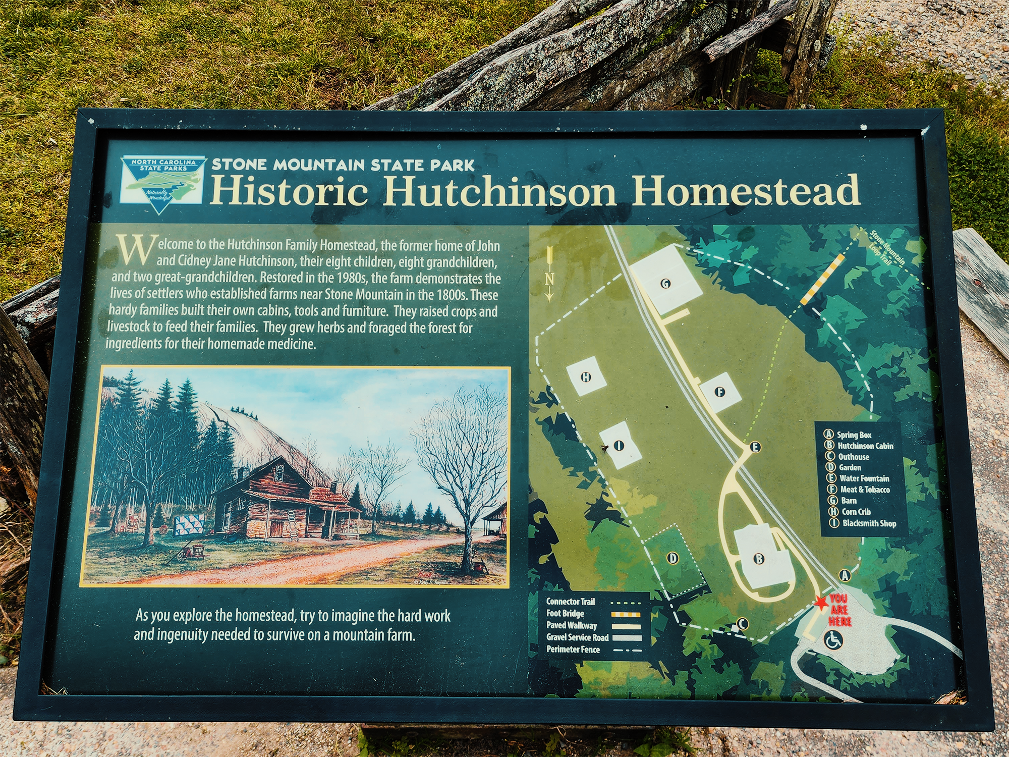
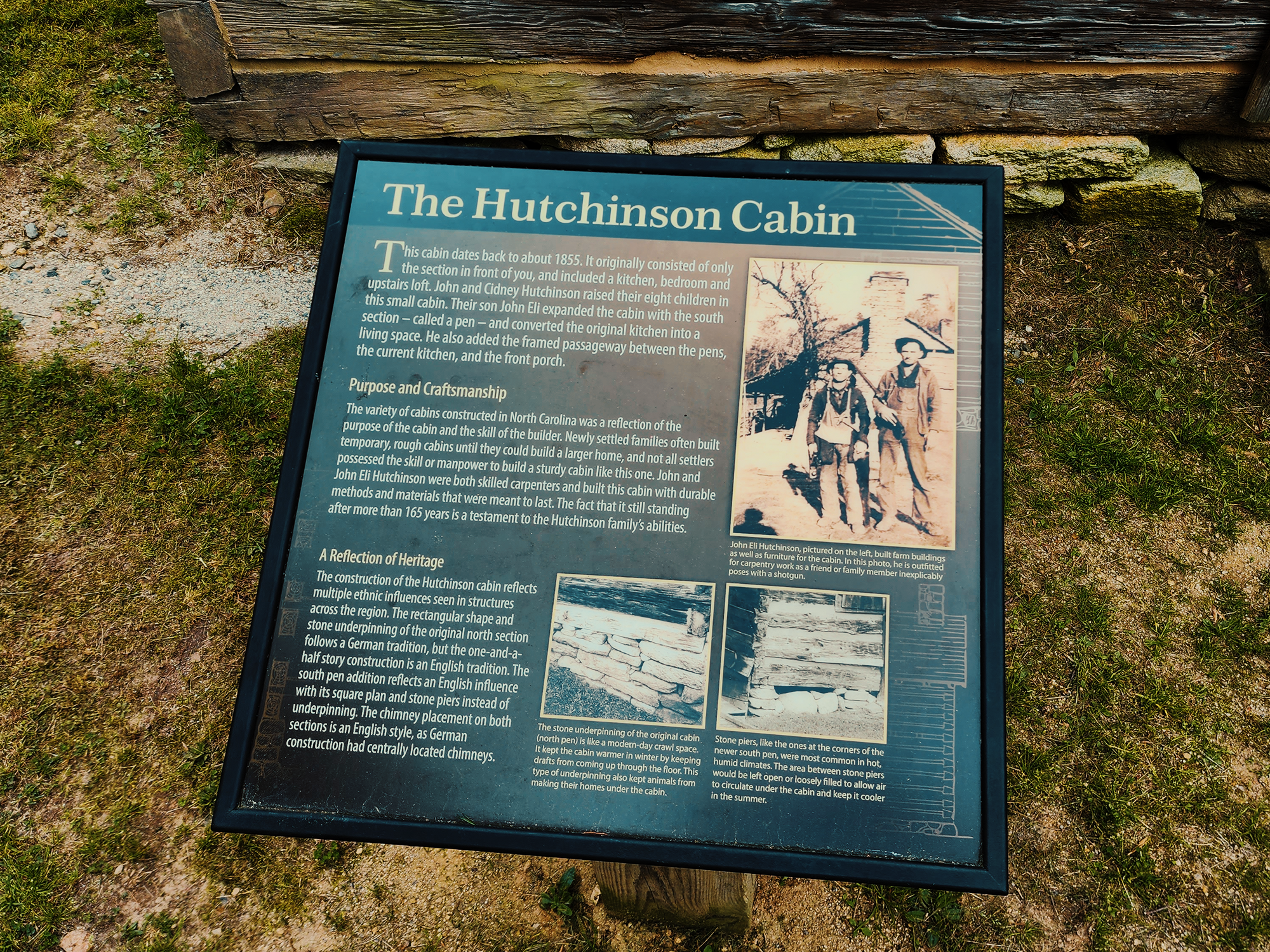
Dating back to 1855, John and Cidney Hutchinson used mostly local materials to construct a homestead for themselves and their eight children. Three generations later, Jim Hutchinson sold the homestead to North Carolina for inclusion in Stone Mountain State Park in 1969. Jim stayed on as the park’s first ranger for the next ten years.
Many of the structures present at the Hutchinson homestead are not the actual buildings John and Cidney raised; rather, they’re era-equivalent relics relocated from elsewhere in the state in order to a) preserve them and b) provide a glimpse into what life might have looked like back then. (I’m pretty sure the actual “Hutchinson Cabin” is original.)
Stone Mountain Falls
We explored the homestead for a while, but by then the sun has burned away most of the clouds. It was getting hot, so we ducked into the trees at the edge of the field. We boiled water for lunch or a snack or something—coffee, maybe—on a well-shaded rock. After that we headed back to the SMLT. About 7/10 mi after leaving the valley, the MST branches to the right and leads to Middle Falls and Lower Falls. I wanted to explore those points of interest, but we were running out of time, so we skipped them and hiked another 3/10 mi (1 mi from the valley) to the base of Stone Mountain Falls.
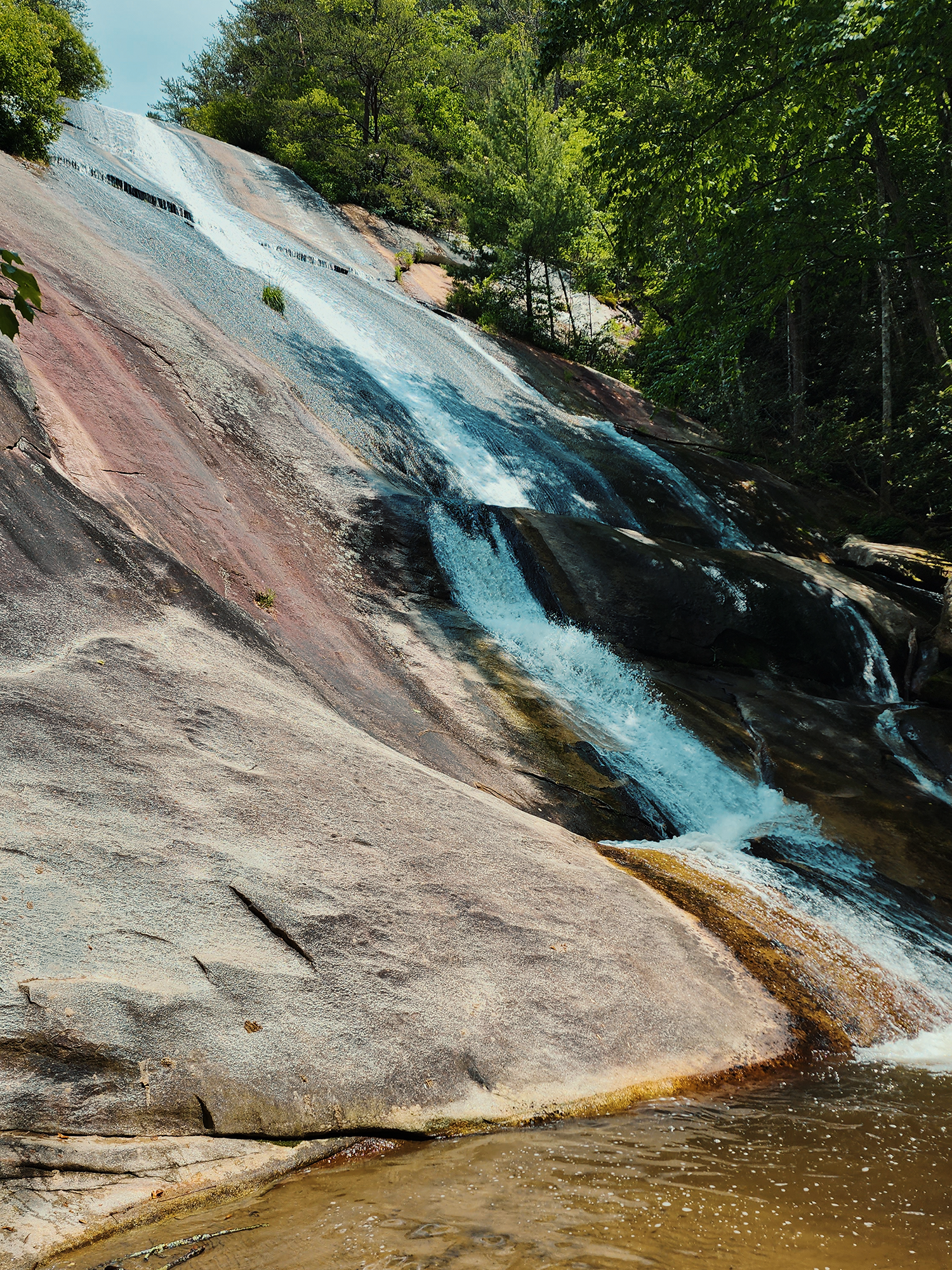
Stone Mountain Falls are more of a cascade where Big Sandy Creek drops over the rocks, but it’s still pretty cool. Of course, in order to reach these falls, we had to walk up a handful of wooden stairs. (We didn’t discover how many there were until later. Someone probably should have researched this. Ha. Ha ha ha.)
After checking out the falls, we continued slogging up those stairs—about 300+ in this section alone. Along the way, there’s a little turnout toward a wooden deck overlook that offers another glimpse of Big Sandy Creek. We checked it out (grateful for the momentary respite from all those stairs), but given the time of year, it was difficult to get a great view through the flora. Eventually we cleared the last wooden step, and we were back on rocks and roots for the last little push to the parking lot.
There’s a lot more to Stone Mountain State Park than we were able to explore today. I think next time, I’ll add another night (or two) and check out Middle and Lower Falls, as well as Widow Creek Falls (northwest of Wolf Rock). We visited in the heat of summer, but I’ll bet this place is even more amazing in the spring. The fall, too. Maybe I’ll plan a return trip for those seasons.
Catch the whole adventure on YouTube! Please consider subscribing (if you haven’t already). Thanks for stopping by!
Pingback Spending the night at Raven Rock State Park (NC)