While visiting family over the summer, I was looking for day hikes in places I hadn’t heard of before. That’s when I discovered Eagle Rock Trail. It’s not too long—just under 3.6 mi out (and another 3.6 mi back), with a short spur to Raven Ledge which gives you great views to the west and southwest. I headed north toward Greenville sometime before 1000 hrs, drove past the Big Moose Mountain trailhead, and parked near the end of the gravel road at the base of the Eagle Rock Trail.
Eagle Rock Trail
Immediately after I stepped out of the truck, I bathed myself in insect repellent—those biting monsters think I’m delicious. Not long after starting the trail, I realized my off-camera microphone wasn’t working, so I switched to the on-camera mic. There’s a rhythmic thump with nearly every step (where it picked up the rattle of the attached LED fill light): I’ve since corrected that rattle, and hopefully I’ll remember to charge my microphone’s transmitter and receiver in the future!
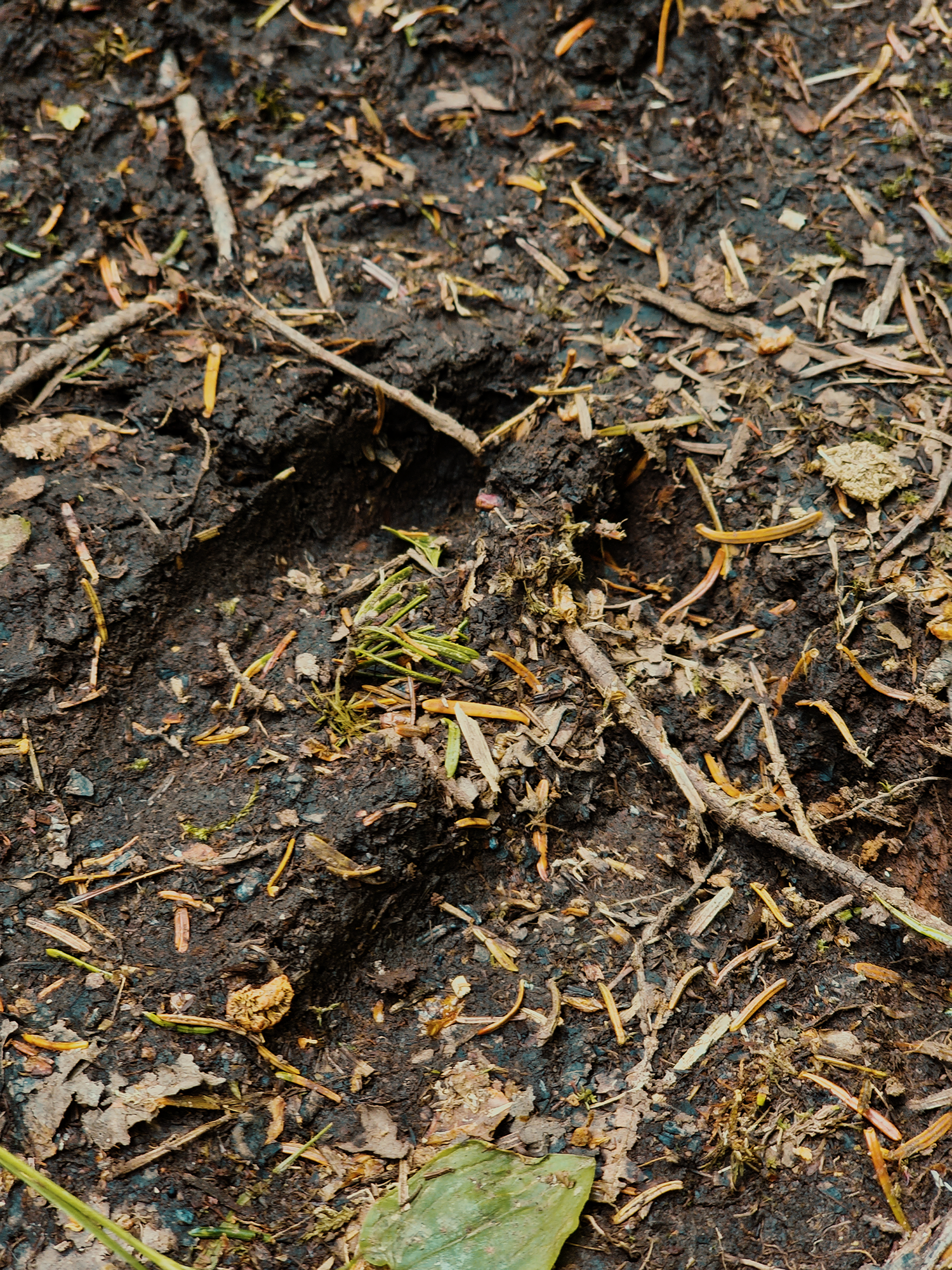
We’re in the Little Moose Public Reserved Land today. The trail begins among hardwood trees and muddy ground. Within a couple of minutes, I saw several moose tracks along my route. I saw several piles of…moose, uh, evidence, but I didn’t see any moose, which isn’t surprising. (I really wanted to see one though!)
Just after about 1/4 mi over relatively flat or gently inclined trail, I came to a rutted, overgrown trail more suited to ATVs (or maybe snowmobiles in the winter) than typical passenger vehicles. (It’s a continuation of the road I took to reach the parking area.) It took me a minute to find the trail again, but I eventually noticed the small cairn that identified the right spot.
Not long after crossing that “road,” the trail begins ascending more quickly. It’s certainly not strenuous, but it’ll get your heart pumping! Especially because there seem to be several ups and downs and ups and downs for at least the next 6/10 mi. The trail is beautiful though. Somewhere along the way here I crossed an unnamed tributary that—I think—ultimately empties into Indian Stream.
I don’t know who maintains the trail, although the Maine Department of Agriculture (Maine Bureau of Parks & Lands) manages the land, but someone built stone steps into steeper sections of the trail, which I always think is cool.
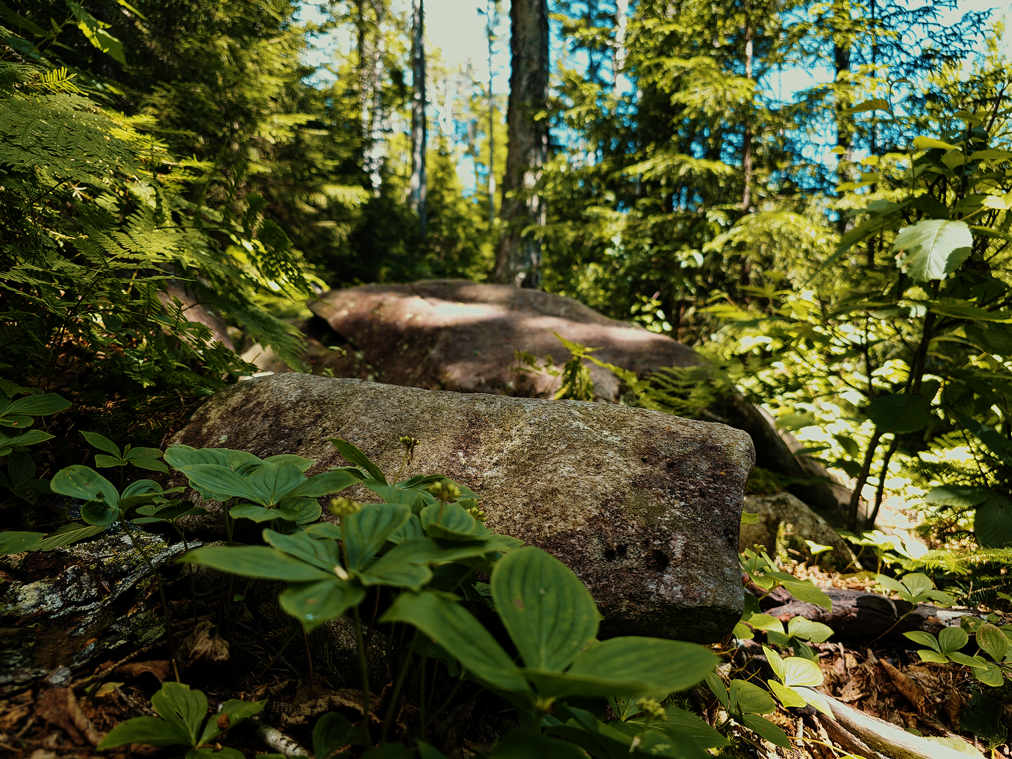
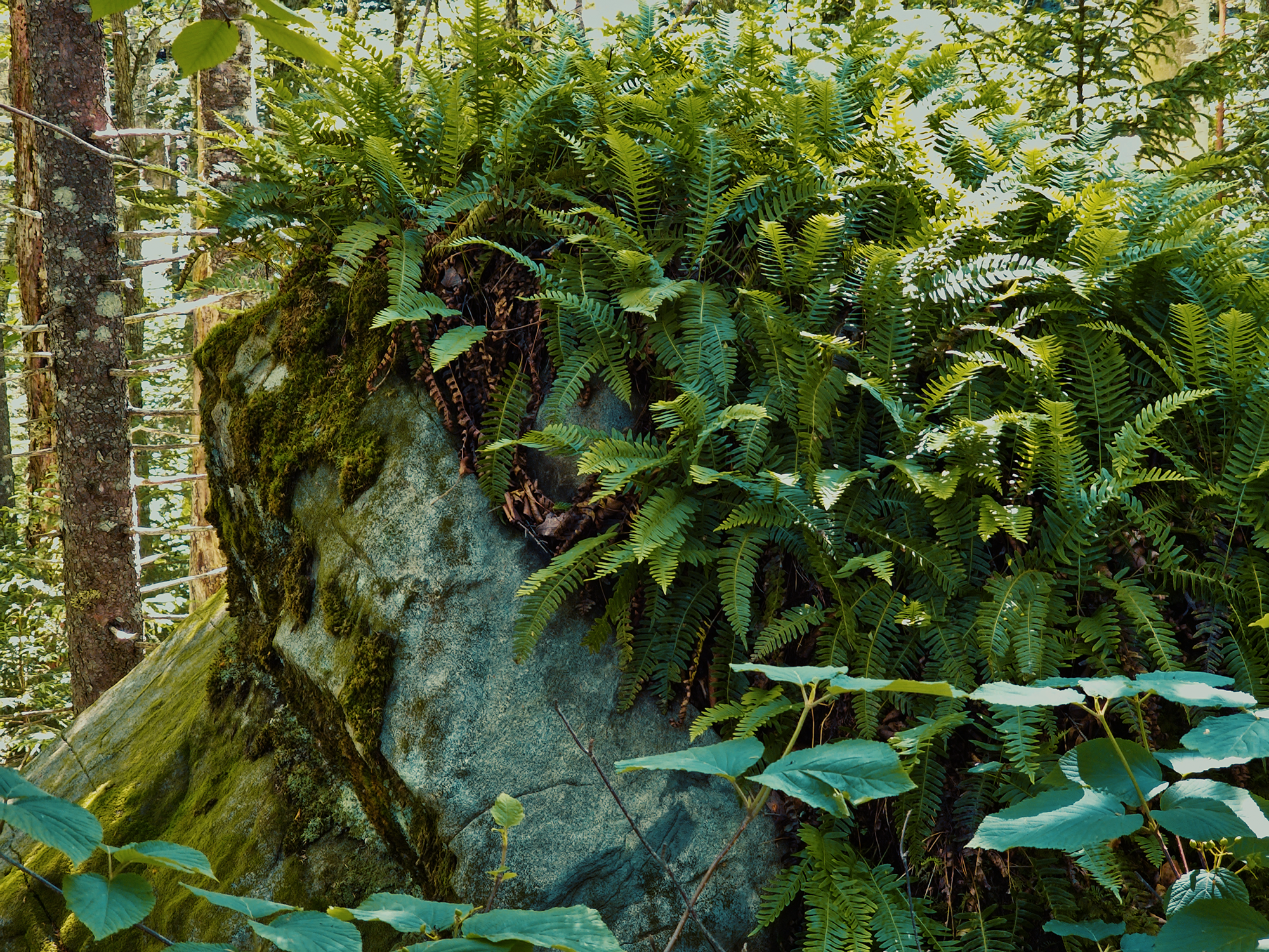
At right around 9/10 mi overall, after crossing that unnamed tributary again, the trail climbs sharply into evergreens that displace many of the hardwoods. Somewhere along the route here I noticed several ferns growing on top of this large rock:
As the evergreens continued to dominate the forest, in the rising heat of this summer afternoon, I caught the scent of spruce and pine sap, which always reminds me of Christmas trees. That fragrance is probably one of my favorites!
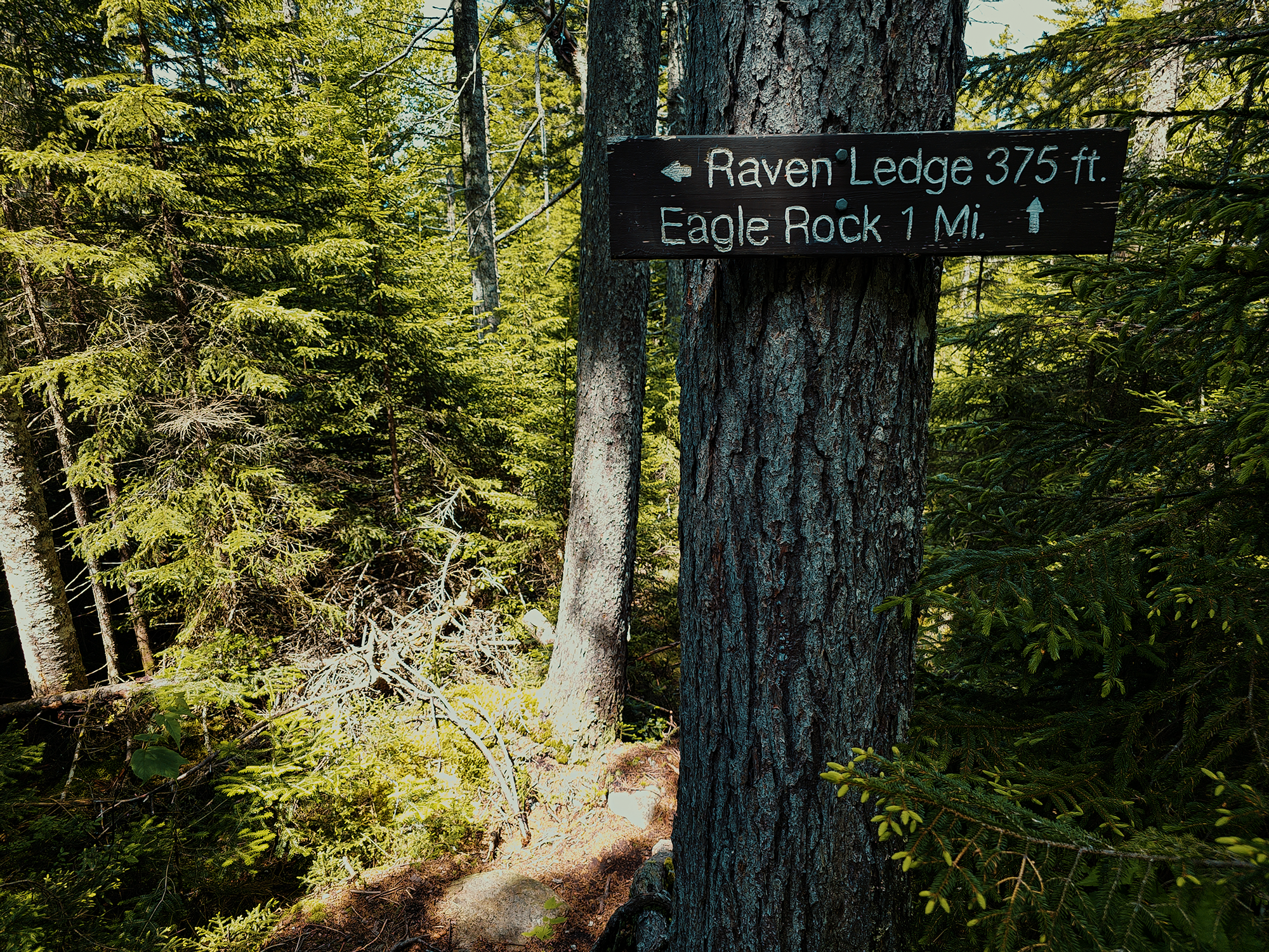
There are two routes up to Eagle Rock: the older route, which it shorter but more direct, and this newer route, which is the opposite of those things. The new route’s trailhead is closer to my parents’ house (my base of operations!), and I was less interested in a brutal “frontal assault” than this more gradual approach. I stated earlier that the new trail is about 3.6 mi (one way): the old trail is almost 2 mi shorter (about 1.5 mi)! And it cuts out the Raven Ledge spur (unless, of course, you hike past Eagle Rock for another 1 mi).
Raven Ledge
About 2.2 mi in, there’s a 375 ft spur toward Raven Ledge. In the video, I suggest that it’s longer than that, but I’m incorrect: it is 375 ft (or close enough), it just feels longer! Similar to the way the South Brother Trail in Baxter State Park feels so much longer that 3/10 mi on the ascent!
This spur, to the left of the main trail, curves gradually to the left as you ascend past a mix of boulders, slab-like rocks, and evergreens. After a long 375 ft, I stepped out onto the exposed surface of Raven Ledge.
From here, looking west and southwest, I got a great view of Indian Pond in the distance. The wind had picked up a little—felt great!—and blew my tripod down! Most of my gear was just fine, but this little 3D-printed thingy that held my (uncharged) microphone receiver snapped off. Since I wasn’t using it anyway, I just put the pieces (and the receiver!) in my pocket.
I fired up the drone and flew it around the vicinity for additional perspective. What I see from eye level versus what I see from hundreds of feet overhead seems worlds apart sometimes! After I packed up the drone, I looked as far along the horizon as possible and thought I saw windmills.
I did.
There’s a wind farm in Bingham, Maine, just about 30 mi from Raven Ledge. Today was clear and sightlines were good, but at that distance, even though I could see the windmills with my eye, I couldn’t see anything that far out with my camera.
With all my stuff secured, I hiked the 375 ft back to the Eagle Rock Trail and continued with the last 1 mi. (The last out 1 mi, that is!)
Eagle Rock
Over that next 1 mi, I hiked up and down through more spruce-fir forest until I reached the intersection with the old trail. Just past that, I was at the base of the rock that is Eagle Rock: there’s probably somewhere between a 70%–100% grade here! Using my hands in places, I scrambled to the top.
Eagle Rock is only about 2,365 ft or so, but the way its broadest face juts into the air, it offers amazing 360° views from its “summit.” Maybe it’s not considered a summit? I don’t know, but whatever it is, it’s beautiful.
While researching this trail, I discovered something called the Moosehead Pinnacle Pursuit: a series of six peaks that each present a different vantage for viewing Moosehead Lake (Maine’s largest). Over the years, I’ve technically completed all six of these routes (including today’s adventure!), but I want to redo them all before applying for the badge!
In hindsight, I’m now quite confident that I misattributed some of the mountains visible across Moosehead Lake in the video. I’m not 100% sure that what I thought was Barren Mountain was, in fact, Barren Mountain. Much less Borestone! Those two peaks are visible from Moosehead—barely—but they’re much farther away than I thought. Rather than suggest other possibilities—which would most likely also be incorrect—I’ll just post this photo as-is. If anyone knows for certain what the two mountains on either side are called, please leave a comment!
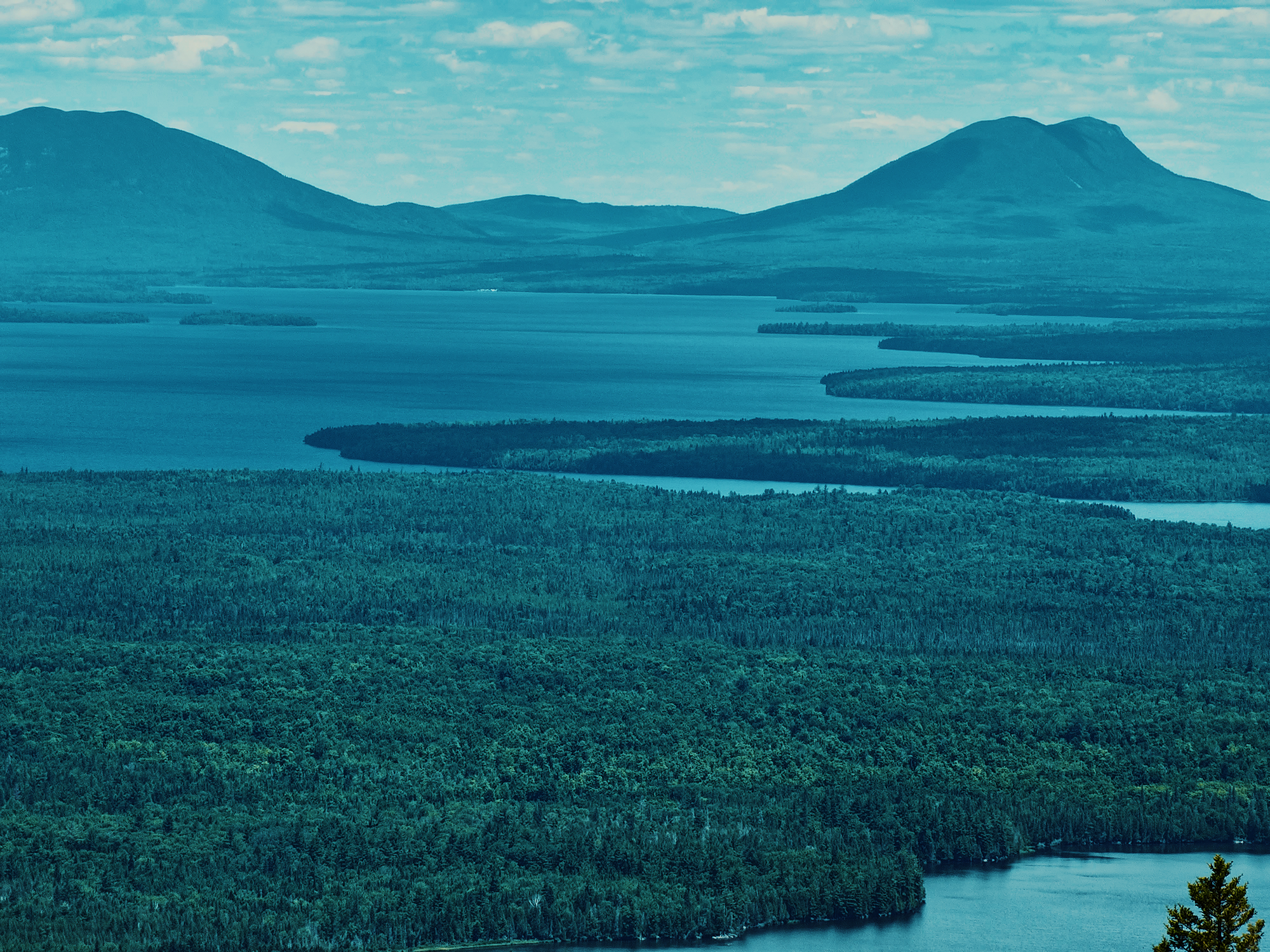
I did recognize Mount Kineo, visible toward the north of Eagle Rock. It’s pretty hard to miss if you’re familiar with the region—and I’m not as familiar with it as I’d like. Mount Kineo rises up out of Moosehead Lake about 13.4 mi from Eagle Rock.
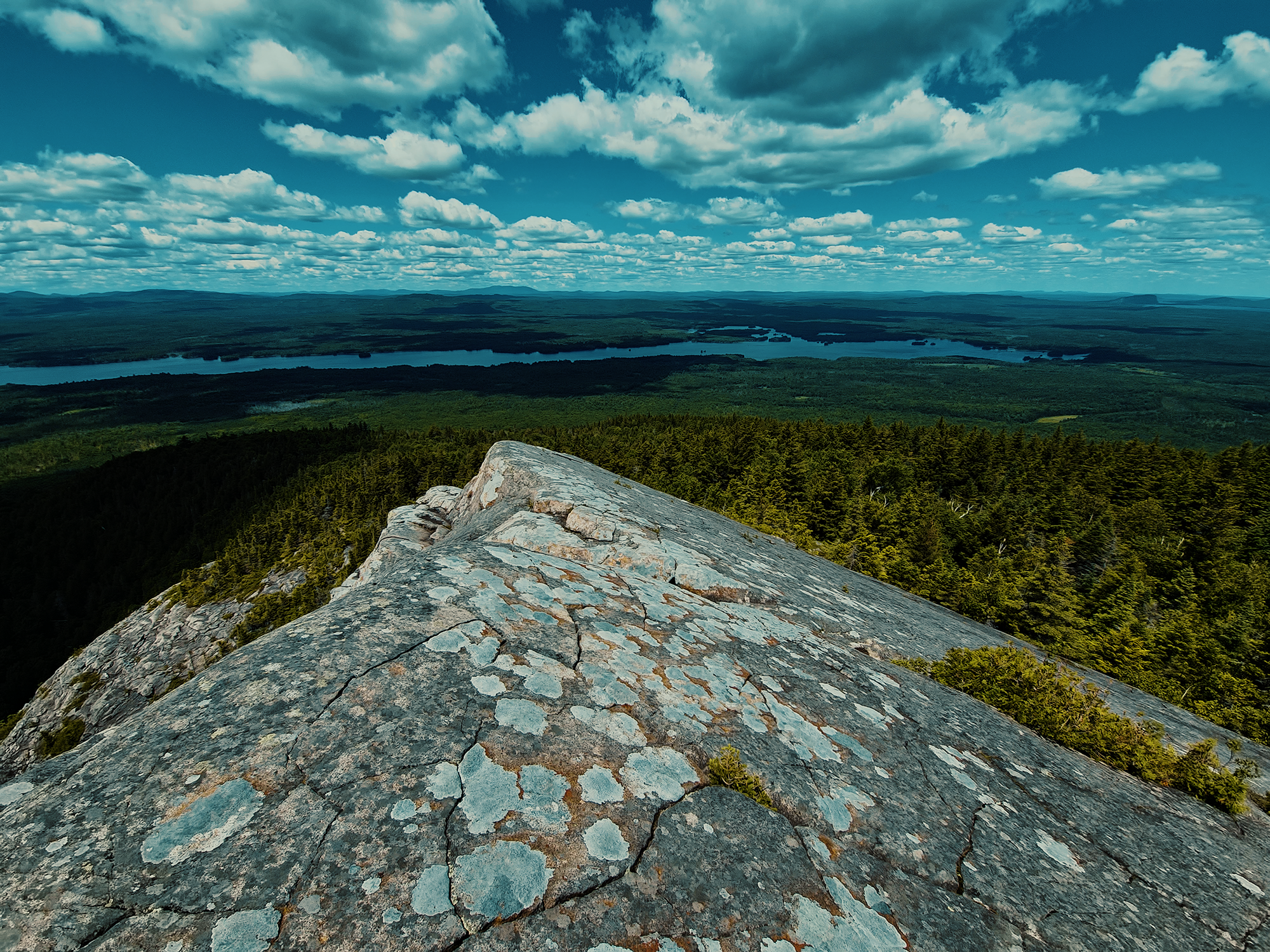
I dropped my pack and explored the area, admiring the views and the immediate geography. Just below the highest spot up here, there’s a series of cracked boulders, and even a large, cracked rock on the opposite side of the “summit.” I recorded some additional drone footage, then ate my lunch in solitude. I didn’t see anyone else on the trail today, and sometimes, that’s awesome.
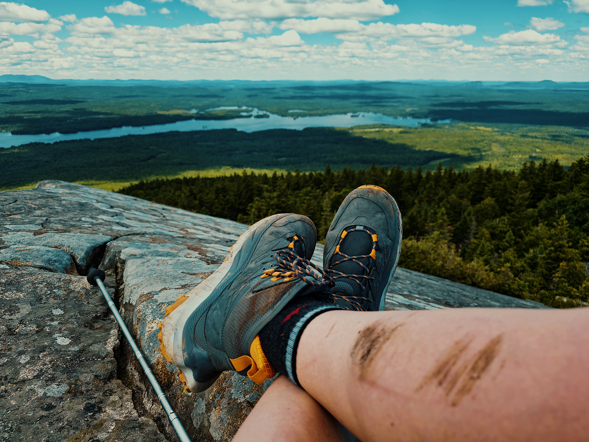
After a while, once the wind had evaporated all my sweat, things got chilly. I’d been up here long enough, so it was time to return to the truck. Somewhere along the trail, the 3D-printed ball head I used to hold my camera steady failed: no matter how tight I tried to clamp it down, there just wasn’t enough friction to keep it in place. That’s all right: I was just about finished recording anyway, so I packed away most of my gear and held just the camera in my hand for the remainer of the hike down.
I never did see a moose. I’ll probably need to start this trail before the sun rises for that to happen. Maybe next time!
Catch the whole adventure on YouTube! Please consider subscribing (if you haven’t already). Thanks for stopping by!
Pingback Spending the night on a little island in Lake Onawa (ME)