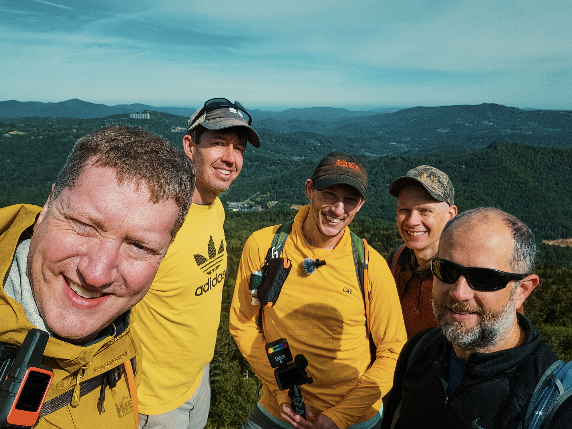
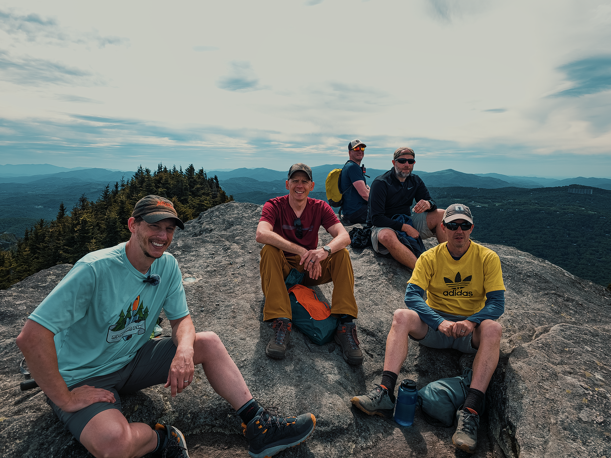
Grandfather Mountain is unique among North Carolina’s state parks: there’s the actual state park, but there’s also the privately owned and operated Grandfather Mountain attraction (that includes the Mile High Swinging Bridge). Five of us traveled to Watauga County for a three-day, two-night “base camping” adventure, splitting our time between the two. I’d hiked the Daniel Boone Scout Trail before (starting in Caldwell County, on the eastern side of Grandfather Mountain—with Matt M., no less!), but not the Profile Trail. I don’t know if it’s the fact that the Profile Trail is a little longer, a little…elevation-ier than the Daniel Boone Scout Trail, or if I was sick (or just plain out of shape), but the next couple of days felt much rougher than I’d anticipated! None of the other guys seemed to be feeling it like I was, so I suspect one of the latter two possibilities.
Day 1
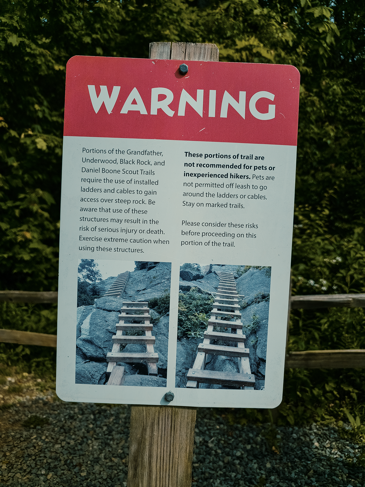
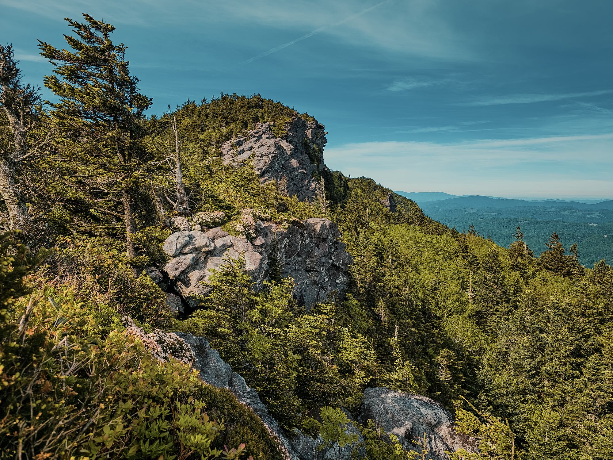
Even before we left the parking lot, signs warned us about the ladders scattered along most of the routes to Calloway Peak (Grandfather Mountain’s highest summit, just shy of 5,920 ft). I remembered many of these from the Daniel Boone Scout Trail (and the Grandfather Trail) from a few years back, and I was looking forward to tackling them again.
Profile Trail
Like many trails, the Profile Trail starts off with a deceptively gentle uphill grade through mostly hardwood forest. At about 6/10 mi, we reached a split between the Profile Trail (what we were on) and the Profile Connector Trail. The actual Profile Trail is a hard left here; we stayed straight and took the Profile Connector Trail. Had we stayed on the Profile Trail, we would have hiked over and alongside the Watauga River for a while. Instead, we skipped some distance and elevation change. Just shy of 4/10 mi later (instead of 6/10), we took a sharp right to reconnect with the Profile Trail proper. About 1/3 mi after that, we crossed the Shanty Spring Branch—we’d see it again in a little while.
About 2 mi in, we reached Foscoe View, a slight opening through the trees that affords limited views of Elk Knob and Snake Mountain. On clear days, it might even be possible to see Mount Rogers in Virginia. I think I started feeling weak—that might be the best way to put it—not long after Foscoe View. By the time we reached the spur toward the Profile campsite, I knew something wasn’t right. The other guys surged ahead (can’t blame ’em—it’s what I typically do!), checking on me every once in a while. That was kind of them, if not a little embarrassing.
Right around 2.8 mi, we crossed the Shanty Spring Branch again, and probably 2/10 mi after that, we reached Shanty Spring, the “last sure water source” this high up the mountain:
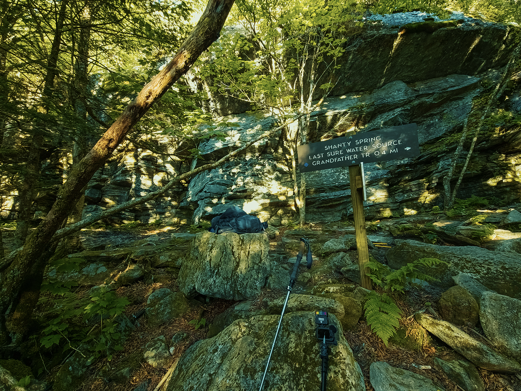
By the time I reached Shanty Spring, most of the other guys had finished filtering their water. I dropped my pack and allowed myself a little extra time to rest after filtering my own. Once I had enough water, I (reluctantly!) put my pack back on and started up the remaining 1/3 mi to the Calloway Gap campsite. Along the way, some of the other guys (who’d already dropped their gear there) backtracked and offered to carry my stuff—that’s how I knew I was in bad shape! But because I have too much pride to accept help sometimes, I thanked them for the offer and slowly trudged up the trail until I discovered a nice, soft place to collapse.
Calloway Gap campsite
It was later in the day, if memory serves. Getting close to supper time. Calloway Gap offers four raised tent platforms. There were five of us. I set up my tent on the ground on a mostly flat spot, not too far from the others. Once we had everything established, we cooked supper. I brought some hot dogs, but many of the higher elevation sites in Grandfather Mountain State Park don’t permit campfires: instead, Matt M. and I cut a couple of skewers from nearby twigs and burned roasted them over the roaring blue flames of a canister stove.
Exhausted—and probably sick with something—I climbed into my tent afterward and went to bed.
Day 2
I woke up feeling better than I had the night before, but still not great. Brian D.’s tent platform became the de facto kitchen and dining room: at least, that’s where most of us ended up preparing our breakfasts! While water boiled and oatmeal cooked, we talked about waxing pants (what else?!). It might have been May, but the mornings and evenings were still cold, and I hadn’t brought anything other than shorts. Brian D. had an extra pair of Fjällräven pants he let me borrow, and he said something about how they needed to be waxed. Or maybe he was talking about some other pair. Maybe it doesn’t matter—at that moment, I was just grateful for pants! During this discussion, Zack B. tried to burn it all down—either that, or his white gas stove flared up a little.
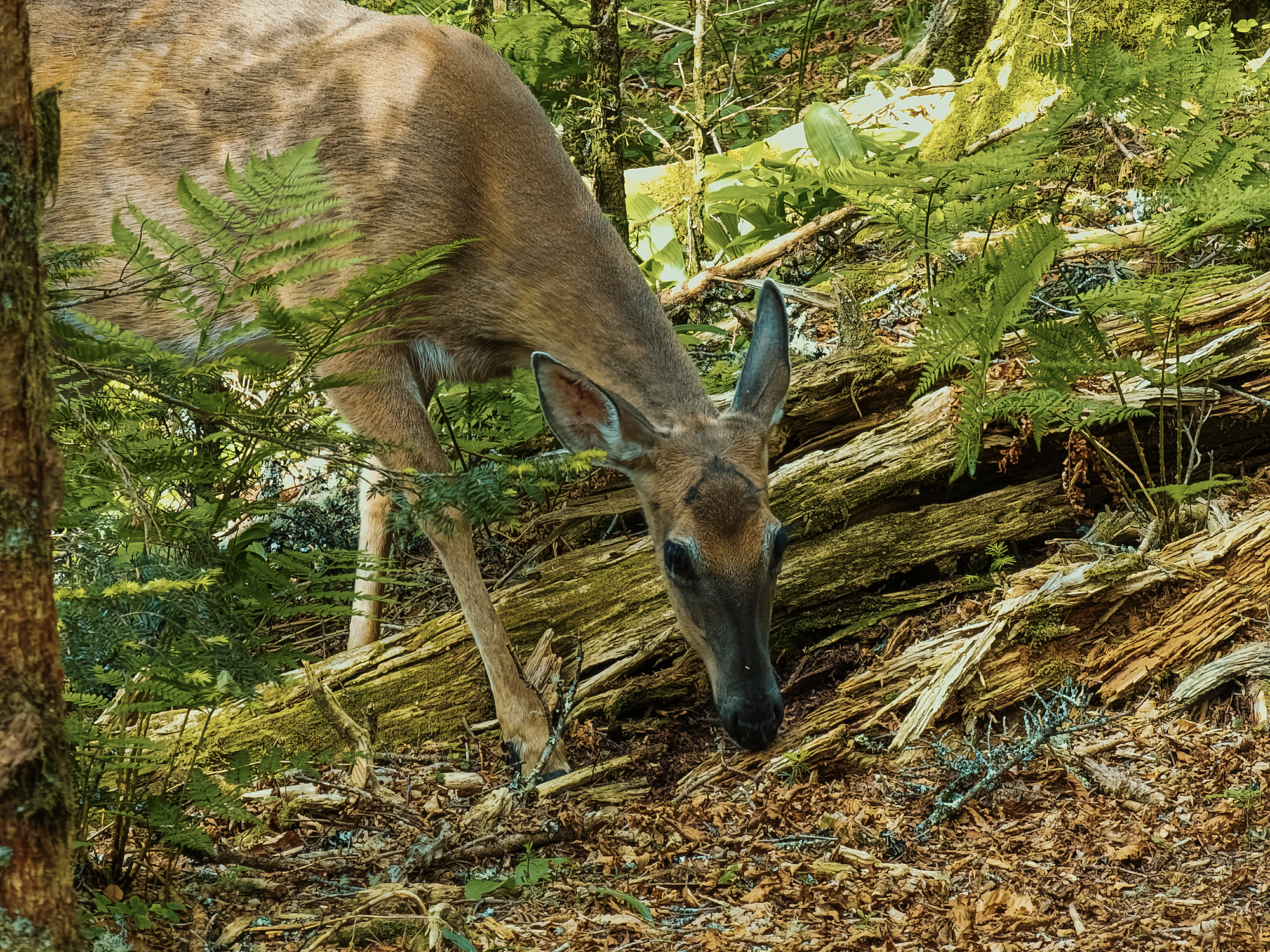
Before we headed for the trail, a single doe stepped out of the woods and into our campsite. Or maybe someone built our campsite in the middle of her home? She seemed quite disinterested in us as she picked her way through young trees and over downed logs. I don’t think we impressed her, and after a few minutes, she disappeared.
Grandfather Trail
Rather than an out-and-back or a loop, in which case each of us would have to haul our entire pack from point to point, we set this trip up (credit where it’s due: Matt M. set it up) as a base camping adventure. We left our tents and our heavy packs at Calloway Gap, then picked up our day packs and headed toward the Mile High Swinging Bridge via the Grandfather Trail.
Descending from there, we reached the side trail (maybe 200 ft) to Indian House Cave. Historically, I don’t think this “cave” (it’s not a cave) ever served as anyone’s home, but the angled and overhanging rock faces abutting one another is an interesting feature. Of course, someone “decorated” one of the “walls” with, uh, imagery I wouldn’t want in my house.
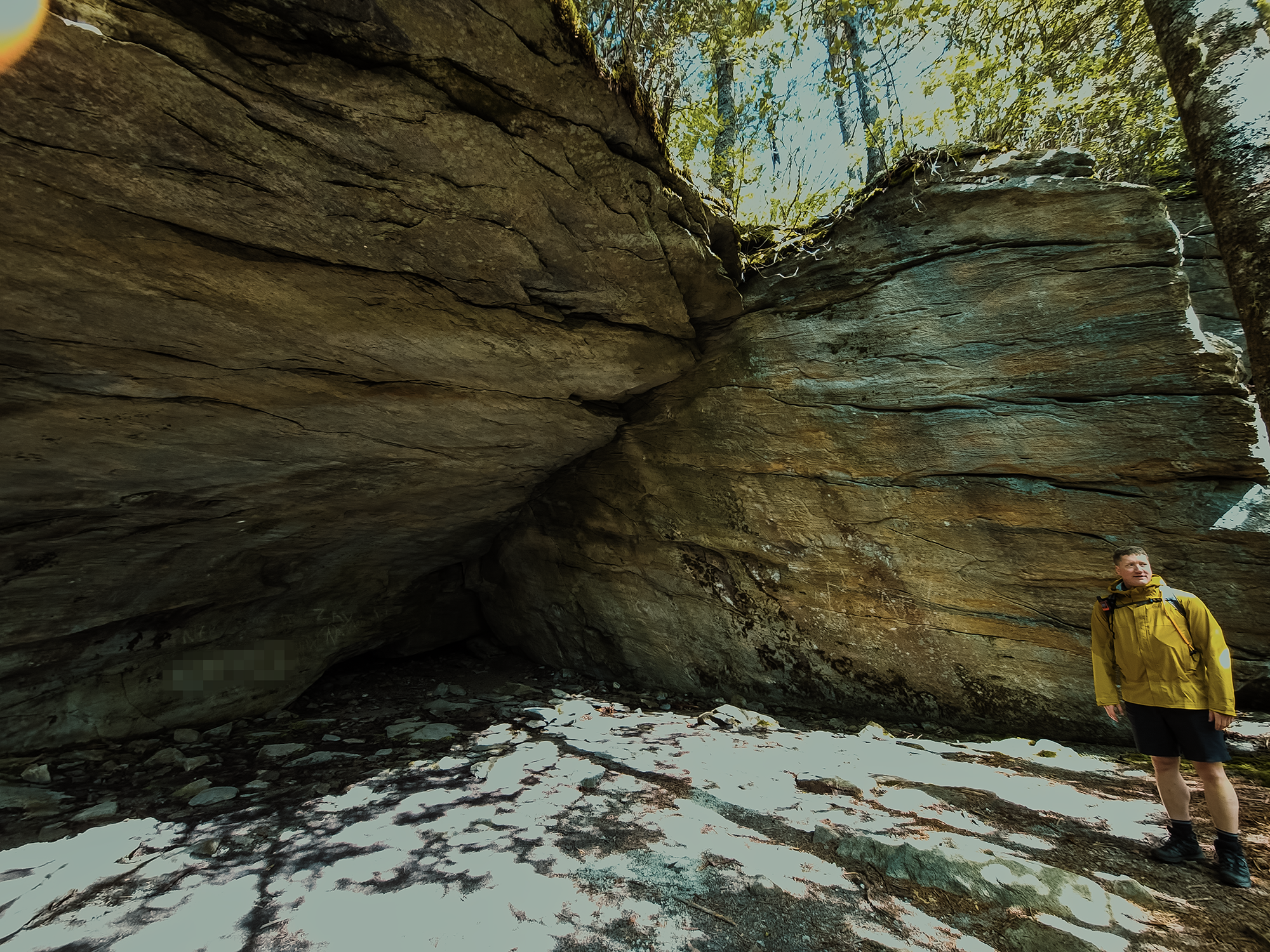
Kids. Probably.
Just before we reached the Attic Window campsite, I spotted this little gray bird flitting from bush to bush. I don’t know what he was investigating, but I’m pretty sure he (or she) was a gray junco:
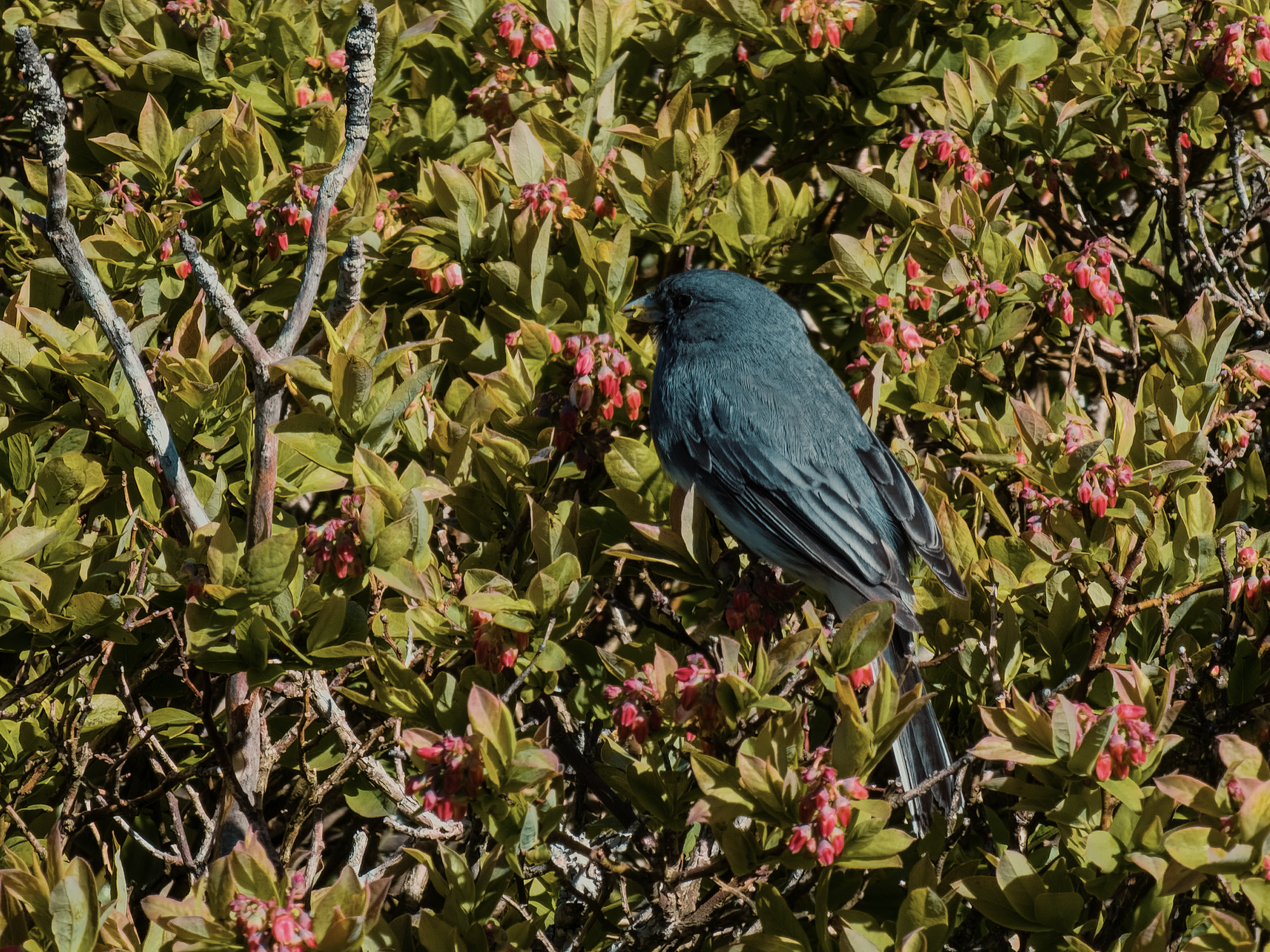
I’m no ornithologist, so it’s possible I’m completely wrong. (If you know what kind of bird this is, leave a comment!)
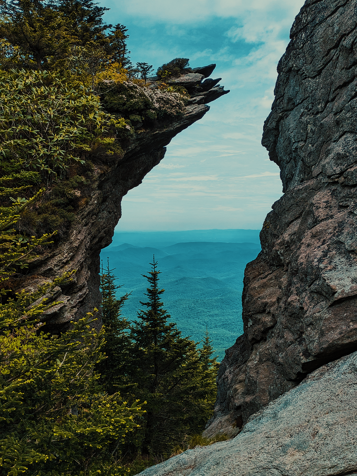
Maybe 600 ft past the Indian House Cave spur (just past the Attic Window), we entered The Chute, a narrow, steep portion of the trail that frames the west in a kind of vertical panorama. There’s probably a word for that. This stretch is more rocks than trail, but if you’re careful, you’ll be fine.
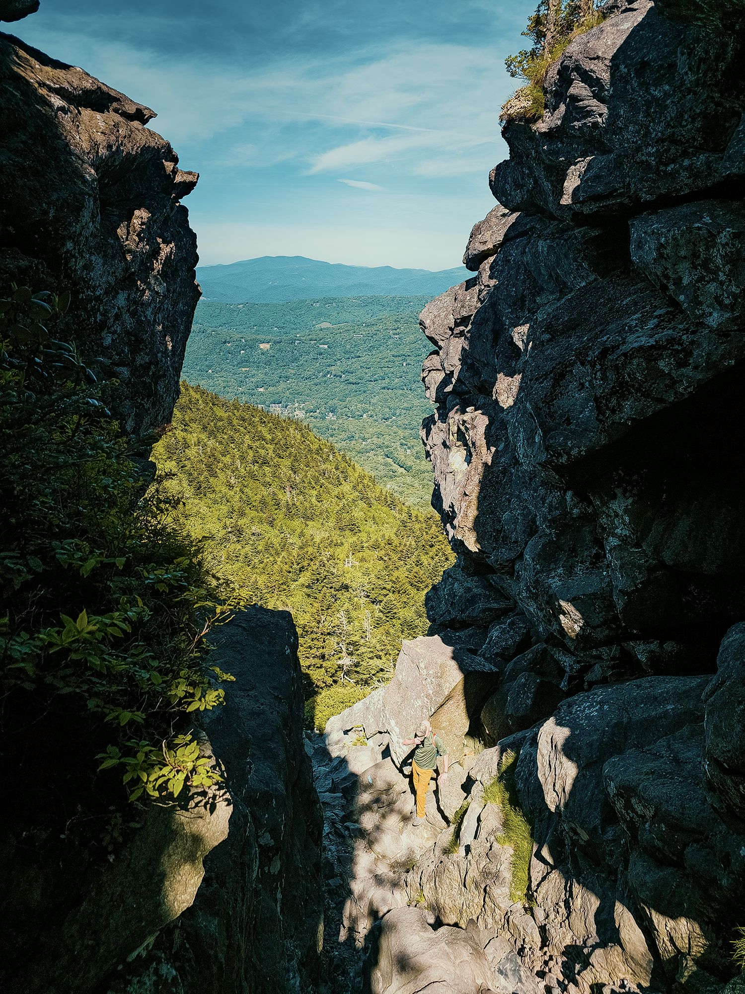
Underwood Trail
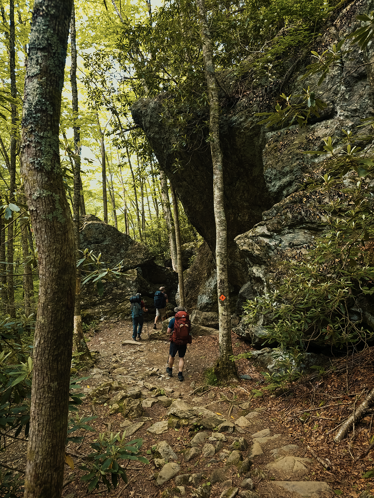
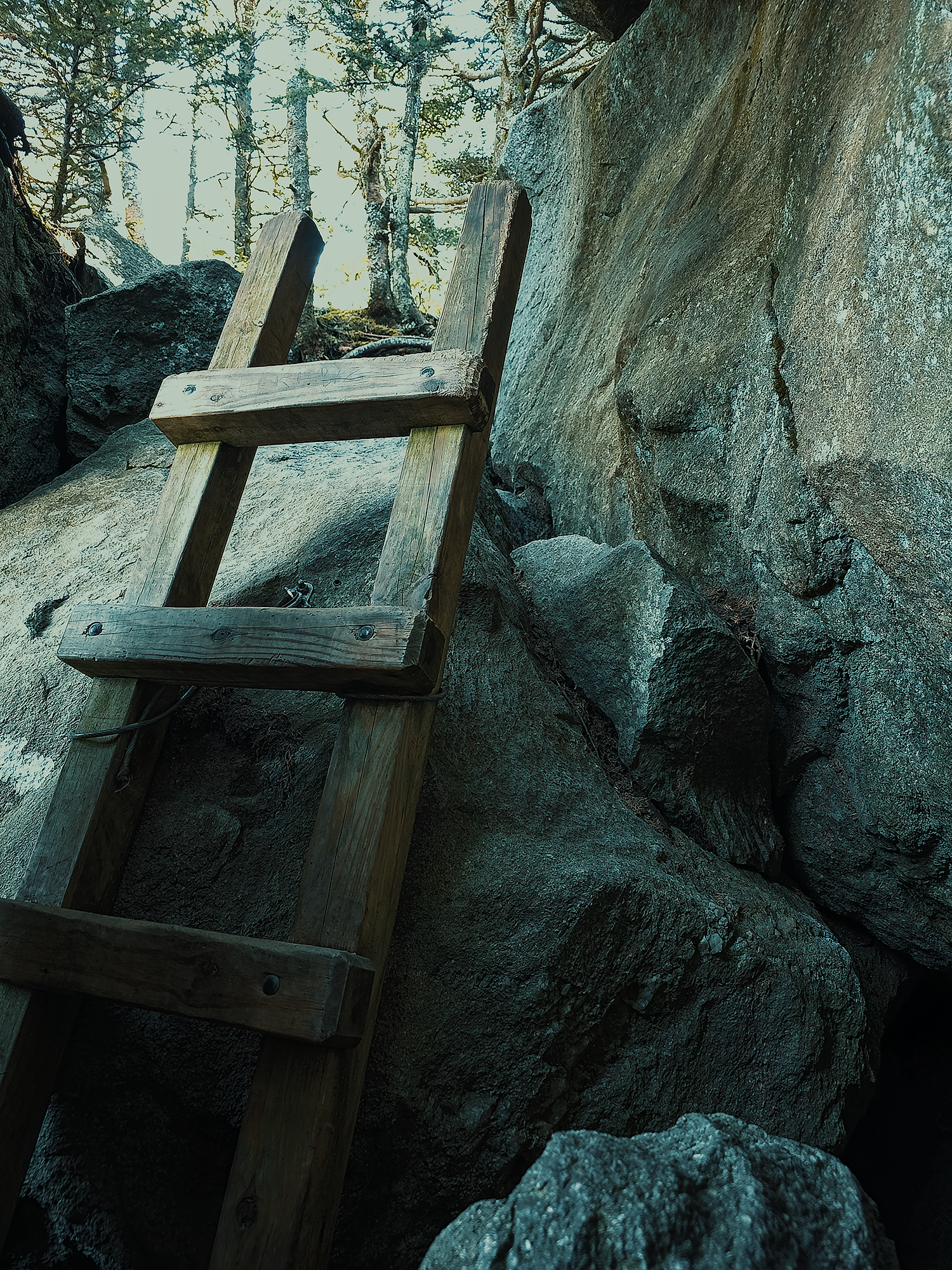
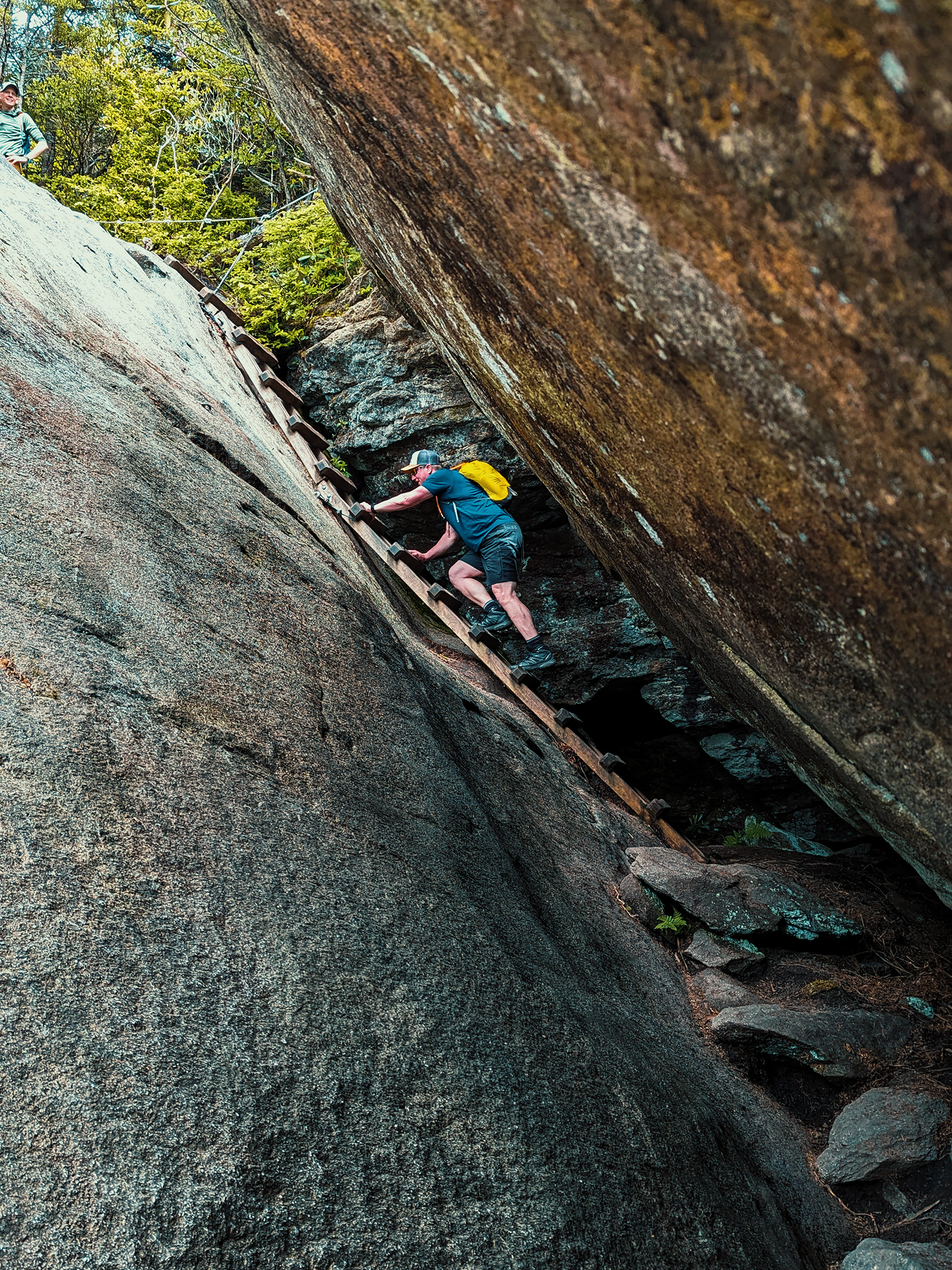
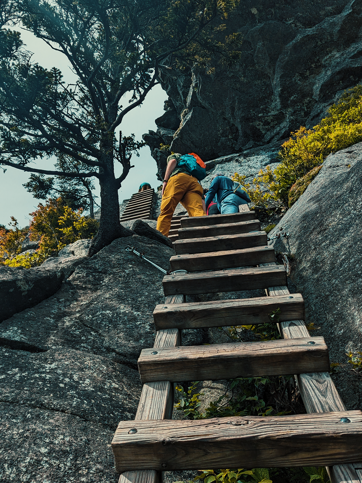
Less than 400 ft after descending The Chute, the trail divides: left keeps you on the Grandfather Trail; right leads you down the Underwood Trail. We took the Underwood Trail down. Almost right away, the trail passes through a “tunnel” of immense collapsed boulders and presents you with the first of many ladders:
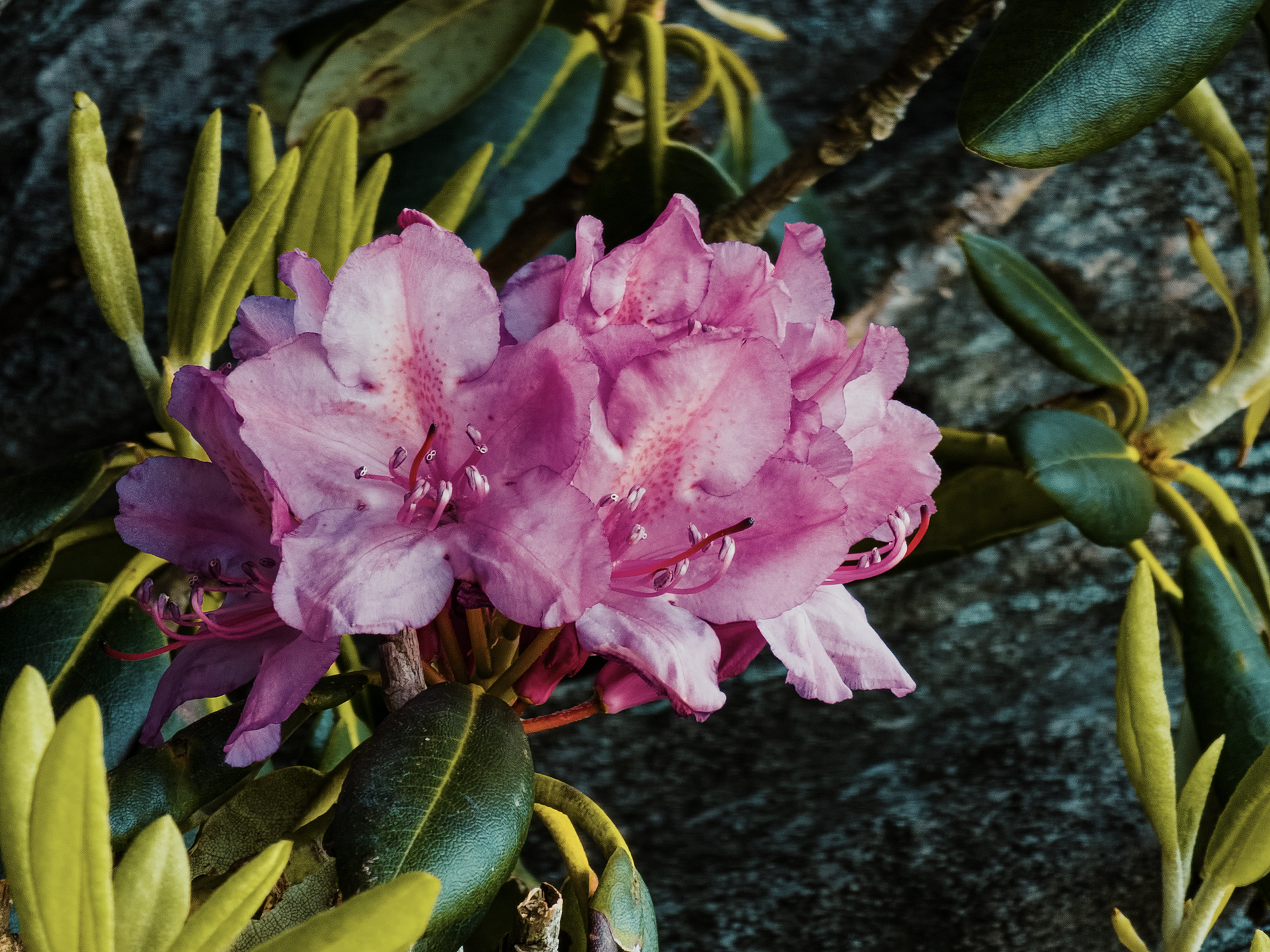
I think it was right around this part of the trail that I noticed some gorgeous rhododendron blooms. Shortly after starting the Grandfather Trail, we did take a look at the Alpine Meadow campsite, and there were some rhododendrons there, but I think the following photo is from somewhere along the Underwood Trail (even though I put it near Alpine Meadow in the video):
The Underwood Trail runs just under 1/2 mi before it merges with the Grandfather Trail again. Right around this point in our hike (I think), a young hiker noticed my camera gear and asked about my YouTube channel. I normally carry a bunch of Do Stuff Outdoors stickers with me, but I’d left them all in my bigger pack! Oh no! I suspect it defies probability, but young man, if you read this: get in touch, and I’ll send you a sticker or two!
Nearly 1.5 mi from Calloway Gap (including the spur to Indian House Cave), we reached Grandfather Gap, a low place between Grandfather Mountain and its surroundings. Roughly another 1/2 mi beyond the gap, we reached the Top Shop and the Mile High Swinging Bridge.
Here’s where it gets interesting. In 1885, Samuel T. Kelsey and Donald MacRae formed the Linville Improvement Company with MacRae’s son Hugh as its head. By the 1950s, likely prior to 1952 and the dissolution of the Linville Improvement Company, Hugh Morton, Hugh MacRae’s grandson, became Grandfather Mountain’s sole owner.
In the 1900s, someone—the Kelseys? the MacRaes? I don’t know—widened an old horse route to the peak (to accommodate automobiles), constructed a wooden platform, and charged a “nominal toll” for motorists to enjoy the view.
When ownership passed to Morton, he widened the road to two lanes and built the Mile High Swinging Bridge. The Blue Ridge Parkway runs nearby: had Morton not extracted a compromise from the federal government in the late 1950s, maybe early 1960s, it’s possible the Parkway would run through Grandfather Mountain rather than around it via the Linn Cove Viaduct.
After Morton passed away, his heirs sold around 2,600 backcountry acres of his holdings to the state of North Carolina. Combined with easements acquired by The Nature Conservancy, that put the total “permanently protected” land surrounding Grandfather Mountain at around 4,000 acres. Much of Grandfather Mountain became a state park in 2006, but other portions, including the Top Shop and the Mile High Swinging Bridge, remain privately held.
Mile High Swinging Bridge
We stocked up on water (and ice cream, I think) at the Top Shop, then sat in the parking lot and ate our lunch. After that, we crossed the bridge and hiked out over to Linville Peak (just over 5,300 ft). I say “hiked,” but it’s really just a short walk across the exposed rock. Linville Peak does offer some additional views into the valley.
The Mile High Swinging Bridge gets its name for two reasons: 1) it’s just over 5,280 ft above sea level, and 2) because it’s a suspension bridge, it’s free to swing (within reason) during high winds, which frequently pummel the peaks of Grandfather Mountain.
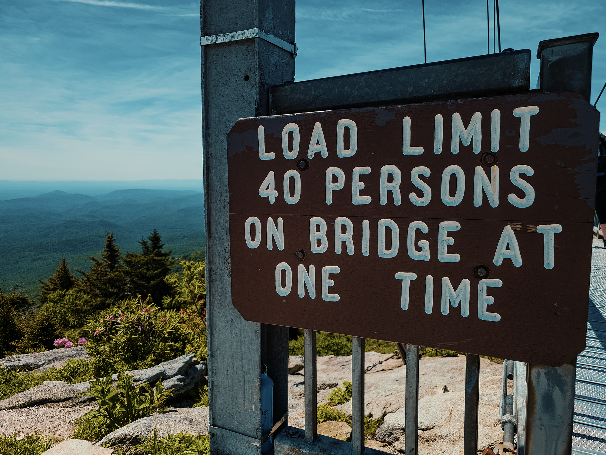
Upon approach, you’ll see signage that says LOAD LIMIT 40 PERSONS ON BRIDGE AT ONE TIME. That’s not really accurate: the bridge can accommodate well over 1,000 persons at one time! (Assuming they could all fit!) After its original construction in 1952, Hugh Morton noticed people hesitated to use the bridge when two or three people were ahead of them. That’s why he put up a sign assuring visitors that the bridge could carry 40 people safely at a time. I’m not sure why Morton decided on 40 versus, say, 80, or even 800, but I’d guess that many people (or more) at a time would make things too crowded to enjoy.
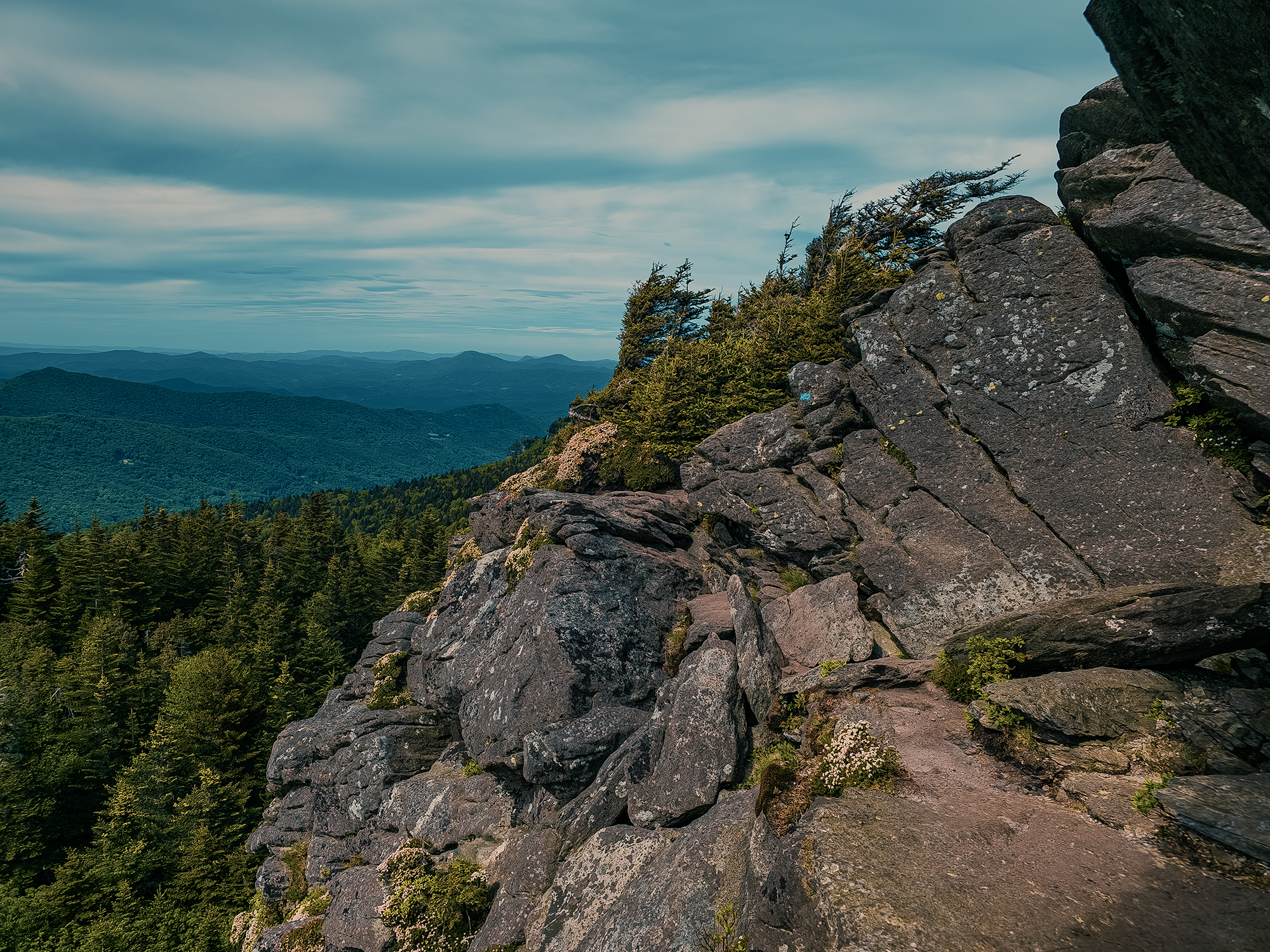
Grandmother View
Next, we took the Bridge Trail (which runs under the bridge in a series of switchbacks) to the Black Rock parking lot, and from there we followed the Grandfather Extension Trail for less than 150 ft before veering right onto the Black Rock Trail. The Black Rock Trail runs southeast for about 9/10 mi and deposited us onto a flat rock face with views of the aforementioned Linn Cove Viaduct about 1/2 mi to the east.
From Grandmother View, we backtracked to the Grandfather Extension Trail and hiked just over 1/2 mi to the Grandfather Trail. Right about here is where yesterday’s fatigue reasserted itself. It’s just over 300 ft of elevation gain over that 1/2 mi, but I felt uncharacteristically spent! I had to go slower than “normal,” but I caught up with the other guys (eventually) along the way to MacRae peak.
MacRae Peak
Here’s why we took the Underwood Trail down to the Mile High Swinging Bridge: this portion of the Grandfather Trail is ladder city! Personally, I think it’s more fun climbing up ladders rather than down. That sign we saw at the Profile Trail parking lot? This is the place it was warning us about. (I mention it in the photo captions, but thanks again, Matt M., for snapping these photos!)
At “lower” elevations, most of the forests here are various hardwoods, but as we ascended, we returned to the rarer spruce-fir variety. Typically more at home in the colder climate of the northeast, pockets of such forests do survive in a few places across the southeastern United States (usually above 4,500 ft in western North Carolina). I enjoy them in large part because they remind me of the woods where I grew up (in central Maine).
Less than 1/2 mi after the split between the Underwood and Grandfather Trails, we reached the ladder to MacRae Peak (5,735 ft). While I suppose it’s possible to boulder to the top of MacRae, that’s probably not the best idea, and fortunately, there’s a ladder for that. At the top, the wind picked up. While resting up here, I had my eyes closed, and for one reason or another I started singing Elvis’ “Can’t Help Falling in Love.” I didn’t realize it, but I had an audience: others had joined us on MacRae. I just hope they were fans of the King!
Down from MacRae, we reached the split with the Underwood Trail in about 400 ft; from there, it’s about 7/10 mi back to our “base” at Calloway Gap. The doe from the morning reappeared—I’m assuming it’s the same one—but she didn’t hang out with us for very long. I don’t blame her. At this point, I’d exhausted all my reserves for the day. The others cooked and ate their supper: I just sat in my camp chair. By the time I mustered up enough energy to prep my own supper, three of the others left for Calloway Peak, about 1/2 mi (one way) from Calloway Gap. I think I was asleep by the time they returned.
Day 3
I think it was raining when we woke up on Day 3. Nothing torrential, just wet. And I didn’t bring my rain jacket. Shucks. We made quick work of breakfast, then packed everything up and headed down the Profile Trail. Spruce-fir became broad-leafed hardwood forest. Maybe it’s because we were losing elevation, or maybe whatever I’d been sick with had run its course, but I felt much better this morning than I had the last couple of days. I even managed to get ahead of the guys for a while—long enough to record Brian D. hiking past the camera while declaring his affection for beans.
We reached the split between the Profile Trail and the Profile Connector and, like before, stayed on the Connector. I think the rain had stopped by now. We crossed the Shanty Spring Branch and returned to the parking lot.
And that’s it for this trip. There’s another route—a much more aggressive route—that requires hiking all three routes to Calloway Peak. It’s called the Grandfather Trifecta, and it’s roughly 18 mi total. That’s up and down the Profile, Grandfather, and Daniel Boone Scout Trails! If you were going to do it over two or three days, I suppose you could drop your pack at strategic locations to avoid carrying all your gear for the entire length. Now I’ve got myself thinking. Definitely something to consider!
Catch the whole adventure on YouTube! Please consider subscribing (if you haven’t already). Thanks for stopping by!
Pingback Spending the night on a little island in Lake Onawa (ME)
Pingback Backpacking through parts of Shenandoah National Park (VA)
Pingback Backpacking in Jefferson National Forest (Mount Rogers, Wilburn Ridge, the Scales, and more) (VA)