We headed toward Lake Tillery for the weekend; there, we a) took advantage of Alan H.’s hospitality, and b) planned to hike a roughly 15 mi loop through the southern parts of Uwharrie National Forest. There were ten of us on this hike! Mark D., Brian D., Rob E. and his son, Alan H., Jason L., Matt M., Marcus W., Kevin W., and me. Not since that one time after graduating high school, when the middle schoolers needed additional chaperones for Borestone Mountain, have I been on a hike with so many people!
Uwharrie National Forest gets its name from the Uwharrie Mountains, which likely get their name from the tribe that once called this region home—according to local legend, anyway. Likely a Siouan nation, although the linguistic roots of the name Uwharrie aren’t certain.
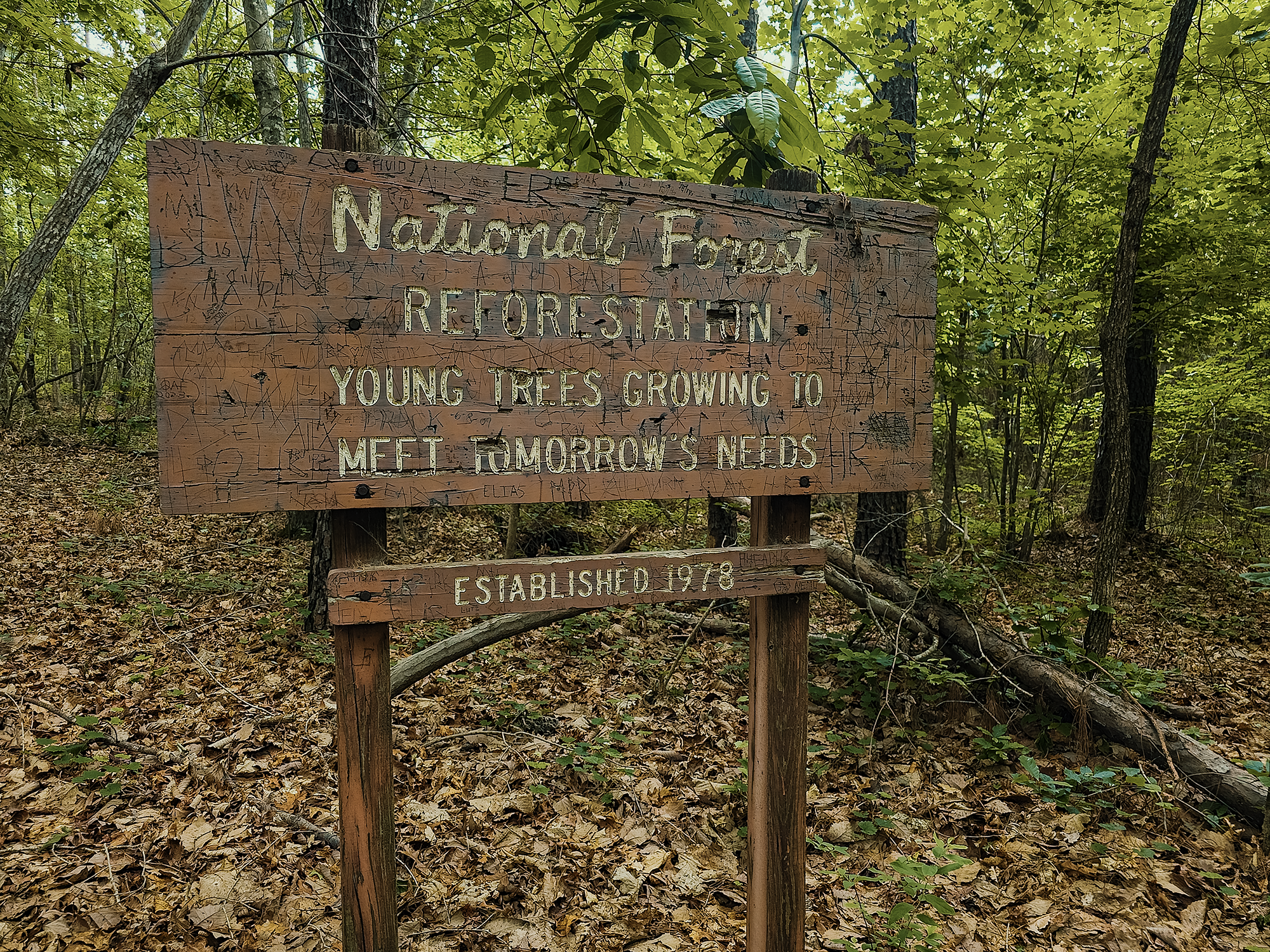
We’re in the southeastern mixed forest ecoregion: mostly pine and oak, although of course there are other species as well. You can almost tell by the arrangement—that’s not the right word—of the trees that we’re in a mid- to late-successional forest (no recent clear-cutting). Uwharrie is a “working forest,” meaning among its other multiple uses, the Forest Service selectively logs portions of it—usually for thinning overmature stands or salvaging dead or damaged trees.
Dutchmans Creek Trail
After my last hiking debacle, where the Neusiok Trail carved another “hikers defeated” notch on a cypress tree somewhere (probably), I wondered how things would go today. Fifteen miles is significantly less than 21 mi 24 mi, sure, but it’s not nothing! I got myself a pair of new shoes—Topo Athletic Traverses—and hoped the wider toe box would give me that missing “wiggle room.”
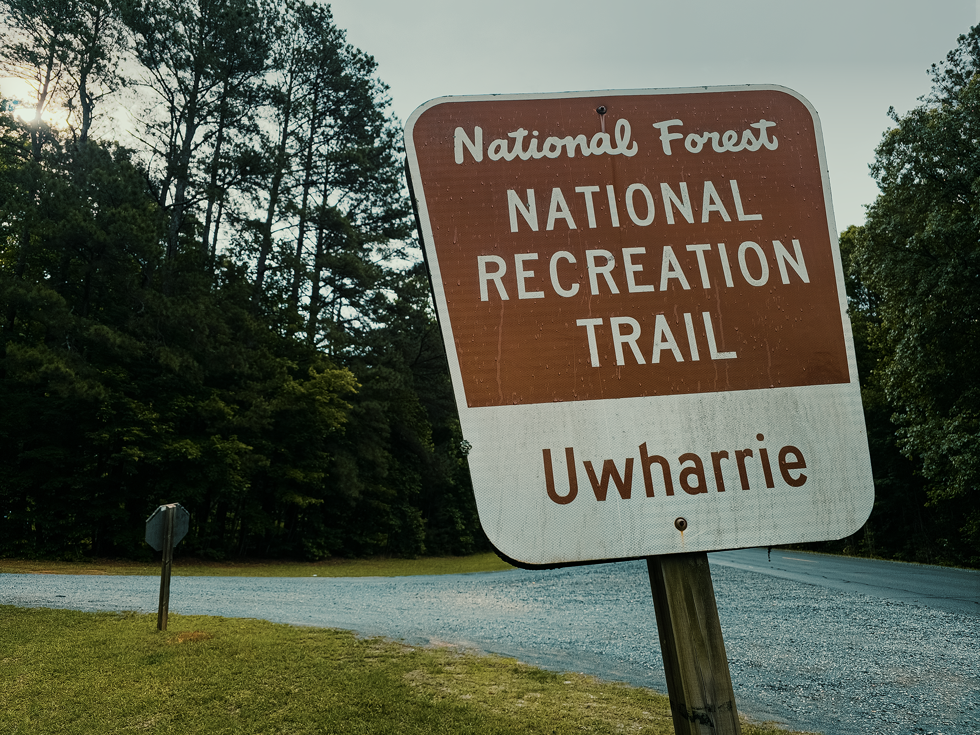
We got on the trail probably right around 08:45 hrs. If you look closely at the sign in the above photo, you can make out residual water droplets from the night before. The sky was overcast, but the chance of rain continued to drop: originally, we heard 98% at 09:00 hrs; as 09:00 hrs got closer, that dropped to 50%. Still, we weren’t expecting more than 2/10 in. (Turns out it didn’t rain today!)
From the parking area just off of NC 24–27, you’ve got a few options. We went northwest along the Dutchmans Creek Trail (DCT). Part of it: the whole thing extends another 5 mi beyond the bounds of our route. There’s more elevation change along the DCT than, say, the Neusiok or Weetock Trails, but it’s not too bad, maybe 1600 ft or so over the course of the whole thing—well, the entirety of our route, which included some other trails as well.
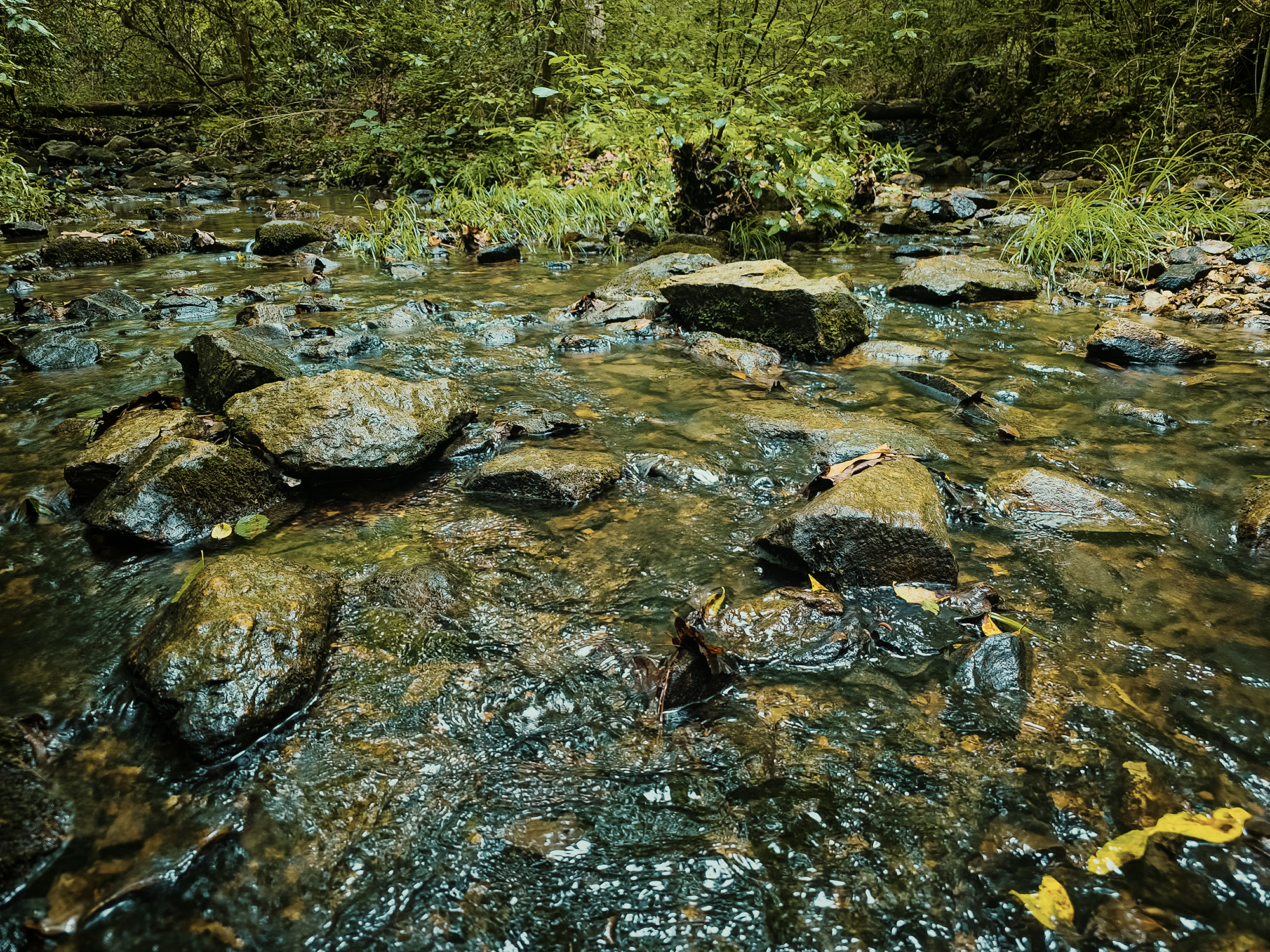
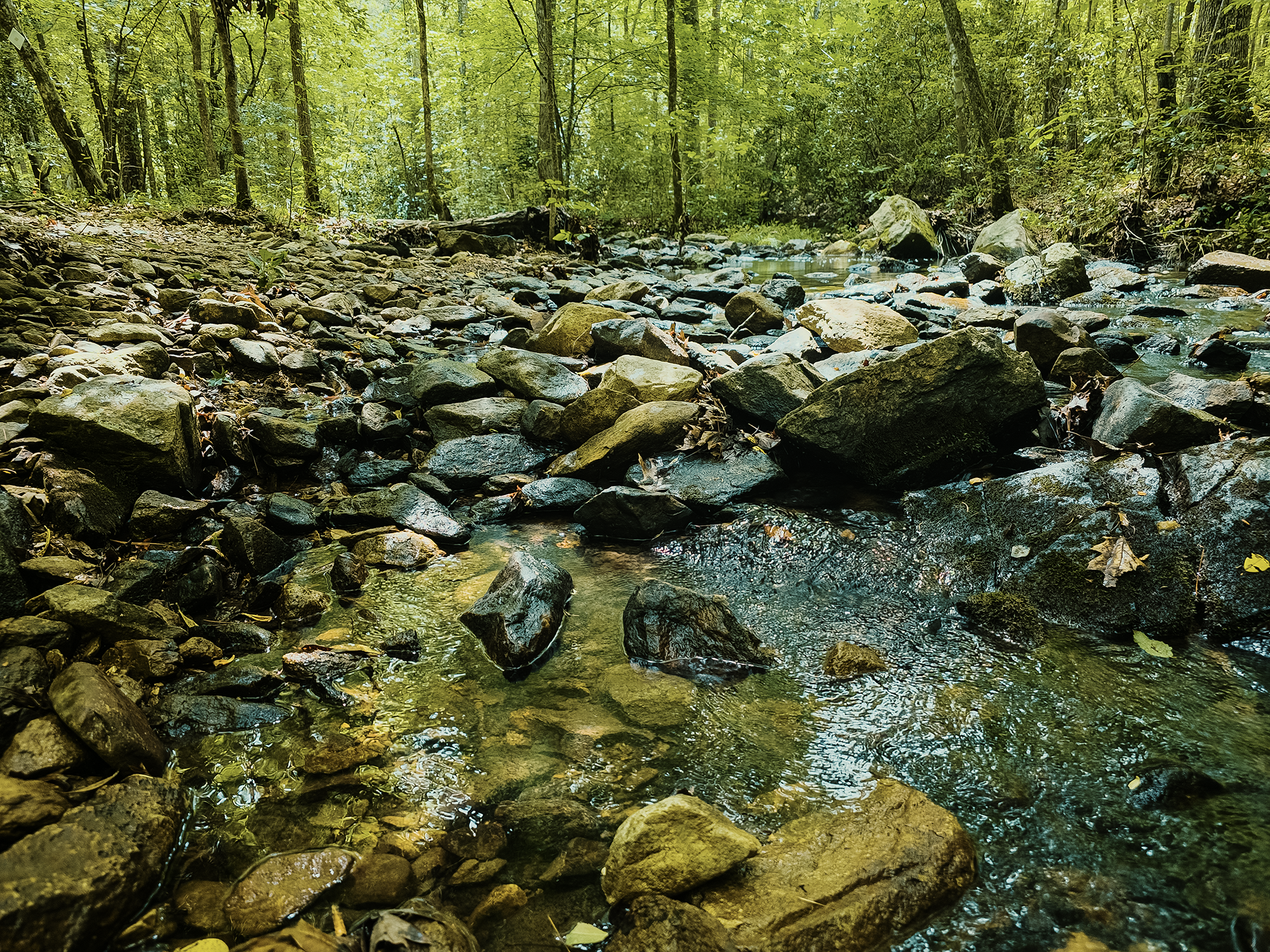
There are a couple of easy-to-cross streams along the DCT, including Dumas Creek, which I think is what I’m standing in in the following photo! (It might be Big Island Creek from farther up the trail.) I think there may have been a few unnamed crossings too, but all of them were pretty straightforward.
Oh yeah, you might notice I’m referring to it as Dutchmans Creek instead of Dutchman’s Creek. Some maps still use the possessive apostrophe (including AllTrails and OnX), but…they shouldn’t! The federally-recognized name is, in fact, Dutchmans Creek. I read that there are, I think, maybe five places in the United States where the apostrophe was “grandfathered in” after the rule change (1890). Dutchmans Creek isn’t one of them!
Okay, enough with the English or grammar or whatever lesson!
As pockets of forest switched from thick to thin and back, we did pass several locations where people had camped. Most such sites had stone fire rings still in place and plenty of flat spots for tents or sturdy trees for hammocks. At least one such place—I’d bet there are others as well—abutted a creek (probably Dumas Creek), and to me that seemed like a perfect place to sit around a fire and forget about the world for a night.
It’s embarrassing, but in the video, I refer to a portion of the DCT as “Hallucination Hill.” While there is such a hill on the DCT, it’s farther north than we hiked today, and about twice as long. That’s what happens when you don’t know how to use the Internet. Yikes.
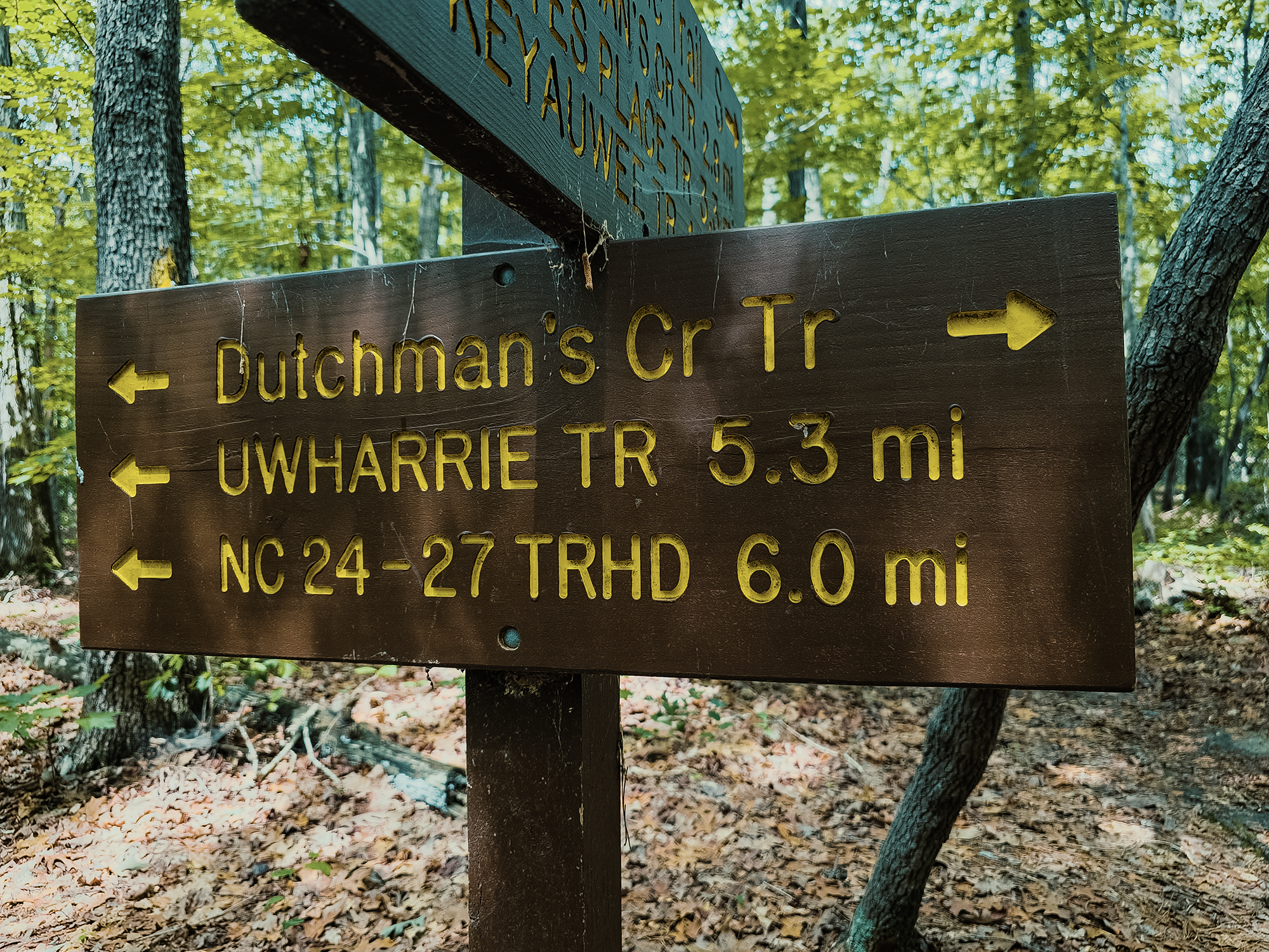
Right around 5.8 mi, we turned left off the DCT and onto the Uwharrie Trail.
Uwharrie Trail
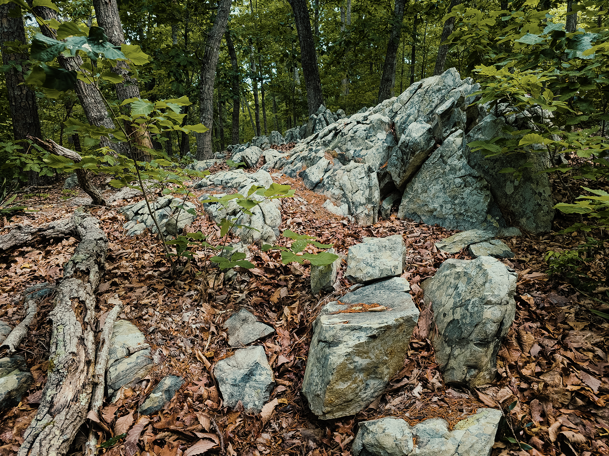
I mentioned the “Uwharrie Mountains” earlier. If you hike these trails, you’d probably wonder where to find them, because there is not a lot of elevation here! I think the highest point we crossed today was just over 750 ft! That said, there are still some pretty cool rock features beside (and in some places across) the trail.
After just little more than 400 ft on the Uwharrie Trail, we crossed Big Island Creek. (We’d crossed it via the DCT as well.) After that, we hiked about 1.6 mi through the same gently rolling hills and similar mixed forests to the intersection between the Uwharrie and Keyauwee Trails. I don’t mean to come across as indifferent (or worse) about the trail! Sure, it doesn’t offer views from 6,000 ft—or even from 1,000 ft—but it’s still a pleasant walk in the woods. I’d probably be lying if I said I didn’t prefer routes with jaw-dropping, awe-inspiring vistas, but I’ve learned that that doesn’t mean other trails with less “wow factor” don’t have anything to offer!
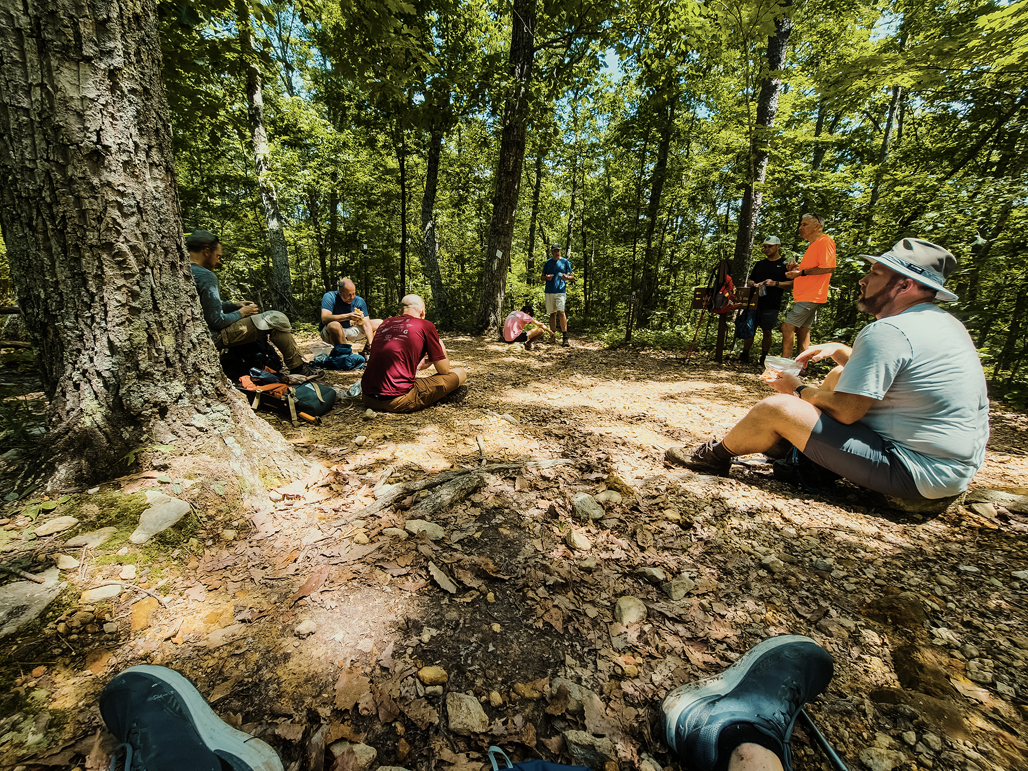
We rested at the intersection for a while. Long enough to enjoy lunch. When I planned this route, I’d initially wanted to hike about 2/10 mi up the Uwharrie Trail to the “summit” of Dennis Mountain (and 2/10 back), but while we ate, a handful of other hikers “descended” (that’s too strong a word!) from the direction of Dennis Mountain (not quite 720 ft), and their, uh, uninspired description didn’t help me make the case for it! I guess I’ll have to check it out some other time.
Keyauwee Trail
After lunch, a handful of guys weren’t too keen on the thought of hiking another 6 mi, so those four stayed on the Uwharrie Trail (for another 3.8 mi—up and over Dennis Mountain, ironically!) while the other six of turned right onto the Keyauwee Trail.
The Uwharrie Trail gets its name from the Uwharrie people: the Keyauwee Trail gets its name from the Keyauwee, a tribe that once lived north of here near the Uwharrie River. That location, nestled in a valley and surrounded by cornfields, proved a tempting target for neighboring tribes. After 1701, the Keyauwee joined other tribes—probably not the ones they deemed threats; in 1714, they journeyed to Fort Christanna in Virginia. Soon after, they left Fort Christanna and joined the Saura (Cheraw) and the Peedee (in South Carolina).
I don’t remember what prompted it, but somewhere along the hike down the Keyauwee Trail, Brian D. once again proclaimed his inestimable devotion to beans. Then he told my camera to turn itself off! Rude! (Ha ha.)
Uwharrie Trail (again)
We hiked the Keyauwee Trail for about 4 mi, then took a sharp right back onto the Uwharrie Trail, and that’s what we stayed on until we returned to the parking area (2 mi). The four of us who didn’t take the Keyauwee Trail weren’t in the parking area, but neither was their vehicle. Either they all got lost and someone stole their car, or they made it back and were already gone. Turns out it was the latter. Good.
The Uwharries once housed a respectable number of mountain lions—pumas, catamounts, cougars, whatever—but it’s been a long, long time since they’ve been “officially” reported around here. That said, there have been a number of unconfirmed sightings in the region (most likely farther north, toward the Birkhead Wilderness). Hopefully that means they’re returning to the Uwharries.
We didn’t see any.
After a little more than 15 mi in new shoes (and new socks), my feet felt surprisingly great! I don’t know if I would have wanted to do another 15 mi right then, but even afterward, I had no blisters. (I’d love to say I never got another blister again, but that’s already not true.) I said at the beginning of this post that I was worried I might conk out before we finished the hike. I’m grateful that wasn’t the case!
This is a beautiful little forest (it’s the smallest of North Carolina’s four national forests), and I’ve already planned a return trip (well, a trip to the Birkhead Wilderness—but that’s still totally within Uwharrie National Forest). I appreciated today’s hike for a few reasons: 1) I learned I’ve still got some hiking miles left in me, 2) I got to hang out with a bunch of cool people, and 3) I got outdoors! That’s (almost) always a good day.
Catch the whole adventure on YouTube! Please consider subscribing (if you haven’t already). Thanks for stopping by!
Pingback Kayaking down the Deep River past Mermaid Point (NC)