One Friday after work, I threw a bunch of stuff in my pack and drove to Raven Rock State Park. It might not the most impressive state park in North Carolina, but it is a great way to take the edge off of that backpacking itch.
Day 1
Overnight camping sites require reservations. I think I made mine the day (or two?) before, although it’s possible I just showed up and hoped for the best. Either way, it worked out, and I paid the fee for Family Camp #3. I slathered on a boatload of bug spray and headed into the woods on the Campbell Creek Loop Trail.
Campbell Creek Loop Trail
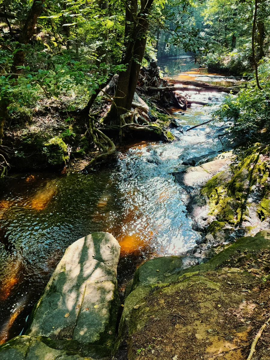
The Campbell Creek Loop Trail (CCLT) begins with a fairly gentle descent through somewhat sparse trees: whether from park maintenance or some other reason, I don’t know. What I do know is that Raven Rock State Park lies within what’s called the Fall Zone. Here, the Piedmont’s harder, erosion-resistant rocks transition into softer, sedimentary rocks. Just shy of 1/2 mi in, the slope’s incline drops more sharply: another 1/10 mi or so and I came to a foot bridge that spans Camels Creek.
Wait—what?! I’ll be honest: Until just now, I thought it was called Campbell Creek! Why call it the Campbell Creek Loop Trail if there’s no Campbell Creek?! Mind. Blown.
Just past that bridge, you’ve got a choice to make: turn left and hike roughly 1.7 mi uphill or turn right and hike roughly 1.7 mi on a mostly flat trail.
I turned left.
No, it’s not because I wanted an extra challenge. It’s because I forgot what I was doing and thought that if I hiked up the steeper stuff now, I wouldn’t have to hike it the next day. Of course, the next day, I’d be coming from the opposite direction, meaning what was up would be down. It’s worse than that though. Yes, you’ll reach Family Camp either way, but the incline from the right side is much gentler. Shucks.
Family Camp #3
Still, it’s a nice hike over rolling hills through hardwood forest. About 1.7 mi from the bridge (and maybe 100 ft higher elevation), I reached Family Camp #3. I didn’t think I had a lot of daylight left, so I dropped all my stuff and set up my tent.
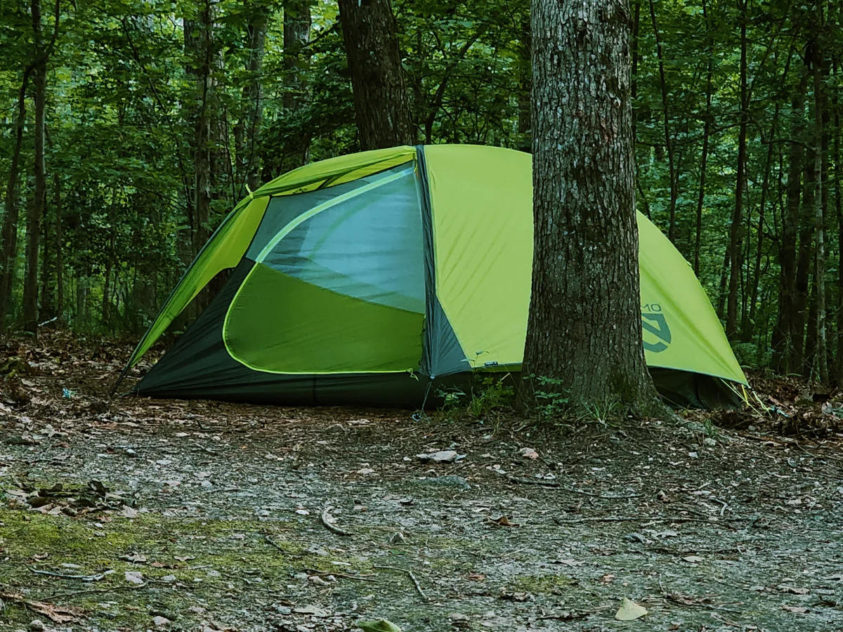
I knew these sites had fire rings, and even though it was summer, I was looking forward to a crackling blaze. I collected some downed wood, twigs, and tinder, arranged my materials, and…failed to keep a fire going. Everything was damp, but I still think I should have managed. Even blasting it with my camp stove didn’t work. I probably shouldn’t admit any of that, but now I carry a couple of fire starter things whenever I backpack.
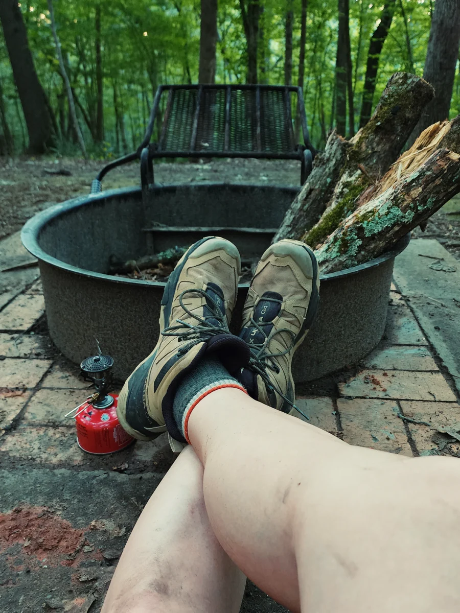
Turned out I had more daylight remaining than I’d anticipated, so I spent a little time just sitting around the cold fire ring full of unburned wood for a minute. I remember not being hungry enough to cook supper—and by “cook supper,” I mean boil water, so I put away my food and crawled inside my tent.
Day 2
I can’t remember if I slept well or not, but I think not remembering must mean I got at least a decent amount of sleep. Yeah, that sounds right.
I didn’t bother trying to light a fire in the morning. (It gets humid around here in the summer!) Instead, I fired up my stove, boiled some water, and…I have no idea what I ate for breakfast. Oatmeal, maybe? I do know I attempted to toast a marshmallow over my camp stove’s roaring blue flame, but I’m pretty sure I just burned it. I’d also brought a couple of gluten-free chocolate chip cookies, so I made a s’more sandwich. Delicious.
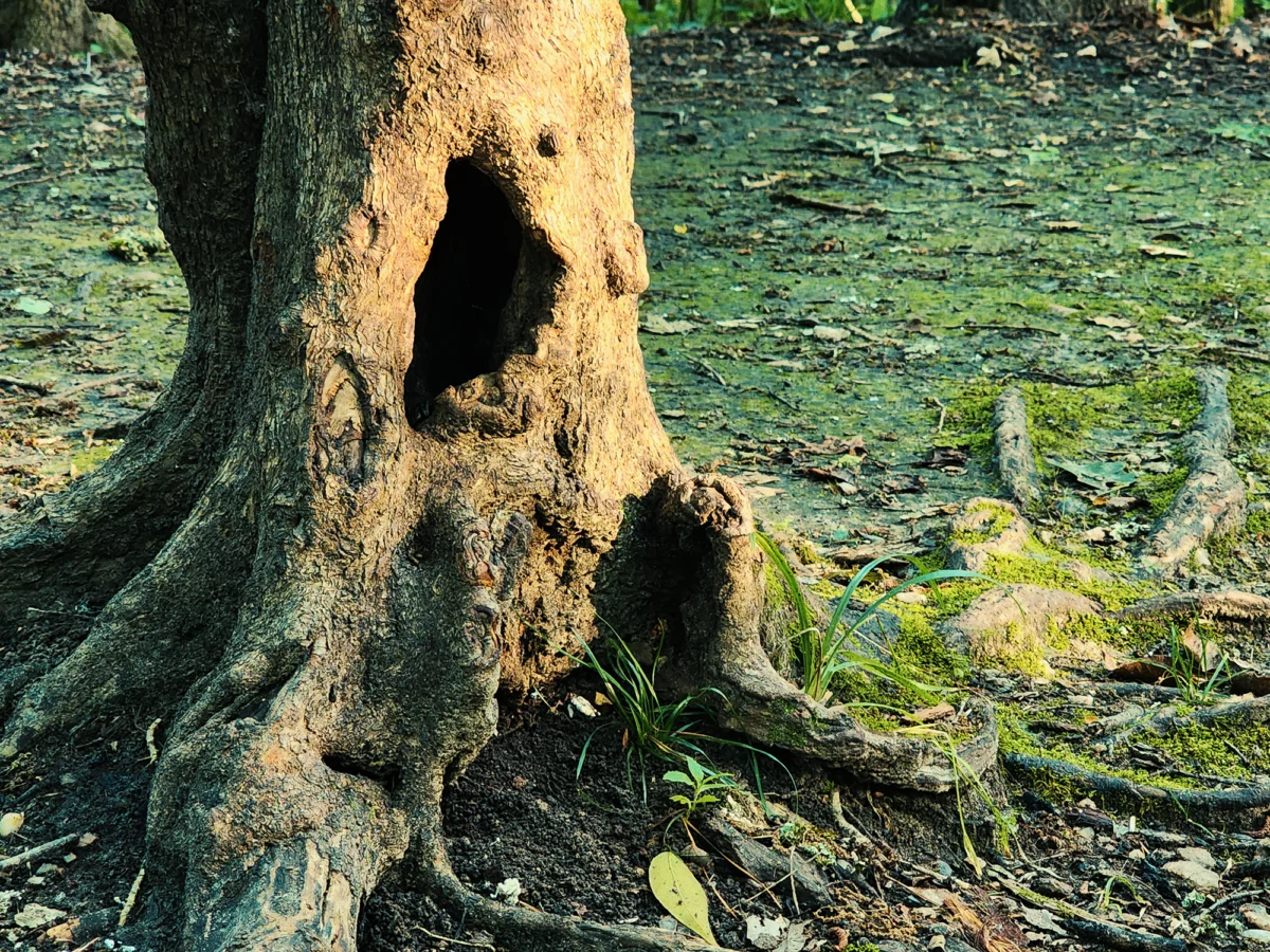
As I packed everything up, I noticed the sunrise poking through the trees and highlighting this cool, semi-hollow tree near my camp site. I snapped a photo and got moving.
Lanier Falls Trail
From Family Camp #3, I turned left onto the CCLT and followed it for about 300+ ft. I passed a Trail Life troop at a neighboring camp site as I was leaving. I’m pretty sure they were preparing a campfire, and before I reached the Lanier Falls Trail (LFT), I smelled smoke. Yes, I was jealous.
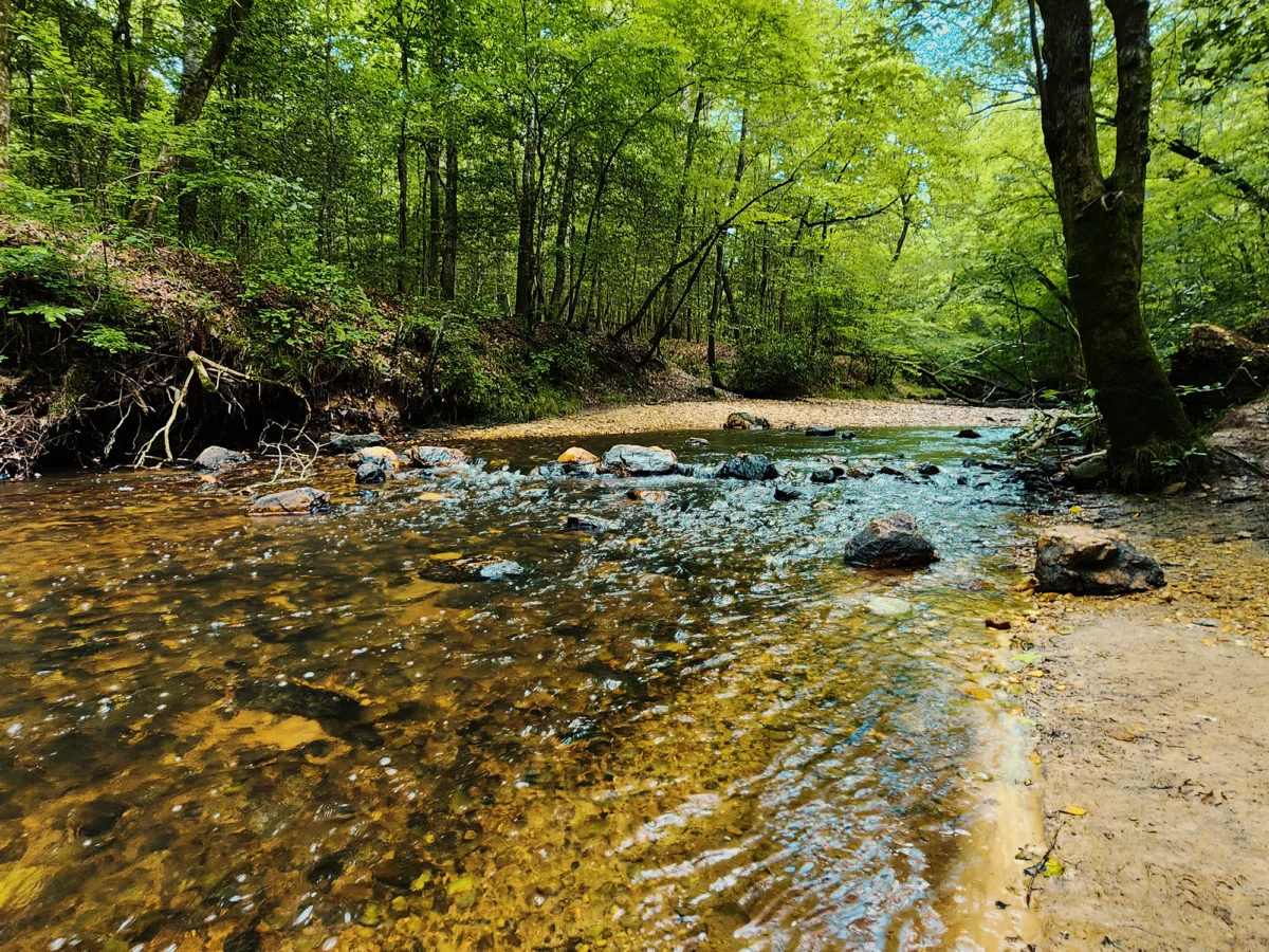
I turned left onto the LFT, which is maybe a 2/10 mi spur off the CCLT that gradually drops you about 100 ft toward the Cape Fear River and a small “break” in the riverbed (I’ve read it’s about a 2 foot drop). Depending on the river’s output, the “falls” here are either indiscernible or kinda neat. I don’t know what the Cape Fear’s discharge was that day, but the experience leaned well into “kinda neat” territory.
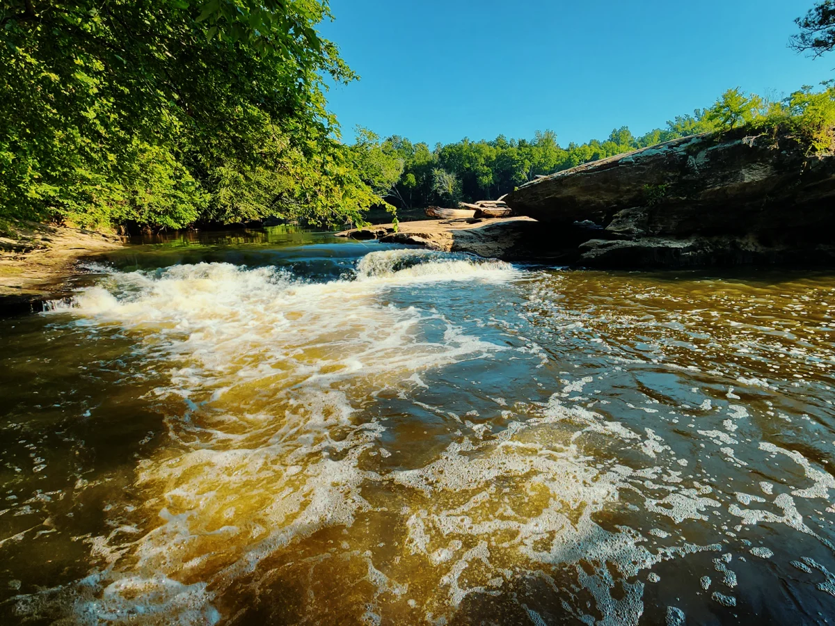
Be careful sneaking your way to the river’s edge here: there’s a narrow “shelf” of sorts that hovers just above the water (well, I guess that depends on the river’s gauge), but it’s typically slippery and muddy. I spent a little time down here, appreciating the water’s movement and the warming sun before heading back to the CCLT. From here, it’s a little more than 3/10 mi until the trail parallels Camels Creek, which it follows until you’re back at the foot bridge.
After Lanier Falls, the CCLT descends about 80 ft, and it’s a relatively flat hike back to the bridge. I enjoyed the pleasant morning weather, hiking through sun-dappled woods until I crossed Camels Creek and returned to the Visitor Center. Oh yeah, I parked at the Visitor Center. Forgot to mention that.
Fish Traps Trail
Back at the truck, I traded my full pack for a bottle of water, drove to the nearby picnic area, then headed toward the Raven Rock Loop Trail (RRLT).
Prior to the Europeans’ arrival (mid-1700s), Siouan and Tuscarora peoples made use of the land in this region, and it’s believed that they used either natural or carved channels in the river to capture fish in woven basket-like contraptions.
From the picnic area (about 350 ft elevation) up the road a bit from the Visitor Center, I started down the RRLT. Just shy of 4/10 mi later, the RRLT takes a sharp right: I stayed straight on the Fish Traps Trail (FTT) for about another 1/2 mi until I reached the Cape Fear River again (about 130 ft elevation). The RRLT (up to this point) and the FTT descend those couple hundred feet in a fairly subtle manner until the last 800 ft or so: then it drops more abruptly, reaching a -20% grade in places.
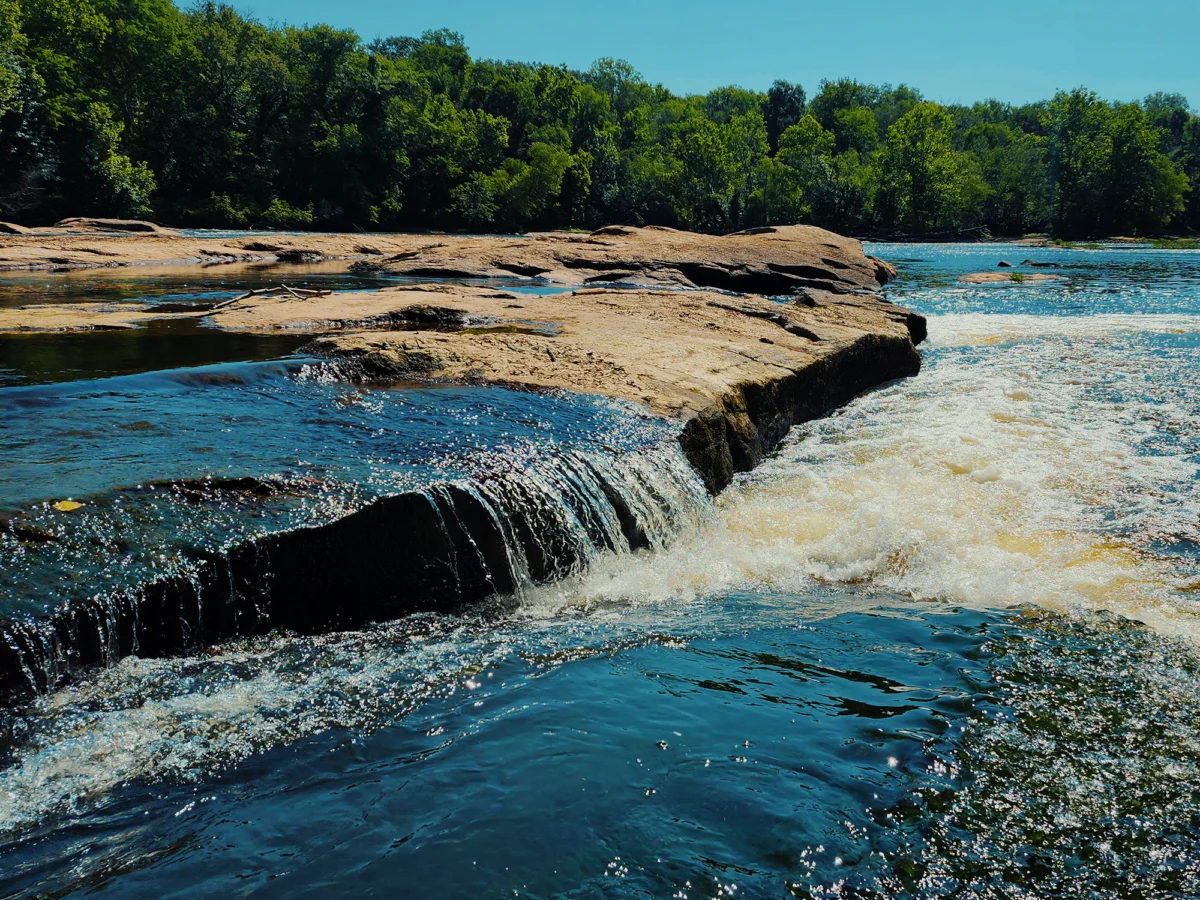
The traps themselves—the basket things—are long gone, but the channels in the rock remain. I spent a few minutes wondering if I’d risk hopping from the shore to one of the rocks across the channel. I didn’t. Instead, I headed back toward the RRLT, slipping on a slick rock along the way.
Raven Rock Loop Trail
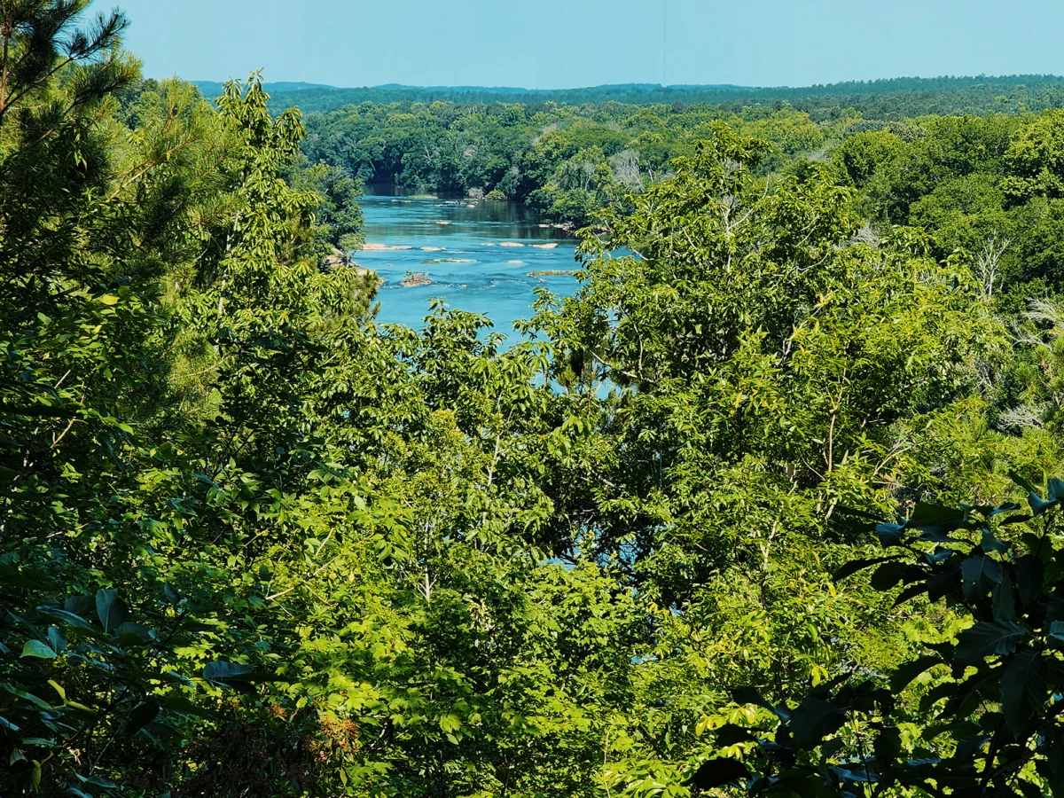
I turned left when I reached the junction for the RRLT and started up toward the Cape Fear Overlook, about another 1/2 mi ahead. There’s an overall uphill bent to this part of the trail, but it’s gradual enough that it’s not a big deal. After that 1/2 mi, I took a short spur (maybe 100 ft) to the Cape Fear Overlook. The view of the Cape Fear River from the overlook is nice in the summer, but it’s better in the fall. I remember a lot of people making use of the overlook that day, so I didn’t stay too long: just long enough to say something about Mermaid Point, about 13 mi up the river.
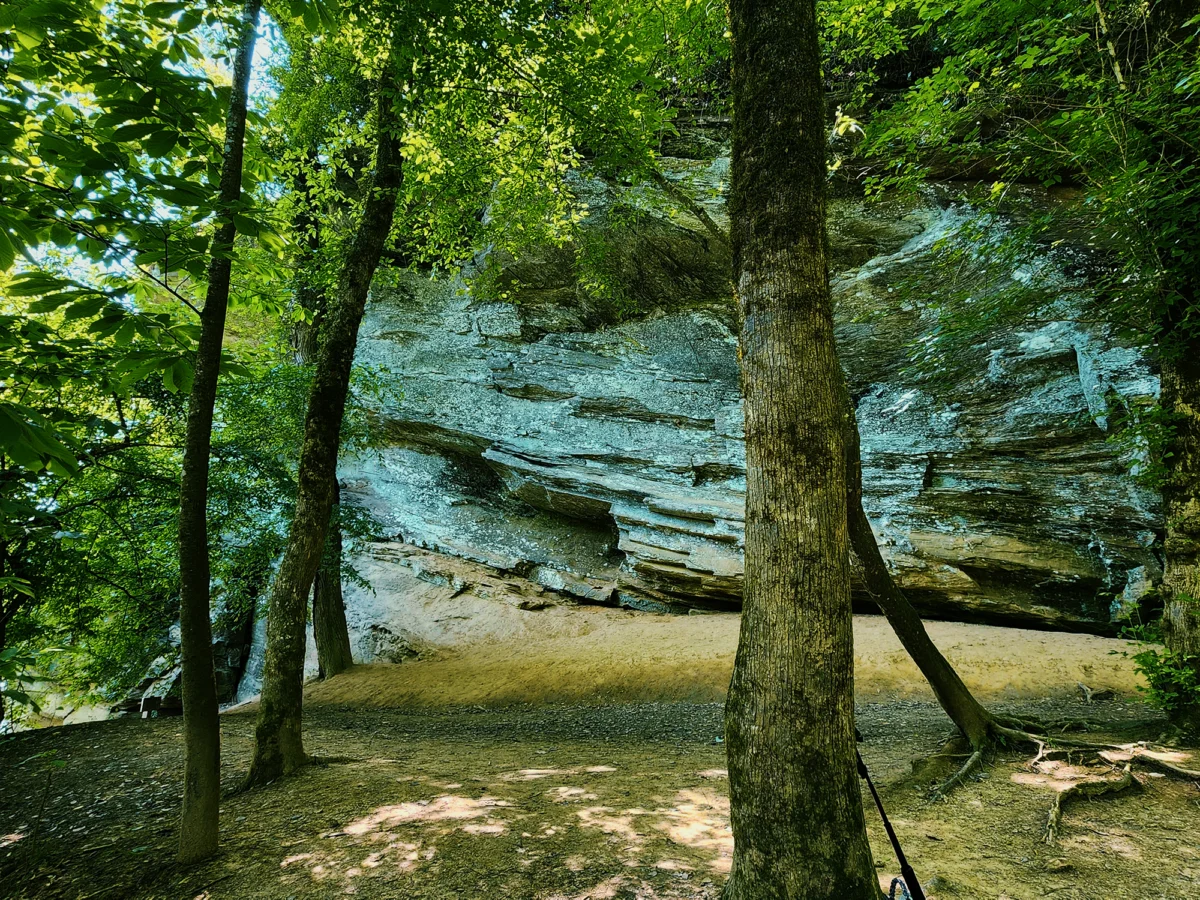
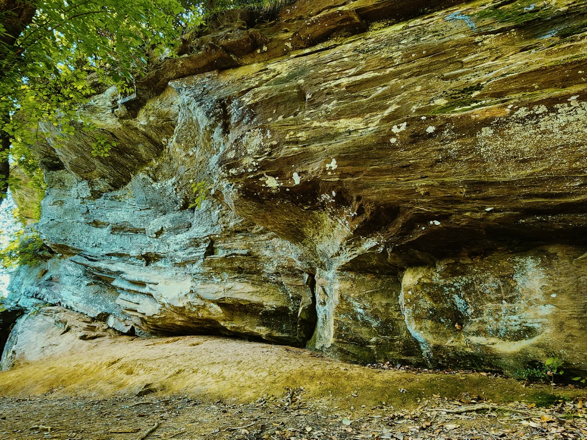
Raven Rock
I follwed the RRLT for another 3/10 mi until I reached the 136 narrow stairs (that’s far fewer than the number at Stone Mountain!) that led to the banks of the Cape Fear. At the base of Raven Rock—an immense crystalline structure that stretches about 150 ft above the ground—the somewhat rockier terrain at, say, Lanier Falls gives way to distinctly sandier dirt. You can get down to the river here, but you’ll probably get muddy, and if memory serves, it’s pretty gross at times.
This impressive cliff wasn’t always called Raven Rock. I suspect the Siouan or Tuscarora peoples had their own name for the place, but for a while people called it Patterson’s Rock. Some time prior to 1854, an early European settler’s canoe capsized nearby, and he managed to swim to shore and find shelter here. I’m guessing his name was Patterson. Later, the powers-that-be renamed it Raven Rock. (Ravens allegedly expressed an interest in the feature’s rock ledges.)
Later, I climbed back up the stairs and continued on the RRLT toward the picnic area. This roughly 9/10 mi portion of the trail is mostly flat, and after a while, the trees seem thinner. Two-tenths of a mile from the top of the stairs, I crossed over Little Creek (I think there’s a boardwalk here?) and continued the rest of the way back to the truck.
Raven Rock State Park might not be awash in features that typically attract people to such places, but I appreciate it nonetheless. Nearer Raven Rock itself, there’s another camping area called Canoe Camp, with a place to put in for paddlers paddling down the Cape Fear River. I’ve hiked into Canoe Camp before but never, say, kayaked to it. Guess I’ll just have to rectify that oversight someday.
Catch the whole adventure on YouTube! Please consider subscribing (if you haven’t already). Thanks for stopping by!
Pingback Backpacking the Tricorner Loop: Great Smoky Mountains National Park (NC/TN)
Pingback Hiking (most of) the Neusiok Trail (NC)
Pingback Kayaking down the Deep River past Mermaid Point (NC)