Not too far from Borestone Mountain, either before or after the bridge over Big Wilson Stream (depending on whether you’re coming from Monson or Willimantic), there’s a small day-use area right along the banks of Little Wilson Stream. When I was a kid, this place was a campground: I remember spending the night here at least a couple of times. Since then, different owners have done different things with it, and while overnight camping is no longer permitted, at least it’s accessible again.
Day 1
Little Wilson Falls Road, which branches off of Elliotsville Road, is, well, it’s terrible. Pitted and potholed and drastically uneven, it’s better suited to ATVs than cars and trucks, but that’s just how it is now! I drove my truck about 7/10 mi toward the parking/picnic area and realized I couldn’t park there.
Well…shoot.
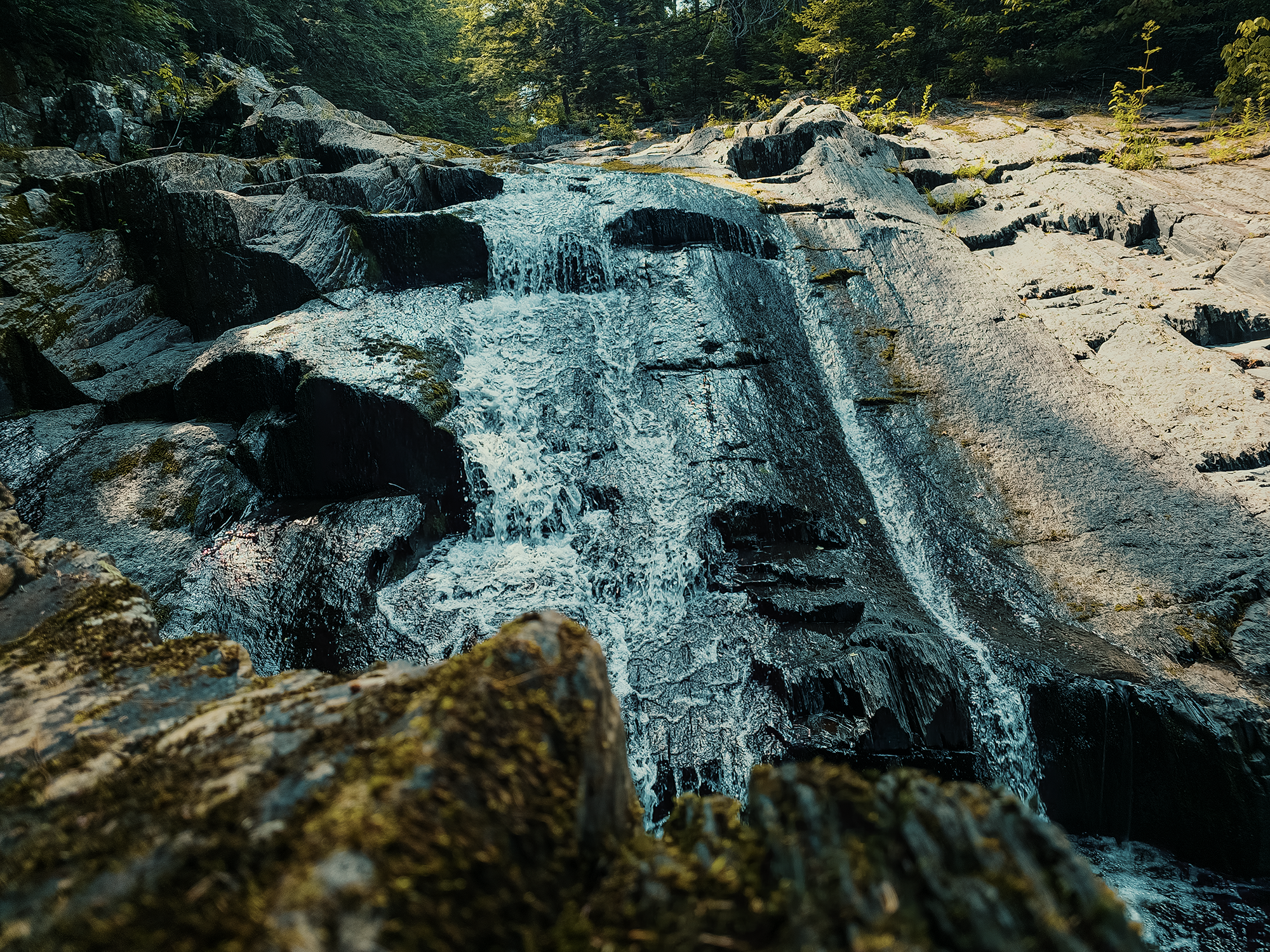
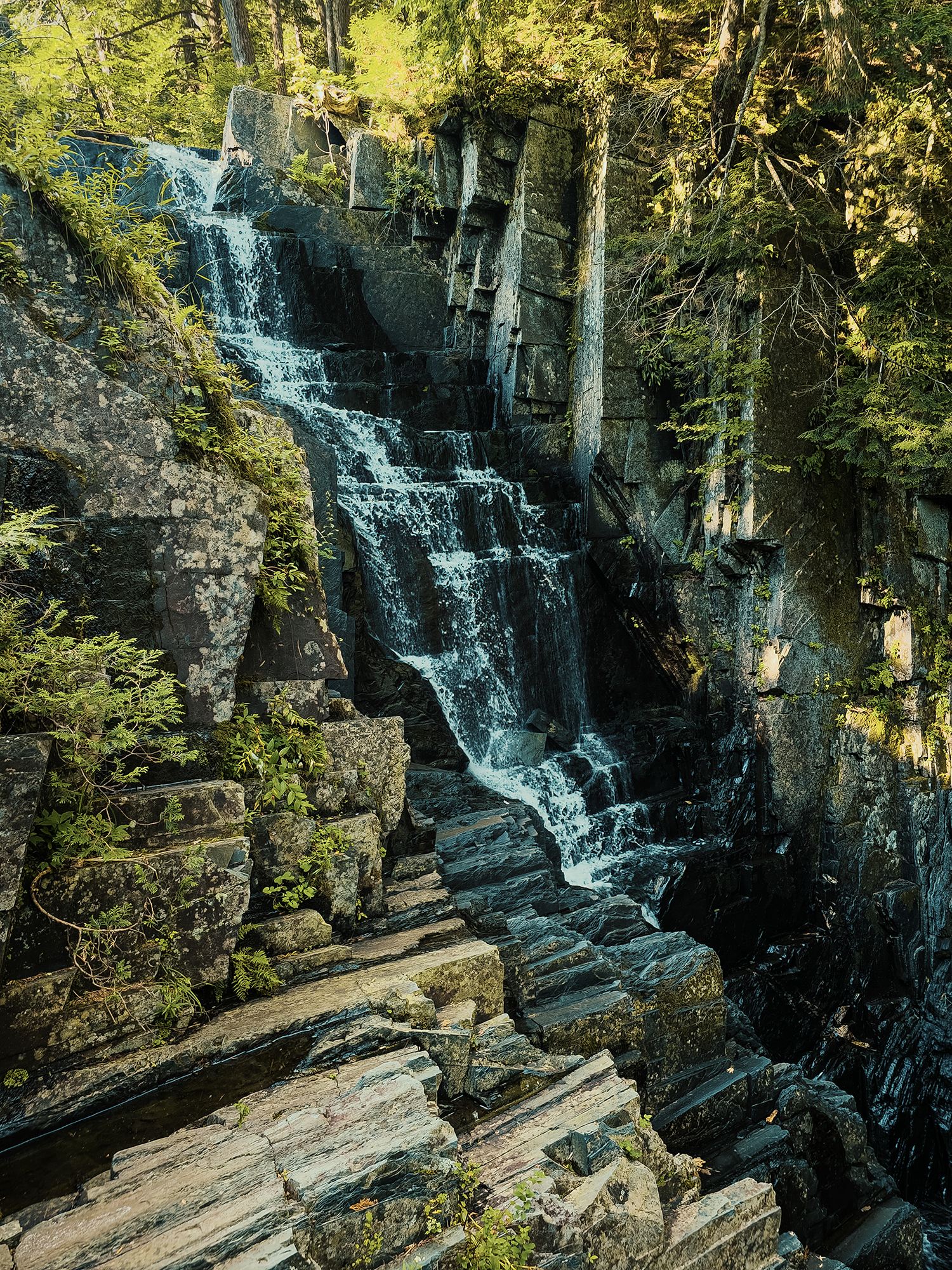
Lower Little Wilson Falls
I tucked my pack next to the lone picnic table, drove back to the information kiosk, and hiked back in. No longer at risk of being towed (probably), I hopped across the rocks toward the opposite bank for a better view of the lower run of Little Wilson Falls. I thought I’d brought this little tripod-thing for my phone, but, well, I didn’t, so all of my attempts at longer exposure shots of the falls are terrible. Here’s the least bad:
I don’t remember how old I was when I first learned that these lower falls were not the entirety of Little Wilson Falls. I’m pretty sure I already lived in North Carolina by then, so…too old. On a previous trip up to the upper run—maybe the first such trip for me—I saw what I assumed would be the perfect place to camp, and I knew I’d have to come back here one day just for that. (I mean, I’d come back here anyway for any number of reasons, but that’s one of them!)
Today, the water was lower than I remembered it, but this isn’t the first time levels have fluctuated over the seasons. I got out my drone and flew it over these lower falls for a while, and in one shot I’m flying over a pool at the base of the falls: this spot is a great place to cool off in the summer! I don’t know how deep the water is here, but there used to be a rope dangling from a tree branch: I used to swing out over the water and never touched the bottom after splashing down.
In hindsight, I probably should have allowed myself a few minutes for a dip before starting—or continuing: that 7/10 mi counts!—toward the upper run, but it was already after 1600 hrs, and I wanted enough daylight to adequately explore those bigger falls. Strapping into my pack, I started up the trail.
Little Wilson Falls Trail
From the picnic area and the lower falls, it’s almost exactly 1 mi through northern hardwood-conifer forest along the Little Wilson Falls Trail (LWFT) that parallels the stream for most of its length. It’s all uphill, but it’s minor, not quite 300 ft of elevation gain at the junction with the Appalachian Trail (AT).
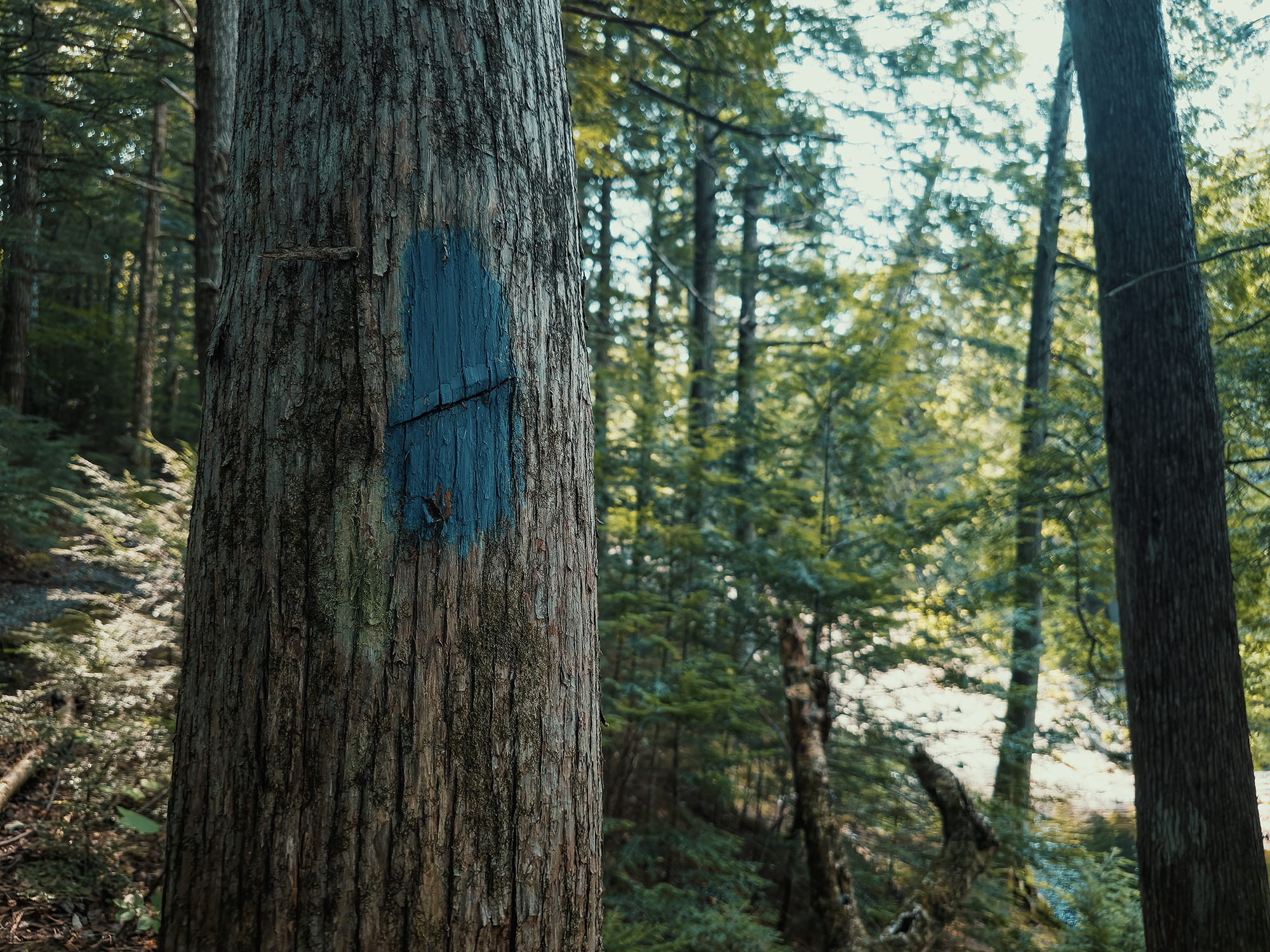
Most spurs or side trails “officially” associated with points of interest accessible from the AT are blazed with blue, while the AT itself is blazed with white. That’s not universal though: some states or regions use different blaze colors. In Maine, however, most such trails bear that distinctive blue paint:
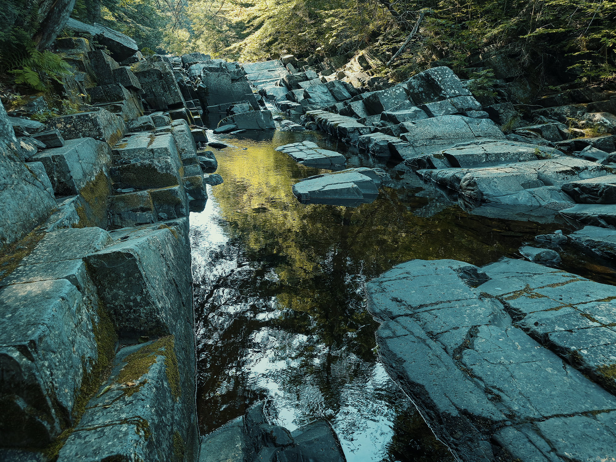
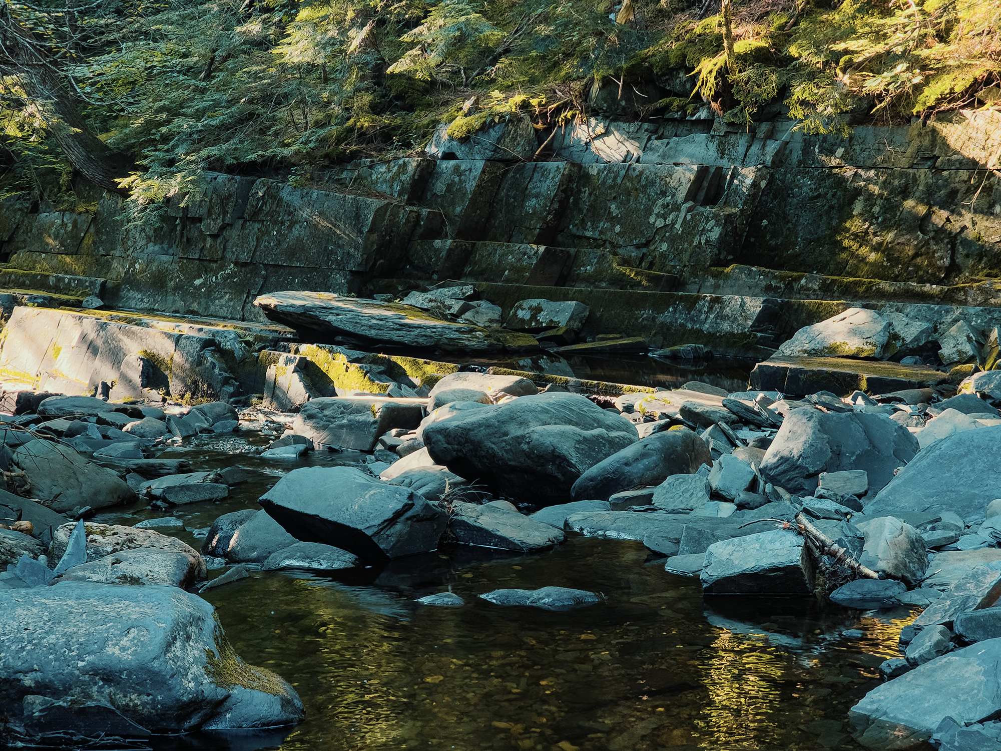
Not too far above the lower falls, maybe 300 ft to 400 ft in (and probably before and beyond), you’ll come across these short social trails that bring you directly to the water—and the curiously cubic phyllite stones that function as the streambed. (I think I mistakenly referred to them as slate in the video.) Even as a kid, these rocks amazed me: with just a little imagination, you could picture these places as ancient ruins from some long-forgotten kingdom!
That’s not the case, however. Phyllite’s metamorphic structure favors fracturing along very clean planes, imparting that almost man-made quality to their faces. You’ll see such features frequently along the lower portion of the stream, whether bank or bed:
After that mile, I came to the T-intersection with the AT. I could feel the sun setting, and I thought if I tried to explore the upper falls tonight, I’d run out of daylight. The place where I wanted to camp was in the opposite direction from the falls, but only about 600 ft, so I opted to set up camp and return this way in the morning.
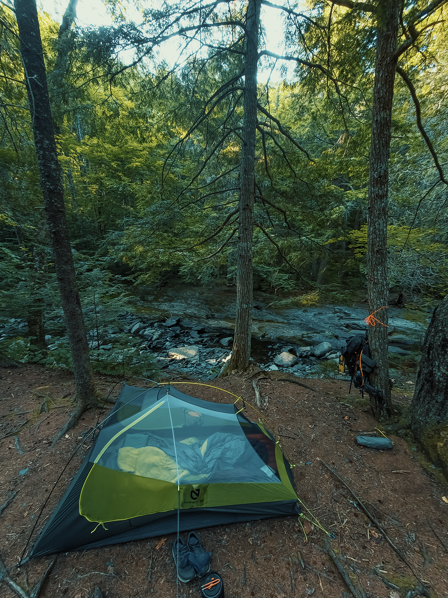
There’s a really cool stone staircase, probably a little shy of 100 ft of elevation change, between this junction and the campsite. Descending the stairs, I was thankful to see that no one had beat me to it! It’s probably just about 100 ft past the stairs, and maybe half that set back from the trail. That’s closer to humans than I prefer to camp, but other than that minor “flaw,” this site was nearly perfect!
I didn’t count them, but there were several flattened spots for tents, and likewise enough trees for hammocks for more than a few people (not an army, but four or five, maybe a couple more). I pitched my tent just above the stream, just a couple of feet from the edge of a vertical drop onto Little Wilson’s rocky bank.
Near the middle of the site sits a large stone fire ring—and around that fire ring, someone positioned slabs of rock to serve as chairs! After getting my tent set up, I explored the stream a little more (there’s a bend here that features more of those phyllite stones), spending a few moments just…enjoying everything, then I sat in one of those “chairs” to prep dinner.
While I was boiling water and rehydrating chili, I saw a handful of people pass my site. I mean, it’s July, and this is the AT: I probably shouldn’t have been surprised! After dinner, I climbed inside my tent and called it an evening.
Day 2
I can’t remember what time I woke up, but the temperature had dropped during the night, enough to make my thankful I’d remembered to bring a jacket! Before I left the tent, I heard a couple speaking as they hiked NOBO on the AT. Their voices had faded by the time I exited, so I returned to the bend in the stream to see the sun filtered through the leaves. Beautiful. After that, I started making breakfast, and I heard familiar voices: it seems that couple from before had gotten turned around. We exchanged hellos, and they were off again.
Upper Little Wilson Falls
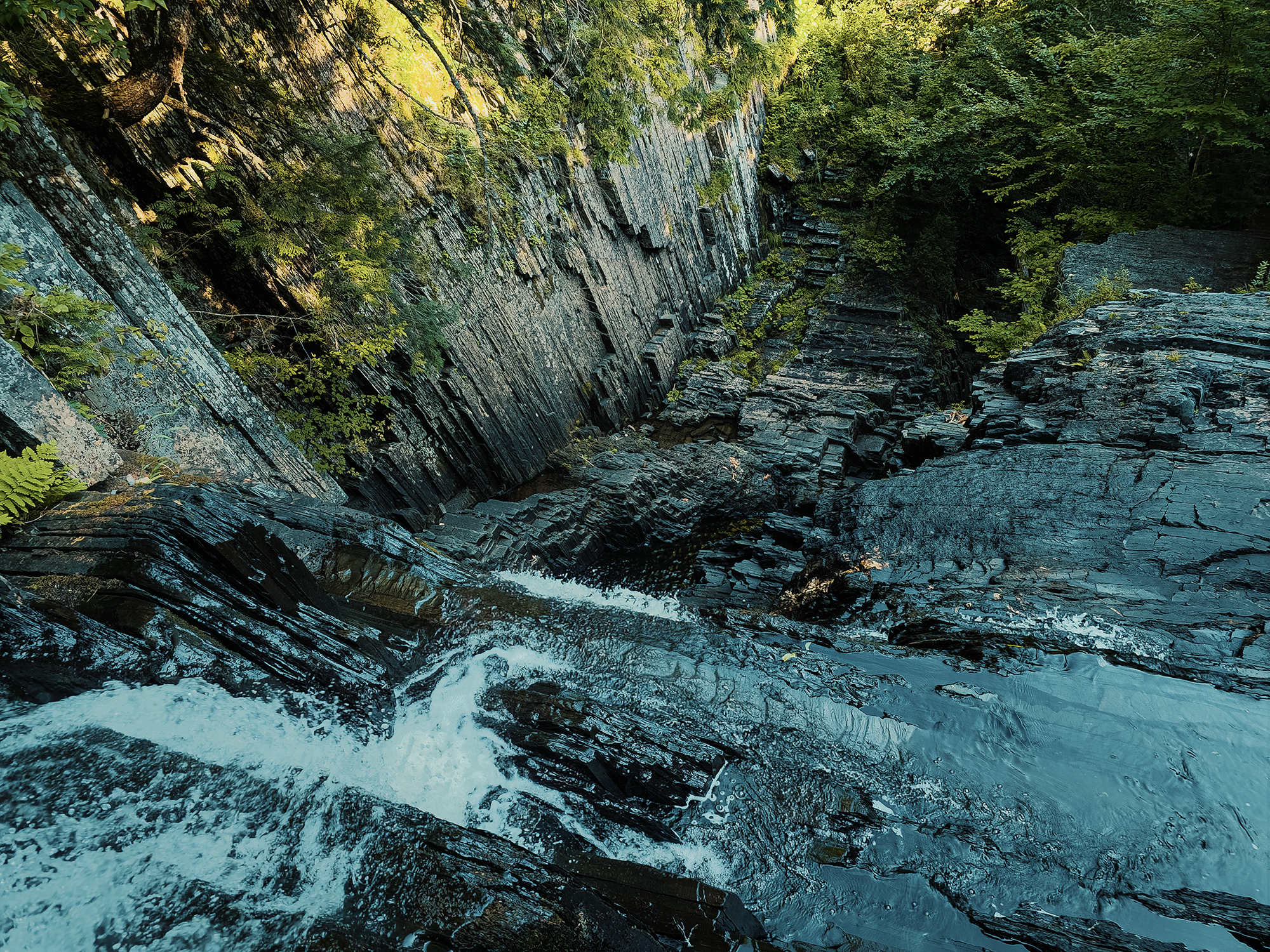
I packed up all my gear and headed up those stone stairs toward the Upper Little Wilson Falls. I’d originally intended to stash my pack behind a tree or a rock or something since I’d be coming back this way later in the day, but it just seemed like there were too many people, so instead, I carried it all.
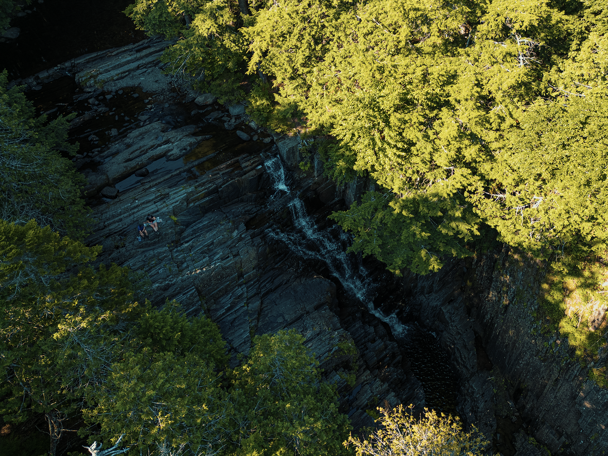
When I first arrived at the upper run of the falls, I thought I was alone, but by the time I had my drone set up, I noticed someone above me, sitting down at the cusp of where the water turns vertical. I hiked up and asked if it’d be all right with her if I captured some drone footage. It would be all right with her. Great!
I returned to my equipment and snagged some drone footage from between the gorge through which the falls run, then captured more with my handheld (or tripod-mounted) camera.
While enjoying these falls, I thought about people who might have been here in centuries past. It’s probable that this region rests within the lands of the Wabanaki Confederacy, most likely the Penobscot Nation. In my research, I discovered that the Penobscot viewed moving water as a thin place, a space where the boundaries between physical and the spiritual worlds blur, where the seen and unseen come together.
They viewed other places of transition with similar respect: the edge between field and forest, between land and water, between earth and sky. I’m not trying to presume too much, nor claim to know the ins and outs of Penobscot spiritual beliefs, but standing here, next to these falls, it’s not hard to understand their reverence for such places.
Appalachian Trail (AT)
Leaving the Upper Little Wilson Falls behind, their roar echoing in my ears, I turned around and headed NOBO on the AT. I mentioned it in my Barren Mountain video, and I’ll mention it here, too: this part of the AT rests firmly within the 100 Mile Wilderness, considered by many to be the wildest section of the entire AT. It’s not technically a true wilderness though. It’s part of the KI-Jo-Mary Multiple Use Forest, so while it is rugged and relatively remote, it’s not designated as “wilderness,” although for some, that distinction might seem irrelevant!
About 1,500 ft up the trail (just past my campsite), I crossed Little Wilson Stream by stepping from rock to rock. I slipped about halfway through and ended up standing squarely in the water. I was wearing Topo Athletics Traverse shoes—decidedly not waterproof: this was the first time I’d gotten them soaked like this, and I was initially concerned that I’d have to deal with squishy feet for the next 6+ mi. Fortunately, these shoes dried surprisingly fast, and within maybe half an hour (if that), they were dry enough that I didn’t notice. (I had merino wool socks as well: those handle moisture better than a lot of other materials.)
After another 1,300 ft or so, I hiked over some extremely questionable boardwalks around the southeastern edge of an unnamed bog. (This bog ultimately drains into Little Wilson Stream.) The AT veers to the left and merges with an ATV or maybe snowmobile trail (I think). While looking across the bog, I noticed a great blue heron wading close to the distant shore:
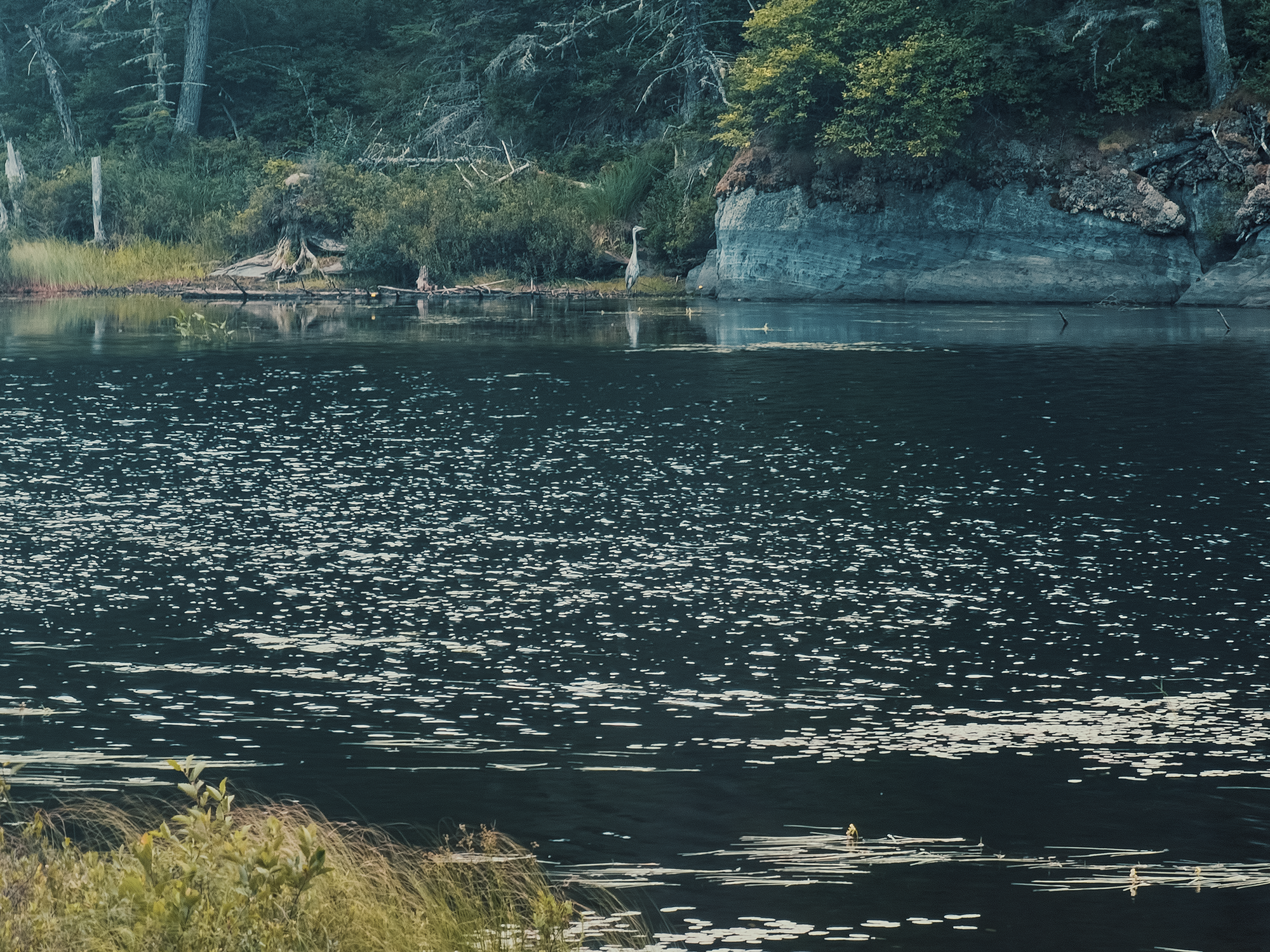
He seemed too busy hunting to pay me any mind. Good for him.
There’s less than 400 ft of ATV trail (or whatever it is) before the AT cuts sharply to the right and begins its ascent and traverse up and across Big Wilson Cliffs. The woods open up a little on either side of the trail next to the bog, but then you’re almost immediately back into thicker trees. Oh: I saw a neat frog hopping across the rocks right near here. Somehow, I managed not to focus on it while recording. Because of course. Anyway, about 200 ft after that right turn (and 100 ft of elevation gain), there’s a sharp left, and now you’re walking along the edge of the cliffs.
Big Wilson Cliffs
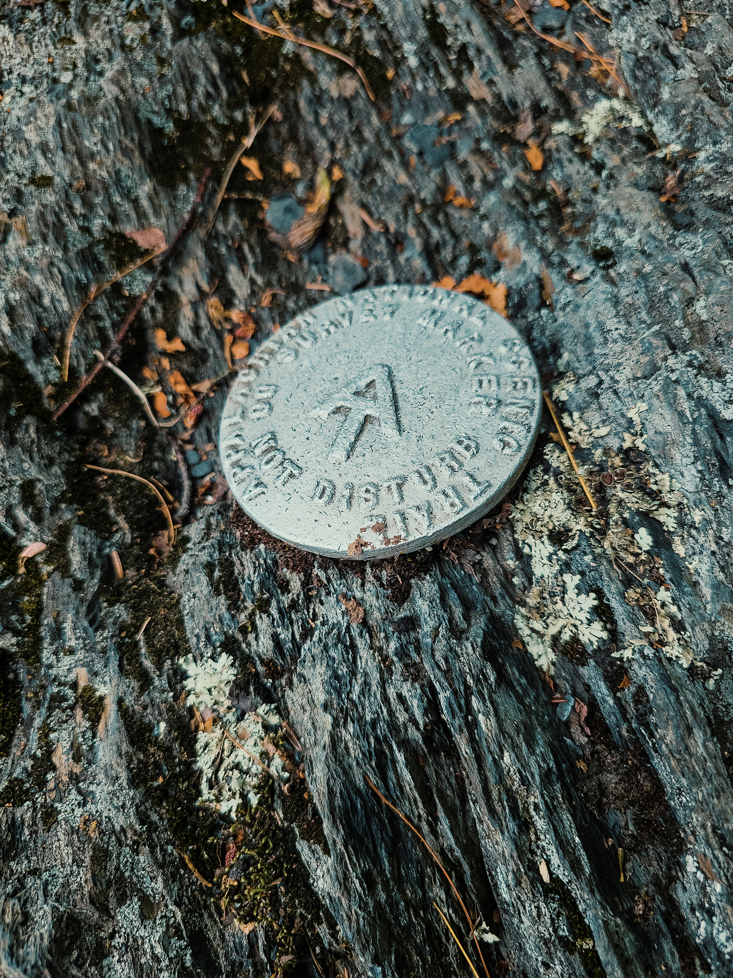
As I was hiking here, I noticed an odd survey marker. I’ve seen a bunch of USGS markers over the years, but I think this might be the first time I noticed an AT-specific variant. (It’s possible that I’ve passed others like it before, but if so, I wasn’t paying attention!)
I launched the drone again and captured some sweeping views along the cliff’s “spine,” I’ll say, headed toward Borestone Mountain (maybe 3 mi away as the crow—or great blue heron?—flies). While messing around with my gear, a couple of the women I’d seen at the Upper Little Wilson Falls passed me. I learned later that they were French Canadian, and that some of them were completing the last leg of a three-year trek through the entirety of Maine’s 100 Mile Wilderness.
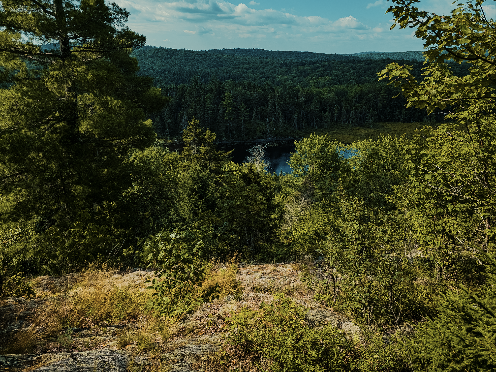
I also took a few standard shots from here: one looking out over the bog and another looking over the forest. (The second photo below I took on the way back, but it fits better here.)
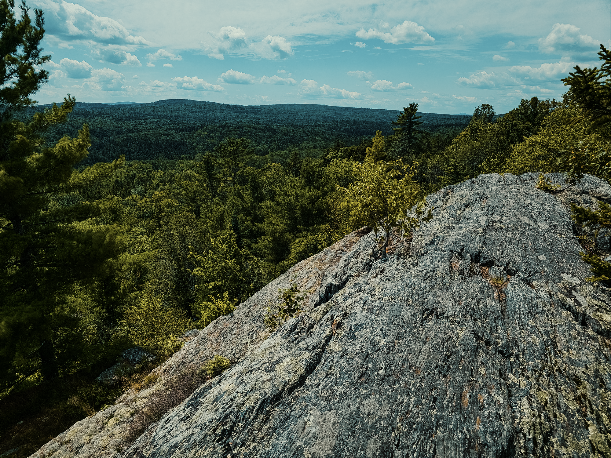
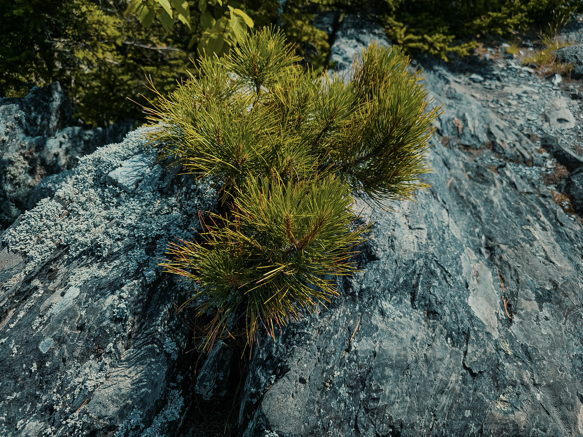
Also, I saw this young pine tree growing between a tiny fissure between the rocks. I’ll have to come back years from now and see which gives first: the rocks or the roots!
The exposed portion of Big Wilson Cliffs runs for just over 1/2 mi before the AT cuts hard left again and you’re back into thicker woods. The cliffs themselves, however, run another 7/10 mi or so east. If the whole ridge were a finger, I’d say the AT changes course about halfway up the “middle phalanx.” (Yes, I had to look that up.) There’s no trail out to that eastern terminus: I brought a machete, intending to bushwack to it, but for whatever reason I didn’t.
Maybe next time.
Big Wilson Stream, Thompson Brook, & Thompson Brook Falls
Over the next 1.2 mi, maybe 1.3 mi, the AT runs up and down through mostly northern hardwood-conifer forest, over and around various lichen-encrusted rock structures, until it parallels Big Wilson Stream for about 600 ft. I passed the French Canadian women somewhere between Big Wilson Cliffs and Big Wilson Stream; here, near a large flat rock angled toward the water, I think I caught up to the people who hiked past my campsite the night before. No idea, really. I said hello, then flew the drone over the stream at various elevations. The wind, which I hadn’t really noticed all day, picked up, so I landed and put everything away. I noticed I was low on drinking water, so I filtered enough to fill two 1.5 L bottles. After that, I put my pack back on and headed for Thompson Brook Falls.
At the time, I thought Thompson Brook was farther up the AT from here, but it turns out I was practically standing in its mouth—that feels like a weird thing to write—while operating the drone! The French Canadians caught up to me this time as they continued their hike up the AT. I can’t remember how many more days they said they’d be on the trail, but I hope they enjoyed the adventure!
I read that there was supposed to be a trail to Thompson Brook Falls, but I didn’t see one. Instead, since the water was so low, and since there were plenty of exposed rocks poking above its surface, I just hiked across the stones.
It seems there must have been a trail—in the past, anyway: after a few hundred feet up the brook, I walked under an old “sideways” bridge. Its footings looked like painted (now rusted) steel, and braided metal cable still spanned the distance between the banks:
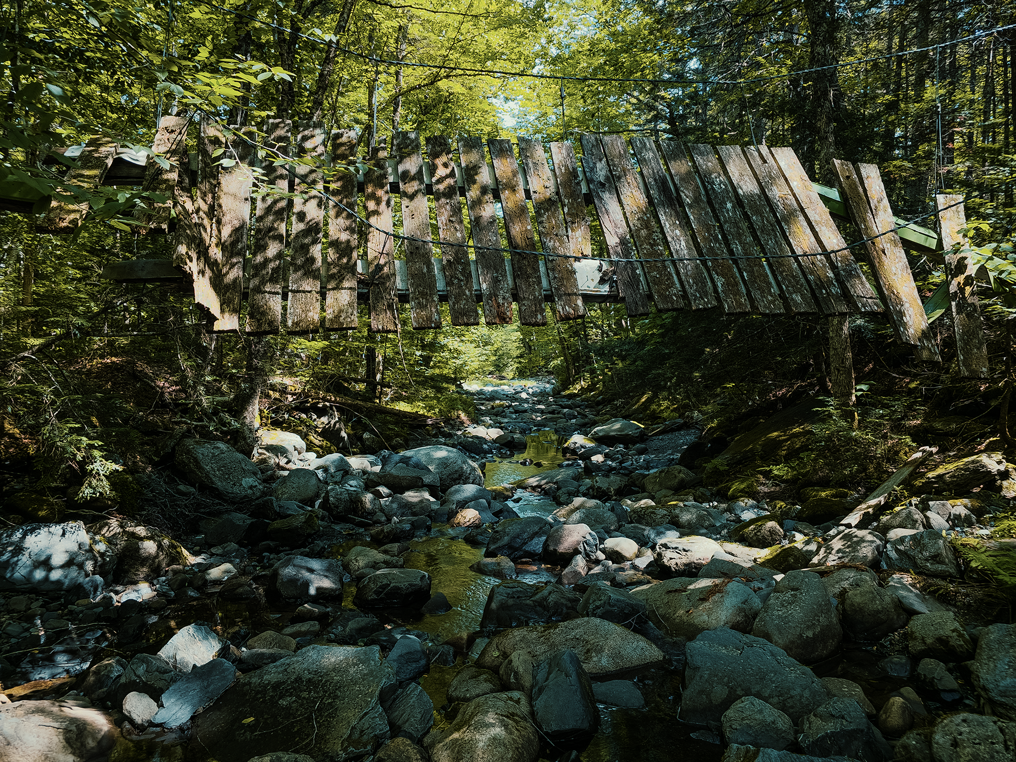
From what I could find (after the hike), it’s likely that this bridge was part of the AT, maybe back in the 1970s. I mention in the video that parts of the AT in this region had been rerouted: this is likely the remnant of an older route, before the Maine Appalachian Trail Club (MATC) abandoned or “retired” structures like this in favor of more natural places for fording. If that is the case, then this is a pretty cool glimpse of up to 50 years into the AT’s past.
Not quite 1,000 ft upstream, I reached the lower run of Thompson Brook Falls. At least, I think it’s the lower run: some sources describe these falls as having upper and lower sections, others describe them as having three tiers. Whatever the case, this is definitely the bottom-most portion!
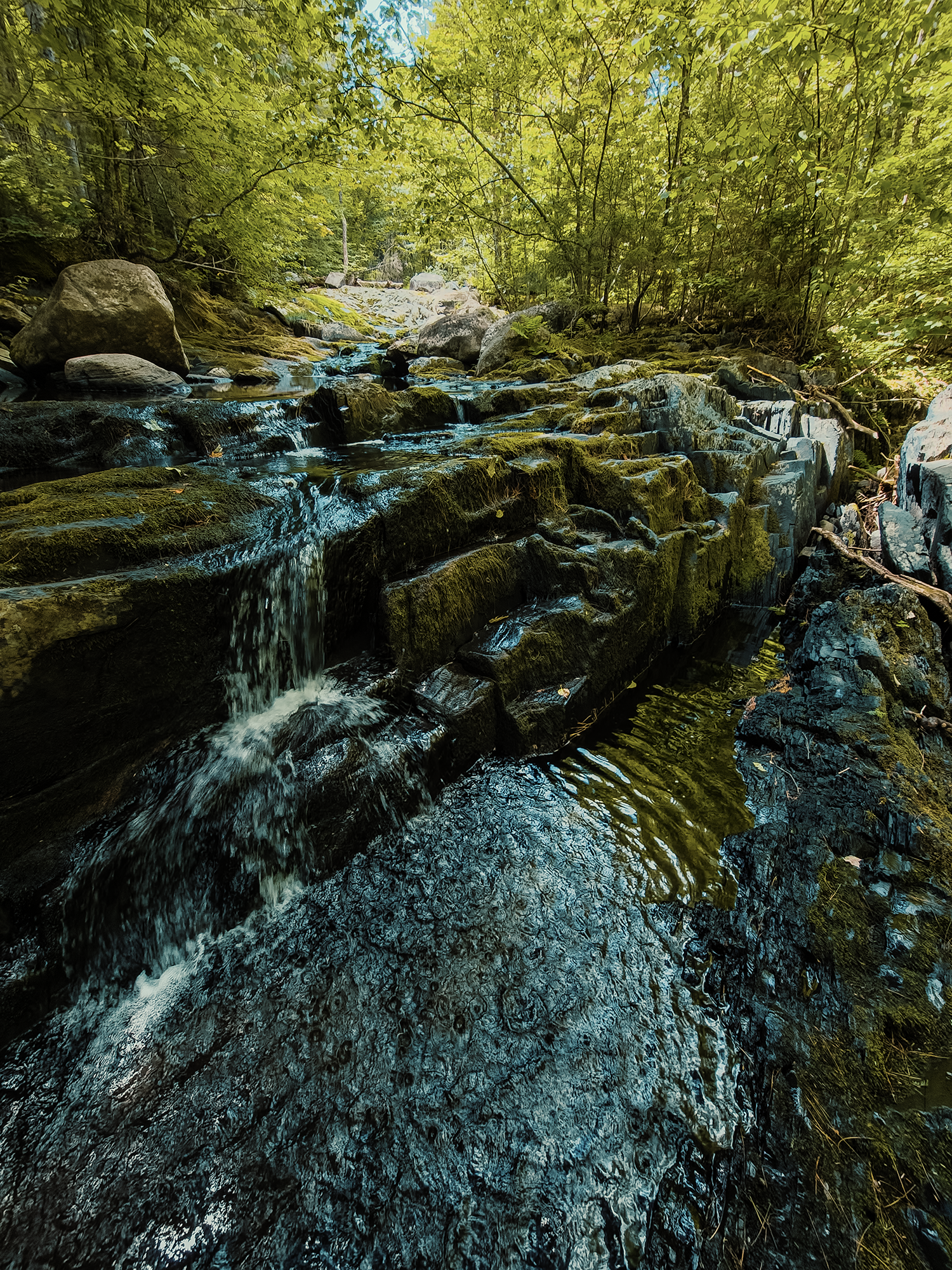
Having never been here before, I don’t know what this place looks like when the water’s higher, but I’ll bet it’s more impressive then. Still, I think it’s neat to get out here and into a place that most people don’t bother with.
I hiked back down the stream toward the AT, slipping (again) when I was trying to record the closing segment for the video. Good thing these shoes dry quickly!
I brought food for lunch, but for some reason, I never stopped to eat it! I think I was feeling the calorie debt after a mile or two SOBO down the AT from Thompson Brook, but still, I didn’t think to drop my pack and at least grab a snack. I probably should have. Instead, I hiked 3.5 mi back to the Little Wilson day-use area (and the lower falls). Today was a beautiful day, and I didn’t mind stopping from time to time to inhale the scent of warm spruce and pine sap whenever I passed through a stand.
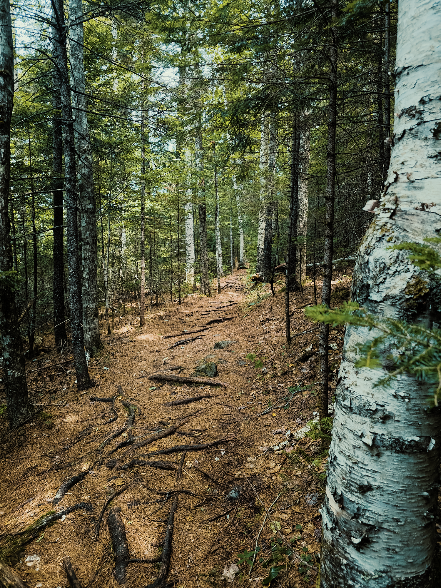
After reaching the junction where the LWFT splits from the AT, I turned left: just one more mile to the—no, that’s not true: it’s 1.7 mi from here! I forgot I had to park 7/10 mi from the day-use area. Shucks. I took one last photo of the pine-needle-covered ground from this trail:
Having completed the LWFT, I took a long swig of water, then started toward my vehicle. Mercifully, someone leaving the picnic area offered me a ride back to the parking lot, so I hopped in the back of her daughter’s Tacoma (I think). That’s probably a good way to get stabbed or something, but I recognized her from church the day before, so I figured it was worth the risk. That’s a joke. (Thanks Rebekah!)
I’m so glad I finally got to spend the night out here. I’m a big fan of waterfalls, and I got to see three distinct runs; I had some opportunities to think about how members of the Penobscot Nation might have regarded this land; and I got to see Borestone Mountain from a new perspective, and to get above the valley between Big Wilson Cliffs and Little Wilson Stream and look out over the forest. Other than the AT, there might not be too many trails through here, but there’s always more to explore, and I look forward to getting out here again someday—whenever that might be.
Catch the whole adventure on YouTube! Please consider subscribing (if you haven’t already). Thanks for stopping by!
Pingback Hiking Maine’s coastal high point (Mount Megunticook via Ocean Lookout) (ME)