
In the post for Mount Megunticook in Camden Hills State Park, I mentioned that my brother and I intended to climb Old Speck that day.
We didn’t.
Today was our opportunity to fix that! And our brother-in-law tagged along.
Grafton Notch State Park is about 3 hrs from my starting point, so I got up at 0400, chugged a cup of coffee, and—wait: did I eat breakfast? I must have. I don’t remember—drove to my brother’s house; from there, we headed west-ish and picked up our brother-in-law.
When we got to the parking area (a little after 0800), it was already packed, and people were still arriving when we finally hit the trail. From the parking lot, you’re presented with an impressive—and imposing!—view of the Eyebrow Cliffs:


Eyebrow Trail
Depending on your ambition, you can hike over these cliffs, or forego them and stick solely to the Appalachian Trail.
We hiked over them via the aptly-named Eyebrow Trail.
After a few tenths (if that?) on the AT, you’ll reach the junction with the Eyebrow Trail. Most guides I researched suggest hiking up the Eyebrow Trail (if you’re going to go that way in the first place) to save wear and tear on your knees.
I guess those guide authors don’t care about your quads!
It’s a good point though: at least a few sections of the Eyebrow Trail feature steel cables and iron rungs intended to aid hikers climbers while ascending:


From the parking area, mature second-growth northern hardwood forest surrounded us; when the Eyebrow Trail ramps up in earnest, spruce-fir montane forest supplanted northern hardwood. It’s interesting to see—to feel, almost—the deciduous trees gradually give way to hardier evergreens…

Unlike, say, at the Maiden Cliff feature at Camden Hills State Park, rock climbing isn’t permitted on the Eyebrow Cliffs. One reason is peregrine falcons nest here. If you’ve read some of my other posts, you might remember that peregrines much prefer sheer rock faces that are inaccessible to predators.
That said, from atop these cliffs, you’re afforded some amazing views of the parking area—all right, staring at an asphalt rectangle isn’t necessarily amazing! Look past that, however, and on the left you’ll see Table Rock; on the right and toward the center you’ll see Slide Mountain and Sunday River Whitecap (and more!) beyond ME 26:

The Eyebrow Cliffs likely formed when glacial meltwater infiltrated lesser fissures, then froze, thawed, and froze again over the years. Those freeze/thaw cycles acted like hydraulic wedges that ultimately split the rock faces.
Much of the surrounding forest—sometimes the trails themselves—are littered with what appear to be glacial erratics: boulders, sometimes enormous, that a retreating glacier could no longer carry. Some of these stones also bear what look like glacial striations, gouges where glacial momentum pushed or dragged these objects over other rocks, leaving “scars” in the aftermath:


Appalachian Trail
It’s just over 1 mi from the parking area to where the Eyebrow Trail joins up with the AT again; from here, there are still some interesting overlooks. At this point we were firmly into spruce-fir montane forest: I don’t remember many (if any) hardwoods in this region. What I do remember is thinner “soils” as we gained elevation. From what I understand, most of what these trees grow from isn’t really soil so much as organic matter comprised of decayed fir needles, fungi, and lichens. It’s fragile stuff, and takes years—maybe decades—to restore if damaged too much.


Old Speck summit (& observation deck)
About 2 mi later, we reached the 3/10 spur toward the Old Speck observation deck (built in 1997).
The 38 ft steel structure that supports the deck was built in 1919—replacing an earlier 30 ft structure built in 1911:

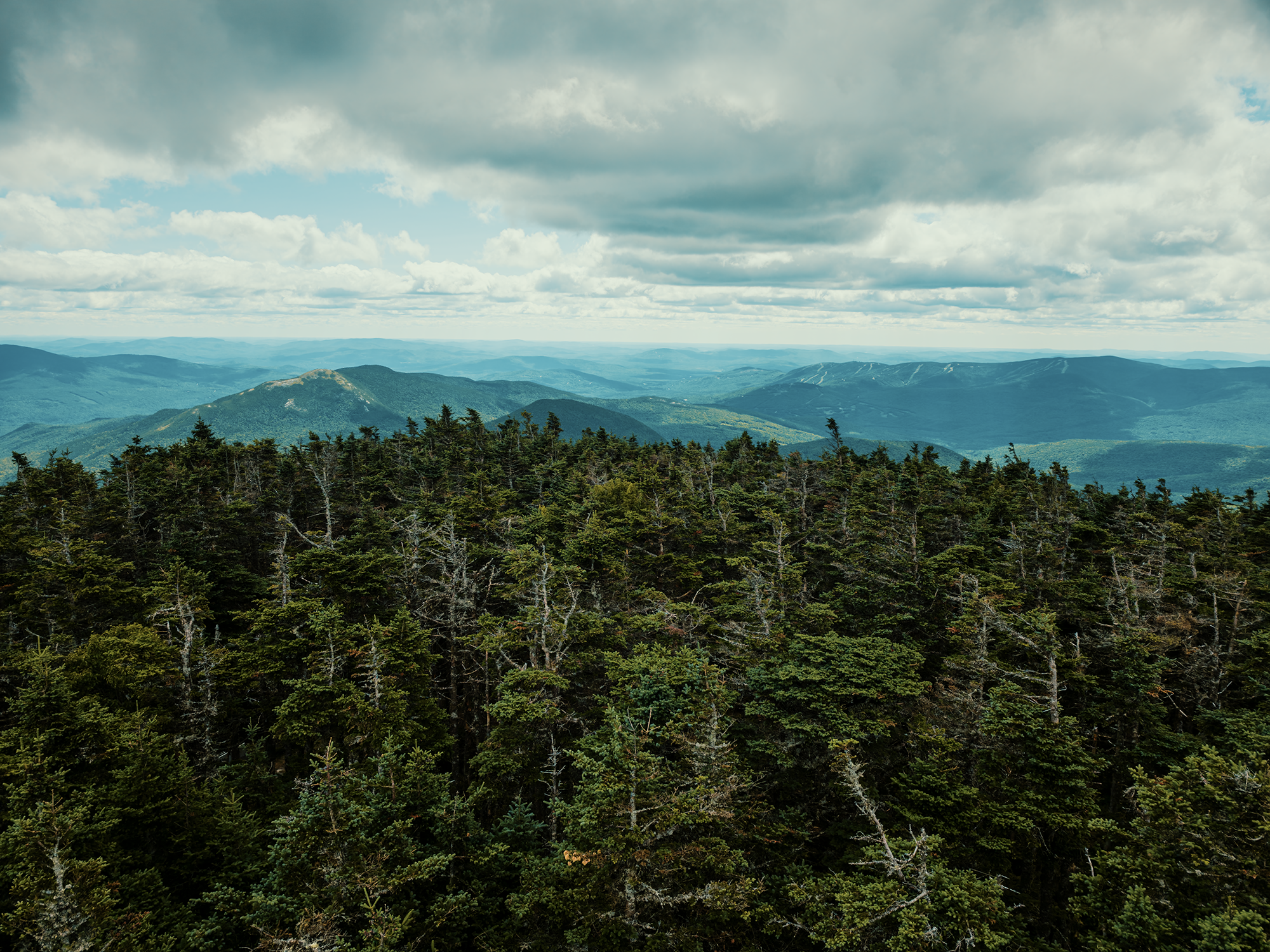
From the deck, you’re offered 360° panoramic views of the Mahoosuc Range toward the southwest, Slide Mountain (and others) toward the southeast, the West and East Peaks of the Baldpate Mountains toward the east-northeast, and several other features too numerous to name—some in New Hampshire, others in Canada (roughly 35 mi to 40 mi away)! We had to wait our turn to climb the observation deck: much like the parking area, the summit was packed with people!


Abenaki legends
While we were up here, looking out over what ultimately became western Maine (and New Hampshire, and Canada), I thought about some of the Wabanaki legends I uncovered while researching this region.
I think most of these accounts are from the Abenaki Nation, but I’m happy to be corrected if I’m wrong! Anyway, some legends speak of Old Speck starting out as a giant beaver, a “water stealer” or hoarder, according to the Abenaki. Gluskap (Glooskap, Koluskap, Gluskab, etc.)—a hero, a teacher, a trickster character—subdued this giant beaver and turned him into the mountain. Another legends suggests Old Speck represents—or simply is—a guardian spirit that protects the Abenaki. There are more, I’m sure, and while I can’t say with concrete certainty that these legends are specific to Old Speck, they do fit the general pattern of Wabanaki storytelling.
Truly interesting stuff.
Descending via the Appalachian Trail
As intriguing as Old Speck’s summit is, we needed to head down after a while, so we returned to the AT and hiked the 2 mi back to the junction with the Eyebrow Trail. We stayed on the AT this time, descending through subalpine forest into spruce-fir montane.
That reminds me: in the video, I refer to krummholz shaped trees, but I never explained what that means! I do mention it in the Jefferson National Forest/Lewis Fork Wilderness video, but krummholz is a German word meaning crooked wood. Freezing wind and flying ice crystals result in the stunted, crooked appearance of some of the trees up here. I said something similar in that same Jefferson National Forest video, but I think there’s an odd beauty in the “imperfection” of these krummholz trees.
On the way down, we crossed paths with other hikers observing a spruce grouse:

These birds are known for their “tameness,” one might say. They’re beautiful, partridge-like creatures, but they lack the (effective) predator avoidance skills of, say, the ruffed grouse. When confronted, oftentimes these birds will simply stay very still and hope the bad things go away. That might work for four-legged predators, but Maine protects spruce grouse from the two-legged variety: there is no open season for these birds. At a glance, they can resemble ruffed grouse, so hunters need to positively identify their quarry before taking the shot.
We watched this guy strut around for a while, then he disappeared deeper into the woods.
Good for him.
Also on the way down, we got an additional perspective of the surrounding mountains: rather than looking out and over things, here, we’re looking up. If you ever need to feel smaller, put yourself in a place like this!


Toward the end of the trail (meaning, almost back at the parking area), there’s a “waterfall” that serves as a transitional marker between spruce-fir montane and northern hardwood forests. I put “waterfall” in quotes because today, it was barely more than a trickle. I’ll bet in wetter summers, or after heavier rainfall, it’s more impressive:

Wrapping up
On the way back to the parking area, we crossed paths with a pair of ladies hiking the entire Grafton Notch Loop—around 35 mi, I think. Turns out my brother-in-law used to work with one of them! They were on their second day, and the other woman remarked how lucky we were only to be day hiking.
I’ve definitely felt like that before!
Anyway, less than a mile later, we were back at the parking area.
Which was completely full. Overfull, really: several vehicles had parked along the side of the road outside the lot.
Old speck is 4,170 ft high—Maine’s fourth-highest mountain, and today was a nearly perfect day for this hike. Cool in the morning, not blisteringly hot during the afternoon, and welcome breezes at the summit, with expansive views from multiple overlooks (and, of course, the deck at the summit). Many of the peaks we saw throughout the day have their own trails (well, via the AT), and I’d really like to get back here some day, maybe attempt the Grafton Notch Loop myself.
Maybe.
Catch the whole adventure on YouTube! Please consider subscribing (if you haven’t already). Thanks for stopping by!